by Eric Lim
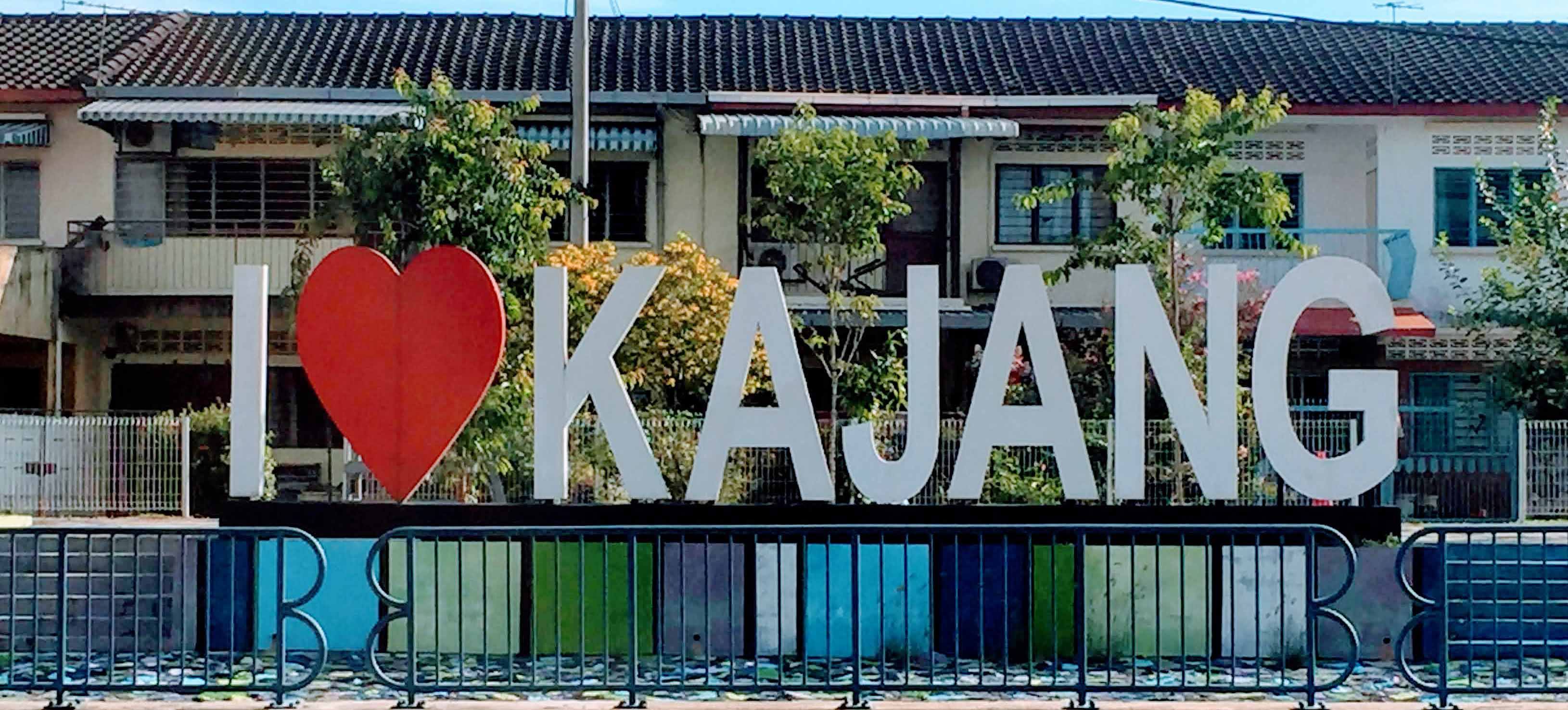
Kajang, the capital of the Hulu Langat district, is located around 21 km south from Kuala Lumpur. There are a number of theories on how the name Kajang came about. The Malay dictionary defines kajang as ‘stuffed objects from leaves of nipah (bamboo, mengkuang or palm leaves) that are used as rooftop or awning’. The Temuan had already been exploring the area since at least the 16th century and they found an abundance of bamboo and palm leaves, which they folded to make rooftops. Thus, they called the place Kajang. Two other theories date from the time of the Austronesian migration. We look at the word as used by two different ethnic groups –for the Mandailing, berkajang means ‘to take shelter’; and for the Bugis, it means ‘to stab / to fight’. Raja Alang, a Mandailing, was cruising along the Langat River with his followers when half way they decided to stop and berkajang. He then called the place Kajang. The Mandailing and Bugis were trying to escape from the Selangor Civil War and both arrived near Kajang. They then fought each other because of the misunderstanding of the meaning of the word to them. After the event, the place was called Kajang.
In 1848, Raja Berayun, a Mandailing, wanted to claim ‘blood money’ from Datoh Klana Sendeng, a Rawa, for the killing of one of his friends. He brought 500 men and invaded Sungai Ujong but they were defeated and they retreated to the north of the Langat River where they established a village called Rekoh. The current name for Rekoh is Sungai Tangkas; it is about 4 km from Kajang. It was to be the earliest settlement around Kajang.
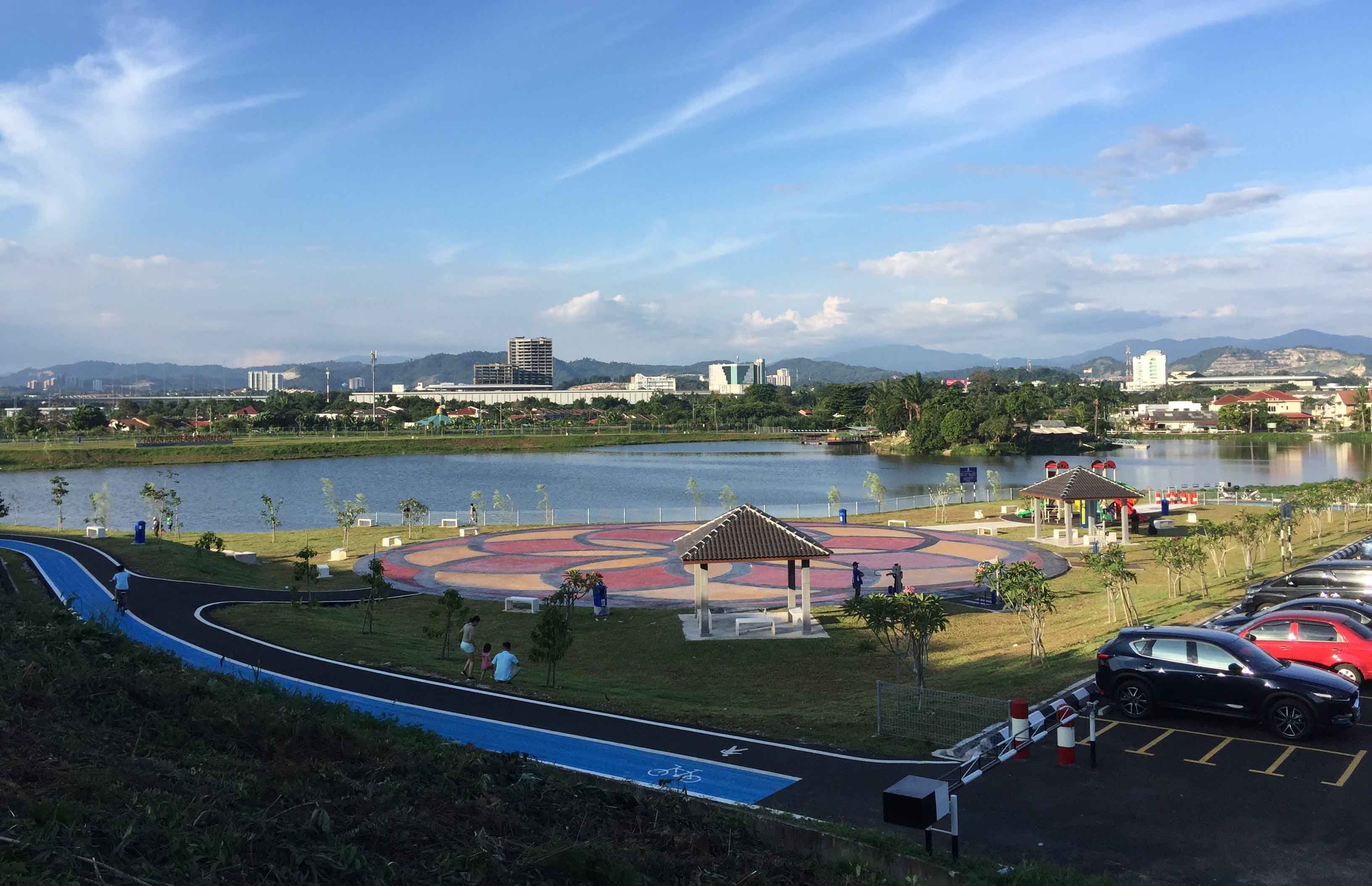
Kajang, like many towns on the west coast of the Peninsular, started as a mining settlement. An American prospector started a tin mine at Rekoh in 1855. However, the locals objected as he did not possess any consent and the venture was abandoned. The tin boom in the district occurred in the middle of 1890’s, when Chinese businessmen made huge investments in the district. One of the Chinese miners was Goh Ah Ngee,who was active in Balau (Broga today). He even built a church for a small group of Chinese Christians in the area. The first mine at Semenyih was opened by a Hokkien named Cheah King. Other Chinese miners were Khoo Seah, who had mines at Sungai Cheow (Sungai Chua today) Road (1896), Loke Yew at Sungai Merbau in Hulu Langat (1896) and Sungai Kachau in Semenyih (1897), Low Boon Kim at Sungai Jebat (1897) and Chan Yoke who operated a mine at Kajang (present Metro Kajang site). Tin was also found just outside of Kajang where Hakka coolies called it Xi Mi Shan (Tin Ore Hill).This site is the only mining pool left in Kajang. Recently, the Kajang Municipal Council converted the site into a recreational park.
Tin mining industry in the district turned out to be a relatively minor enterprise, paling in comparison to other towns in the state. This prompted the District Office to suggest moving to agriculture. Tobacco had been planted in 1890 on a trial basis in Semenyih but the project failed. Coffee was next and it gained interest amongst European planters who were applying for land for coffee planting. Chinese businessmen were equally interested and joined in the demand for land. However, at the turn of the 20th century, faced with strong competition from Brazilian coffee producers, fluctuation of coffee prices and the appearance of a fungal disease called H. vastatrix and further assisted by the outbreaks of Cephonodes hylas moth that threatened to cripple the local coffee production, the industry soon vanished from the scene.
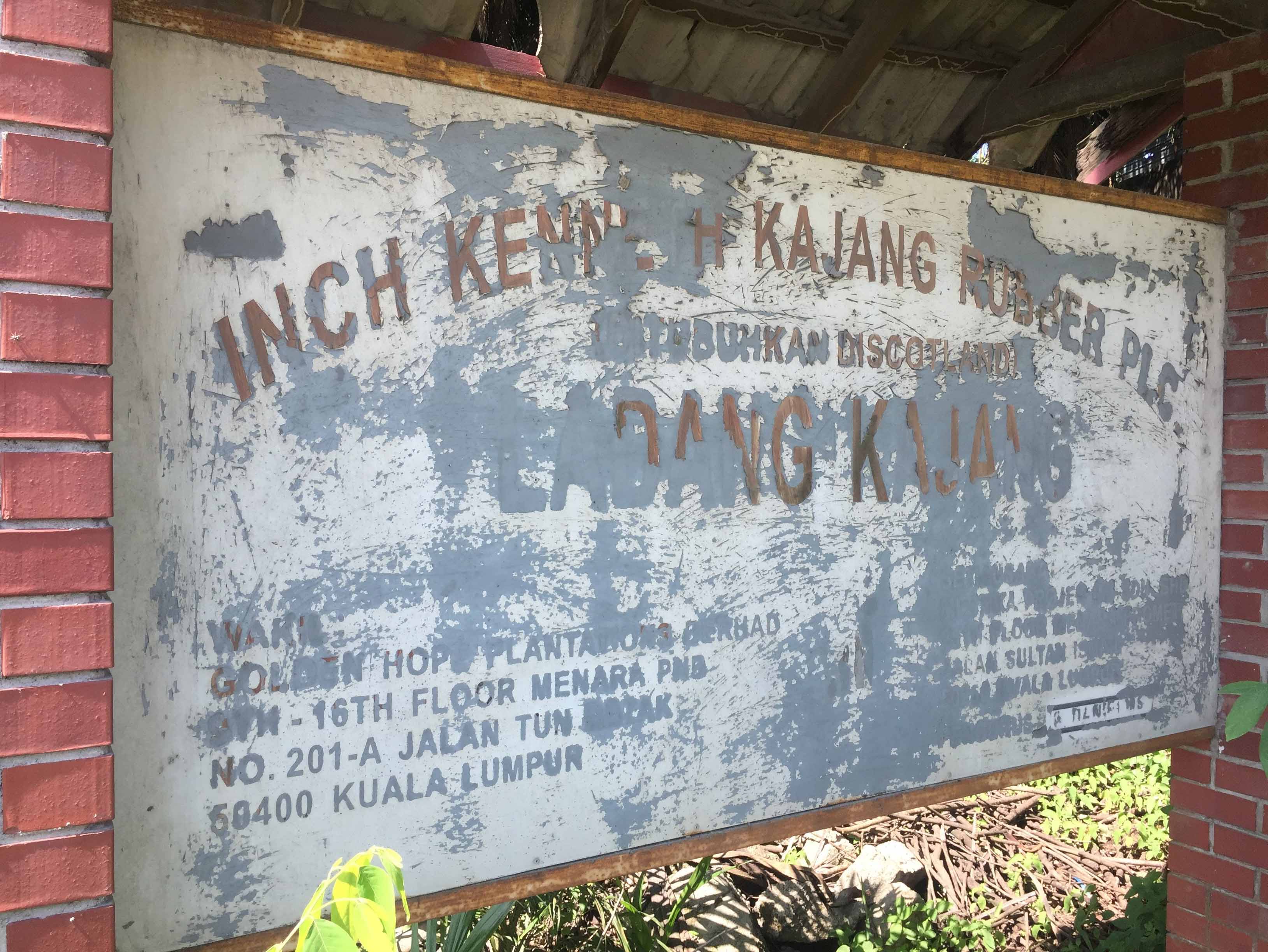
Rubberwas the next big crop. The Inch Kenneth Estate located just outside Kajang became the first estate to plant rubber on a commercial scale in Malaya. Among the Chinese planters who obtained land in Kajang for rubber plantation were Choo Kia Peng with 182ha in 1910, Loke Yew with 41ha in 1912 and Low Ti Kok with 24ha. Goh Ah Ngee, who had tin mines in Balau, also ventured into rubber plantation in Semenyih after his failed ventures in coffee planting. The development of the rubber industry was also helped by the extension of the railway track southwards from Kuala Lumpur to Kajang in 1897. Before that, Kajang was connected to Kuala Lumpur via a cart road built in 1888.
A prominent person in Kajang was Raja Alang, son of Raja Berayun. He attended Malay schools in Malacca and Singapore and, upon his return, worked as a Forest Ranger in 1883. When Raja Alang ended his working career, he was made an aide to the District Officer and was his right hand man in Malay affairs. He rose to become a very influential man in Kajang. In his honour, two roads in the town were named after him but both roads have since been expunged. He also became very rich; in fact, it is said that he was the richest man in Selangor in the early 20th century. He built a mosque in Beranang, which is named after him. In his later years, he moved to Kuala Lumpur and stayed at his residence at 13, Jalan Raja Laut (present day Jalan Ipoh Kecil), in front of the former Capitol and Federal cinemas. Raja Alang died on 11 December 1927 and he was buried at the Ampang Islamic Cemetery in Kuala Lumpur. His dream of a road to be named after him became a reality when his son, Raja Muhammad was the given the privilege to rename Perkins Road in recognition for his services in the struggle to achieve independence for the Federation of Malaya. Raja Muhammad chose to rename the road after his father.
Kajang Town
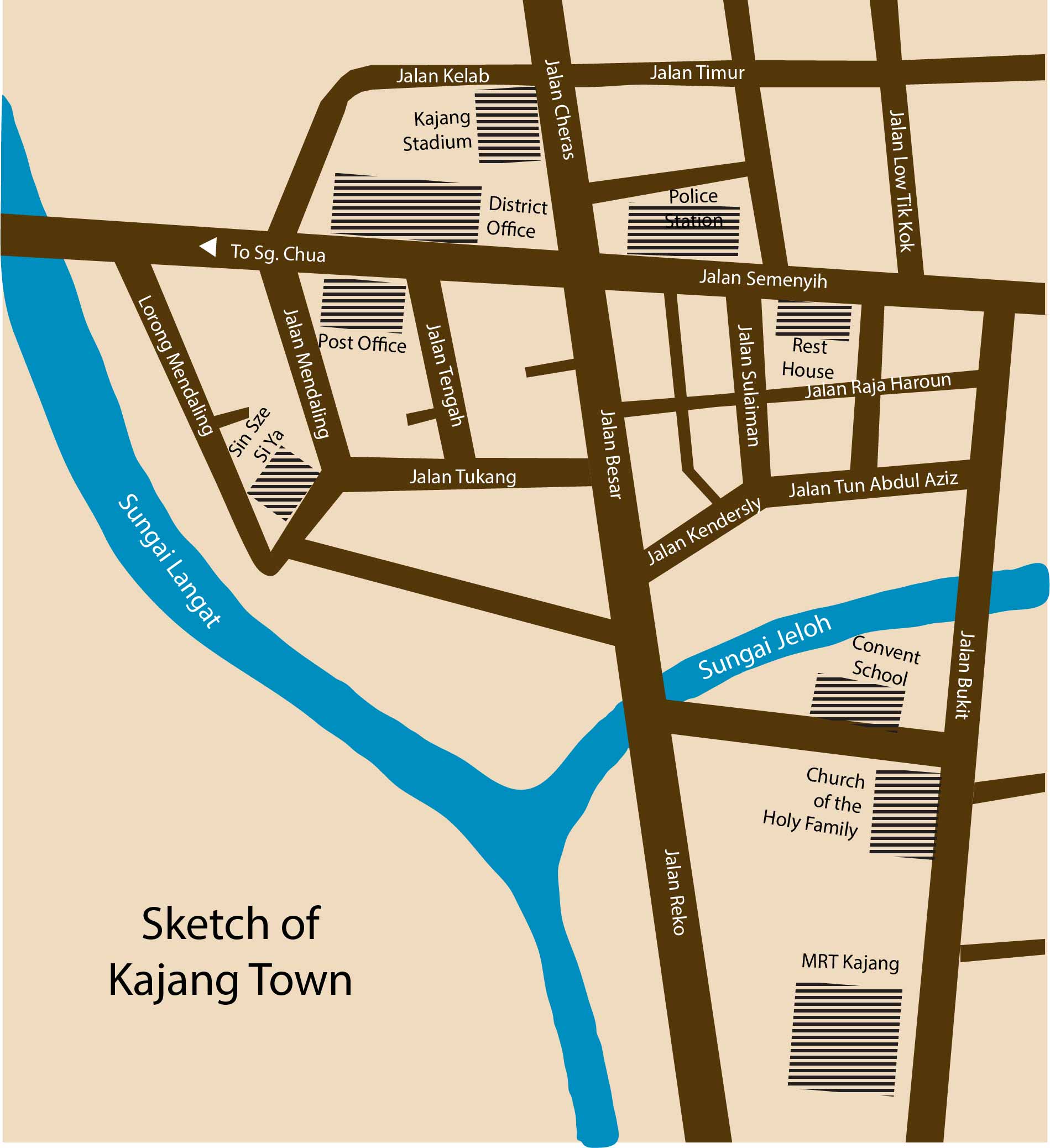
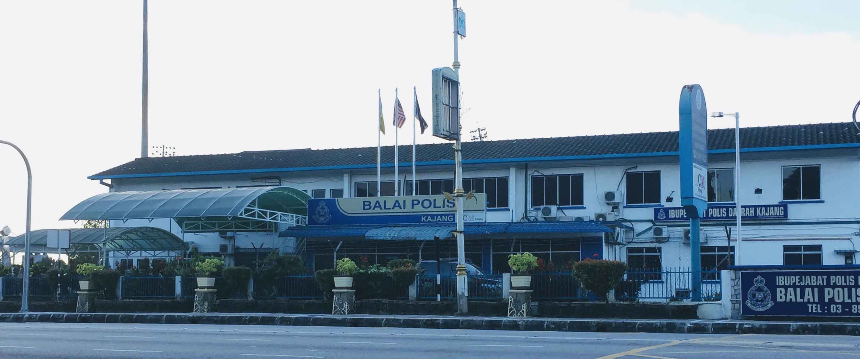
Ulu Langat District Office was set up in 1883 and records of that time show that the Ulu Langat village was the largest settlement in the district but Kajang was chosen as the district capital because of its central location. An early census of Kajang is interesting – one police clerk (indicating that the police station was already established), one ranger (most definitely Raja Alang), twenty-two shopkeepers (of which sixteen were Sumatrans) and one gambler (most likely a Chinese!). The district office building was built in the 1910s and was in operations until it was demolished and a new building (Bangunan Dato Nazir) constructed in 1970. Situated nearby, across Jalan Cheras, is the Police Station, which was established in 1875, after the British succeeded in crushing Sutan Puasa’s suspected uprising. Across Jalan Hishammudin is the Post Office, which was also built at about the same time as the former Ulu Langat District Office; it is still in operation until today.
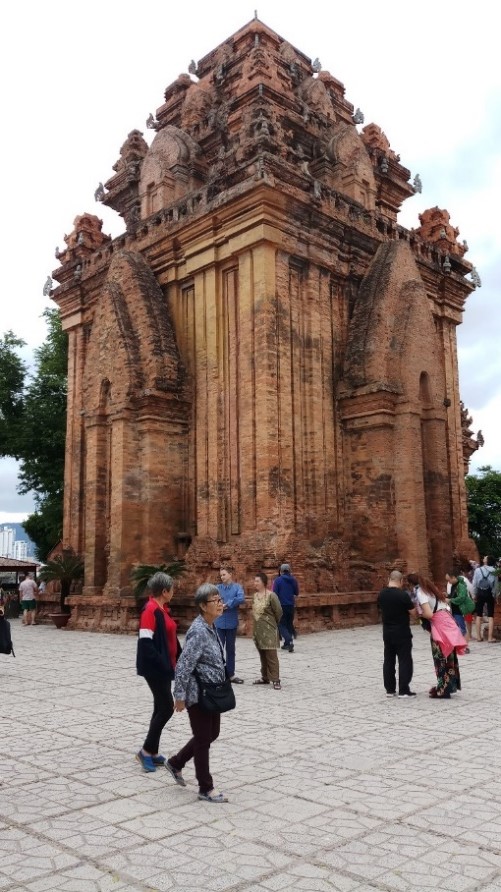
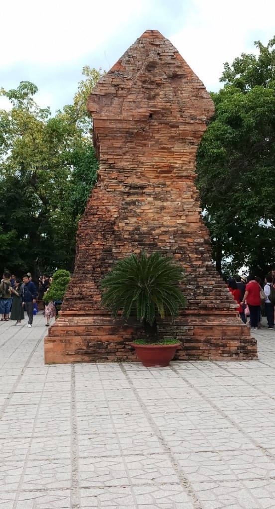
Located between Jalan Tukang and Jalan Mendaling is the Sin Sze Si Ya temple, the oldest Chinese temple in Kajang. The temple was initially located at Rekoh but was later moved to its current site in Kajang in 1892. It went through some construction work in 1898 and a grand ceremony was held in 1899. Today, the temple is among thirteen Sin Sze Si Ya temples that can be found in major tin mining towns in Perak, Selangor and Negri Sembilan.
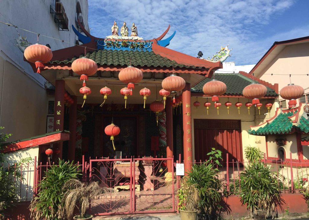
Kajang Sin Sze Si Ya Temple 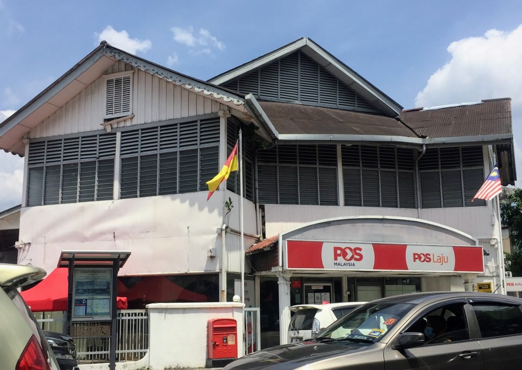
Kajang Post Office
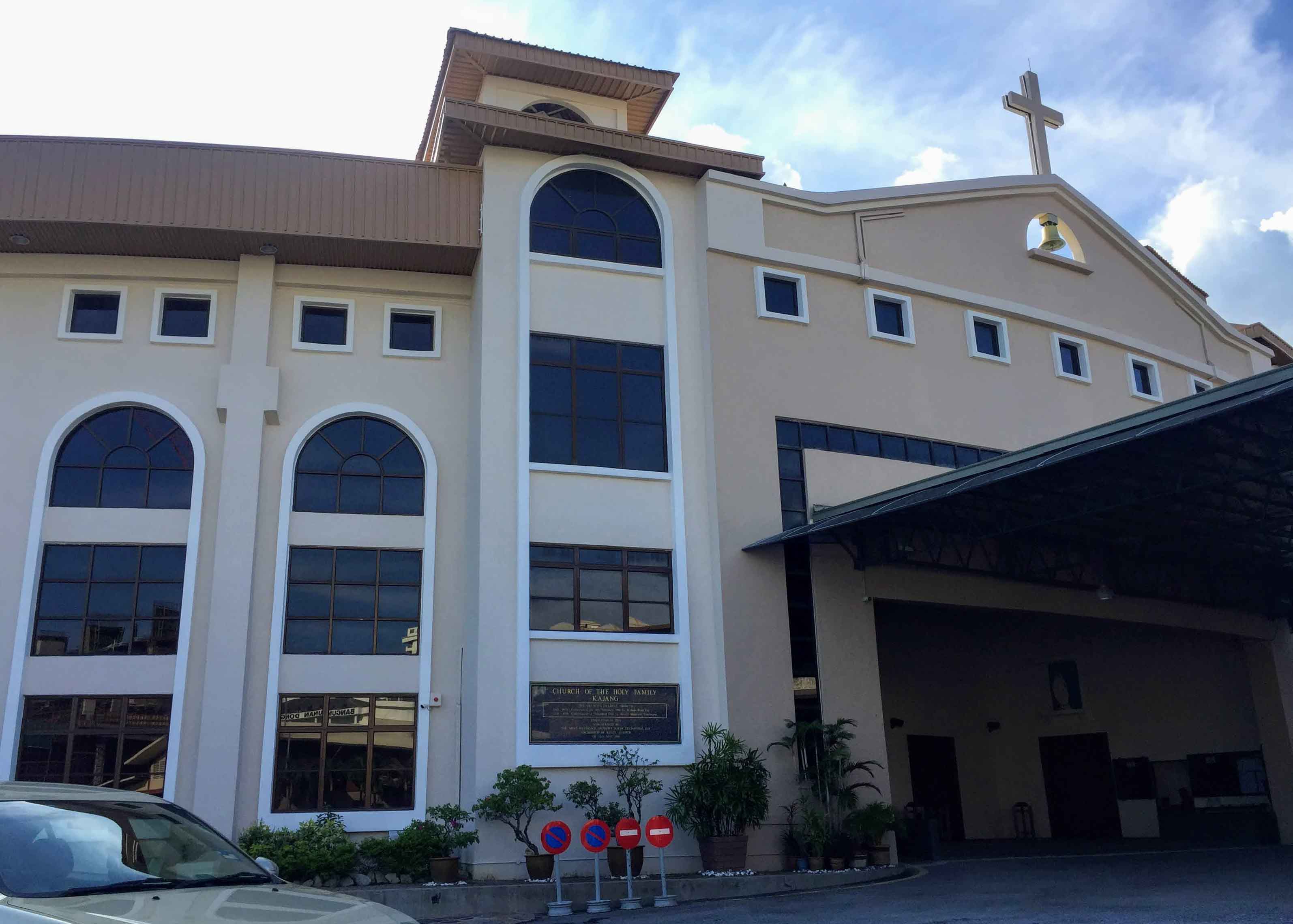
Rev. Fr. Francois Terrein MEP started a Catholic mission in Kajang and a church was built on a former rubber estate donated by Goh Ah Nee. The Church of the Holy Family was consecrated on 24 February 1901and it had a bell and three stained glass windows each depicting a member of the Holy Family. Goh Ah Nee also donated a piece of land for the purpose of a burial ground in 1903, which is still in existence. Later, the parish administrator allowed the Infant Jesus Sisters to start a girl’s school in Kajang. In 1939, the new Convent School (present site of SK Convent Kajang) was ready for the school year. During the Japanese Occupation, Japanese warplanes bombed Kajang on 12 January 1942; their target was the old railway station but unfortunately the bombs landed on the church and school compound. The church was damaged but somehow the three stained glass window panels suffered only minor damage. Today, the panels can be seen at the back of the altar.
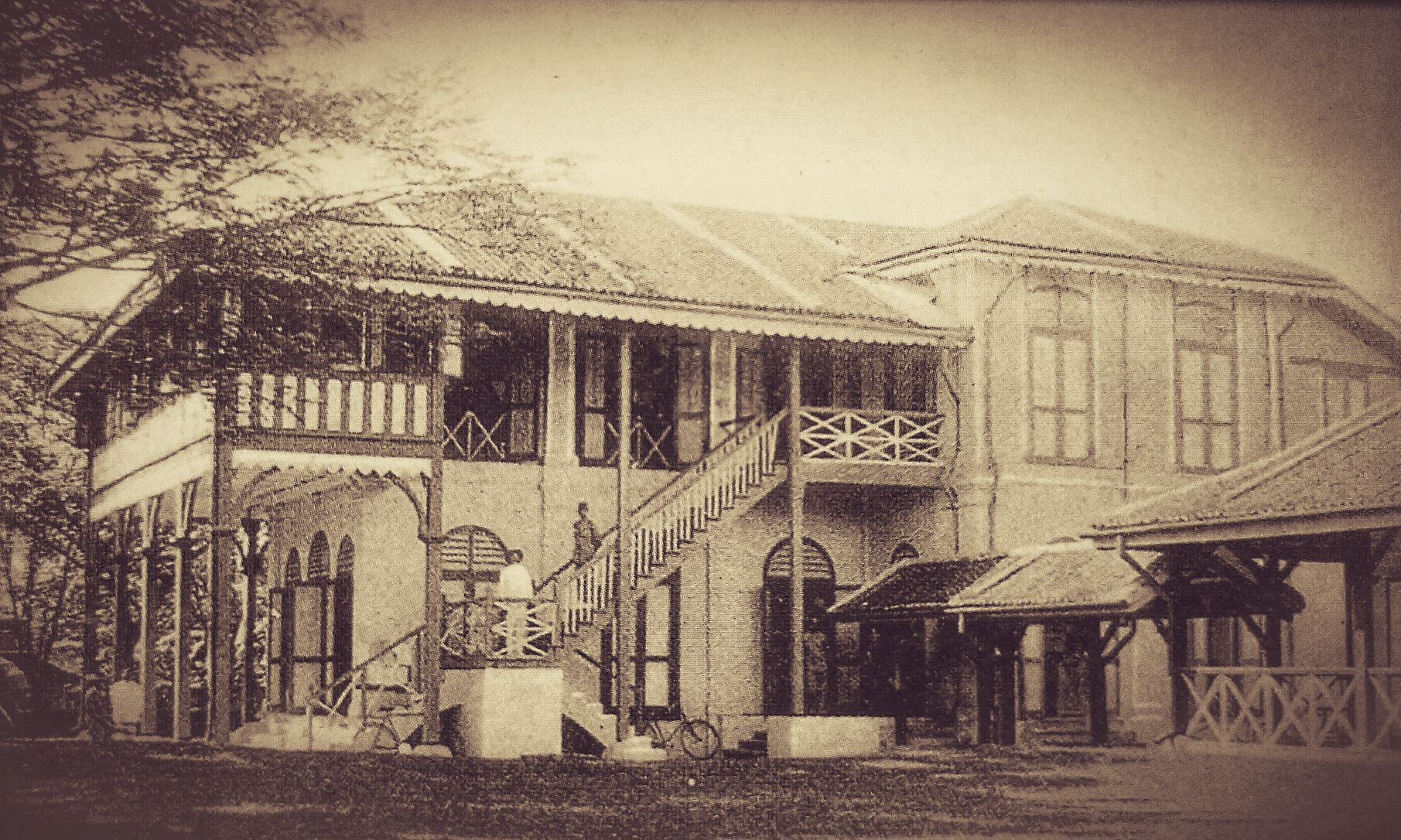
The first English school in Kajang was opened by Reverend William Edward Horley in 1905. It was to be a private school and limited only to residents in Kajang. Since then, there were no further records of the school. Thanks to the efforts of a group of local community leaders, saw the resumption of English education in the district with the setting up of the Kajang Government English School, which was officially opened on 1 April 1919. The old Rest House building at Jalan Semenyih had been converted to accommodate the school premises. The school started with an enrolment of 100 students and grew to 129 the following year, with 10 female students. When Ng Seo Buck became the first Malayan Headmaster of the school in 1923, he was forced to turn the kitchen of the old Rest House into a classroom. By 1926, the school was overcrowded and the building had dilapidated. Ng left the school in 1927 and started a campaign to seek a new site and building for a new school. He was joined by Low Ti Kok, Raja Muhammad (son of Raja Alang), Haji Abdul Jalil and Ronald CM Kindersley (of Inch Kenneth Estate) and they succeeded in securing a site, which was a hillock along Jalan Semenyih. The school was named Kajang High School. Sultan Sir Alaiddin Sulaiman Shah officiated at the opening ceremony on 19 March 1930. Among the first batch of students was Tan Chee Koon, who went on to become a major figure in our country’s politics and was nicknamed ‘Mr Opposition’. The first Headmaster for the new school was C.E. Gates and he turned out to be a great inspiration to the students. When he returned to England in 1936, the Kajang Town Board named the road near his residence Gates Road. During the Japanese Occupation, the school became the headquarters of the Japanese army and it was called Toa Seinan Gakko. After the war, the boys from the school made two interesting discoveries – they found a skull and skeleton, which were later used as authentic visual aid during Biology classes, and they discovered a tunnel linking the school to the nearby cemetery!
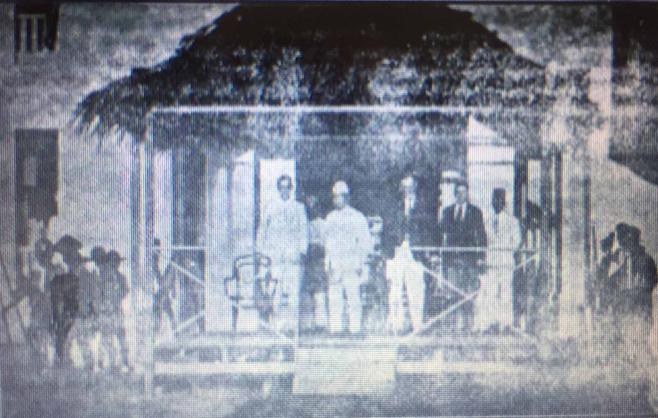
Photo credit: hanafiahlubis.blogspot.com
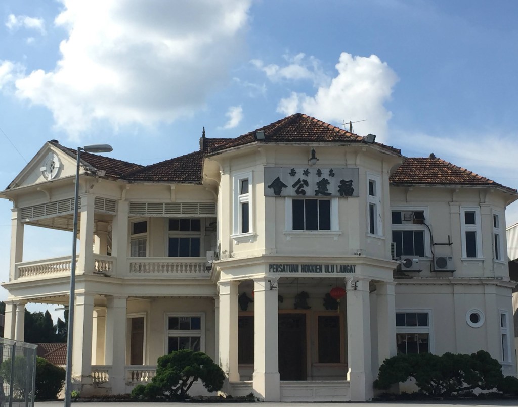
Chinese education came at about the same time as English education. Boon Hua Chinese School started in the 1910s and, by 1917, the school was attached to the Merchant Club at a shop lot located at Main Street. It then shifted to two shop lots at No.2 & 4, Sulaiman Street when enrolment increased. The Chairman of the school, Low Ti Kok, and the Headmaster, Tan Yi Hoh, had applied for a piece of land in town as a site for the school. It was granted and works to build the school started in 1918; by the following year, the school operated from the new site. The school was renamed Yu Hua School. The school acquired the adjoining land in 1935 for its expansion. In 1958, the school was separated into Yu Hua Middle School and Yu Hua Primary School. To honour the contributions of Low Ti Kok to education in Kajang, the road in front of Yu Hua School is named after him. Low Ti Kok died during the war in 1943 and his residence, which is located near Yu Hua School, has been converted into the Hulu Langat Hokkien Association.
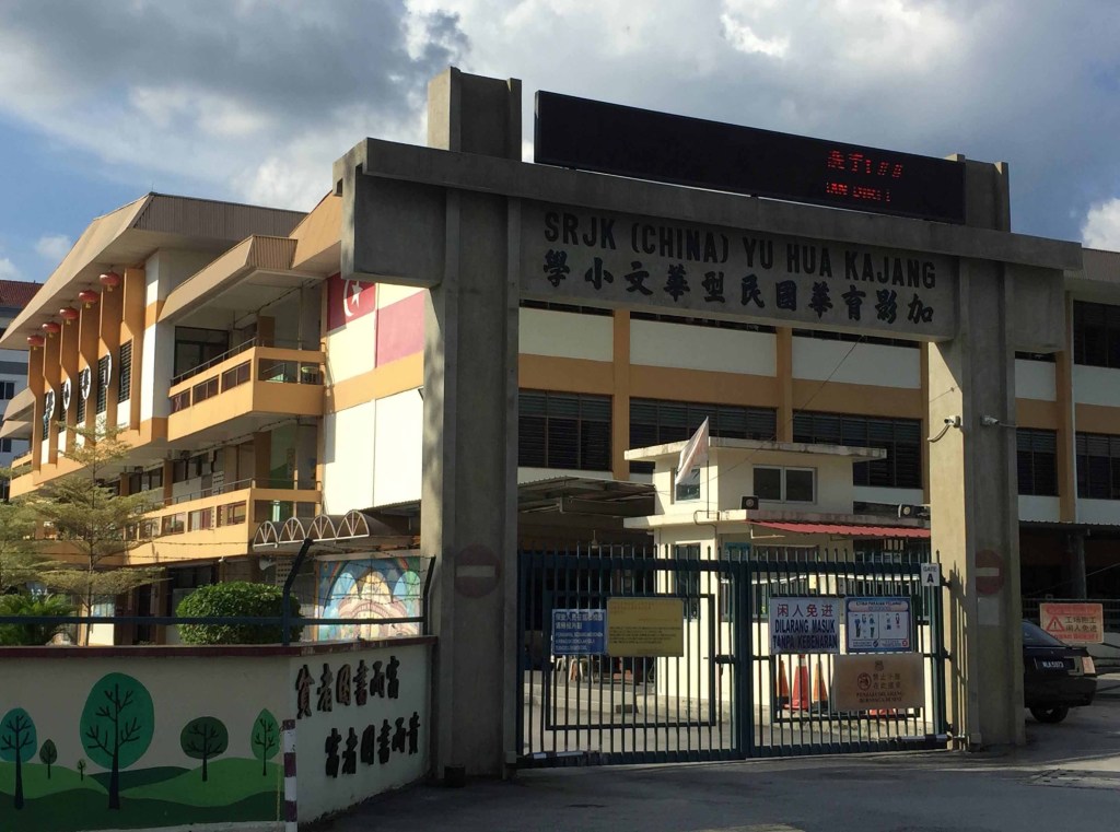
Yu Hua Primary School 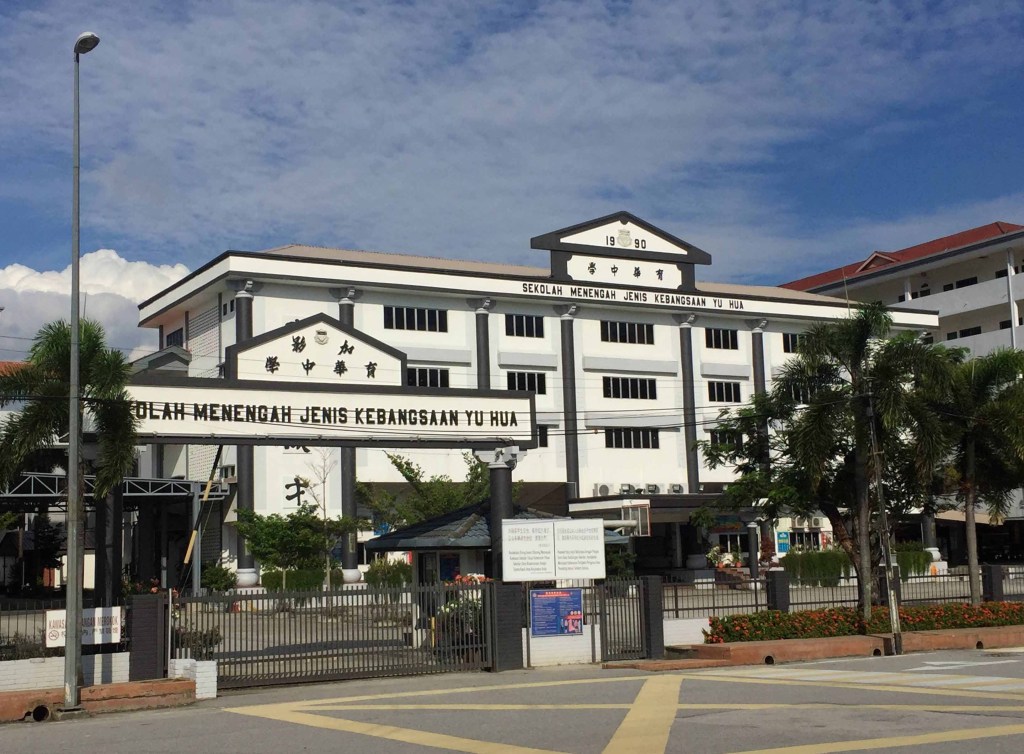
Yu Hua Secondary School
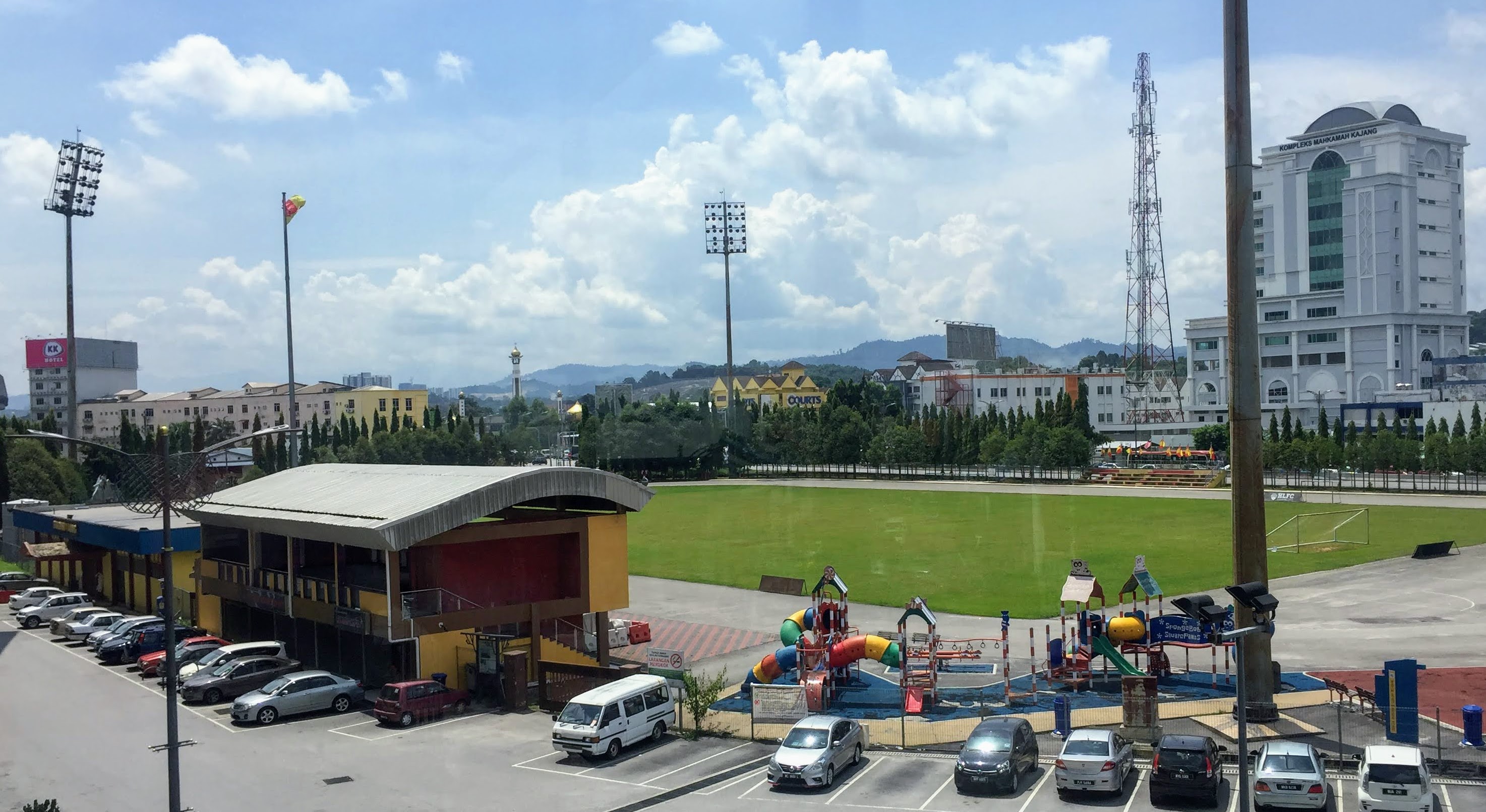
Another site that brings back fond memories to the people of Kajang is Stadium Kajang. It was built in the 1970s and, over the years, the stadium was the training ground for football legends such as Arumugam, Santokh Singh, Soh Chin Aun and Mokhtar Dahari. In 2014, it was turned into a public area called Kajang Square. Finally yet importantly, when one mentions ‘satay’, Kajang automatically springs to mind. Satay Kajang was first introduced by Wak Tasmin Bin Saiban who came from Java in the 1910s. Haji Samuri who married the granddaughter of Wak Tasmin, took Satay Kajang to new heights by expanding outside of Kajang and started operating a satay factory. Today, Haji Samuri satay restaurant is housed at the former site of Ulu Langat District Office. In front of the restaurant is the Stadium Kajang MRT station. The MRT line to Kajang was opened on 17 July 2017 and it has greatly improved public transportation and accessibility to KL city centre and beyond.
Low Ti Kok’s former residence 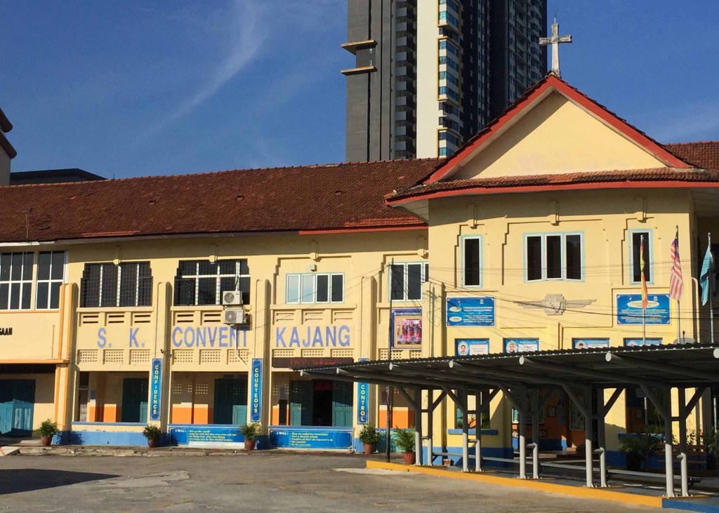
Convent Kajang (present SK Convent Kajang)
To end this article, here is a look at some current street names that still carry the names of people linked to the history of Kajang.
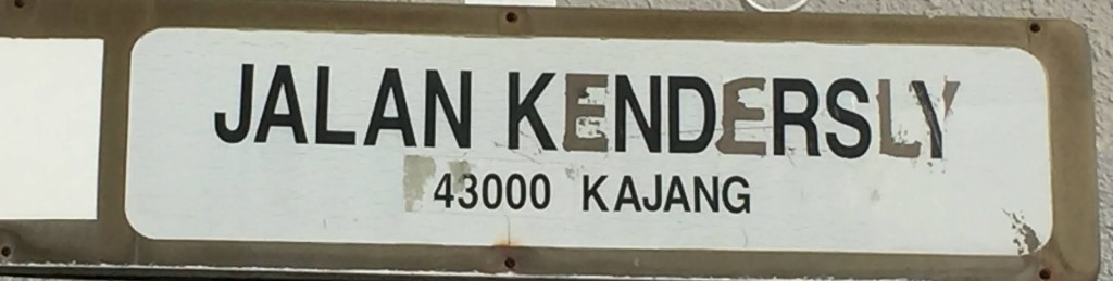
Jalan Kendersly – named after Ronald CS Kindersly of the Inch Kenneth Estate
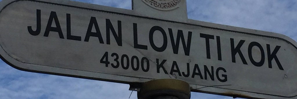
Jalan Low Ti Kok – named after Low Ti Kok, a prominent businessman who was also the Chairman of Yu Hua School
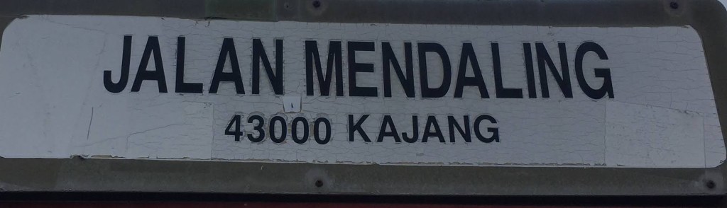
Jalan Mendaling – commemorates the Mandailing community, which was amongst the earliest in Kajang
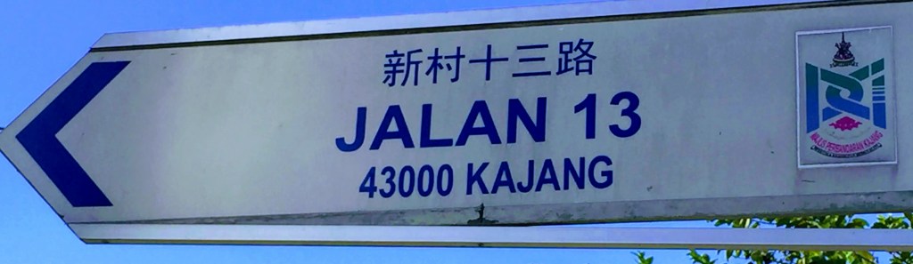
Jalan 13 – this street is in Sungai Chua New Village. It was formerly known as Goh Ah Nee Road, after the prominent businessman in Ulu Langat district.
References
The peopling of Ulu Langat – David Radcliffe – https://core.ac.uk/reader/127607722
A short history of Ulu Langat – www.jstor.org
Chinese pioneers in the Ulu Langat district of Selangor – Voon Phin Keong / www.newera.edu.my
Migration, settlement and the rise of a middle class in Chinese society : a case study of Kajang -Diana Wong, Lin Chew Mun and Tan Pok Suan / www.newera.edu.my
Some old forgotten things about Kajang High School – hanafiahlubis.blogspot.com
Parish history – hfckajang.org.my
Lee Kim Sin – Kajang Heritage Centre – Facebook and Blog