by Eric Lim
Introduction
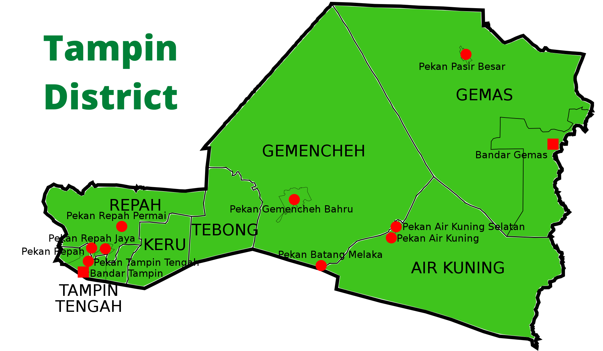
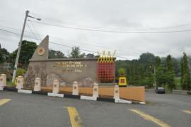
The next town from Tampin to the east via Federal Route 1 is Gemencheh. The distance is 27.3 km, which is almost the same distance from Gemencheh to the following town of Gemas, which sits on the border between Negeri Sembilan and Johor. Both towns have a number of things in common; for starters, both towns start with the alphabets ‘G, E and M’, both are located in the district of Tampin, and the establishment of these settlements have something to do with a precious ‘gem’, in this case one of the most popular precious metals with investors, this is gold.
History and Places of Interest
Gemencheh
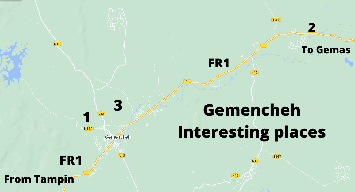
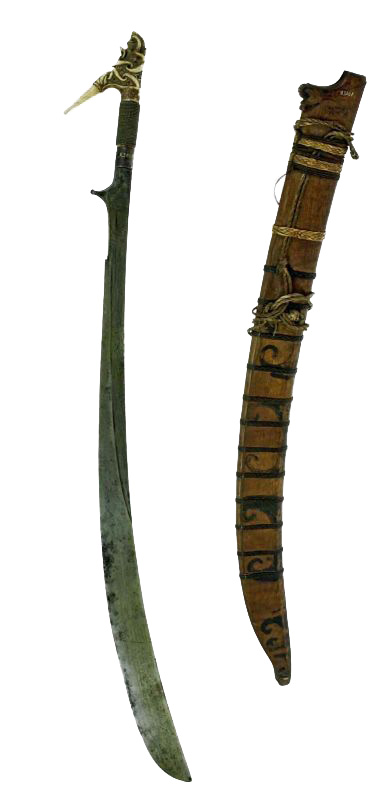
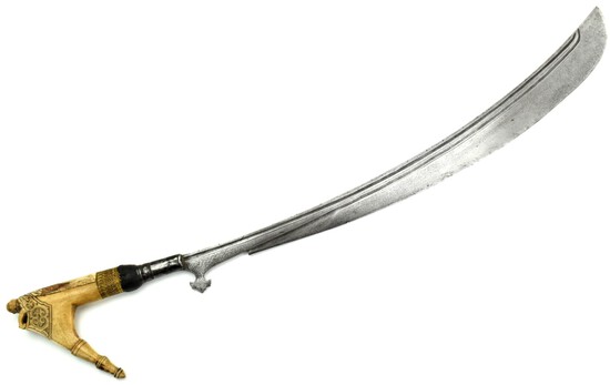
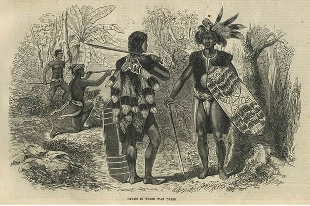
The area was initially called Sungai Siput but was later changed to Mencheh, the name of the wife of Penghulu Supai who was a Jakun (indigenous people). According to Newbold, gold mines were in existence in Gemencheh in the 1830’s, which was entirely a Malay industry. Sites were selected by a pawang (shaman / healer) and primitive methods were used to obtain the gold dust. Small nuggets were also found. The total output was twenty kati (equivalent to twelve kilograms) per annum. In 1890, the Undang (Lawgiver) of Johol, Datuk Saeto wanted to restart gold mining in Gemencheh and to keep it in the control of Johol but residents of Gemencheh disagreed. This dispute led to several clashes at Bukit Talang (Kampung Pulau [1] today) between Datuk Muda Pilih who led the group fromJohol and Raja Husain for Gemencheh. The latter retreated but later mounted another attack. The British who were in a strong position in the state at that time told Datuk Saeto to fire Datuk Muda Pilih for his crimes against the residents of Gemencheh but was met with refusal by the latter. Much later, Datuk Muda Pilih was killed. Gold mining in Gemencheh ended in 1893 and it disappeared from record. Newbold, whose full name was Thomas John Newbold, was an officer of the East India Company’s Madras Army who served in Malacca from 1832 to 1835. During his three-year’s stay, he had collected materials for his book and other papers for publication. His book has become a valuable document of the Straits Settlements.
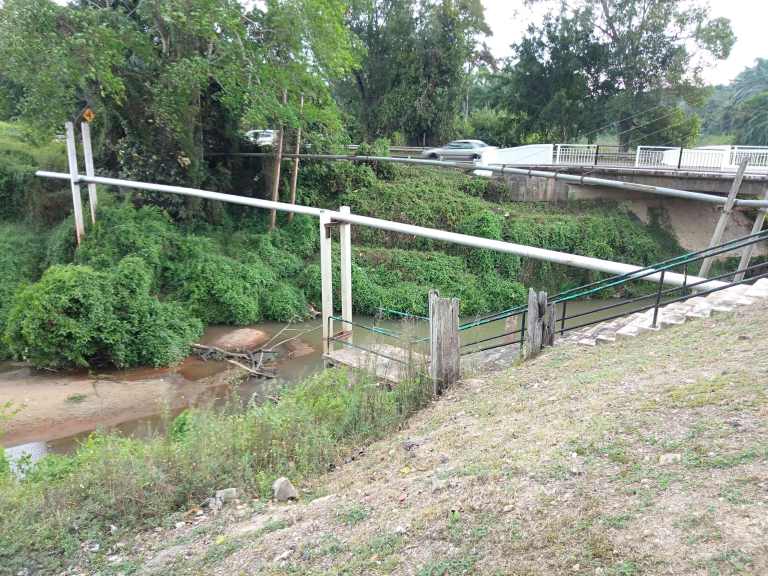
(Left) Sungai Kelamah War Memorial / Photo source : Wikimedia Commons(Right) Remnants of the wooden bridge and the new bridge / Photo source : Malaya at War (part 1) – Museum Volunteers, JMM
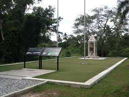
Moving forward to the period of the Japanese Occupation, after losing the Battle of Slim River to the Japanese on 7 January 1942, British and Commonwealth forces abandoned Kuala Lumpur and withdrew southward beginning on the morning of 10 January. Japanese troops secured Kuala Lumpur with relatively little difficulty at 8.00 pm on 11 January. By the afternoon of 14 January, Japanese forces had advanced past Gemencheh town and were fast approaching the Gemencheh bridge outside the town and just 12 km north of Gemas. Unbeknownst to the Japanese, the 2/30 Battalion of the Australian Imperial Force under Lieutenant Colonel Frederick Gallaghen, nicknamed Black jack, had arrived and occupied positions to the rear of the bridge along the main trunk road on 12 January. The B Company of 2/30 Battalion, which was chosen by lot to conduct the ambush, moved to the bridge area the following day. The ambush occurred at 4.20 pm. Once a large group of Japanese had reached the engagement site, the bridge was detonated and the Australian soldiers hurled grenades and started firing at the Japanese. According to records from battalion members who were present at the ambush, estimate that approximately 600 Japanese were killed. It was also recorded that the action at Gemencheh bridge was the first time that Australian and Japanese troops had met in battle. Today, a new bridge has been built. The remnants of the old wooden bridge can still be seen and not too far from here is the memorial site called Sungai Kelamah War Memorial[2] (war story to continue in the section on Gemas).
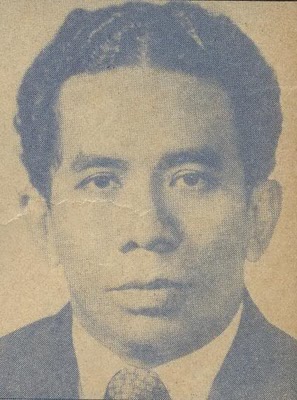
(Left) Datuk Mohd Taha (Right) Datuk Mokhtar HashimPhoto source : 3 Assassination Cases That Will Forever Remain in Malaysian History
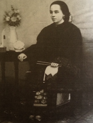
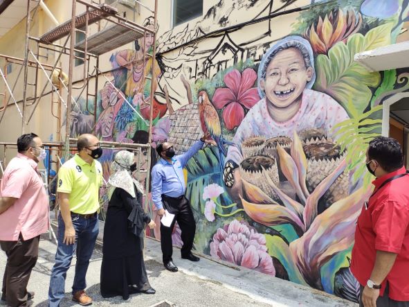
The town continued to hog the headlines of local dailies. Two events took place that sent shockwaves to the nation. The first took place in the early hours of 14 April 1982 at Kampung Seri Asahan [4] where Datuk Mohamed Taha Talib who was then the Negeri Sembilan Legislative Assembly Speaker, was gunned down outside his home. It was eight days before the 1982 Malaysian Election (GE6). On 10 July, Datuk Mokhtar Hashim, the Member of Parliament for Tampin and Minister of Culture, Youth and Sports and four others were arrested and charged with the murder of Datuk Taha. After seventy-six days in court, which was one of the longest criminal trials in Malaysian history at that time, Datuk Mokhtar was sentenced to death by the Kuala Lumpur High Court in March 1983. It was later commuted to life imprisonment by the Pardons Board in 1984. After serving for seven years, he was released from prison following a royal pardon by the then Yang Di Pertuan Agong, Sultan Azlan Shah. A posting on Facebook on 18 November 2020 confirmed the passing of Datuk Mokhtar at Ampang Hospital at 3.10 am on the same day. He was 78.
The second event was also a scene of killing. It happened on 12 January 2010 at Kampung Batang Rokan [3] where a 34 year-old man killed his grandparents, father and younger sister. He then returned to Shah Alam with his father’s head where he buried it in a Muslim cemetery. He was caught the next day when he tried to attack an auxiliary police officer with a knife near the Masjid Jamek LRT station. In September 2010, he was acquitted of the crimes on the ground of insanity but ordered that he be held at the pleasure of the state ruler.
Gemas
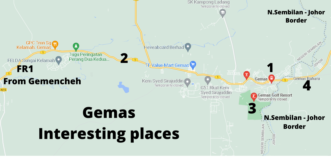
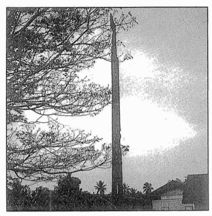
The first settlers arrived in the area around 1890’s and named the place, first, in accordance to the actual topography of the surroundings, which was literally covered with swamps with lateral roots that grow upward, as Paya Akar and then changed it to Ayer Terap (latex from the Terap tree). The Terap tree is a native flora and can grow to a height of 45 metres with buttress roots. The bark of the Terap tree is used by the locals for lining baskets and bins, making house-walls and as strings while the latex from the tree, which is very sticky, is used for bird trapping. When the British came in the early 1900’s, they found gold while digging around the district and decided to call the place ‘Goldmas’, a combination of the word Gold in English and Malay (emas), and it eventually evolved into ‘Gemas’.
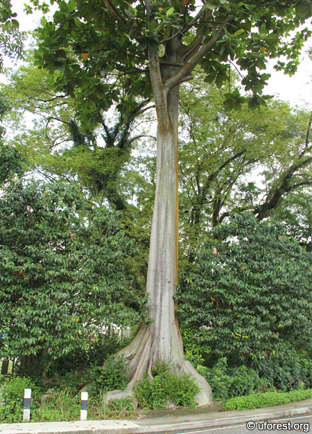
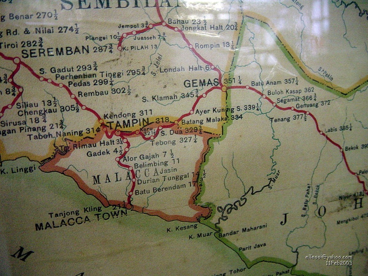
(Left) Terap tree / Photo source : Terap – Artocarpus elasticus
(Right) Railway map – connection between Malacca, Tampin and Gemas / Photo source: http://braderdm.blogspot.com/2009/01/fmsr-tampin-melaka-line.html
When the Federated Malay States Railway was formed in 1901, the tracks were still separated between Perak and Selangor. The North to South trunk line was finally connected in 1903 between Perai and Port Dickson. The Malacca Government Railway then proceeded to link Tampin to Malacca, which was opened on 1 December 1905 and the section connecting Tampin to Gemas was opened to traffic on 1 October 1906. Upon the completion of the latter, the Malacca Government Railway was absorbed into the Federated Malay States Railway. This was followed with the opening section between Gemas and Segamat on 1 March 1908 and the whole of the railway through Johor was commissioned on 1 July 1909. With the completion of the North-South section, the next phase was to connect the railway line to the East from Gemas, which started in 1910.
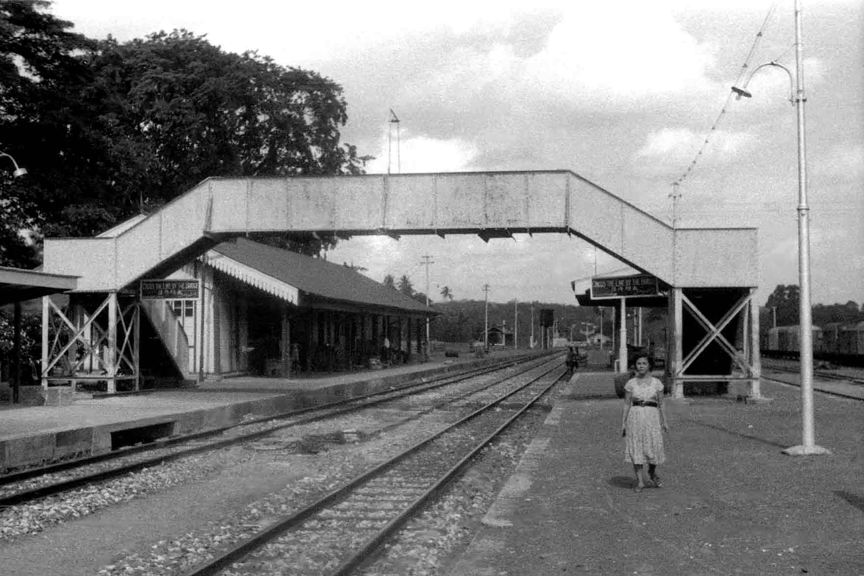
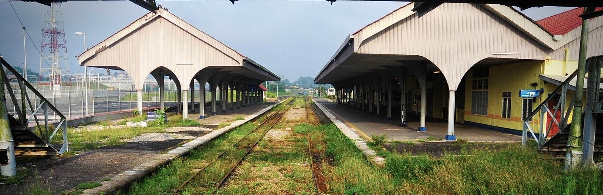
The date 5 September 1931 witnessed the completion of the East Line (aka East Coast Line) connecting Gemas and Bahau (in Negeri Sembilan) through to Mentakab and Kuala Lipis (in Pahang) and finally to Gua Musang, Tumpat and Sungai Golok (in Kelantan). Today, Gemas is an important railway hub in the country. It is located at the intersection of Keretapi Tanah Melayu (KTM) East and West Coast main lines, which is now collectively known as KTM Intercity rail service. As of now, KTM Intercity is the only train service that transports passengers from Tumpat to Johor Bharu Sentral. Meanwhile, the ETS (Electric Train Service) inter-city electric rail service is currently operating from Gemas to Padang Besar up North in Perlis. Previously, Gemas was the southern terminus of the KTM Komuter Southern sector shuttle train but since 20 June 2016, the shuttle service terminates at Pulau Sebang/Tampin station. The original Gemas station [1], which was opened sometime in 1922, is still standing, located just beside the completely new station complex that was built in 2012.
The ambush at Gemencheh bridge on 14 January 1942 and the fierce fighting in the ensuing day has become known as the Battle of Gemas. The rather lop-sided engagement at the bridge lasted for twenty minutes after which Captain Desmond Jack Duffy, Officer Commanding B Company, told his men to withdraw according to plan to the rendezvous area. Duffy wrote a report when he was held captive as a prisoner of war at Changi gaol and described the aftermath of the ambush: ‘…. the whole of the roadway was completely covered with fallen enemy and their bikes – the road was literally a complete stretch of dead and wounded enemy as there was not a move out of the whole stretch and I doubt if it would have been possible to have walked over this bit of road unless the walker walked on bodies’.
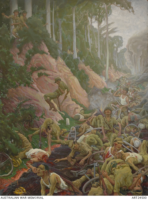
Photo source : Gemencheh Bridge
The Japanese advance came to a sudden halt. They immediately set out to repair the bridge using timber from a nearby sawmill and by dawn the next day, Japanese Type 95 Ha-Go tanks were rolling across the new bridge and heading up the Tampin-Gemas trunk road [2] to the vicinity of 61 mile peg, where the main 2/30 Battalion was waiting for their arrival. A roadblock made up of concrete cylinders was set up and further strengthened with the addition of four anti-tank artillery regiments. In the battle, five tanks were destroyed but Japanese forces continued the attack with reinforcements on the ground as well as taking full command of the air. Japanese aircrafts were bombing Gemas, battalion headquarters and company areas. This resulted in the withdrawal of the battalion in mid-afternoon to the Gemas River. For the Japanese troops, they have now arrived at the southernmost state of Johor, inching ever closer to their ultimate destination, Fortress Singapore.
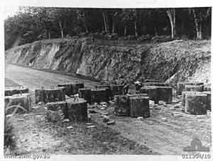
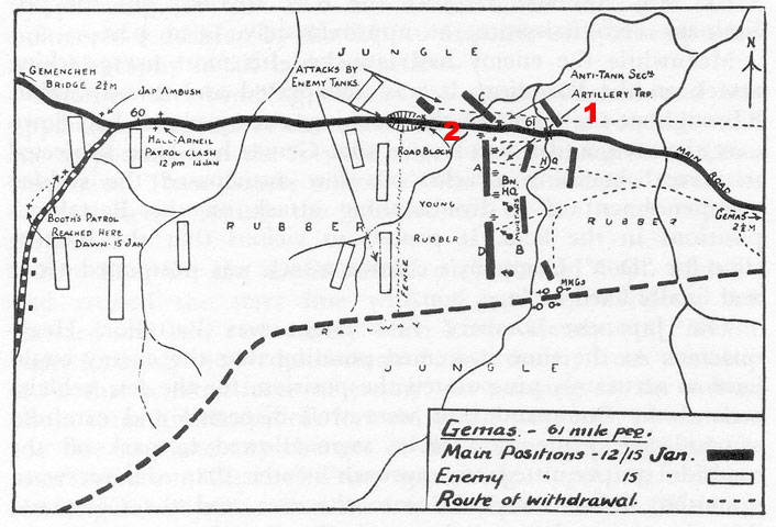
(Left) Road block made up of concrete cylinders at Gemas
(Right) Map showing the Battalion area at Gemas
Photo source : Gemencheh Bridge
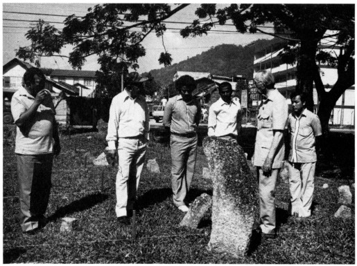
According to the article ‘Sejarah Gemas-Ruangan Lorekan Remaja’, written by students from Sekolah Menengah Tuanku Abdul Rahman, Gemas which won the first prize in a national level secondary school history writing competition, revealed that there are two memorial sites in Gemas. One of the sites is located near the KTM (Keretapi Tanah Melayu) sports club. Immediately after occupying the town, Japanese troops had constructed a monument to commemorate their colleagues who were killed at the ambush. Families of the fallen soldiers will come for the memorial service every five years. The other site is located about 100 metres from a Hindu temple and this is to commemorate Indian railway workers who were killed by Japanese soldiers.
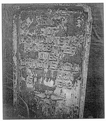
(Left) Indian railway workers and (Right) Japanese soldiers memorial sites in GemasPhoto source : Sejarah Gemas (ruangan lorekan remaja) · Malaycivilization
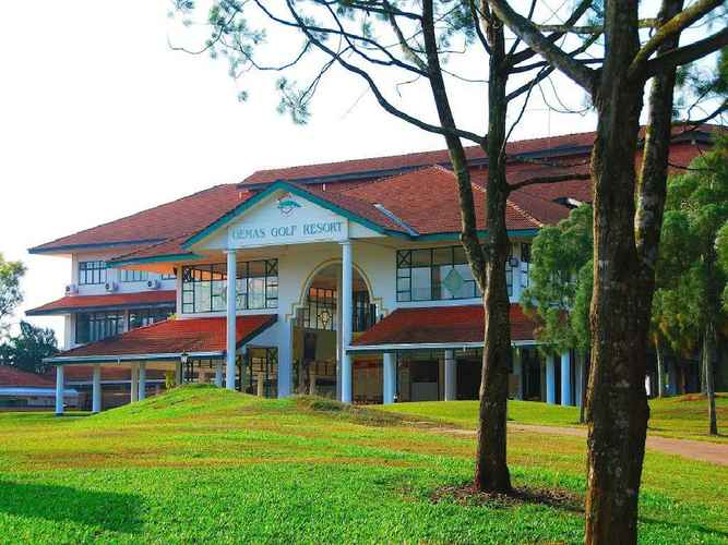
When Captain Duffy, later promoted to Lieutenant Colonel, retreated with his men, they stayed the first night in the jungle. The following night, they found their way to the Gemas golf links where they found half a tin of condensed milk, a few bottles of soda and tonic water. They spent the night in the golf links and the next morning, headed through the rubber plantation and eventually made it to the battalion headquarters. Today, the golf links is known as Gemas Golf Resort [3], an 18-hole par 72 golf course. The three-storey clubhouse houses a three-star hotel with 43 guestrooms, meeting rooms, a restaurant and a swimming pool.
A new township called Gemas Baru [4] is located about one kilometre from the Johor-Negeri Sembilan border and it comes under the Segamat district. Though the towns are in two different states, both towns share the same postal code 73400.
Getting There
From Kuala Lumpur city centre, use the North South Highway (E2 South) and exit at Exit 227 Simpang Ampat. After the toll plaza, turn left to join Lebuh AMJ (Alor Gajah – Central Melaka – Jasin Highway) a.k.a Federal Route 19 to Simpang Ampat. Once the Simpang Ampat Police Station is in sight on the left, turn left to join M10 – Jalan Kemus / Sempang Ampat. Upon reaching Pulau Sebang intersection, turn left to join Federal Route 61 / Jalan Alor Gajah – Tampin a.k.a Jalan Dato Mohd Zin (former Melaka Chief Minister Mohd Zin Abdul Ghani). Upon reaching the intersection in Tampin town, turn to join Federal Route 1 / Jalan Tampin – Gemas to Gemencheh and Gemas.
References
The Negri Sembilan Economy of the 1890’s (page 50)
THREE 19th CENTURY MILITARY AUTHORS OF THE FAR EAST (page 147 – 149)
Sejarah Gemencheh. · Malaycivilization
Malaya at War (part 1) – Museum Volunteers, JMM
Former minister Mokhtar Hashim dies
Gruesome killings that rocked a nation
Sejarah Gemas (ruangan lorekan remaja) · Malaycivilization.
Gemas Tourism: Best of Gemas, Malaysia – Tripadvisor
In this Series
Please click HERE for a list of articles in the ‘A Very Rough Guide’ series.