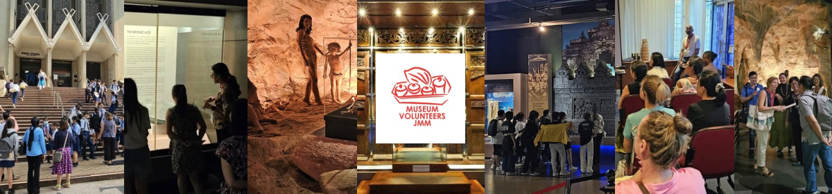
(Note: MVs were invited on this visit to give feedback on ideas for heritage tours of the Merdeka Precinct.)
On 6 May 2023, a breezy and beautiful Saturday morning, MVs were honoured to be invited to witness the development of a new iconic building for Malaysia – Merdeka 118. We were greeted and given a very warm welcome by the staff of PNB Merdeka Ventures Sdn Bhd followed by a briefing by their CEO, Y.M. Tengku Dato’ Abd Aziz Tengku Mahmud. Y.M. Tengku Dato’ Abd Aziz Tengku Mahmud started his briefing with the history of how PNB Merdeka Ventures Sdn Bhd became involved with the development of Merdeka 118, which is part of Stadia Land.
Stadia Land consists of 6 lots :-
Changkat Pavilion site (Lot 354 & Lot 355) Taman Tuanku Abdul Rahman (Lot 742) Stadium Negara (Lot 743) – National Heritage Stadium Merdeka (Lot 744 & 747) – National Heritage
In 1994, the Malaysian Government transferred Stadia Land to Puncak Vista Sdn Bhd (“PVSB”), a subsidiary of UEM Berhad (via Syarikat Tanah dan Harta Negara) as per the terms and conditions of the Agreement for UEM to build the National Sports Complex in Bukit Jalil. In 1997, Pengurusan Danaharta National Berhad (“Danaharta”) took over Stadia Land from PVSB due to the 1997 Asian financial crisis. On the suggestion of Tun Ahmad Sarji, the 9th Chief Secretary to the Government from 1990 to 1996, who was also a former President of Badan Warisan, PNB Merdeka Ventures Sdn Bhd acquired Stadia Land from Danaharta in 2000. The 1997 Asian Financial crisis prevented 2 heritage stadiums from being demolished. Under the PVSB plan, only Lot 747 is to be preserved as a memorial and the rest of the buildings in the other 5 lots are to be demolished.
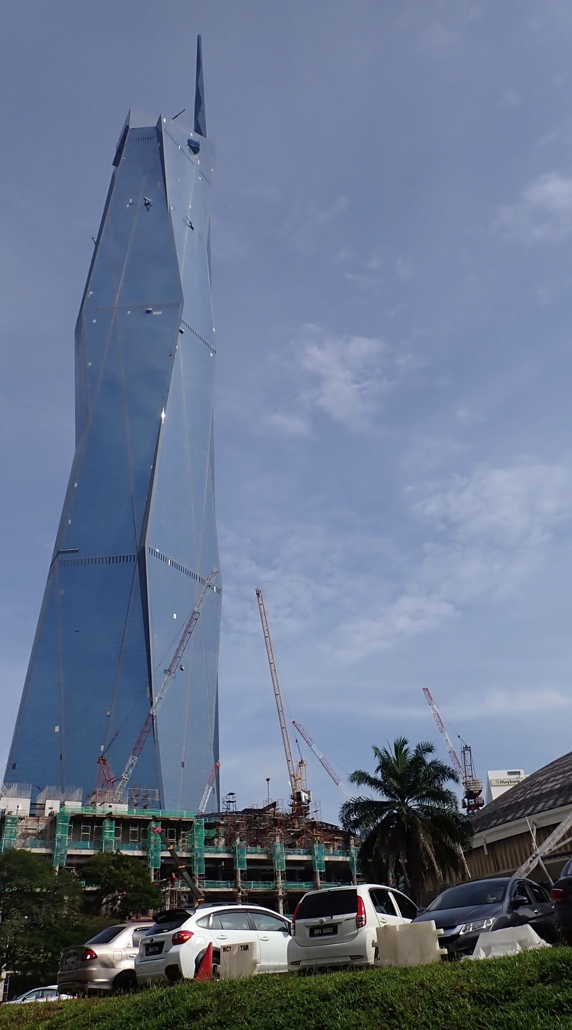
There were only 100 floors in the original plan. However, as nearly 20 floors were required for machinery, utilities, etc, the number of floors had to be increased. The management decided to stop at 118, pronounced “Yat Yat Fatt” in Chinese meaning daily prosperity! Merdeka 188, standing at 678.9m tall (a very easy number to remember, in the sequence of 6,7,8,9), is the tallest building in South East Asia and the second highest building in the world after Burj Khalifa standing at 828m tall. Its form was inspired by the outstretched hand gesture made by Malaysia’s first Prime Minister in 1957, when he declared the nation’s independence in Stadium Merdeka, which is part of the Merdeka 118 precinct.
Merdeka 118 comprises a Shopping Complex from levels 1-3, offices up to level 96, Hotel at levels 97-98, and observation deck at levels 115-118. Visitors descending from the observation deck will end at Level 3, the “Malaysian Floor” – to experience Malaysian cultural products and food.
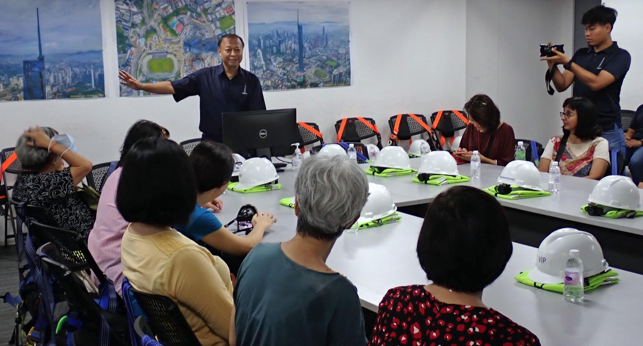
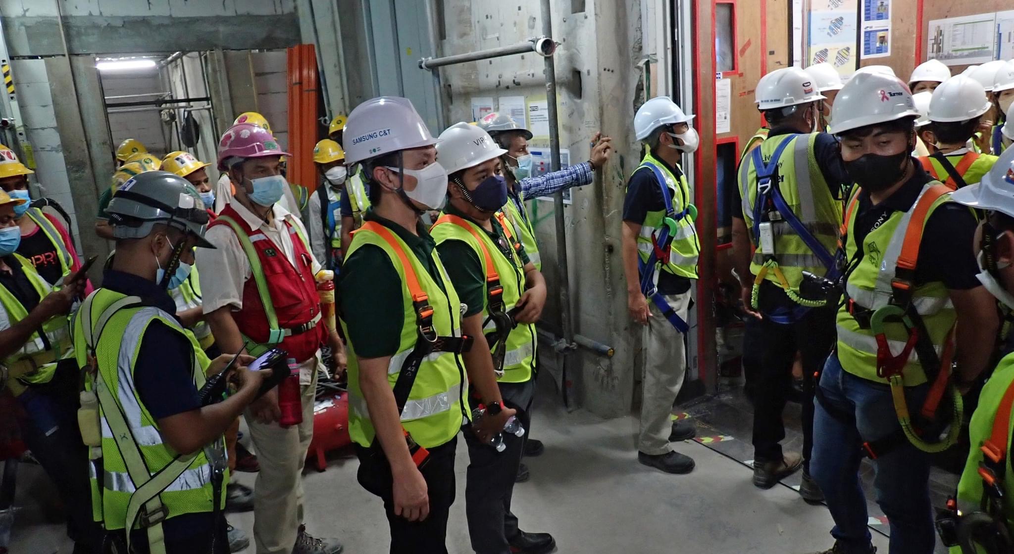
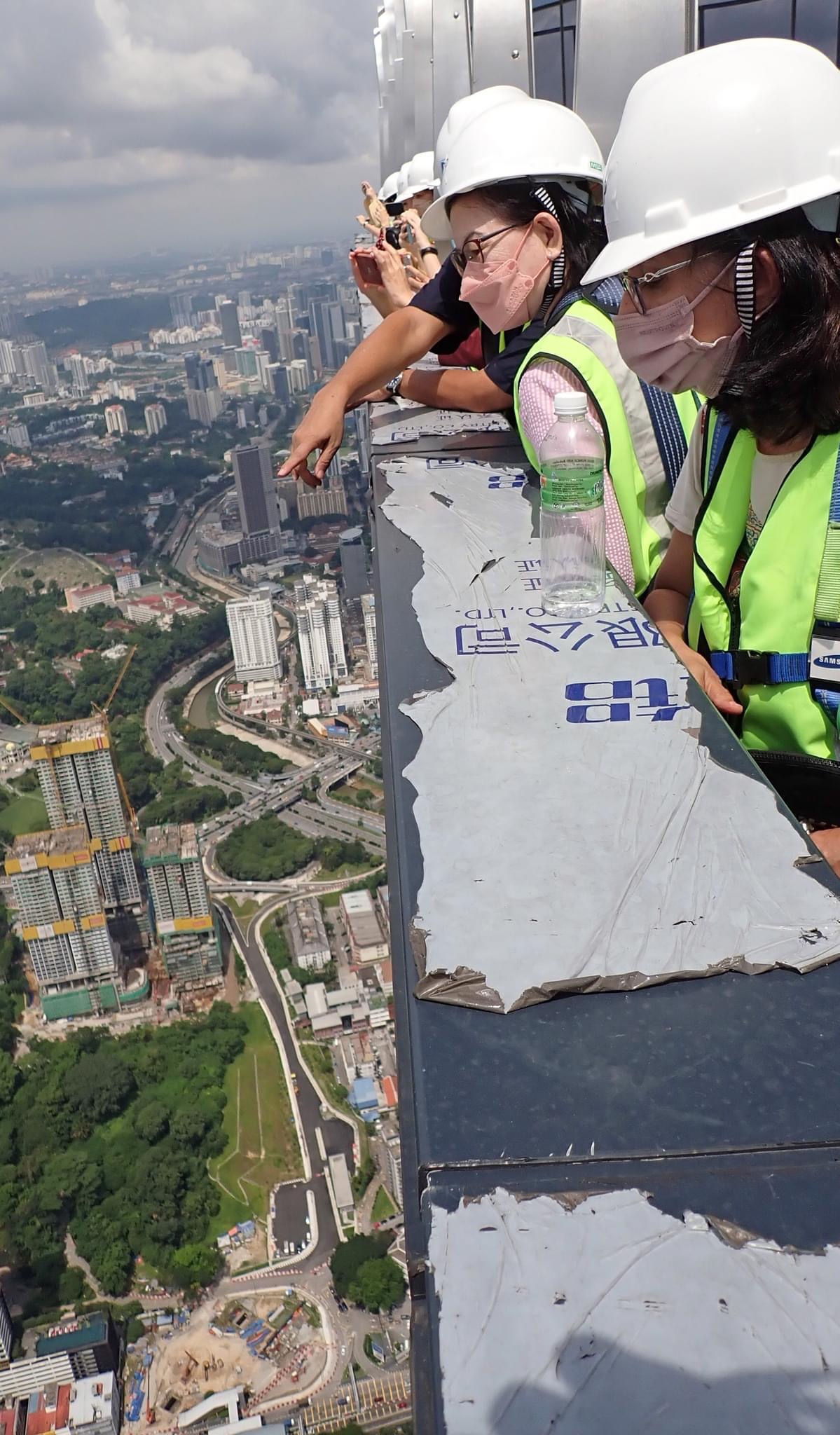
After the briefing, all of us were geared up with PPE complete with safety boots. It was not easy to move around in the heavy PPE and every step taken wearing those safety boots felt like foot-weight lifting. We were taken up to floor 116 by the service lift, which could accommodate all 20 MVs and our guides. The journey from the ground to floor 116 only took approximately 65 seconds. Unlike other buildings, lift evacuation in the event of fire is allowed in Merdeka 118.
We were amazed by the spectacular view at level 116. We could see the National Museum, Victoria Institution School, Stadium Merdeka, Royal Museum, National Mosque, Old KL Railway Buildings, Chin Woo Stadium, Daya Bumi Building, Dataran Merdeka, Parliament Building, Bank Negara and the canopy stretching over Petaling Street. With so much to look at and a lovely cooling breeze, it was an out-of-the-world experience and we wished we had more time to enjoy it.
A brief explanation was given about the glass used for the building. There are three layers of glass. These are non-conjoining glass with space in between them. For safety purposes, if there is a slight crack in one layer, all the three pieces of glass will be replaced.
After enjoying the spectacular view and cooling breeze at level 116, we were brought back to the meeting room for lunch. We passed through the temporary office which will be turned into a carpark with a vehicle number plate recognition system. With 8,000 park bays available, visitors can use the vehicle number plate recognition system to locate their cars.
Behind the development of Merdeka 118 lies an incredible noble vision and mission. Merdeka 118 is a proud symbol of Malaysia’s independence with plans for the betterment of the people. Accessibility between the Merdeka 118 precinct and its immediate surroundings will be improved. It aims to build relationships, enhance resilience and incubate new content with the communities surrounding Merdeka 118 through its Merdeka Community Grants Programme. This Programme includes activities such as Heritage Walk & Talk, Vocational Training for Underprivileged Young Women, PESZTA Festival in conjunction with Merdeka Month at Kampung Attap and Economic Empowerment Programme.
And last but not least, the Merdeka 118 project includes the reactivation of Stadium Merdeka, which has hosted countless memorable events in the past. The preservation and restoration work had reversed the stadium back to the original 1957 look. The original floor tiles were found to be still manufactured in India, which enabled the replacement of the damaged floor tiles. The original turnstiles were found and retrieved from Manchester. Unesco has recognized the restoration works and in 2008 it was conferred the Cultural Heritage Conservation Award.
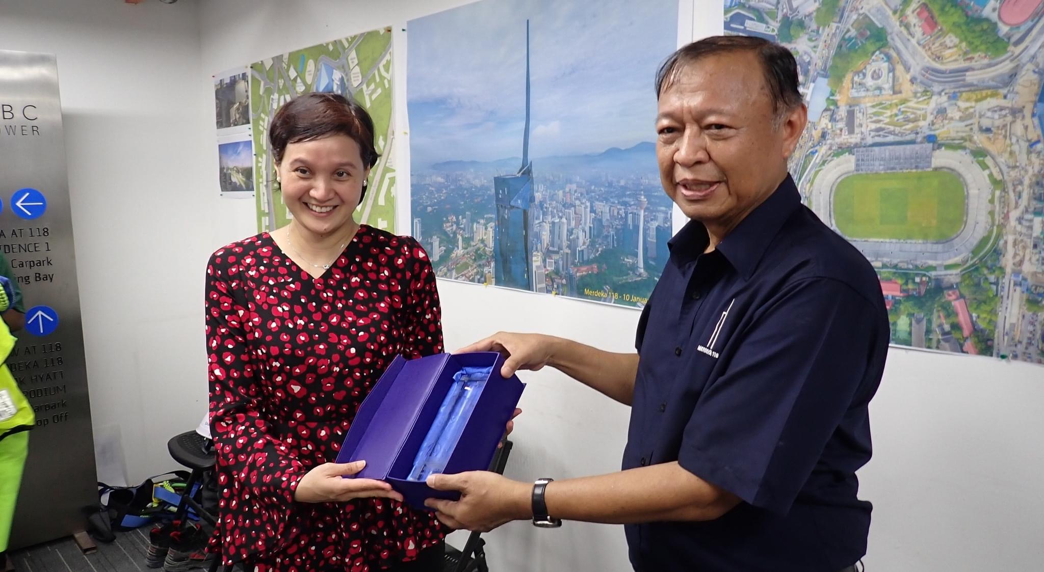
Our visit ended with a scrumptious Raya lunch, receiving souvenirs from Merdeka 118, and presentation of souvenirs from our Honorary President, Puan Afidah Zuliana Abdul Rahim to PNB CEO, Y.M. Tengku Dato’ Abd Aziz Tengku Mahmud. We left Merdeka 118 with a nostalgic feeling of what our country went through on the road to independence for all of us to enjoy a harmonious, prosperous and beautiful Malaysia with its unique diversity … proud to be Malaysian!
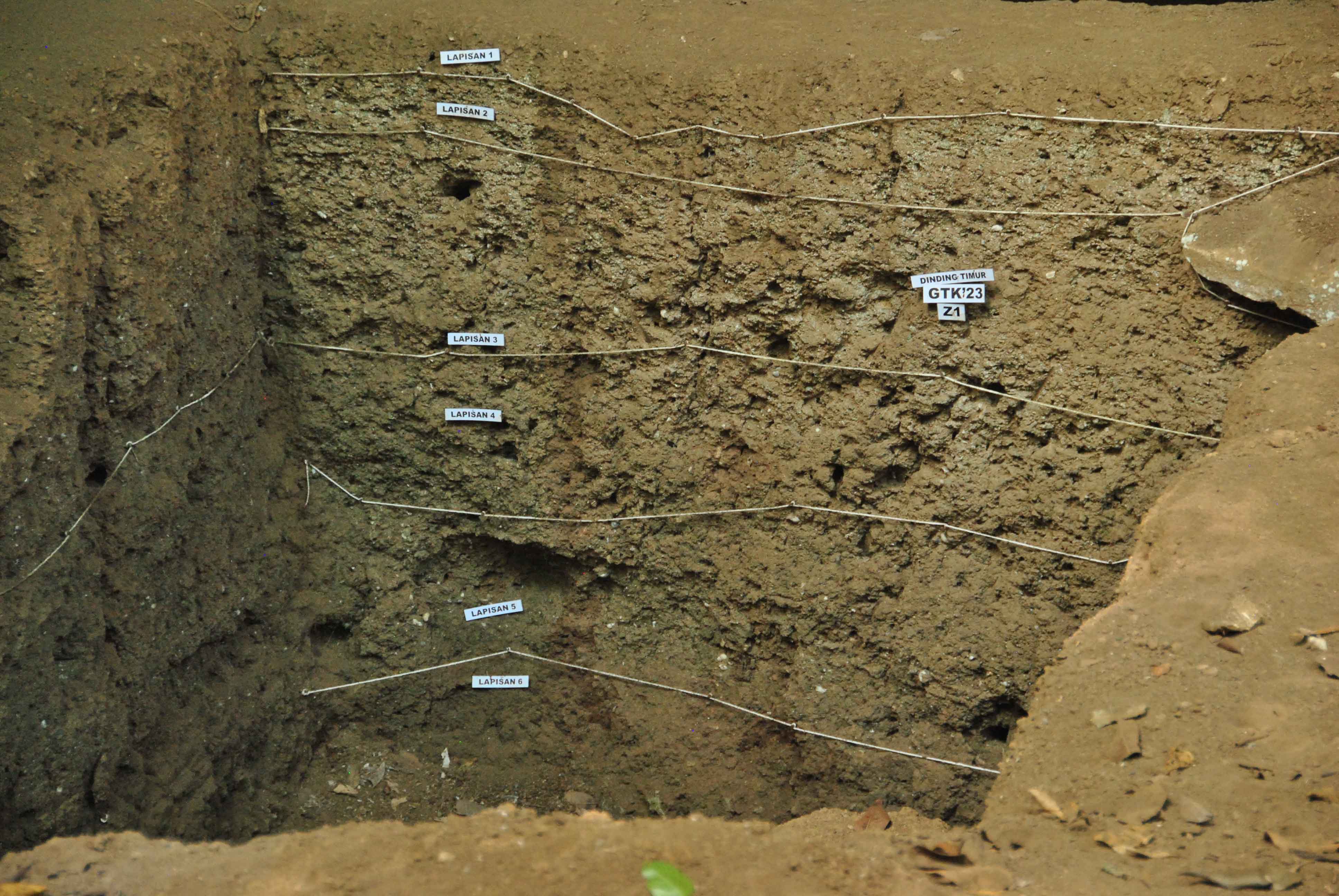
This could be a standard script when we take visitors to Gallery A of Museum Negara, passing by the corner from the entrance, before the Dong Son drum. Perak Man is a complete skeleton found in Lenggong Valley, dated 10,000 years ago. We all know about the ‘told’ stories of the bones, i.e., the skeleton, the excavation site and the pelvic bone that signify that the bones belong to a man. We also learned the ‘untold’ stories, such as the genetic disorder of the Perak Man and the respect he gained from his tribe in our classroom or publications. However, there is still a bundle of stories lying in Lenggong Valley, underneath the soil layers, to be revealed.
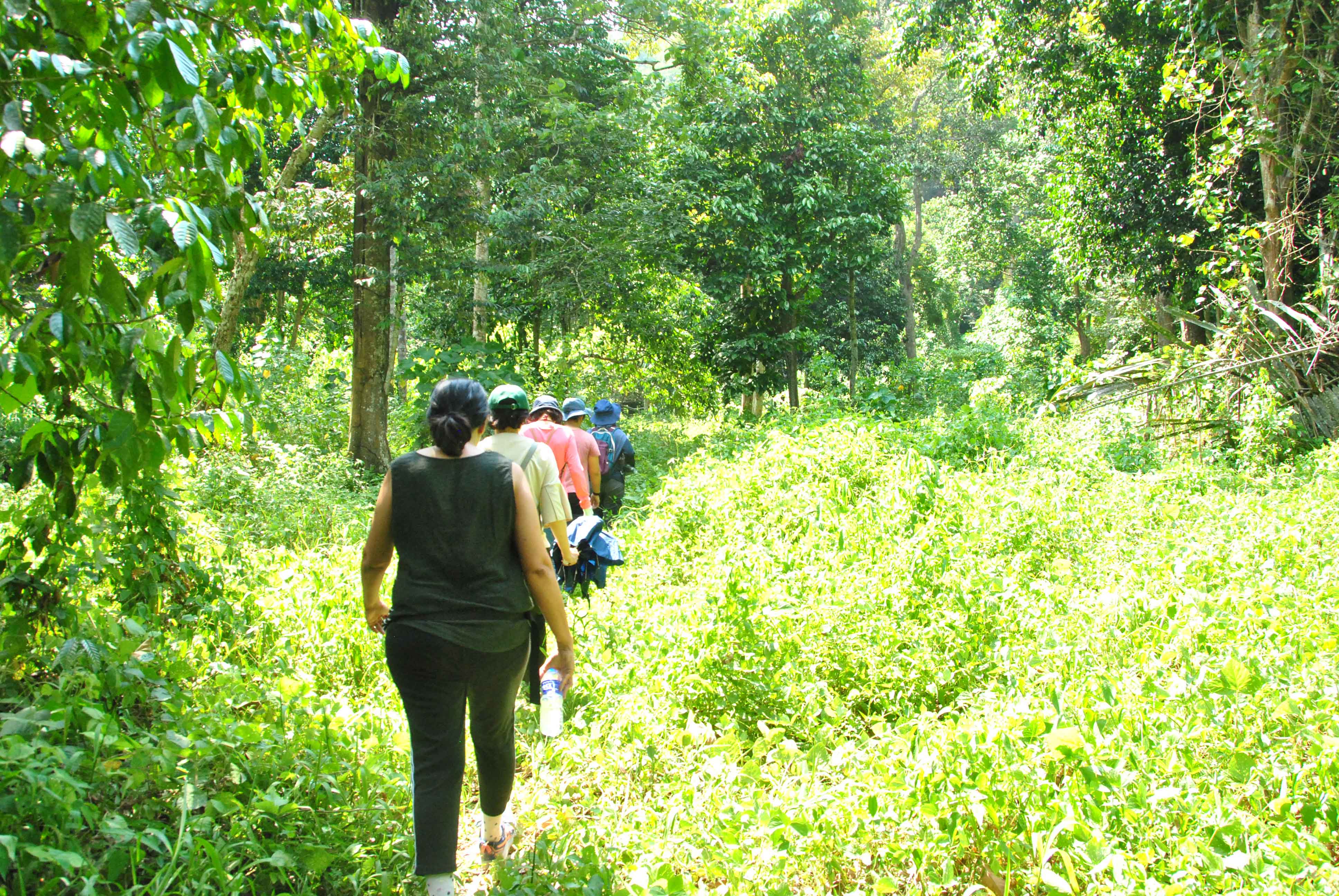
Hence, the trip to Lenggong Valley took the Museum Volunteers out from museums and publications, to be like an archaeologist, at least for a few hours.
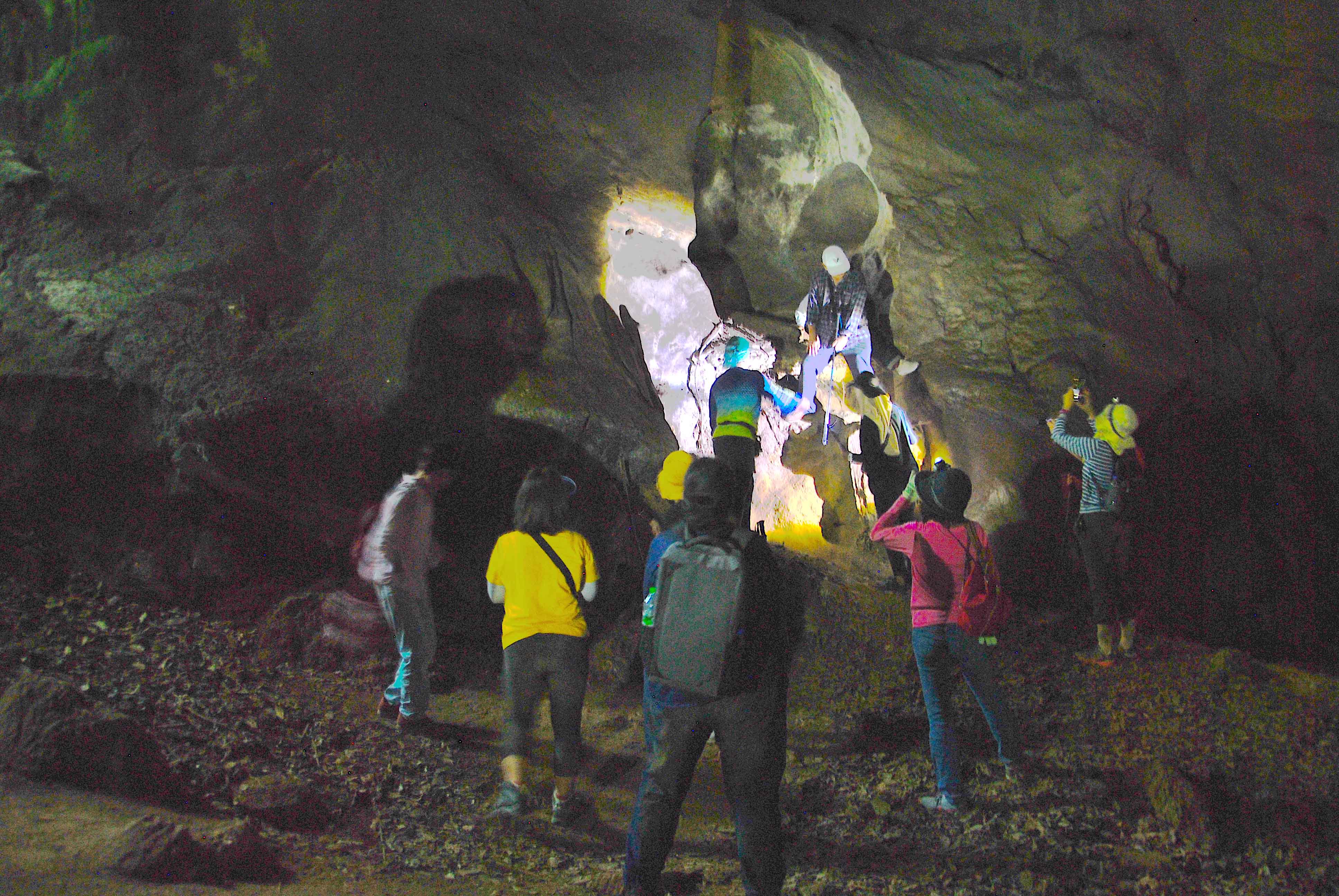
The trip was under a ‘summer-like’ hot sun, but we took it as a summer camp excitedly. The group of volunteers were from different batches, and we hardly knew each other before this trip; but we had lots of precious bonding opportunities at this campsite. Our ‘battery’ wore off slightly early on the first day because we visited a lot of caves in only three hours during the late afternoon. Thus, we faced the reality of our stamina – we missed the stargazing activity and slept soundly, lights off at 11 pm (or earlier).
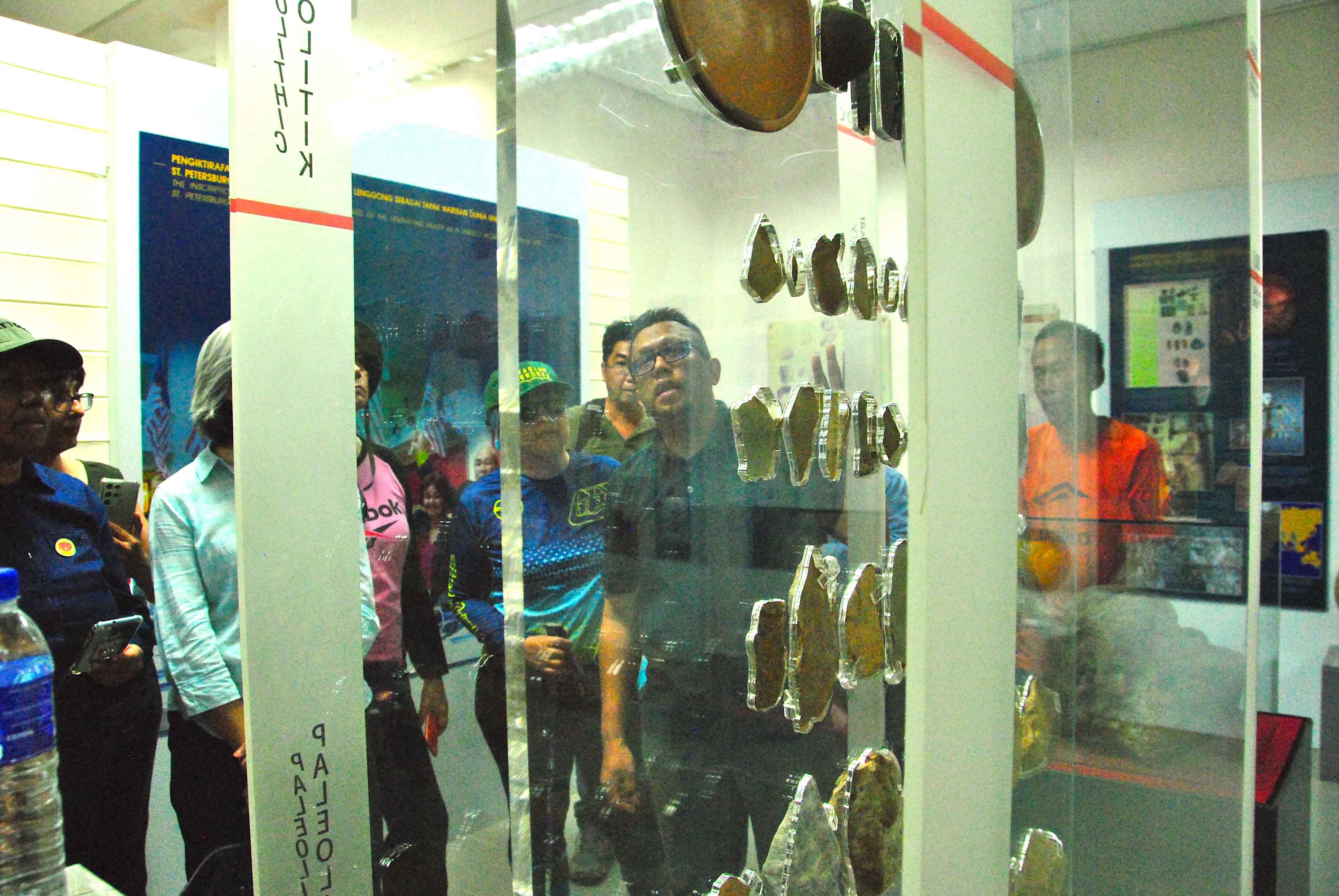
The Lenggong Temporary Gallery was the ‘appetizer,’ specially prepared for the museum volunteers since the Gallery had not been opened to the public in the last few years. At this gallery, we got to know some precious stones and tools from the Palaeolithic age, including the 1.83-million-year-old suevite rock, which we learnt more about on the following day.
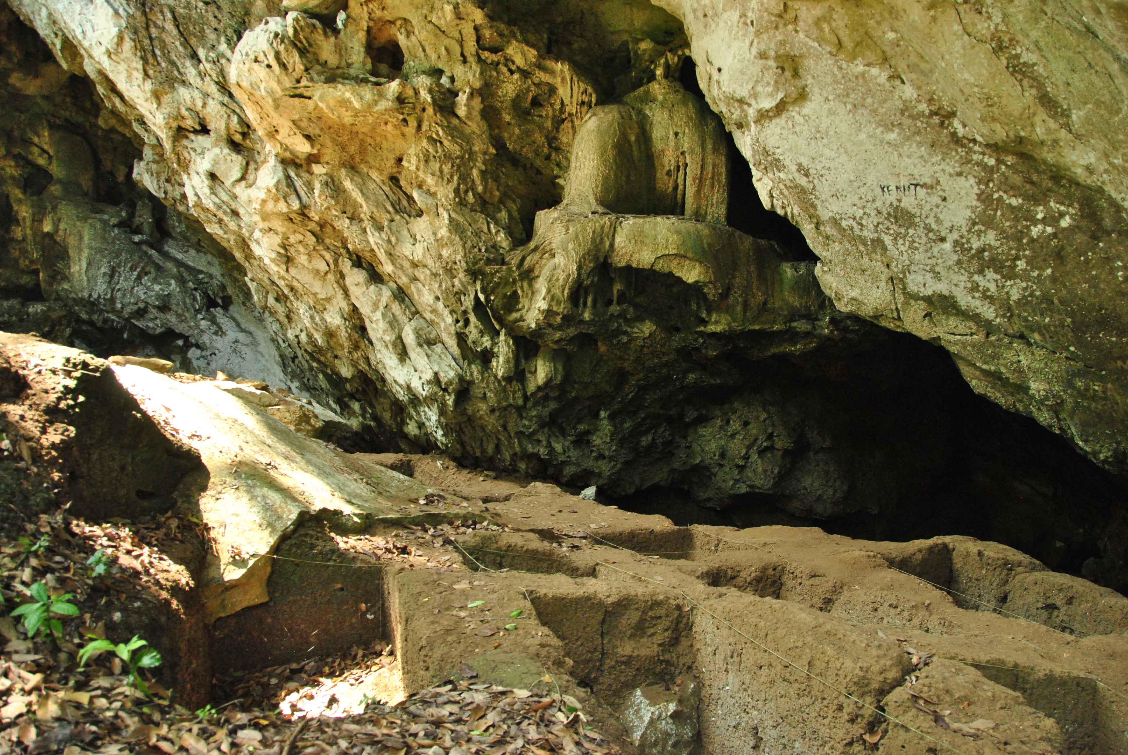
The highlight of the day was Gua Kelawar (Bat Cave), where the 8,000-year-old Perak Woman was found. This site provided us with some ‘out-of-textbook’ information on the ancient people. We learnt that Perak Woman’s burial was covered by later habitation levels on the same site. We saw shells embedded in the soil and understood the connection between the sea level and the habitation choices of the ancient people. The caves also gave us a picture of how it has been selected as a shelter, cohabiting with other creatures such as snakes and bats. However, the mountain and caves are now deformed, possibly due to geographical movements and human activities such as quarries.
There was a shortcut from Gua Kelawar A (Bat Cave A) to the exit, where the whole journey could be shortened to only a 500m walk under the home of bats, but we were brought through another route, which was full of adventure in the caves. These caves are all located in the Bukit Kepala Gajah limestone complex, named as such because an elephant head is outlined from afar.
We walked past Gua Kelawar B (Bat Cave B), to reach Gua Ular (Snake Cave), named as there are a lot of snakes in this cave at night. We had a bit of ‘team building’ in this cave, helping each other navigate the dark cave.
Caves here are normally named after an animal commonly seen there; Gua Ngau (Ngau Cave) got its name after a tiger’s roar was heard. Despite the tiger, the faunas that I wished I could encounter are two snail species – Sinoennea lenggonegensis and Diplommatina lenggonegensis – as well as a lizard, Cyrtodactylus lenggongensis, which is a unique species found only in Lenggong Valley. Read more here.
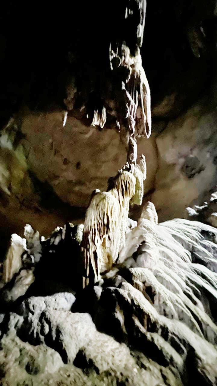
After Gua Ngau, we had a choice of continuing straight to Gua Kajang, the last cave on our list, or taking a detour via Gua Puteri; only seven of us took this rock-climbing challenge. The cave is associated with a lot of folk tales, stories made up around the stalagmites and stalactites seen in the cave.
We have to thank En. Rosli (also known as Pak Li or Encik Li), the living ‘Perak Man’, for all the adventures and stories. En. Rosli was also the man who found the stone in which Perak Man’s tooth was embedded, a day before Prof. Zuriana Majid and her team’s project was closed, hence opening another huge chapter for the team.
We would like to express our deepest gratitude to Dr. Nisa, Dr. Shaiful and Research Officer En. Shyeh for sharing their knowledge and ‘stories’.
“Here lies the Perak Man.” was my line where I brought museum visitors through Gallery A, but after this trip, I think I will have to enhance my script with the following:
“Here lies the Perak Man, and also Perak woman (or women), they are all found in the caves of this World Heritage Site known as ‘Lenggong Valley’.”
Early on in my working career, I had worked in two companies located at Section 51A in Petaling Jaya, just off the Federal Highway. And Sungai Way which is just a short distance away, is where my colleagues and I used to frequent for lunch, where there were plenty of food choices and at reasonable prices. Recently, when I heard that there is a mini museum in the area, I immediately messaged a ‘kind-of-foodie’ friend to make plans to visit over the weekend, and he replied ‘let’s go’.
Sungai Way is made up of SS8 (Sungai Way Free Trade Industrial Zone), SS9 (residential zone) and SS9A (Seri Setia / Sungai Way New Village) and is one of three sections that combined as the Petaling Jaya sub district (the prefix SS stands for Sungai Way – Subang). Together with Sungai Buloh, Bukit Raja and Damansara, it forms the Petaling district which is regarded as the smallest district in Selangor.
Map of the sub districts of Selangor. Photo source : Wikimedia Commons
History
Sungai Way is named after the river that meanders across the area. The river is 12 km long and begins as two small water channels that meet and converge into one channel that flows to meet Sungai Penchala and continues for a short distance to Sungai Klang. Today, 100% of the river has been concrete-channelized (appearing like a drain) for its entire stretch making it a typical urban river.
The discovery of rich tin deposits in the area had resulted in an influx of Chinese migrant workers as early as 1870. When the British opened the second train line connecting Kuala Lumpur to Bukit Kuda near Klang on 15 September 1886, it is believed that one of the stations was located at Sungai Way. This had benefited the area and it continued to make rapid expansion. At the turn of the 20th century, rubber was introduced and there was a large-scale rubber planting effort within the surrounding area. 1908 saw the start of rubber tapping in the estates around Sungai Way. The boom for both commodities contributed greatly to the economy of Sungai Way. All these came to a standstill when our country went through its two most tumultuous and turbulent periods, first the Japanese Occupation and followed three years later, the Emergency.
The Americans dropped atomic bombs on Hiroshima and Nagasaki on the 6th and 9th August 1945 respectively and on the 15th August, Emperor Hirohito announced the surrender of Japan over a radio broadcast. Incidentally, it was the first radio address by the Emperor. After three years and eight months of Japanese rule, the British returned and resumed control of our country once again. However, a period of unrest emerged again when three European plantation managers were shot and killed at Sungai Siput on 16 June 1948 by suspected Communist militants. This marked the start of the Emergency. It reached its climax when the then highest ranking British officer in the country, Sir Henry Gurney was assassinated while on his way to Fraser Hill on 6 October 1951. Right after, General Sir Gerald Templer was appointed as the British High Commissioner and Director of Operations. Under his command, he carried out Sir Harold Briggs’ recommendations, which included the resettlement of rural Chinese in ‘new villages’ (xincun in Mandarin / sanchuen in Cantonese). By the end of 1951, over 400,000 people had been resettled in 500 new villages around the country.
Photo source: PETALING JAYA: THE EARLY DEVELOPMENT AND GROWTH OF MALAYSIA’S FIRST NEW TOWN
Sungai Way is one of the new villages established near our capital city. The British gathered scattered Chinese communities in Puchong, Damansara, Old Klang Road and Cheras into Sungai Way new village. According to local records, a total of 3,000 residents settled in the new village, consisting mainly of Hakkas and Hokkiens. After the war, the population of Kuala Lumpur increased at a very fast pace until the British administration had to mobilize resettlement programmes. One of the programmes was to build a new town. In 1952, vast tracts of former coffee, rubber and ex-mining land along Old Klang Road were acquired and the new town of Petaling Jaya (affectionately known as PJ) took shape. From the moment PJ started developing, the fate of Sungai way was sealed and it grew in tandem with the progress.
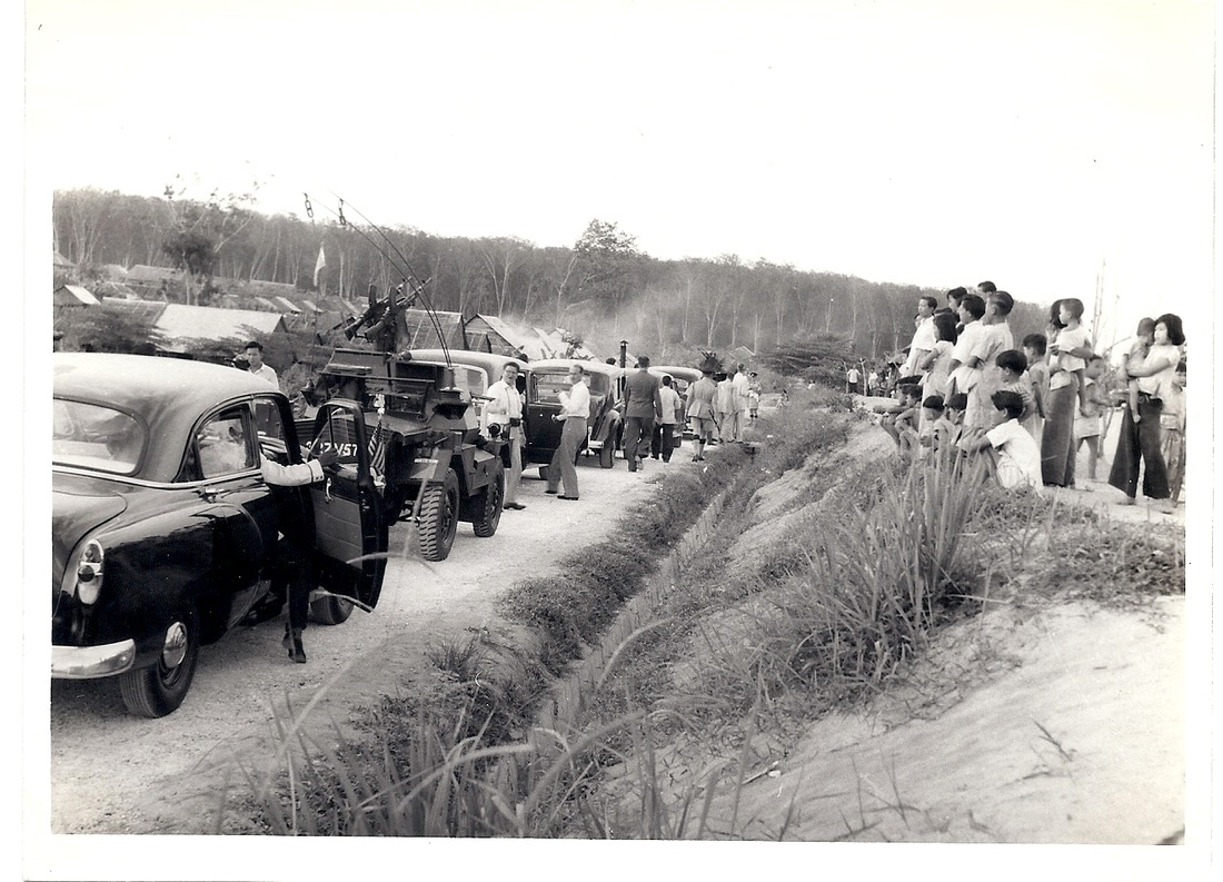
Arrival of VP Richard Nixon’s convoy at Sungai Way new village. Photo source: Journey through US Vice President Richard Nixon’s 1953 visit to Malaya – ExpatGo
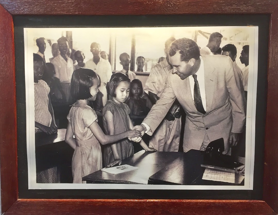
VP Nixon visiting the school at Sungai Way. Photo source: Sungai Way New Village History Corridor
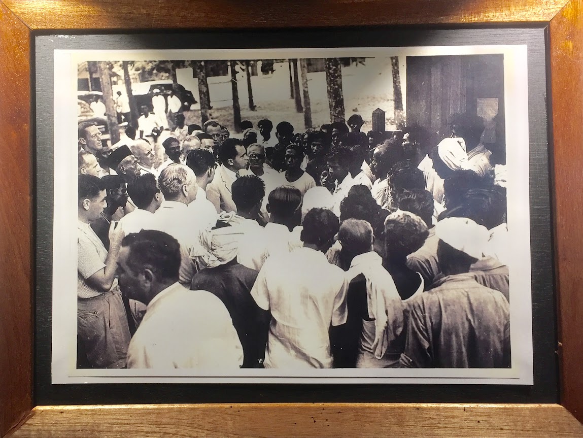
VP Nixon meeting Indian laborers at a rubber plantation. Photo source: Sungai Way New Village History Corridor
On 26 November 1953, Sungai Way played host to a Very Important Person, then United States Vice President, Richard Nixon and his wife Thelma Catherine. Nixon’s visit to Malaya was to assess the political and military threats posed by Communists in the region following Mao Tse Tung’s recent takeover of China. While in Sungai Way, VP Nixon visited the village market, school, rubber plantation and a tin dredge. This was followed by the construction of the Kuala Lumpur – Klang Highway that cut across the middle of the new town of PJ through the land reserved for recreational purposes. This highway was intended to replace the longer and cumbersome Old Klang Road. The first phase was completed in 1957, making PJ (including Sungai Way) more accessible and convenient. The highway was opened to traffic on 14 January 1959. In the 1960s, the highway was upgraded to a full motorway (expressway / freeway) and was renamed Federal Highway Route 2. The opening of this highway had greatly helped the industrial zones in PJ and also saw an expansion and creation of more industrial areas like Section 51A in 1960. The people of Sungai Way particularly in the construction sector were involved in the work on the Subang Airport in 1961. It was completed and opened to traffic on 30 August 1965 and at that time, it had the longest runway in Southeast Asia. In an effort to move the country towards industrialization, the Free Trade Zone Act 1971 was gazetted, and in 1972 saw the opening of the first Free Trade Zone in Bayan Lepas, Penang. In the same year, the Sungai Way Free Trade Zone was officially opened. Major Electrical and Electronics companies like Motorola and National / Panasonic set up operations at Sungai Way FTZ and provided employment for the locals as well as foreign workers. Many hostels were set up in Sungai Way to cater for the foreign workers. Today, the Free Trade Zone has been renamed Free Trade Industrial Zone in line with the FIZ Act 1991. Since 1992, Sungai Way has been known as Seri Setia.
Places of Interest
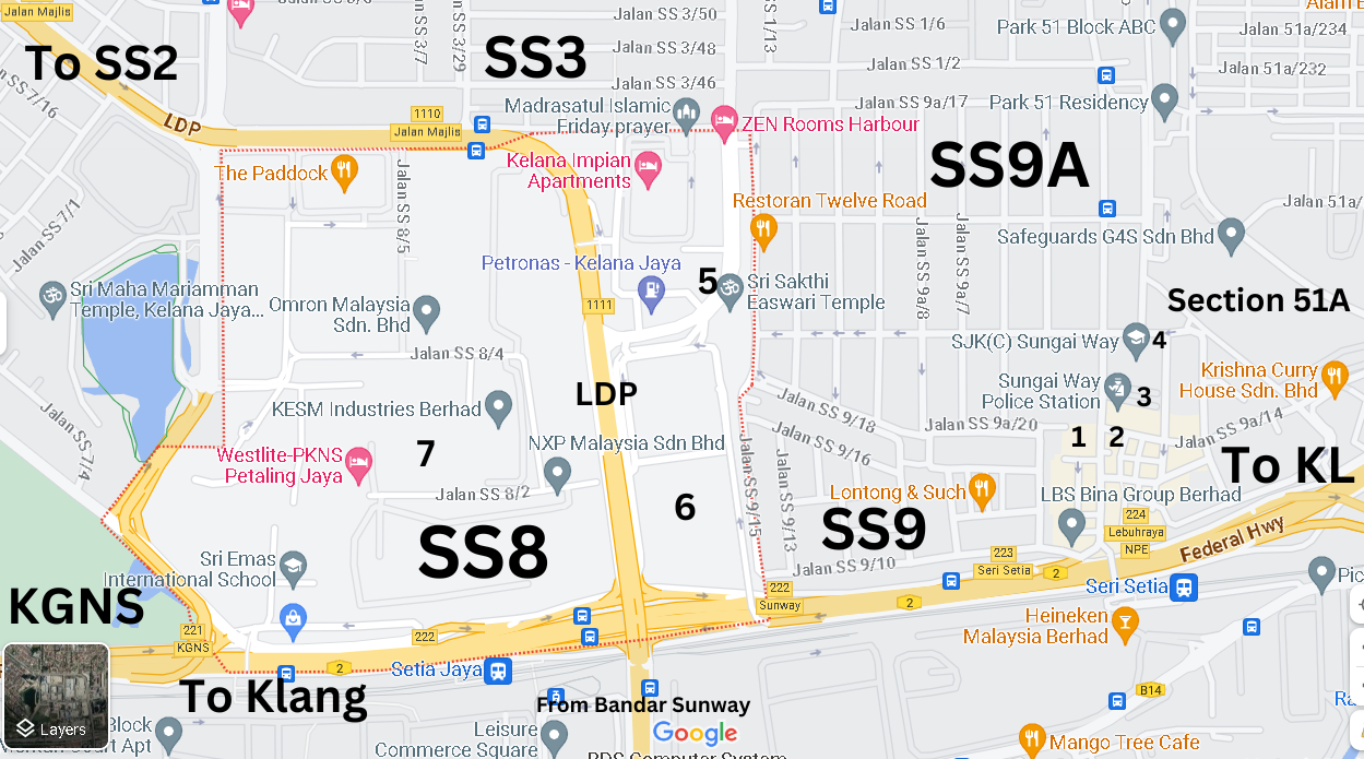
Photo source : Google Maps
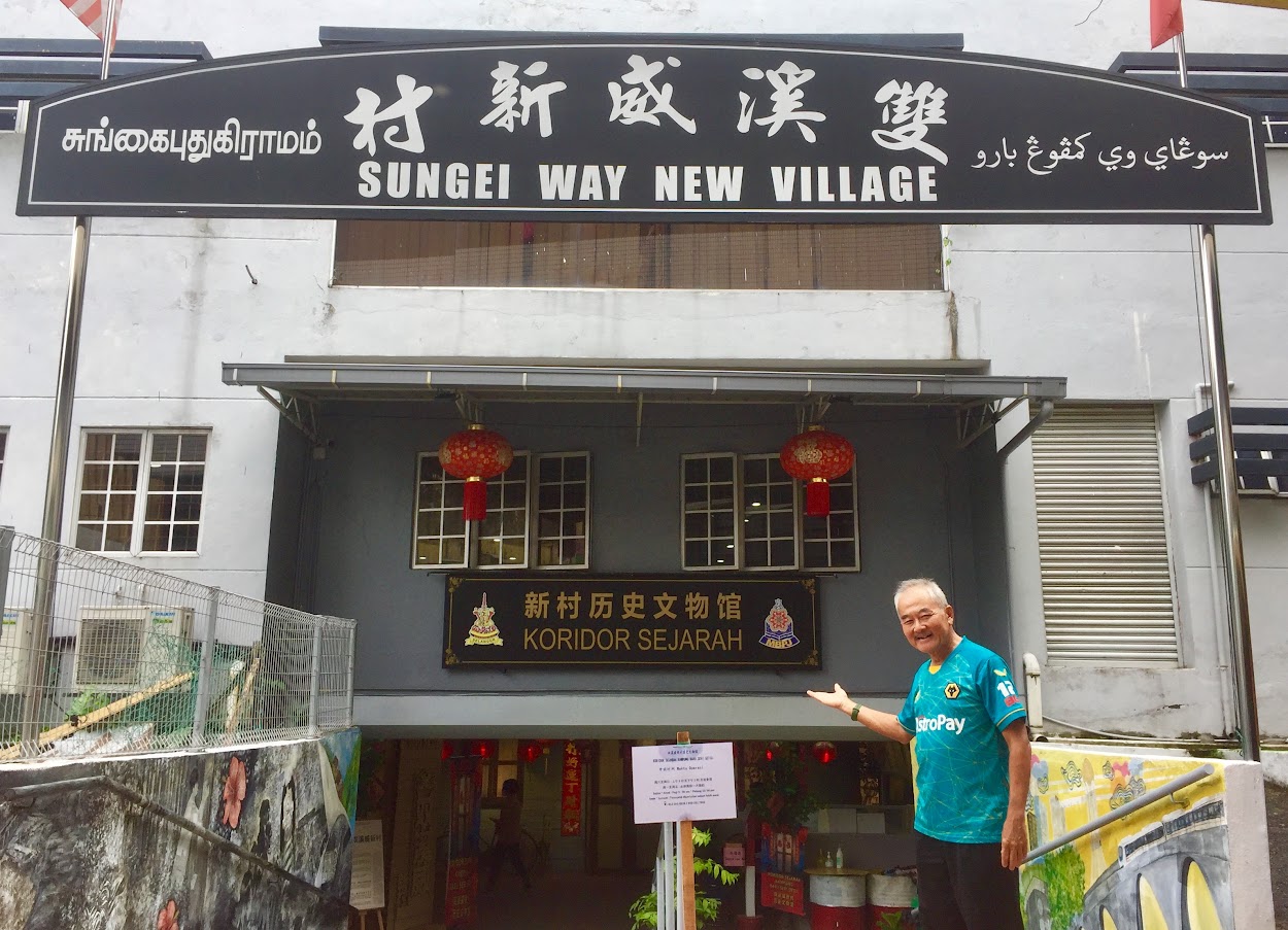
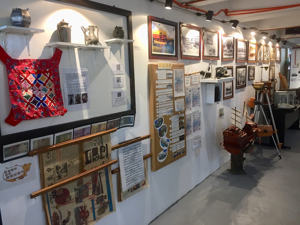
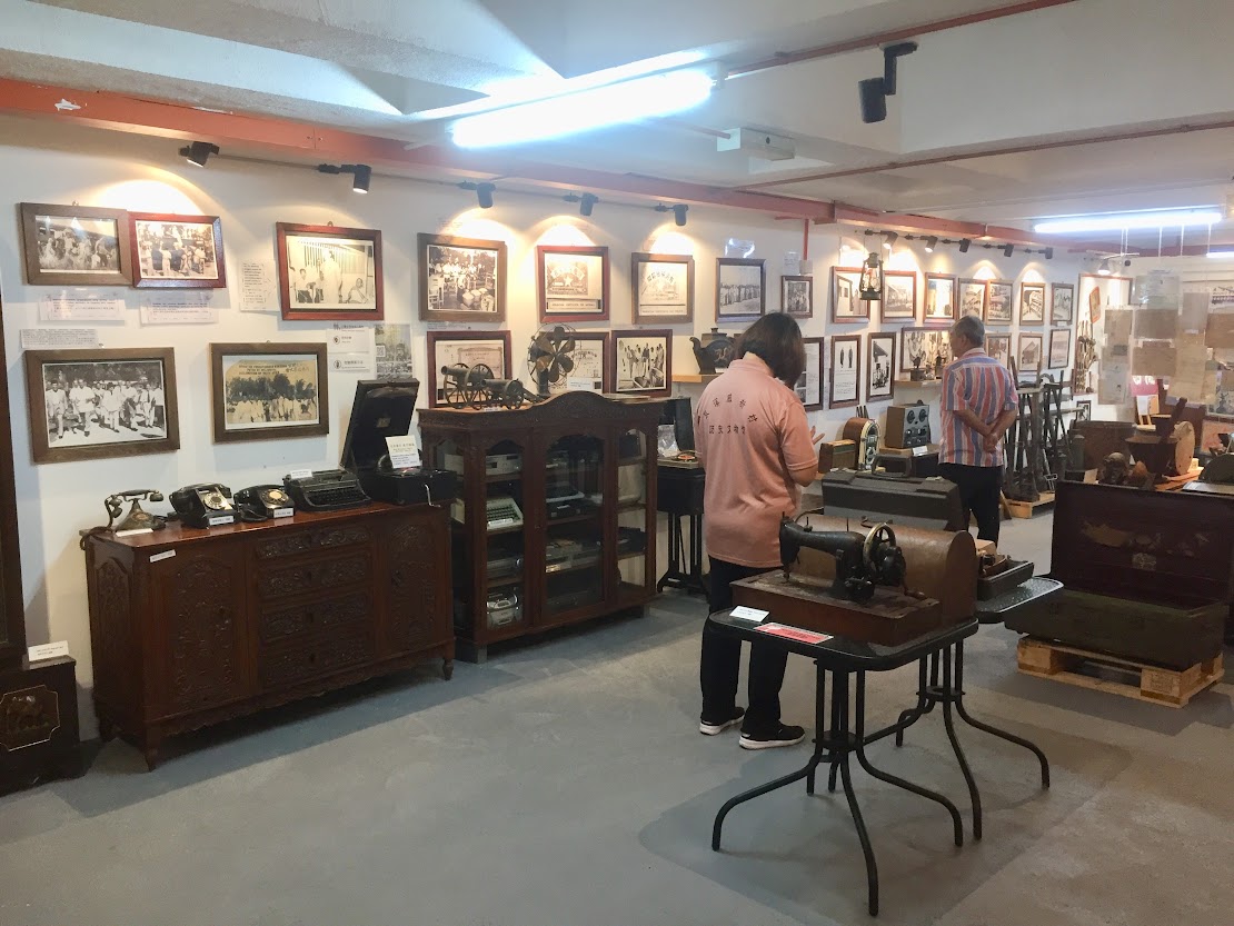
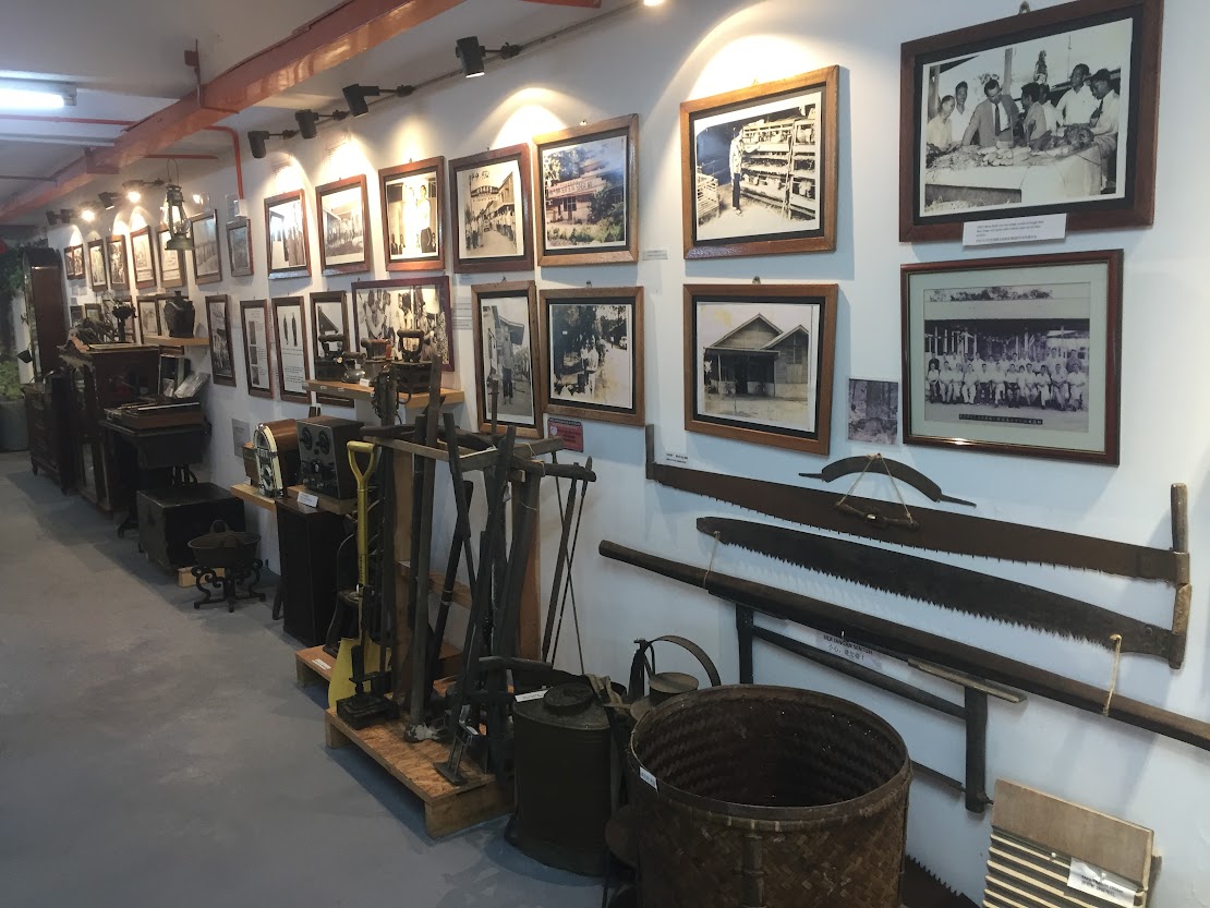
The Sungai Way Market Food Court (1) would be the main focus point for the residents of Sungai Way. It’s a three storey building with the wet market on the lower ground and dry market on the ground floor. The food court is on the top floor, and this was where I met my ‘kind-of-foodie’ friend for breakfast. Many of the stalls have been operating for many years, some as far back as their grandparent’s time. The food court is fairly large and is very clean. We then crossed the main road to the opposite multi-purpose building where the Sungai Way New Village History Corridor (2) is located, in the former basement carpark. This mini museum was officially opened on 12 December 2021 and the first in Malaysia to be developed by a local community management council. The museum showcases the progress of the village from the time of the communist insurgency before independence right up to the present day. Currently, 80% of the items on display are contributed by the local community. The museum is open on Saturdays and Sundays, from 9.00 am to 1.00 pm and entrance is free.
Sungai Way New Village History Corridor. Photo source : Eric Lim
Across the busy Jalan SS9A / 14, about 100 meters from the museum is the Sungai Way Police Station (3). Just next to the Police Station is the SJK(C) Sungai Way (4), the same school which VP Nixon visited in 1953. Then, it was known as the Convent School. The school was built in 1934. Just within Sungai Way new village / SS9A, there are altogether 6 places of worship which clearly reflect on the multiracial mix of the area. The places of worship are Sungai Way Christian Church at Jalan SS9A/1, Leng Eng Teng Khiew Ong Tai Tay Temple at Jalan SS9A/1, Masjid Ridhwani at Jalan SS9A/8, Tho Guan Seng Teng at Jalan SS9A/9, Seventh Day Adventist Church at Jalan SS9A/14 and Kam Ying Temple at Jalan SS9A/15. The Sri Sakthi Easwari Temple (5) is located just outside Jalan SS9A/12. There are several popular Chinese restaurants located on this street (on the right side of this one way street). Moving on to the Sungai Way Free Trade Industrial Zone / SS8, the current Icon City (6) is where the National factory was located and across the Lebuhraya Damansara Puchong (LDP) is where Freescale Semiconductor (7) is situated.
Getting There
If you are coming from Kuala Lumpur, use Federal Highway Route 2. After passing PJ Hilton (on the left), keep left to Jalan Templer and Jalan 222. Keep right at the traffic junction and immediately keep left to Jalan 51A/225 until the second traffic light. Turn right to Jalan SS9A/14 / Sungai Way new village – Seri Setia.
From Klang, either exit left after passing Icon City on the left to Jalan SS9A/1 (Public Bank and LBS Bina Group Bhd office on the left would be the landmark) or go further and turn left to Cycle & Carriage PJ. At the traffic junction, turn left to Jalan SS9A/14.
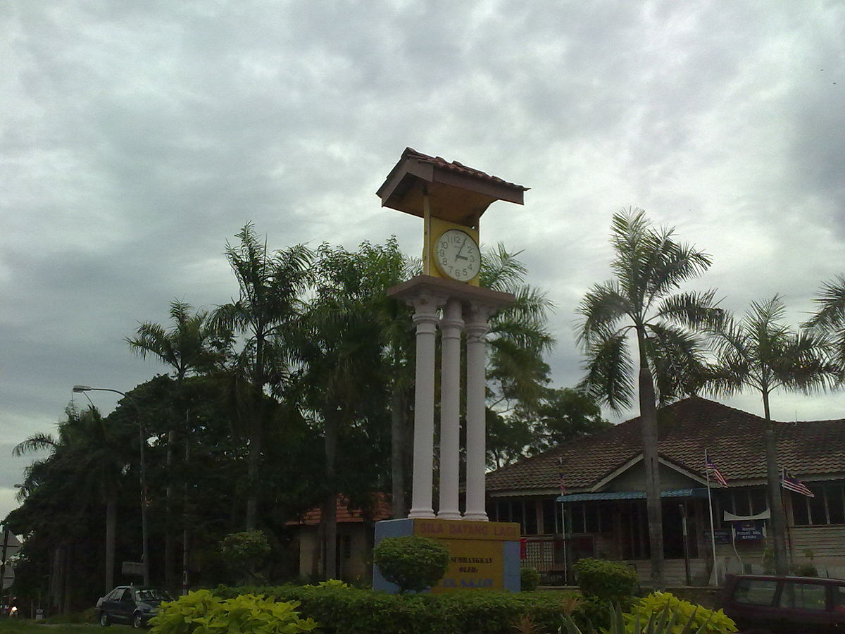
The Clock Tower is an iconic landmark of Bahau / Photo source : Wikimedia Commons
Moving back to Negeri Sembilan, this time to the district of Jempol. It is the largest district in the state which covers approximately 22% of the total land area of Negeri Sembilan. It shares boundaries with the district of Jelebu, Kuala Pilah, Tampin, Bera in Pahang and Segamat in Johor. Prior to becoming the Jempol district, it was known as Bahau Kecil, under the administration of the Kuala Pilah district. Jempol was declared a district on 1 January 1980. Then on 29 January 2019, the status was upgraded to a municipal council, the fourth municipal council in Negeri Sembilan. The two principal towns in the district are Bandar Seri Jempol (previously known as Bandar Baru Serting, and the current district capital) and Bahau. This article will focus on the history of the district, Jempol and the town of Bahau.
History
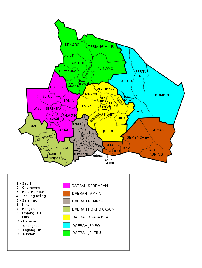
Map of districts and mukims of Negeri Sembilan today.
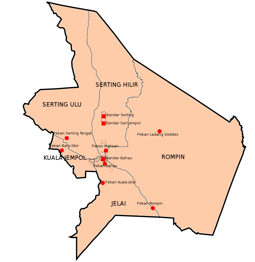
Map of towns in the district of Jempol / Photo source : Wikimedia Commons
Jempol was not in the original Malay federation that consisted of nine states when Raja Melewar became the Yam Tuan Besar of Negeri Sembilan in 1773. However, when the British arrived in the state, Jempol was very much in the picture where a series of treaties were signed between the 1870’s to the 1890’s. Sungai Ujong was the first state in Negeri Sembilan that had requested for British protection in 1874. On 23 November 1876, a treaty was signed between Tengku Antah and the minor states of Johol, Inas, Ulu Muar, Terachi, Gunung Pasir and Jempol; witnessed by British officials from the Straits Settlements which recognized Tengku Antah as the Yamtuan of Sri Menanti. This treaty effectively ended the civil war in the state where the warring states were divided into two, the East region came under Sri Menanti and the West consisting of Sungai Ujong, Jelebu and Rembau. On 13 July 1889, the rulers of Tampin and Rembau joined Sri Menanti and agreed to a confederation known as ‘The Old Negri Sembilan’ and placed themselves under the protection of the British government. The states were then separated into two districts namely Kuala Pilah which administered the minor states of Sri Menanti and Johol; and Tampin which took care of Rembau, Tampin and Gemencheh.
Charles Mitchell / Photo source : Wikimedia Commons
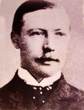
Martin Lister / Photo source : Sejarah-ahmadyaakob.com: PENUBUHAN KONFIDERASI NEGERI SEMBILAN
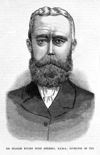
When Charles Mitchell (full name Charles Bullen Hugh Mitchell) succeeded William Edward Maxwell as the 14th Governor of the Straits Settlements in 1894, he had proposed that Sungai Ujong and Jelebu be amalgamated with ‘The Old Negri Sembilan’ faction. He commented that ‘the Negri Sembilan are a small confederation in which Sungai Ujong was in old days included, so that their combination under one Resident is historically sound as well as politically convenient’. It was initially met with resistance but later, both states agreed to the proposal. On 8 August 1895, a treaty was signed and a larger and modern Negeri Sembilan was constituted and Martin Lister was appointed as the first Resident. The following year, Negeri Sembilan joined the other three protected states in the Malay Peninsula namely Perak, Selangor and Pahang, in the formation of the Federated Malay States (FMS). The first Resident General of FMS was Frank Athelstane Swettenham. Finally, in a treaty on 29 April 1898, the Yamtuan of Sri Menanti was elected the official ruler of Negeri Sembilan.
The history of Jempol long precedes the formation of Negeri Sembilan, and some believed it was even earlier than the Malacca Sultanate. The district was first settled by people from Pasai, a Muslim kingdom on the north coast of Sumatra (Acheh today).This kingdom was the first to convert to Islam, believed to be in the second half of the 13th century. The settlers started the cultivation of paddy in the state and due to the fertility of its soil, enjoyed a bountiful harvest every year. This prompted them to name the area ‘Jempol’ which roughly translated to mean ‘beautiful and the best place’.
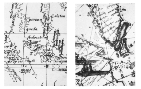
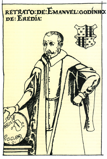
Jempol continued to thrive when the locals discovered two navigable waterways that proved to be invaluable assets. These two rivers flowed in opposite directions from the interior, one to the direction of the Straits of Malacca and the other drains to the South China Sea, creating a shortcut for traveling from the west coast to east coast without having to go through the arduous journey round the southern tip. This led to the start of the trans peninsula trade route used by both local Malay and foreign traders. And the key factor that attracted foreign traders to this trade route was gold. This waterway was marked on early mapping of South-East Asia compiled by cartographers of the West from the 16th century. However, the waterway is depicted as a continuous river or canal as roughly bisecting the peninsula. This glaring error was corrected by Emanuel Godinho de Eredia in a map drawn in 1602.
Emanuel Godinho de Eredia was born at Malacca on 15th July 1563. He was of Bugis – Portuguese descent and had his early education at College of the Company of Jesus, Malacca. When he reached thirteen, he was sent to Goa where he completed his studies in astronomy, cartography and mathematics. In 1594, he was ranked ‘Descobridor e Adelantado da Nova India Meridional’ by King Philip I of Portugal. ‘Descobridor’ means ‘officer commissioned to organize the work of exploration and discovery’ and the rest of the title supposedly means ‘the southern land’. He did not see action for six years and only in 1600, he was given the green light. He returned to Malacca to make preparations for the exploration but local wars intervened and he was forced to stay back to see action for the next four years. During this time, he was made the commanding officer of the southern squadron of 70 armed ships. In 1604, he founded the Fortaleza de Muar (Fortress of Muar) located at the mouth of Muar river and joined General Andre Furtado de Mendoca in the conquest of Kota Batu, the capital of Johore at that time. Then he was met with some health issues that kept him away from starting his exploration. He then turned to writing books until his last book in 1620. He died in 1623. His books were never published in his lifetime. Declaracam de Malaca e da Índia Meridional com Cathay (Description of Malacca, Meridional India and Cathay in English) written in 1613, first translated to French in 1880 and later to English by JV Mills in April 1930, contains valuable information on Malacca and the surrounding region when it came under the control of the Portuguese. It also included maps and illustrations, including the location of the two rivers that formed the trans peninsula trade route as mentioned above.
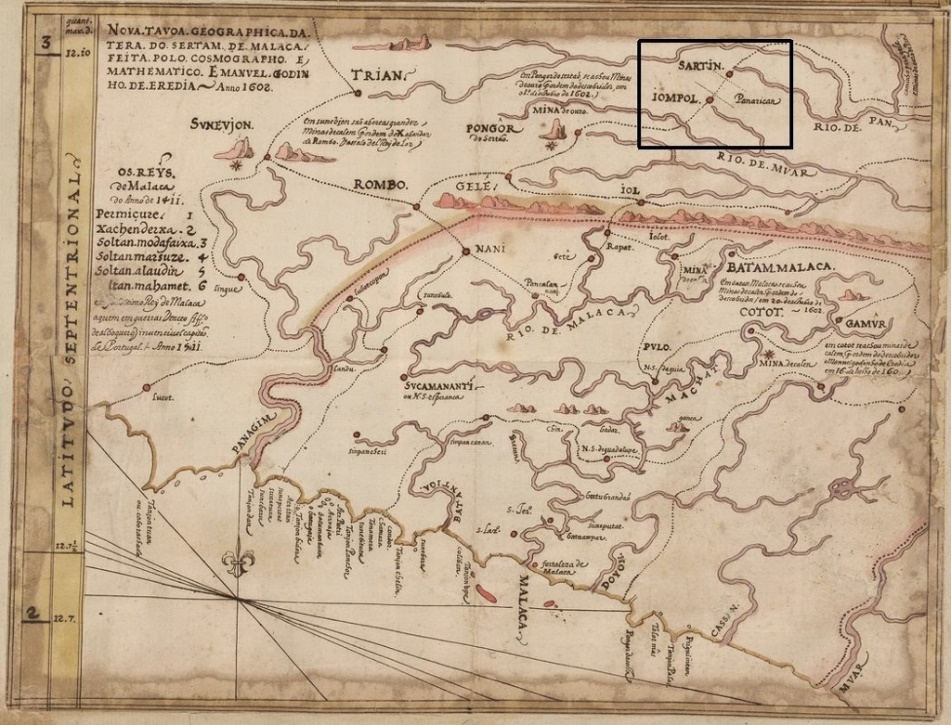
Map by Emanuel de Godinho Eredia showing the location of the Panarican (in box) / Photo source : Wikimedia Commons
Self portrait of Emanuel de Godinho Eredia / Photo source : Wikimedia Commons
Emanuel de Godinho Eredia discovered that the two main rivers, Pahang river (Rio de Pan in the map) and Muar river (Rio de Muar), are separated by land about 600 meters apart. He also pointed out two points, namely Sartin (Serting today) and Jompol (Jempol), and these are names of tributaries of Pahang river and Muar river respectively. He also named the place ‘Panarican’, from the Malay word ‘penarikan’ which is from the root word ‘tarik’, meaning to pull / drag. The overland portage of vessels and goods were carried out by the locals, elephants and buffalos. Later, in 1614, he appended an explanatory note in the map that ‘Por panarican passao de Malaca a Pam em 6 dias de caminbo’ meaning ‘By the Panarican, one travels from Malacca to Pahang in 6 days’ journey’. It was believed that the journey using the open sea south route would take up to six months and traders also face the risks of rough waters and pirates.
According to local text references, the Panarican / Jalan Penarikan in Malay, was used by merchants from Arab to spread Islam in the interior during the 11th century. The route was also frequented by the Sultanate of Malacca, Pahang and Negeri Sembilan. In the 14th century, at the height of power of the Srivijaya and Majapahit Kingdom, Jalan Penarikan was an active trade route between the interior and the cities along the shores of the Malay Peninsula. Sultan Mahmud also used the route to escape from the Portuguese. Earlier, Hang Tuah had used it to accompany the beautiful Tun Teja from Pahang to Malacca. At the start of the 17th century, the newly formed Dutch V.O.C was a threat to the Portuguese’s monopoly in the region. On 25 February 1603, the Dutch managed to capture Portuguese’s treasure ship, Santa Catarina, at the Strait of Singapore. The ship and its cargo were taken back to Europe as booty of war. After that incident, the Portuguese diverted to use Jalan Penarikan to return to Muar. It also cited the journey through the portage taken by Charles Gray in early January 1827, and in his journal, he noted that he made an overnight stop in a small village called Bahru, which is believed to be Bahau today. Coincidentally, the next part of this article would be on Bahau.
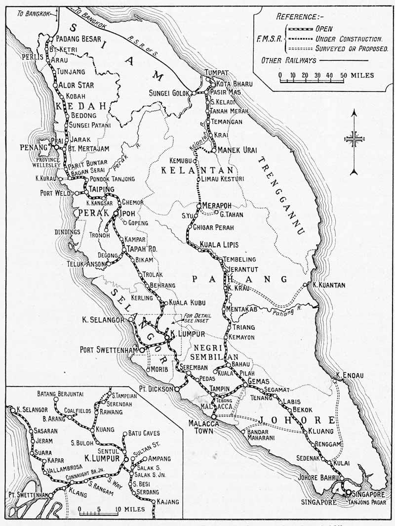
The first railway line built by the British linked Taiping in the Larut Valley to Port Weld, covering a distance of about 8 miles (13 kilometers) , was officially opened for traffic on 1 June 1885. By the turn of the new century, saw the formation of the Federated Malay States Railway (FMSR) and in 1903, the railway track was extended from Prai in Province Wellesley (Penang) in the North, running across Perak and Selangor to reach Port Dickson in Negeri Sembilan in the South. The next phase of construction was in the state of Johore, starting in 1904. And in 1910, saw the start of the East Coast Line connecting the West to the East coast states of Pahang and Kelantan.
The first stretch of the East Coast Line between Gemas and Bahau was opened on 4 April 1910. Also on the same day, was the opening of the branch line from Bahau to Kuala Pilah in the interior. The opening of this branch line was to serve the tin mining industry at Parit Tinggi which is situated north of Kuala Pilah. This line was in operation until 1930 when it was dismantled due to stiff competition with road transport. On 1 October 1910, the East Coast Line was extended from Bahau to Pahang, reaching Triang located in the south west of the state. The line was completed with the opening section of the last stretch between Gua Musang and Kuala Gris in Kelantan on 5 September 1931.
1929 FMSR map showing the branch line between Bahau and Kuala Pilah and Bahau – Triang. Photo source : FMSR 1929 railway map
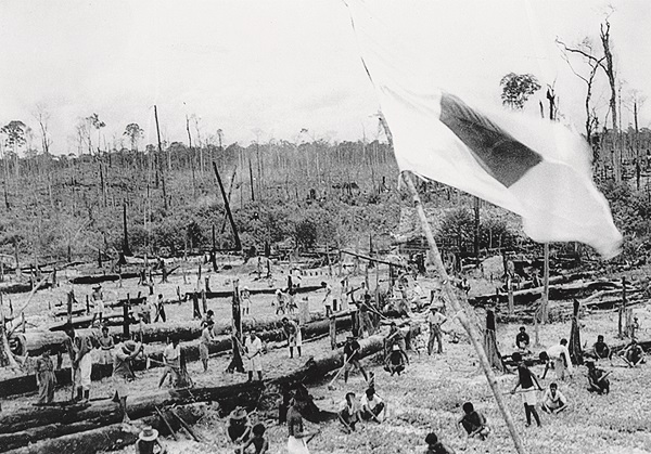
The next significant record of Bahau in the history archive came during the Japanese Occupation. Japanese forces landed in Kota Bharu on 8 December 1941 and in just two months, they had steamrolled the peninsula and were fighting the British in Singapore. On 15 February 1942, Lieutenant General Arthur Percival surrendered the island to the Japanese. The loss came as a great shock to Prime Minister Winston Churchill. With an impending chronic food shortage, Japanese authorities immediately embarked on a Grow More Food Campaign in the city state. However, the campaign did not produce the desired results. The next course of action by the Japanese was to set up agricultural settlements outside of Singapore. The Chinese were the first group to be coaxed into the resettlement project and Endau in Johor was the venue for the project. The pioneer settlers arrived in September 1943 and by the end of that year, 12,000 Chinese had made Endau their new home.
Settlers building the rudimentary road from the train station to the settlement Photo source : Bahau: A Utopia That Went Awry
The next group to join the project were the Eurasians and the new venue was Bahau. The first settlers consisting of mainly young, single men and led by Catholic Bishop of Singapore, Adrien Devals arrived in late December 1943. They took the overnight train from Singapore to Gemas, followed by a local train to Bahau town and walked the last five miles (8 km) to the site of the settlement. Prior, the site had been cleared and rejected by the Japanese for use as an airfield and by the Chinese group who had wanted Endau instead. The Japanese name for the settlement was ‘Fuji Go’ which means ‘Fuji Village or beautiful village’. These men were tasked to clear the land of dense forest, build a rudimentary road from the train station to the settlement and set up the basic infrastructure for the arriving families. By April 1944, the population had risen to 2,000, of which about half were Chinese Catholics and it also included European Protestants families and neutrals from countries like Denmark, Switzerland, Romania and Russia. Each family was given three acres of land to build their own home with whatever that they could find from the jungle and to grow crops.Though they had enjoyed some measure of freedom from the Japanese, many of them suffered from malnutrition and diseases such as malaria which eventually led to a high death toll. Japanese Occupation came to an end in August 1945, and immediately after, the MPAJA (Malayan People’s Anti Japanese Army) guerilla movement took over control of the country for a brief spell. Bahau was finally liberated with the arrival of Force 136 on 3 September 1945. The settlement was abandoned and settlers returned to Singapore. (In total, Japanese authorities had created three agricultural settlements outside of Singapore, namely Endau, Johor for the Chinese, Bahau, Negeri Sembilan for the Eurasian community and Pulau Bintan in Indonesia for the Indians).
Photo source : Google Maps
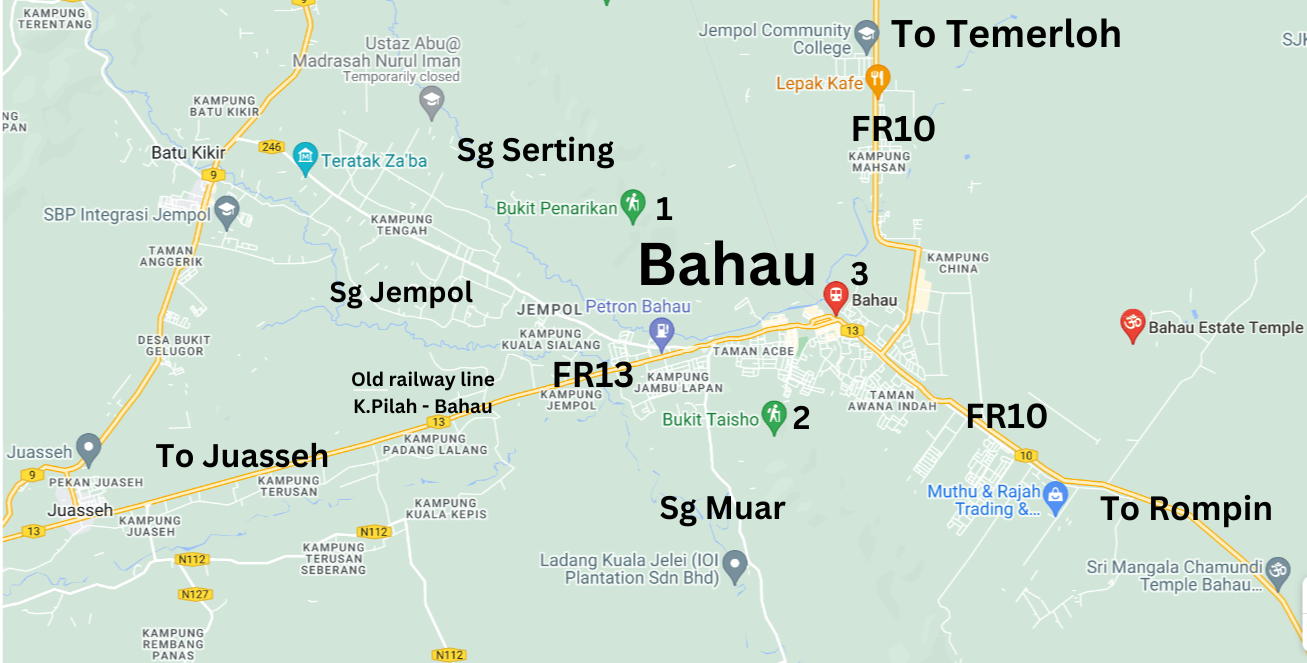
According to the 2020 survey, the population of Bahau stands at 32,018. Federal Route 13 (FR13 in the map) that links Juasseh to Bahau, cuts across the town to connect to Federal Route 10 (FR10) to Rompin and Gemas. In essence, the straight stretch of FR13 is built over the old railway track that used to run from Kuala Pilah to Bahau. Remnants of the old tracks like stone foundations can still be seen underneath the road. There are two popular trails that are open all year-round and are beautiful to visit at any time of the day in Bahau. The elevation of Bukit Penarikan (1) is 1364 ft / 416 meters and the 3.2 km out-and-back trail takes an average of 1 hour 28 minutes to complete. It is regarded as a moderately challenging route. Bukit Taisho (2) is shorter than Bukit Penarikan, and it takes a slightly shorter time to complete. However, it attracts more hikers / visitors as they can enjoy a spectacular sky mirror and breathtaking sea of clouds view from the peak of the hill. The modestly built Bahau train station (3) is located at the center of town. Today, Bahau has the distinction as the only town in the west coast to be served by the East Coast Line instead of the west coast main line. The name Bahau is believed to come from a Chinese / Cantonese phrase ‘Makou / Mahou’ meaning ‘horse’s mouth’ and there is a nearby Chinese village by the name of ‘Mahsan’ which means ‘horse’s body’.
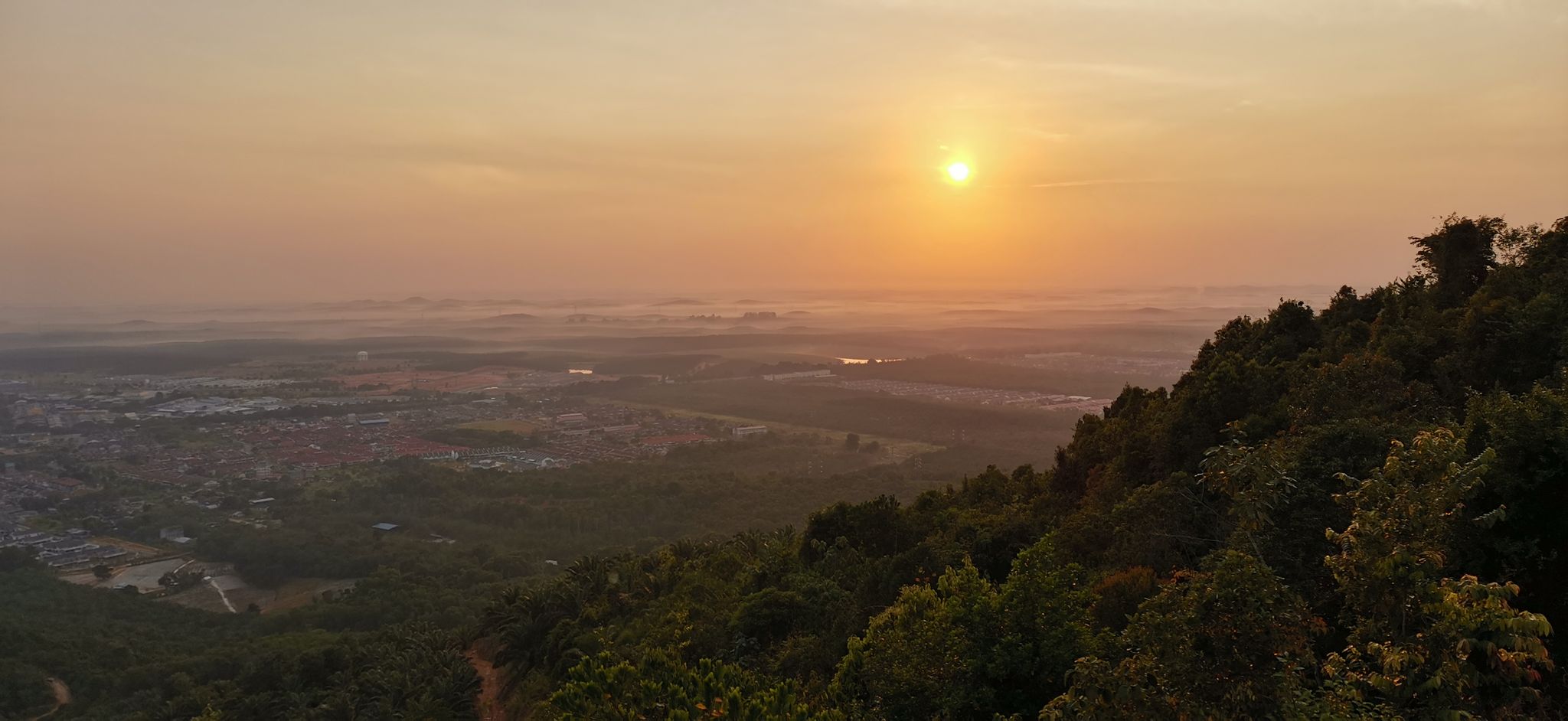
View from the peak of Bukit Taisho Photo source : Bukit Taisho: 116 Reviews, Map – Negeri Sembilan, Malaysia | AllTrails
Getting there
From Cheras, use the Cheras – Kajang Expressway (E7) that would link to Kajang Dispersal Link Expressway / SILK (E18). Look out for Exit 1804 Kajang Perdana, then link to LEKAS (E21) Lebuhraya Kajang Seremban. Exit at Paroi interchange and link Federal Route 51 (Seremban to Kuala Pilah). At Kuala Pilah, join Federal Route 13 to Bahau.
Note
Negeri Sembilan was historically spelt as Negri Sembilan.