By Eric Lim
Introduction
Early on in my working career, I had worked in two companies located at Section 51A in Petaling Jaya, just off the Federal Highway. And Sungai Way which is just a short distance away, is where my colleagues and I used to frequent for lunch, where there were plenty of food choices and at reasonable prices. Recently, when I heard that there is a mini museum in the area, I immediately messaged a ‘kind-of-foodie’ friend to make plans to visit over the weekend, and he replied ‘let’s go’.
Sungai Way is made up of SS8 (Sungai Way Free Trade Industrial Zone), SS9 (residential zone) and SS9A (Seri Setia / Sungai Way New Village) and is one of three sections that combined as the Petaling Jaya sub district (the prefix SS stands for Sungai Way – Subang). Together with Sungai Buloh, Bukit Raja and Damansara, it forms the Petaling district which is regarded as the smallest district in Selangor.

Map of the sub districts of Selangor.
Photo source : Wikimedia Commons
History
Sungai Way is named after the river that meanders across the area. The river is 12 km long and begins as two small water channels that meet and converge into one channel that flows to meet Sungai Penchala and continues for a short distance to Sungai Klang. Today, 100% of the river has been concrete-channelized (appearing like a drain) for its entire stretch making it a typical urban river.
The discovery of rich tin deposits in the area had resulted in an influx of Chinese migrant workers as early as 1870. When the British opened the second train line connecting Kuala Lumpur to Bukit Kuda near Klang on 15 September 1886, it is believed that one of the stations was located at Sungai Way. This had benefited the area and it continued to make rapid expansion. At the turn of the 20th century, rubber was introduced and there was a large-scale rubber planting effort within the surrounding area. 1908 saw the start of rubber tapping in the estates around Sungai Way. The boom for both commodities contributed greatly to the economy of Sungai Way. All these came to a standstill when our country went through its two most tumultuous and turbulent periods, first the Japanese Occupation and followed three years later, the Emergency.
The Americans dropped atomic bombs on Hiroshima and Nagasaki on the 6th and 9th August 1945 respectively and on the 15th August, Emperor Hirohito announced the surrender of Japan over a radio broadcast. Incidentally, it was the first radio address by the Emperor. After three years and eight months of Japanese rule, the British returned and resumed control of our country once again. However, a period of unrest emerged again when three European plantation managers were shot and killed at Sungai Siput on 16 June 1948 by suspected Communist militants. This marked the start of the Emergency. It reached its climax when the then highest ranking British officer in the country, Sir Henry Gurney was assassinated while on his way to Fraser Hill on 6 October 1951. Right after, General Sir Gerald Templer was appointed as the British High Commissioner and Director of Operations. Under his command, he carried out Sir Harold Briggs’ recommendations, which included the resettlement of rural Chinese in ‘new villages’ (xincun in Mandarin / sanchuen in Cantonese). By the end of 1951, over 400,000 people had been resettled in 500 new villages around the country.
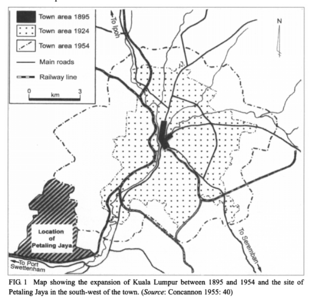
Photo source: PETALING JAYA: THE EARLY DEVELOPMENT AND GROWTH OF MALAYSIA’S FIRST NEW TOWN
Sungai Way is one of the new villages established near our capital city. The British gathered scattered Chinese communities in Puchong, Damansara, Old Klang Road and Cheras into Sungai Way new village. According to local records, a total of 3,000 residents settled in the new village, consisting mainly of Hakkas and Hokkiens. After the war, the population of Kuala Lumpur increased at a very fast pace until the British administration had to mobilize resettlement programmes. One of the programmes was to build a new town. In 1952, vast tracts of former coffee, rubber and ex-mining land along Old Klang Road were acquired and the new town of Petaling Jaya (affectionately known as PJ) took shape. From the moment PJ started developing, the fate of Sungai way was sealed and it grew in tandem with the progress.
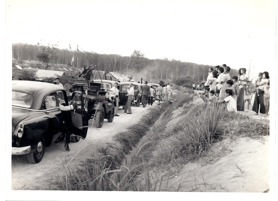
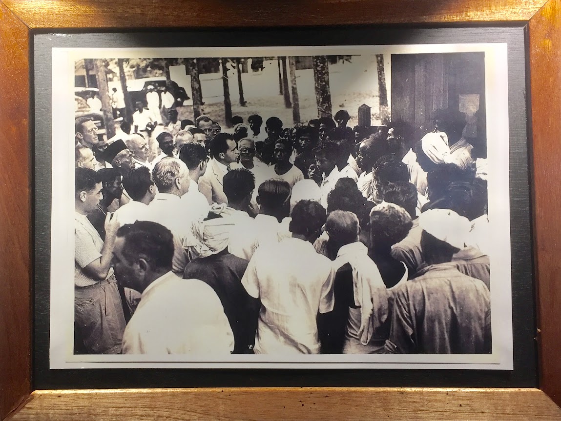
Arrival of VP Richard Nixon’s convoy at Sungai Way new village.
Photo source: Journey through US Vice President Richard Nixon’s 1953 visit to Malaya – ExpatGo
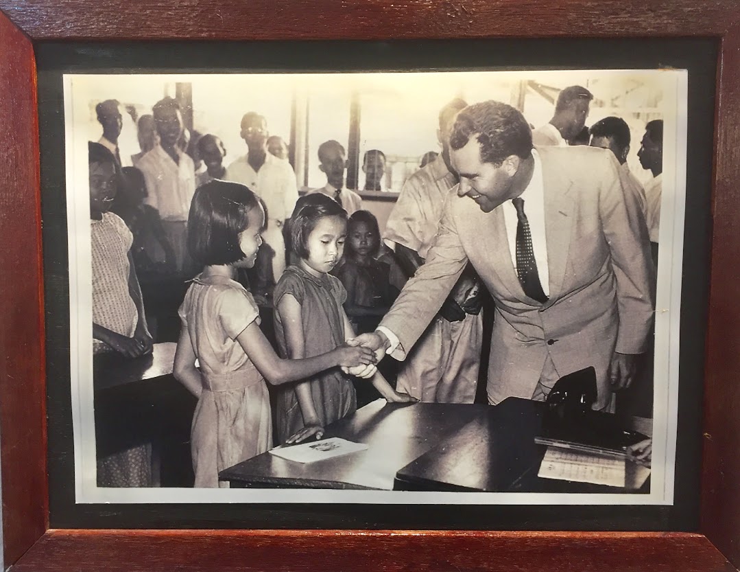
VP Nixon visiting the school at Sungai Way.
Photo source: Sungai Way New Village History Corridor
VP Nixon meeting Indian laborers at a rubber plantation.
Photo source: Sungai Way New Village History Corridor
On 26 November 1953, Sungai Way played host to a Very Important Person, then United States Vice President, Richard Nixon and his wife Thelma Catherine. Nixon’s visit to Malaya was to assess the political and military threats posed by Communists in the region following Mao Tse Tung’s recent takeover of China. While in Sungai Way, VP Nixon visited the village market, school, rubber plantation and a tin dredge. This was followed by the construction of the Kuala Lumpur – Klang Highway that cut across the middle of the new town of PJ through the land reserved for recreational purposes. This highway was intended to replace the longer and cumbersome Old Klang Road. The first phase was completed in 1957, making PJ (including Sungai Way) more accessible and convenient. The highway was opened to traffic on 14 January 1959. In the 1960s, the highway was upgraded to a full motorway (expressway / freeway) and was renamed Federal Highway Route 2. The opening of this highway had greatly helped the industrial zones in PJ and also saw an expansion and creation of more industrial areas like Section 51A in 1960. The people of Sungai Way particularly in the construction sector were involved in the work on the Subang Airport in 1961. It was completed and opened to traffic on 30 August 1965 and at that time, it had the longest runway in Southeast Asia. In an effort to move the country towards industrialization, the Free Trade Zone Act 1971 was gazetted, and in 1972 saw the opening of the first Free Trade Zone in Bayan Lepas, Penang. In the same year, the Sungai Way Free Trade Zone was officially opened. Major Electrical and Electronics companies like Motorola and National / Panasonic set up operations at Sungai Way FTZ and provided employment for the locals as well as foreign workers. Many hostels were set up in Sungai Way to cater for the foreign workers. Today, the Free Trade Zone has been renamed Free Trade Industrial Zone in line with the FIZ Act 1991. Since 1992, Sungai Way has been known as Seri Setia.
Places of Interest
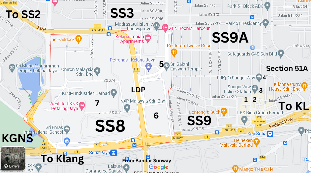
Photo source : Google Maps
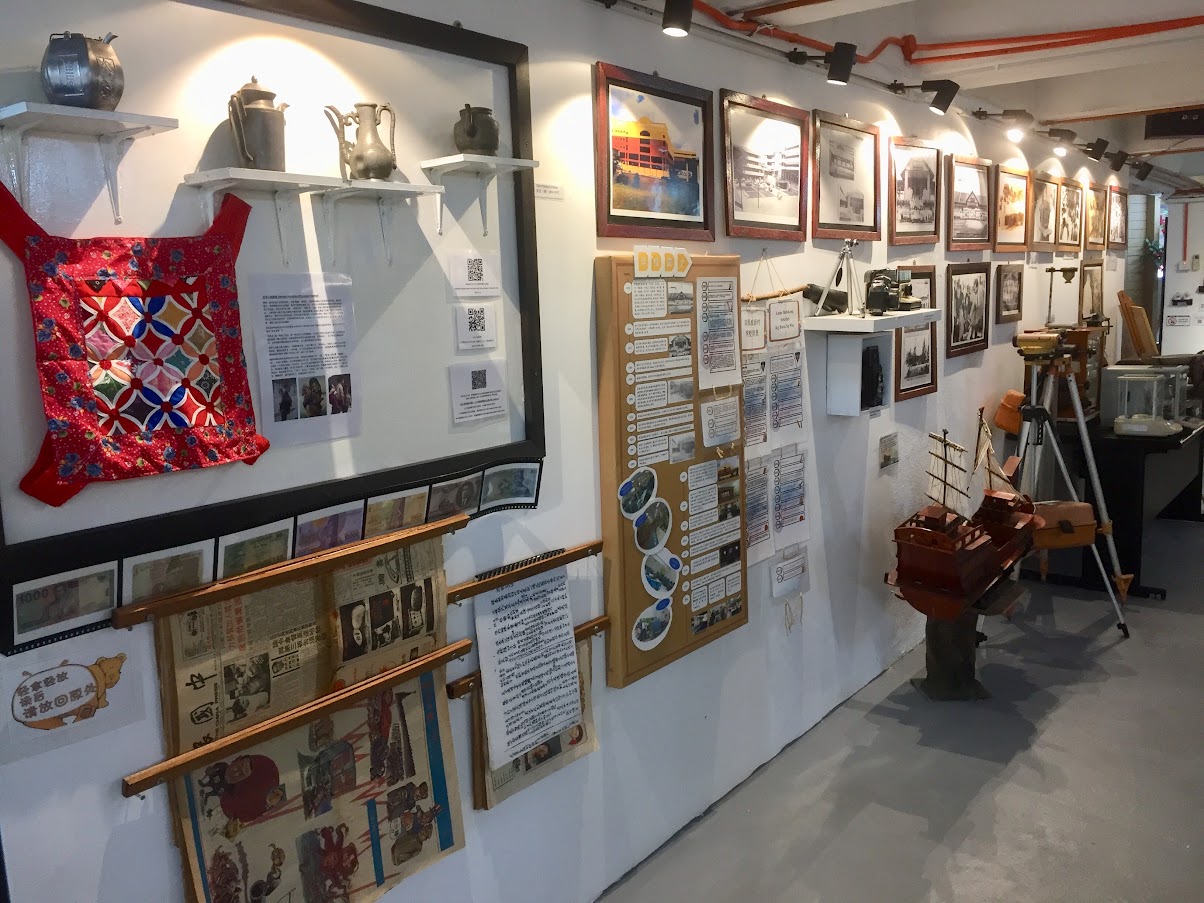
The Sungai Way Market Food Court (1) would be the main focus point for the residents of Sungai Way. It’s a three storey building with the wet market on the lower ground and dry market on the ground floor. The food court is on the top floor, and this was where I met my ‘kind-of-foodie’ friend for breakfast. Many of the stalls have been operating for many years, some as far back as their grandparent’s time. The food court is fairly large and is very clean. We then crossed the main road to the opposite multi-purpose building where the Sungai Way New Village History Corridor (2) is located, in the former basement carpark. This mini museum was officially opened on 12 December 2021 and the first in Malaysia to be developed by a local community management council. The museum showcases the progress of the village from the time of the communist insurgency before independence right up to the present day. Currently, 80% of the items on display are contributed by the local community. The museum is open on Saturdays and Sundays, from 9.00 am to 1.00 pm and entrance is free.
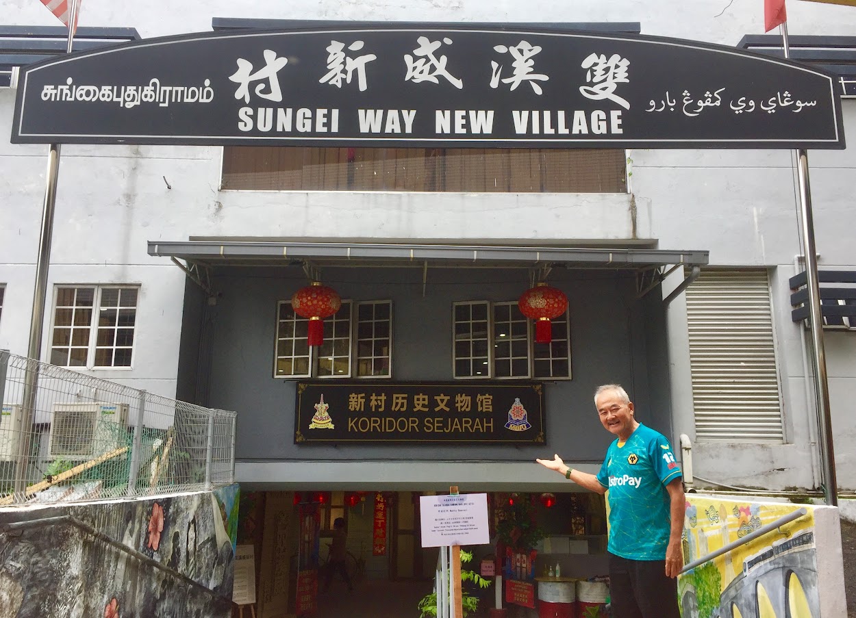
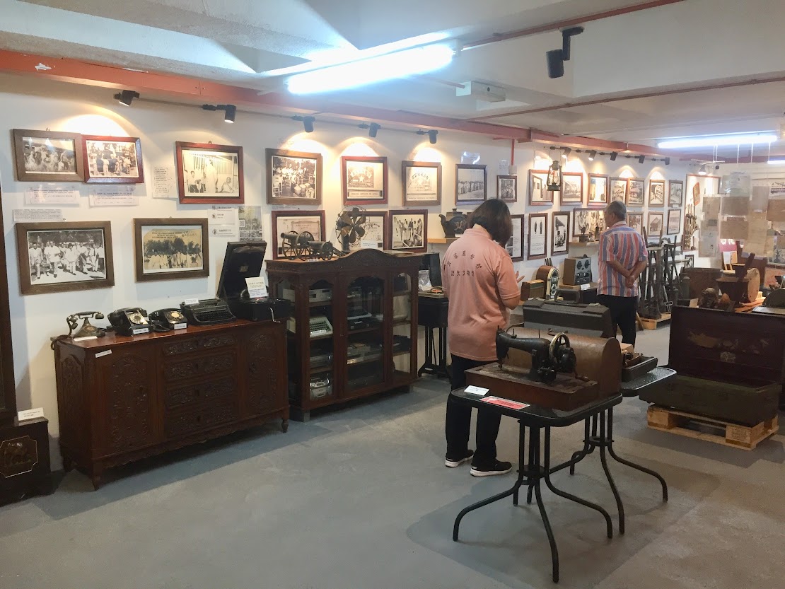
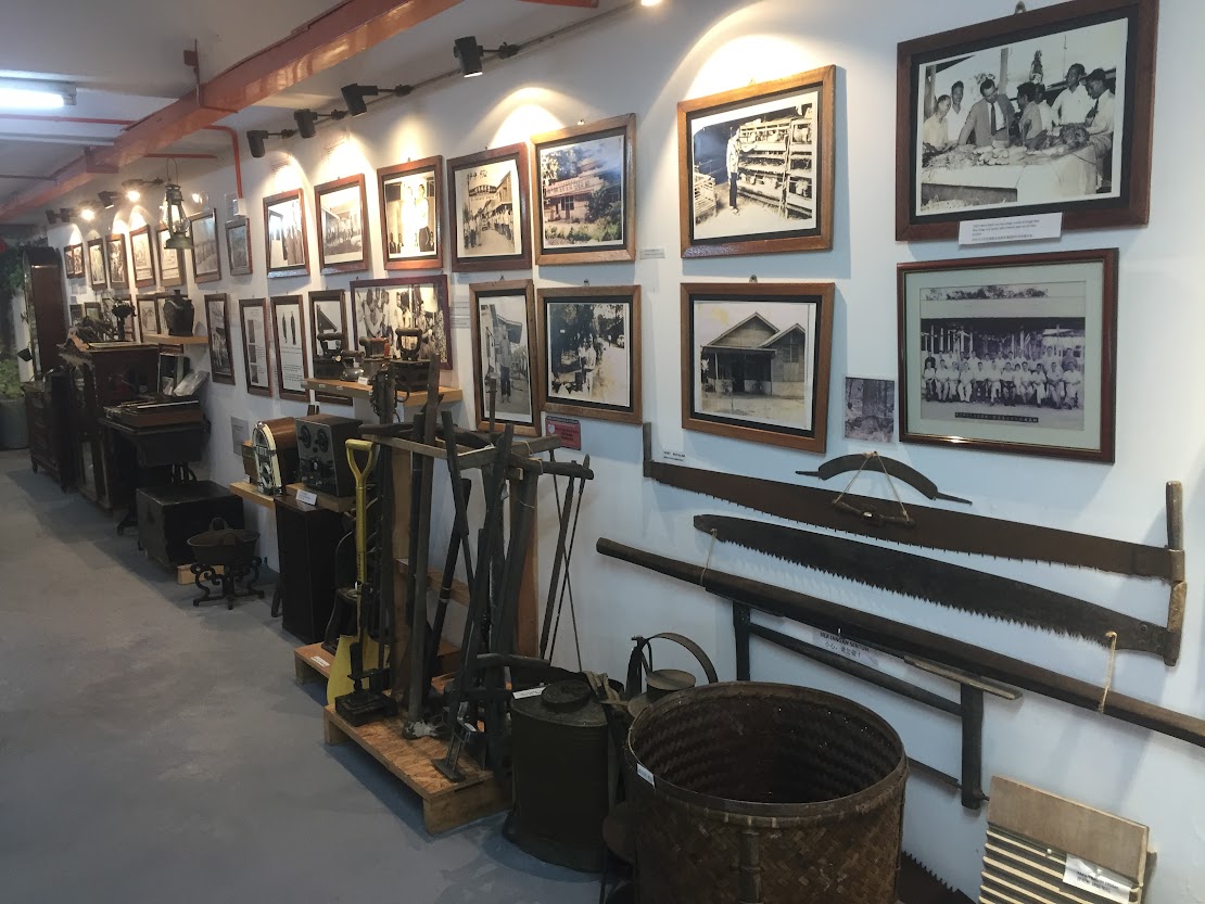
Sungai Way New Village History Corridor.
Photo source : Eric Lim
Across the busy Jalan SS9A / 14, about 100 meters from the museum is the Sungai Way Police Station (3). Just next to the Police Station is the SJK(C) Sungai Way (4), the same school which VP Nixon visited in 1953. Then, it was known as the Convent School. The school was built in 1934. Just within Sungai Way new village / SS9A, there are altogether 6 places of worship which clearly reflect on the multiracial mix of the area. The places of worship are Sungai Way Christian Church at Jalan SS9A/1, Leng Eng Teng Khiew Ong Tai Tay Temple at Jalan SS9A/1, Masjid Ridhwani at Jalan SS9A/8, Tho Guan Seng Teng at Jalan SS9A/9, Seventh Day Adventist Church at Jalan SS9A/14 and Kam Ying Temple at Jalan SS9A/15. The Sri Sakthi Easwari Temple (5) is located just outside Jalan SS9A/12. There are several popular Chinese restaurants located on this street (on the right side of this one way street). Moving on to the Sungai Way Free Trade Industrial Zone / SS8, the current Icon City (6) is where the National factory was located and across the Lebuhraya Damansara Puchong (LDP) is where Freescale Semiconductor (7) is situated.
Getting There
If you are coming from Kuala Lumpur, use Federal Highway Route 2. After passing PJ Hilton (on the left), keep left to Jalan Templer and Jalan 222. Keep right at the traffic junction and immediately keep left to Jalan 51A/225 until the second traffic light. Turn right to Jalan SS9A/14 / Sungai Way new village – Seri Setia.
From Klang, either exit left after passing Icon City on the left to Jalan SS9A/1 (Public Bank and LBS Bina Group Bhd office on the left would be the landmark) or go further and turn left to Cycle & Carriage PJ. At the traffic junction, turn left to Jalan SS9A/14.
References
QuickCheck: Does the ‘SS’ in SS2 mean Sungai Way-Subang? | The Star: https://www.thestar.com.my/news/true-or-not/2023/03/24/quickcheck-does-the-039ss039-in-ss2-mean-sungai-way-subang
Water Project – Geography of Sungai Way: http://www.waterproject.net.my/index.cfm?&menuid=3
The Malayan Emergency 1948 to 1960 – Anzac Portal: https://anzacportal.dva.gov.au/wars-and-missions/malayan-emergency-1948-1960
Malayan Emergency | National Army Museum: https://www.nam.ac.uk/explore/malayan-emergency
Sejarah | jkkk seri setia: https://jkkkserisetia.wordpress.com/history/
PETALING JAYA: THE EARLY DEVELOPMENT AND GROWTH OF MALAYSIA’S FIRST NEW TOWN: https://www.jstor.org/stable/41493670
New village’s history dates back to 1800s | The Star: https://www.thestar.com.my/metro/metro-news/2021/12/15/new-villages-history-dates-back-to-1800s
Guardians of Sg Way legacy | The Star: https://www.thestar.com.my/metro/metro-news/2021/12/15/guardians-of-sg-way-legacy

What an informative article on Sungai Way. Thank you, Eric.
Will visit the museum soon.