By Eric Lim

That was the theme for my recent sojourn in neighbouring Indonesia. The trip was ‘three years in waiting’ due to the global pandemic of Covid 19. Join me on a journey to some of the popular tourist spots in the province of East Java.
Day One
Upon our arrival at the Juanda International Airport, named after the 11th and the last Prime Minister Djuanda Kartawidjaja, near the capital city of Surabaya, we were immediately transported to the Ijen District in the Bondowoso Regency, located at the eastern end of the province. It was a six-hour journey and by the time we arrived at the Arabica Home Stay Hotel, it was almost dinner time. You are right if you say the familiar Arabica name relates to coffee. Arabica coffee seedlings were first brought in by the Dutch in the late 17th century and by 1711, saw the first shipment of coffee fromJava to Europe and sold at high prices. Since then, coffee has been cultivated widely in Indonesia. The fertile soils, high altitude and the suitable climatic conditions have been the key factors in the cultivation of coffee in the Bondowoso Regency.
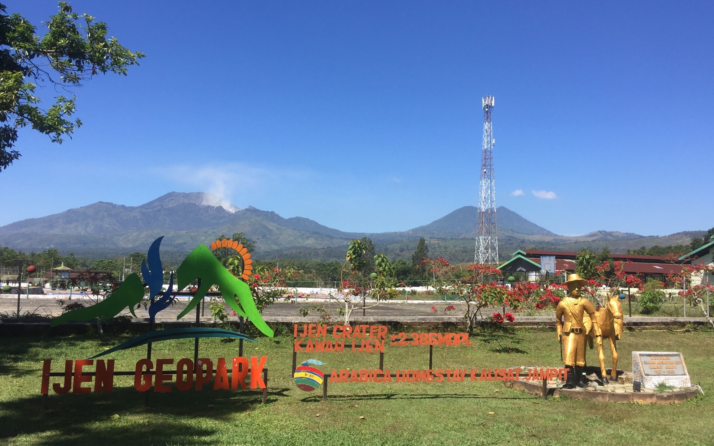
View of Mount Ijen (in the background) fromArabica Home Stay Hotel.
Photo source: Eric Lim
Day Two
It was an early morning start for day two of the tour with the highlight of hiking up Mount Ijen, an active volcano within the Ijen Volcano Complex. The volcanic history in this area started about 300,000 years ago with a single large stratovolcano named Old Ijen (Gunung Purba Ijen / Ijen Purba). Then, about 50,000 years ago, after a series of enormous explosive eruptions, it produced a caldera ten miles wide and many small stratovolcanoes have formed within the caldera. Mount Ijen is one of the stratovolcanoes and it covers part of the eastern margins.
Mount Ijen is probably the only site in the world where one can see these unique features – the largest and most acidic crater lake in the world, home to the phenomenal Blue Fire / Flames and artisanal sulfur mining.
* The dimension of the crater lake is approximately 950 x 600 meters with a depth of 200 meters, and the altitude is about 2,386 meters / 7,828 feet above sea level. The crater lake is filled with turquoise-blue water which is caused by its extreme acidity and a high concentration of dissolved metal content. And the cause of its acidity is an inflow of hydrothermal waters charged with gases from a hot magma chamber below.
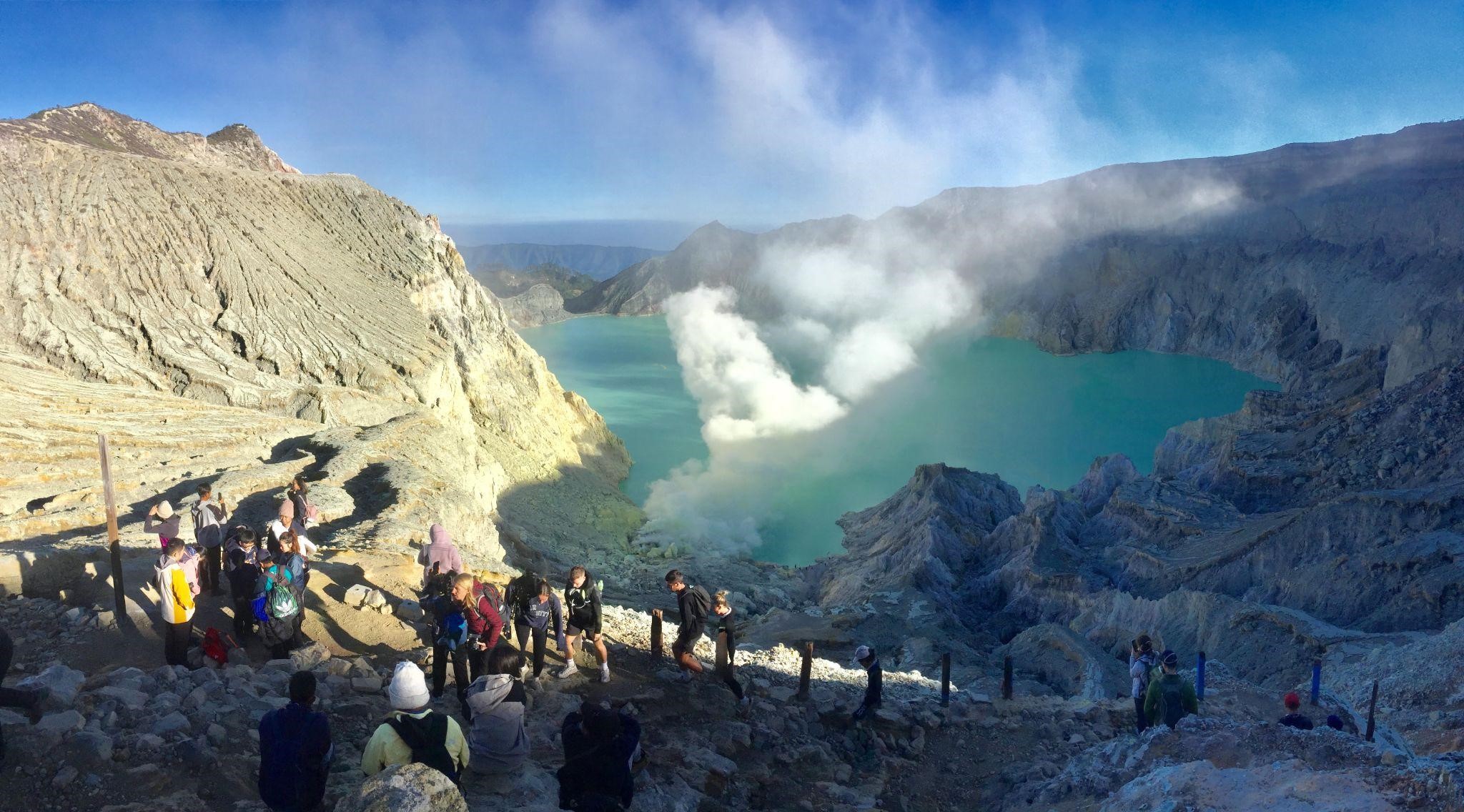
Mount Ijen crater lake.
Photo source: Eric Lim
* The Blue Fire / Flames is the result of the reaction of the hot, flammable sulfurous gases emitted from the active solfatara meeting earth’s oxygen-rich atmosphere. Some of the gas condenses in the atmosphere to produce flows of molten sulfur that also burn with an electric blue flame. The flames can only be seen at night. Besides Mount Ijen, the only other sites where Blue Fire / Flames occur are at Dallol Mountain in Ethiopia and in Iceland.
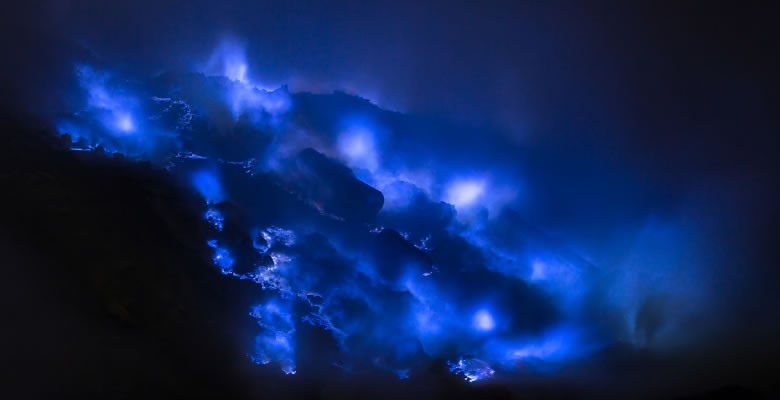
Blue Fire / Flames.
Photo source: Kawah Ijen Volcano
* As the burning gases (Blue Fire / Flames) cool, it would turn into solidified sulfur slabs. In order to speed up the process, mining companies have installed ceramic pipes on active gas vents that condense it into liquid sulfur which then drips and solidifies on hard sulfur mats. Miners will use metal poles to break the solid sulfur and carry it down the mountain in reed baskets. Sulfur mining at Mount Ijen has been active since 1968 and it remains as the last and only artisanal sulfur mining in the world.
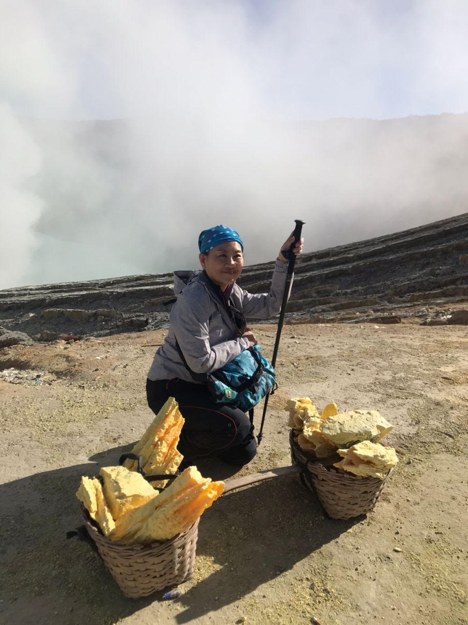
Sulfur slabs in reed basket.
Photo source: Eric Lim
We started our ascent to the rim crater of Mount Ijen at Paltuding Post. Based on the information given by our local guide, the distance is about 3 km (one way) and we should reach the top within two hours on average. It’s uphill all the way but the track is well trodden and wide, with many rest stops in between and a canteen with toilet facilities at the third quarter stage of the climb. We were also informed that for those who do not want to ‘break a sweat’, taxi service is available to be hired. The so-called ‘taxi’ comes in the form of a trolley which allows the user to sit at the center with the feet up while three locals would drag it up to the summit. This service would certainly add more value to an already popular tourist destination – ‘now everyone can visit and reach the summit of Mount Ijen’. On our day of the visit, we only managed to see the crater lake and encounter some of the sulfur miners. Prior, we were told that the Blue Fire / Flames are out of bound due to increased hazard risk in the area.
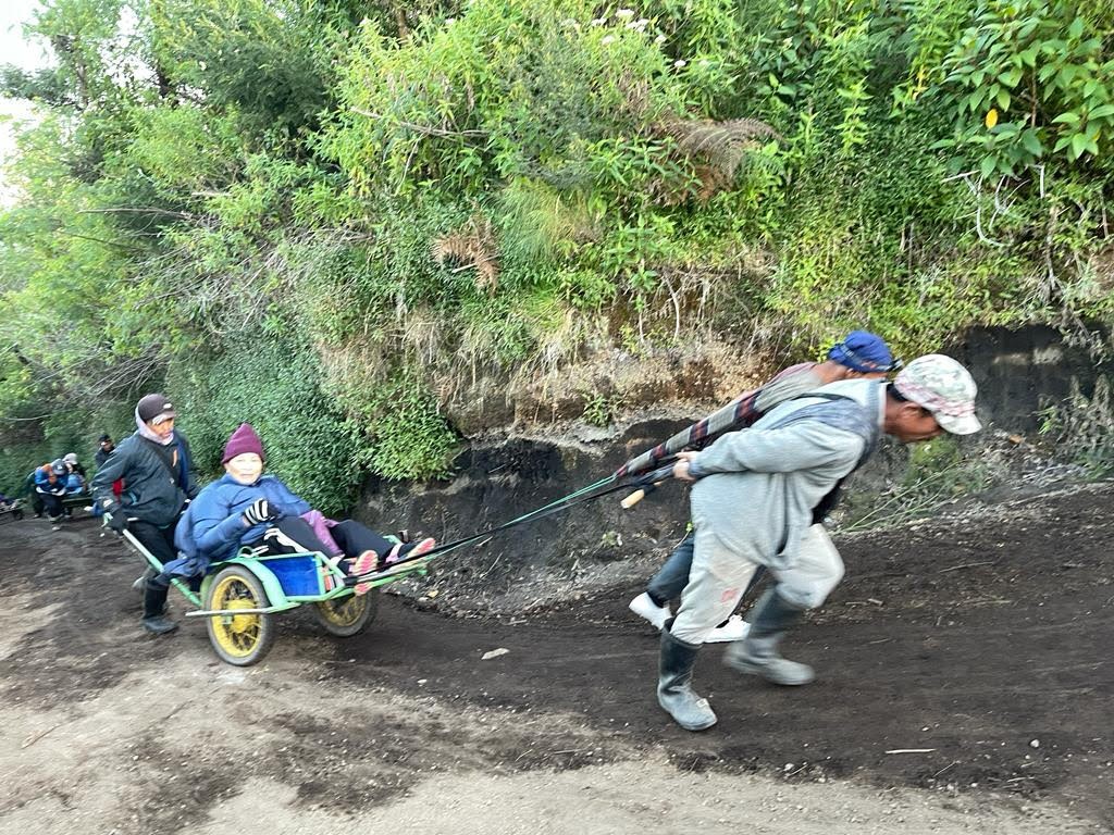
Mount Ijen taxi service.
Photo source: Eric Lim
On the way back, I discovered an abandoned building just before the canteen. On closer scrutiny, the semi-circular building is called Pondok Bunder (Bunder House) and was built during the colonial government of Dutch East Indies in 1920. Originally used as the basement camp for irrigation employees who managed Ijen dam. Later, it was used to measure rainfall around the area and in anticipation of any natural disaster that may occur.
The next stop was the Blawan Hot Springs Complex. It was just the perfect place to be, to soak our tired legs and for some relaxation. After about thirty minutes, we left the hot springs refreshed and full of energy. We left the hotel at about noon time and travelled west to the city of Malang where we had late lunch, and then to the mountain village of Cemoro Lawang. Our accommodation, Cemara Indah Hotel, is situated right at the edge of Bromo Tengger Semeru National Park where Mount Bromo is located.
(In May, UNESCO announced the endorsement of Ijen as a new Global Geopark. Incidentally, in the same communique, Kinabalu in Sabah is also named as a new UNESCO Global Geopark. The Geopark includes Mount Kinabalu, Poring Hot Springs and the Ranau-Tambunan area.
Does our country have volcanoes? The answer is yes and the volcanoes are all located in Sabah. Four of them are within the Tawau Hills Park and according to Dr Seach, who is a scientist and volcano adventurer, Mount Bombalai at an elevation of 531 meters / 1,742 feet is the only active volcano in Malaysia. Still on volcano, at the time of writing, it was reported that a volcano at Reykjanes Peninsula, south of Iceland’s capital Rejkjavic, had erupted after hundreds of minor earthquakes were detected earlier. However, it did not pose any ‘immediate risks’ as the eruption took place in an uninhabited area.)
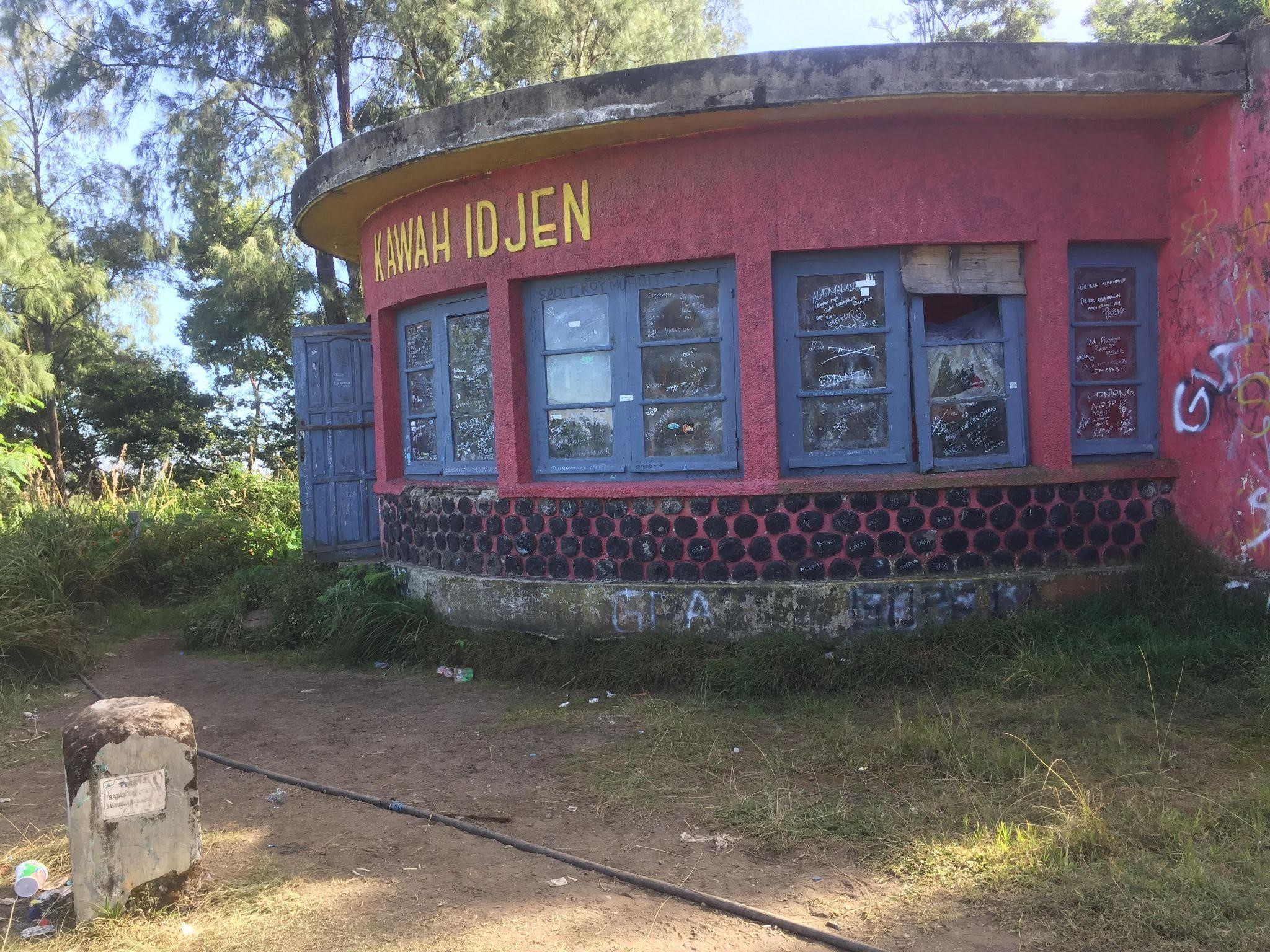
Pondok Bunder.
Photo source: Eric Lim
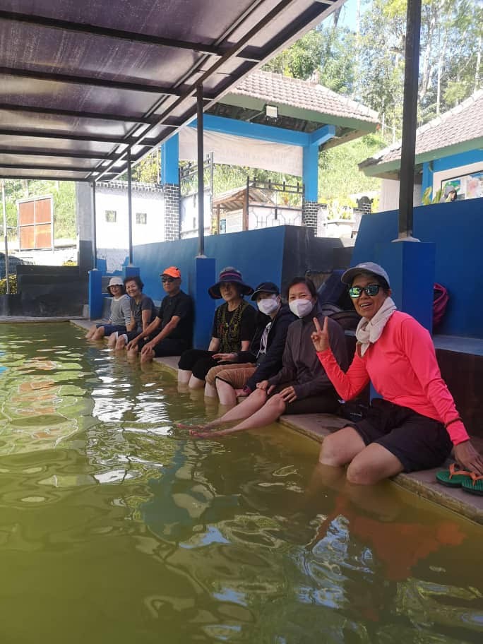
At Blawan Hot Springs Complex
Photo source: Eric Lim
Day Three
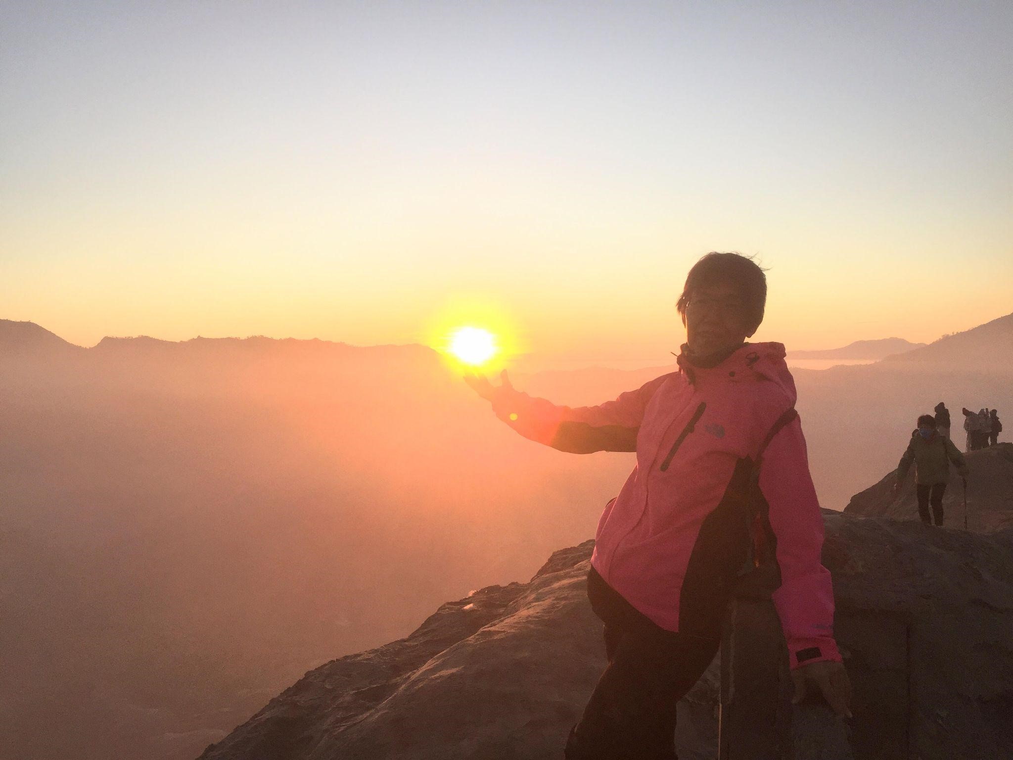
View of sunrise from the top of Mount Bromo.
Photo source: Eric Lim
At the start of the hike to the top of Mount Bromo (in the background) and the concrete stairway on the steep slope.
Photo source: Eric Lim
Again, we woke up at the crack of dawn and by the time we assembled at the front office, the 4×4 jeeps were all set and ready to go. Just like the previous Mount Ijen trip, we had to put on a few layers of clothes at the start of the day and then take it off piece by piece once the vigorous hiking set in and as the day progressed. So off we went to the foot of Mount Bromo which is just 2.5 km away from the hotel. It was still pitch dark when we got down from the jeep and with the help of our LED headlights, we soon made it to the last part of the hike, the steep 254 steps concrete stairway to the top of the crater. We were huffing and puffing by the time we had reached the top and the situation was made worse with the strong sulfur smell as the crater is now just below where we stood. We found a new spot along the narrow path and waited patiently to catch the very first glimpse of sunlight. We did not have to wait too long before daybreak and as i checked my watch, it was just 5.30 am local time (Indonesia is one hour behind Malaysian time). As we were making our way down, we saw a wave of tourists rushing towards us, many arriving on horsebacks. Just like us, they would have seen the sunrise (at other lookout points) and were now making their way up to Mount Bromo while we were heading the opposite direction, to the ‘sea of sand’, past the Luhur Poten Hindu temple and to our little picnic area at the far end, away from the crowd. After a short rest at our hotel, we made the return journey to Malang and before we checked in to the Ibis Styles Hotel, we visited an apple plantation at Batu, just outside of Malang.
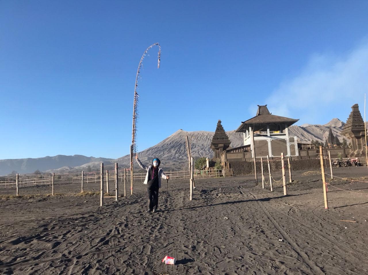
At the Sea of Sand.
Photo source: Tigaatappicture
* The area where Mount Bromo is located has experienced multiple episodes of volcanic activity over millions of years which resulted in the collapse of the summit area and forming a large caldera. Mount Bromo is situated within the Tengger Caldera which is a massive volcanic crater with a diameter measuring about 10 km (6.2 miles) and it has a small active crater with a diameter of approximately 800 meters (2,625 feet) and a depth of about 200 meters (656 feet). Standing at 2,329 meters (7,641 feet) tall, Mount Bromo has been active since at least the 18th century with the first recorded eruption that occurred in 1775. Eruption in 1822 resulted in ash emission and lava flows that reached the nearby sea. The period between 1915 and 1921 saw an increased volcanic activity that resulted in the formation of a new crater known as the ‘sea of sand’ crater which is a unique and prominent feature of Mount Bromo landscape. In the local language, it is called ‘lautan pasir’ and ‘pasir berpisik’. One of the most recent significant eruptions occurred in January of 2010 which resulted in the closure of the surrounding area to tourists. Today, monitoring and research efforts are in place to better understand the volcanic activity in the area and provide early warning systems to local communities.
Mount Bromo is considered a sacred site by the Tengger people, a Hindu ethnic minority living in the surrounding area. The Tengger claim to be descendants of the Majapahit Kingdom and they practice a unique blend of Hindu – Buddhist beliefs that incorporate elements of animism and ancestral worship. Mount Bromo is believed to be the site where the deity Brahma, the Hindu god of creation, sacrifices his son by throwing him to the crater as an offering. The annual Yadnya Kasada festival is held at the Luhur Poten Hindu Temple and Mount Bromo where the Tengger people make offerings of fruits, flowers, vegetables, livestock as well as money to appease the gods and seek blessings for the community.
At the Sea of Sand and Luhur Poten Hindu Temple.
Photo source: Eric Lim
* East Java province is the largest apple growing area in Indonesia. Batu, together with neighbouring Pasuruan and Malang is collectively known as Indonesia’s ‘City of Apples’. Apple is said to have been brought into the country by the Dutch colonizers in the 1930’s and first planted in the Pasuruan regency. There are a few varieties of apples grown in the orchards like Anna, Rome Beauty and Manalagi (Indonesian for ‘where else’). On our visit, we were introduced to the latter which is rather small, green to yellow in colour, round and when we took a bite, it was slightly hard but crunchy. In recent years, the effects of climate change are taking a toll on apple growers and many are switching to other fruit crops like oranges.
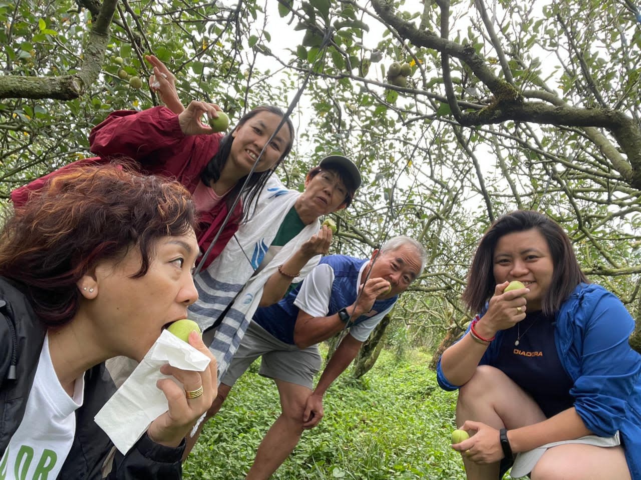
Enjoying freshly plucked ‘Manalagi’ apple at the orchard.
Photo source: Eric Lim
Day Four
Finally, we could put the morning rush of the last three days behind us and settle for a nice, cozy and satisfying morning breakfast at the hotel. Also, we would not be hiking up mountains anymore, instead we would be visiting the other main attractions in this part of the world i.e. waterfalls. And the waterfall we would be visiting is none other than Tumpak Sewu.
*Tumpak Sewu is regarded as the biggest and most beautiful in the whole of East Java. Tumpak Sewu is loosely translated to mean ‘a thousand waterfalls’ in the Javanese language. It is located in the Lumajang Regency and the nearest major city to the waterfalls is Malang which is about a two-hour drive. People from Malang called it Coban Sewu and I reckoned, Malaysians will call it Air Terjun Tumpak Sewu. The waterfall stands at a whopping 120 meters (390 feet) and Mount Semeru which is the highest mountain on the island of Java provides the best backdrop for Tumpak Sewu. There is another waterfall by the name of Goa Tetes which is closeby and usually visited in conjunction with Tumpak Sewu.
There are two ways to enjoy the magnificent view of this wonderful waterfall i.e. from the top and at the bottom. For the first view, all we needed to do was to walk past the entrance gate for about ten minutes and arrive at the observation deck. At the deck, we had a wide and unobstructed view of the massive waterfalls below. It was truly an unforgettable sight of the beauty of mother nature. Unfortunately, we were not able to see Mount Semeru due to the hazy background.
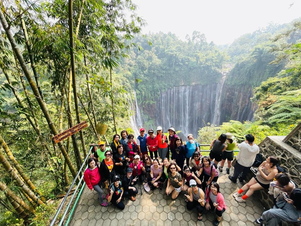
Panoramic view of the waterfall.
Photo source: Eric Lim
To see the waterfall from below, it called for some adventure as we navigated through rushing waterfall streams, slippery rock surfaces, bamboo ladders, side ropes and chains to reach the waterfall’s ravine. There were several viewpoints from the bottom of the waterfall but we decided on one ‘sweet spot’ and walla!, the photos came out just the way we liked it.
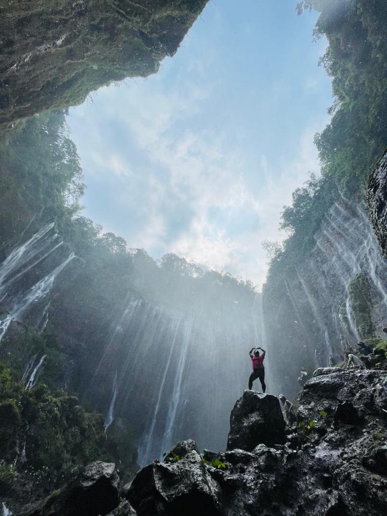
View from the bottom of the waterfall.
Photo source: Eric Lim
Getting up the boulder for the photo shoot took a while as it is constantly wet and slippery. And when the task was over, we moved to the other direction, to Goa Tetes which is another ten minutes hike from here. After another round of photo shoots, it was time to head back to the top and to our waiting van.
For those who are visiting and planning to go to the bottom of the waterfalls, here are some essentials needed for the trip – get the correct shoes like sandals with grip, aqua boots; wear waterproof or quick dry clothes; bring a dry bag, waterproof camera, plastic cover for your phones and towel.
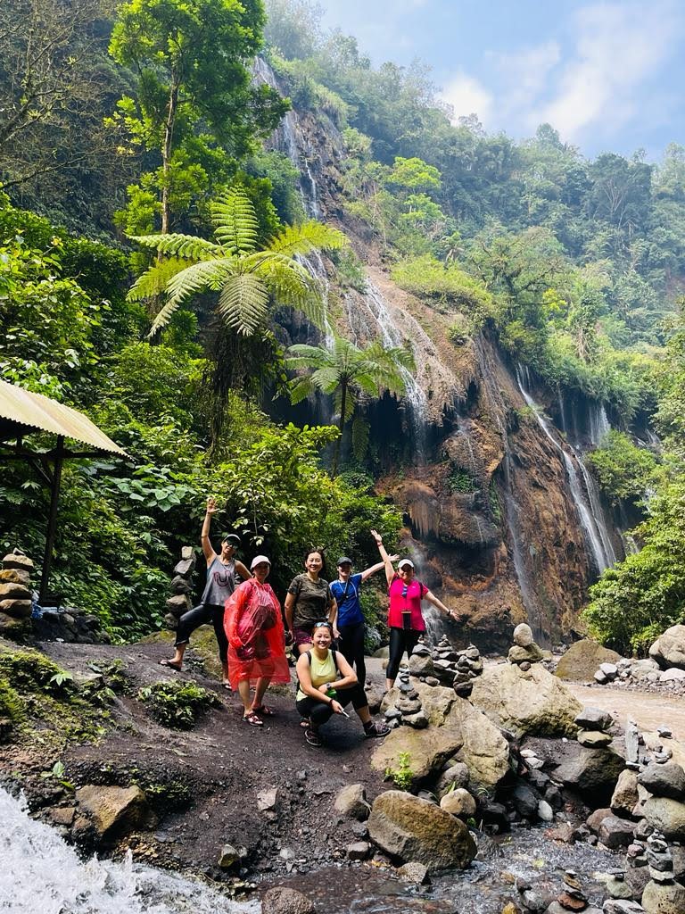
Photoshoot at Goa Tetes.
Photo source: Eric Lim
We had lunch at Desa Wisata Ampelgading where we were served local traditional foods and dishes. Desa Wisata Ampelgading is one of the participants of the Village Tourism programme that is initiated by the Ministry of Tourism and Creativity Economy. Upon our return to Surabaya, we managed to squeeze some time for some last minute shopping. Later, we had dinner at a Chinese restaurant which specializes in Hakka food.
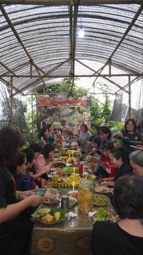
Lunch at Desa Wisata Ampelgading.
Photo source: Eric Lim
Day Five
We had made reservations to return in the afternoon so we still had the morning for one more sightseeing trip and we had chosen to visit The Mosque of Muhammad Cheng Hoo / Cheng Hoo Mosque. Just before reaching the mosque, we had a fleeting glance of the Submarine Monument-cum-Museum. The submarine was built by Russia in 1952 and it started service for the Indonesian Navy on 29 January 1962. The submarine was later converted into a museum and was officially opened to the public on 5 July 1998.
*The construction of The Mosque of Muhammad Cheng Hoo / Cheng Hoo Mosque began on 15 October 2001 and was opened to the public the following year. The design of the mosque took inspiration from the Niu Jie (Ox Street) Mosque in Beijing which was built in 996 AD. This mosque is a dedication to Admiral Cheng Hoo (Zheng Ho) who was a devout Muslim. The pagoda at the center of the main building is octagonal which represents Pat Kwa, symbolizing luck and prosperity in Chinese culture and for the Muslims, it symbolizes spider webs which played a role in Prophet Muhamad’s survival during a chase in a cave. The building measures 11 meters by 9 meters – eleven to echo the measurements of the Kaaba in Mecca and nine to symbolize the nine pious leaders who spread Islam in Java. The mosque can accommodate about 200 worshippers.
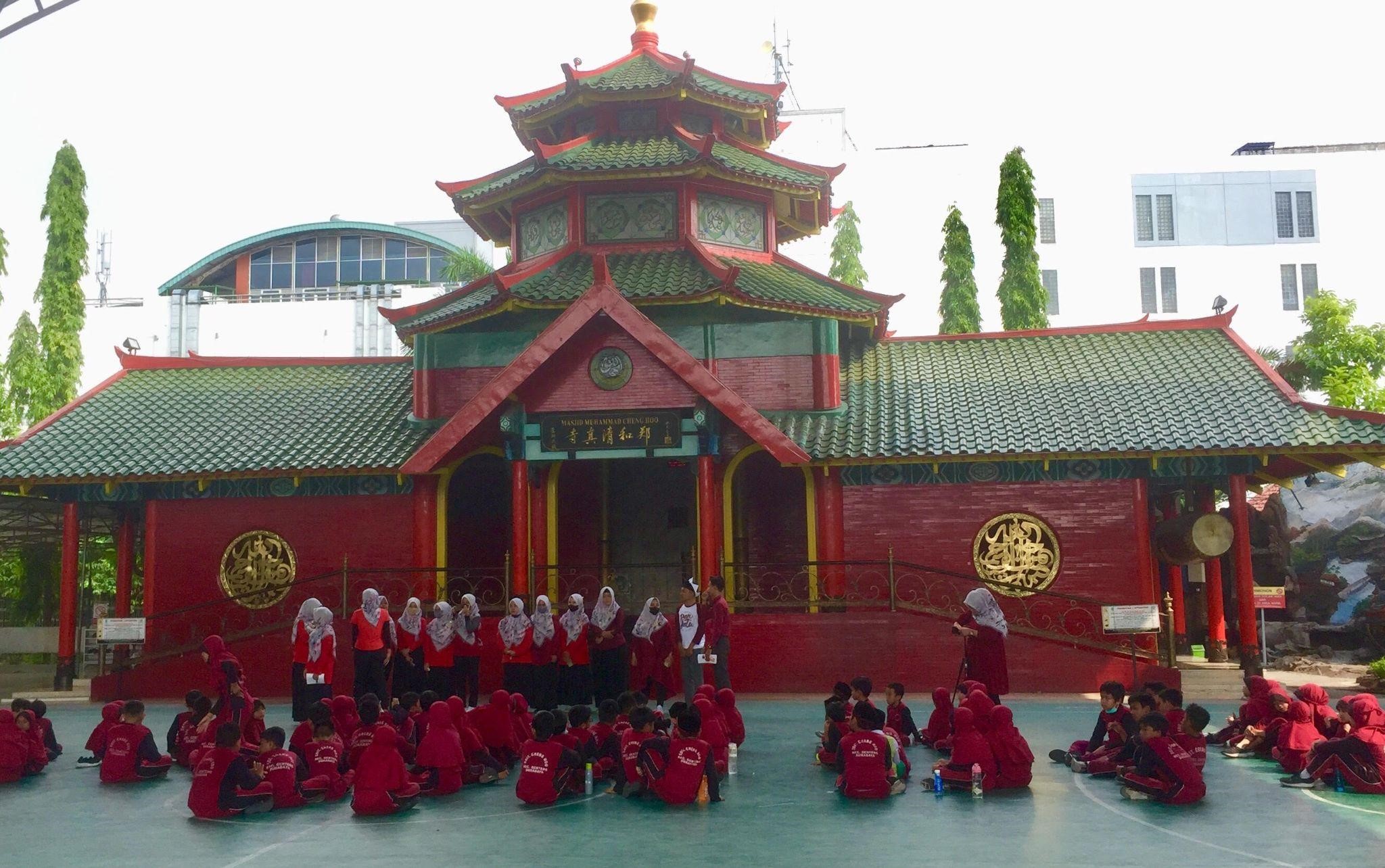
Cheng Hoo / Zheng Ho Mosque.
Photo source: Eric Lim
References
Coffee production in Indonesia – Wikipedia
https://www.nationalgeographic.com/photography/article/the-struggle-and-strain-of-mining-devils-gold
MOUNT IJEN HIKE INDONESIA – A Complete Guide – The Travel Author
UNESCO names 18 new Global Geoparks | UN News
Iceland: Volcano erupts in Litli-Hrútur after weeks of earthquakes | CNN
Mount Bromo Volcano | Geology, History
In Indonesia, climate change takes a bite out of apple crops – LiCAS.news | Light for the Voiceless
https://jadesta.kemenparekraf.go.id/desa/ampelgading
Cheng Hoo Mosque: An Oriental Divinity
