That Other Capital City Across the South China Sea

By Chuah Siew Yen

Situated in north west Borneo, on the banks of the Sarawak River at approximately the same latitude of Kuala Lumpur, across the South China Sea, is Kuching.

Kuching was trading town for at least two centuries under the Bruneian Sultanate. In 1841, it became the capital of the Brooke ‘Rajah-dom’ after the territory west of the Sarawak River was ceded to James Brooke. From then on, Kuching became Sarawak’s capital, receiving attention and development, which continued under the second Rajah, Charles Brooke. After the third Rajah, Charles Vyner Brooke ceded Sarawak as part of the British Crown Colony in 1946, Kuching remained its capital … and retained its status as state capital after the formation of Malaysia in 1963.

Granted city status in 1988, the City of Kuching is administered by two separate local authorities – Kuching North (administered by a Commissioner) and Kuching South (administered by a Mayor). Kuching experienced further development and was declared ‘City of Unity’ for its racial harmony, on 29 July 2015 by One Malaysia Foundation. 

This capital city is the main gateway for travellers visiting Sarawak and Borneo, and a member of the UNESCO Creative Cities Network (Field of Gastronomy).

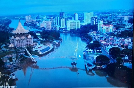
Aerial view of Kuching City. To the left is north Kuching with the State Legislative Building dominating, and south Kuching to the right. Source: YouTube, Gazetica Explorer

Being driven around the city on a recent visit, I observed its natural and built heritage.  As I mingled and chatted with its people and enjoyed the cuisine, I can attest to the fact that Kuching is indeed a city of unity as well as a city of gastronomy and creativity.  

The diversity that we see in Kuching touches all spheres of life, from the people and nature to culture and food. This is the place where traditions thrive and history remains in the time-worn streets of Old Kuching where stories of the White Rajahs are retained. Kuching holds on to its past as it moves into the present. Juxtaposed among the new are Brooke era buildings in neo-classical and baroque designs which peer out in between modern contemporary structures. At every turn in the city, one is greeted with a mosque, temple, church or colonial building.  

Sitting majestically on the north bank of the Sarawak River is the State Legislative Building with its distinctive umbrella-inspired roof, also reminiscent of the Bidayuh longhouse and the Melanau hat. Here, Sarawak’s 82 elected representatives (assemblymen and women) debate and pass laws.

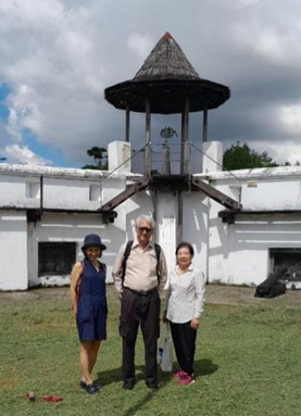
In the courtyard of Fort Margherita with award-winning guide, Edward Mansel, who took us on a walking tour ‘On the Trail of the White Rajahs’. Photo by author.

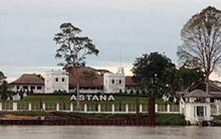
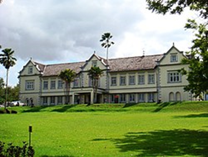
The Astana was built in 1870 by Charles Brooke. It was the venue for various meetings of the General Council from 1873 – 1937. Laid out in the style of an English manor house, it was the third and last residence built by the Brooke Rajahs. Photo source: Old Kuching Smart Heritage booklet.

Walking along the waterfront, the Darul Hana Bridge catches the eye with its two towers designed to complement the hornbill-like structure of this 2017 icon. This S-shaped bridge, 12 meters above the water, is the only pedestrian crossing linking north and south Kuching.     

The bot penambang (water taxi) still makes the crossing as it is the fastest and probably the cheapest way to cross the river, especially for the villagers of Kampung Boyan, Kampung Gersik and surrounds.

On the opposite bank of the river, moving away from the promenade, are the historical and heritage buildings that give Kuching its unique character such as Sarawak’s former administrative centre found in the Old Courthouse built in 1874, and the hub of the earliest trading activities. The area is a meeting spot of old and newer mosques, Brooke-era buildings, Chinese temples, and shop houses along India Street, a covered pedestrian street lined with shops and stalls selling textiles and sundries. The city then was a self-segregated area where heterogeneous communities of Chinese, Indian, and Malays lived and thrived in different areas while peacefully co-existing with each other.

Midway is a narrow alley named Masjid India Lane that passes by the entrance of the India Mosque and leads to Jalan Gambier, where Kuching’s Indian spice traders and Chinese hardware merchants are found. Further up is Carpenter Street, named for the many woodwork shops set up in the last century.

When James Brooke landed in 1839, the row of shops along the river were made of wood and nipah. This Attap Street soon became the prime trading area due to its proximity to the original piers, where goods were unloaded at the jetties and wharfs. Business activities picked up, and in 1872, the second Rajah had some shops rebuilt with bricks, with a 5-foot walkway in front connecting the shops of each block.  

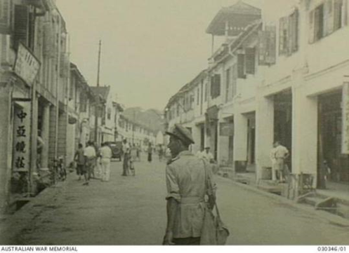
A street of Kuching town shortly after the surrender of Japan, image taken on 12 Sept 1945. Shops with 5-foot walkway visible. Photo source: Australian War Memorial

In 1884, a fire ravaged the wooden buildings, but these were quickly rebuilt with bricks. They are the quaint old shops we see today in Main Bazaar Road facing the river—a vestige of Kuching’s past, a lower working-class neighbourhood with hardware and bicycle shops amid gambling and opium dens, and brothels—and a haven for clandestine activities. What is interesting is that the local people were not aware of the Japanese spies in their midst who disappeared two days before the Japanese landing on 8 December 1941.

Here is the historic core of the city, well-preserved as a peaceful merging of Indians, Chinese, and Malays in its modern-day co-existence, an eclectic mix of history, culture, tradition, and community. A walk through the layers of history and architecture and everything in between is both educational and relaxing.

Main Entrance, Sarawak Club. The Club was established in 1876 for the recreational and entertainment needs of the White Rajahs and government officers. Sarawak-valued belian timber was used for the roofing truss and shingles. Photo by author.

As Kuching prospered, its boundaries expanded with de-centralisation combined with development of new commercial centres. Hotels, shopping malls, tertiary education institutions, civic and religious structures, and infrastructure were constructed or upgraded to meet the needs of an evolving demographic trend towards urbanisation and modernity. As in the past, Sarawak’s built environment was largely concentrated in Kuching, it being the capital and government centre.

After the opening of the Tun Abdul Rahman Yacob Bridge in 1974, the development of the city shifted from the old town to the northern side of the Sarawak River. Many government offices relocated here and Petra Jaya is now the administrative centre for the Sarawak Government. 

The State Library of Sarawak is set amid beautiful surroundings and overlooks a man-made lake. The library offers a direct-to-consumer book borrowing service. Also in Petra Jaya, are the Sarawak Stadium, a multi-purpose sports facility with 40,000 seats, and the Sarawak State Jamek Mosque.

State Library of Sarawak (Pustaka Negeri Sarawak) in Petra Jaya Photo source: Wikimedia Commons

Greater Kuching is a metro area of 2,030 km sq., almost the size of Greater Kuala Lumpur at 2,243km sq., but with a much smaller population.

Sarawak’s population is made up of about 26 major ethnic groups, with sub-groups within them. The two biggest groups are the Ibans and the Bidayuhs. Those groups in the interior are collectively referred to as Orang Ulu (people of the interior). Inter-racial marriages, formerly rare and only between closely related groups, are increasingly common in this day and age.

The culture of some of these indigenous communities has been influenced by Islamic practices, while others have converted to Christianity. However, indigenous beliefs, customary rites, and social customs known as adat continue to be practised. Those practices, entwined with traditional beliefs, are carried out through customary law or adat.   

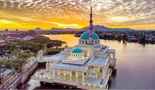
The Floating Mosque sits on the banks of the Sarawak River. It can accommodate 1,600 worshipers. At dusk, the architecture is accentuated when it is flooded with the light of the golden sunset. Photo source: KuchingSarawak.com – (https://www.kuchingsarawak.com/2020/01/10/top-3-beautiful-masjids-of-kuching/)

The diversity of Sarawak’s (and Kuching’s) population is seen in the places of worship throughout the city. The Floating Mosque is at least one of eight religious places in the historical core of Kuching. Masjid Bandaraya Kuching replaced the old wooden mosque in 1968. Masjid India, built in 1879, is the oldest extant in the city. Masjid Bandaraya Kuching is the main mosque in Kuching. It had served as the state mosque before the new mosque was built in Petra Jaya.

Other places of worship are St. Thomas Anglican Cathedral, originally built in 1856, followed by the neo-Gothic-style St. Joseph Cathedral, built in 1894 but has since been replaced by a modern building in 1969.

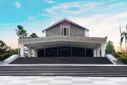
St Thomas Cathedral Kuching. Photo source: CW Food Travel (cwfoodtravel.blogspot.com/2010/01/kuching-architecture-st-thomas.html)

St. Peter’s Catholic Church is undergoing construction, which, when completed, will resemble Westminster Abbey in miniature. The Gothic-style building will have pointed spires, ogival arches, flying buttresses, rose windows, and a bell tower.

Temples in the vicinity are the Tua Pek Kong Temple, the Taoist Hong San Si Temple built in 1848, the rebuilt Siew San Teng Temple, and the 1889 Hiang Tiang Siang Ti Temple, an Indian temple and a Sikh gurdwara.

The original Sarawak Museum. Photo source: Wikipedia Commons

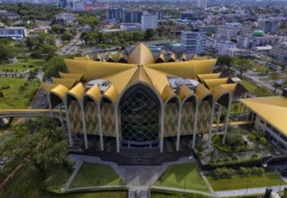
An aerial shot of the Borneo Cultures Museum at Jalan Tun Abang Haji Openg in Kuching. Photo source: Bernama

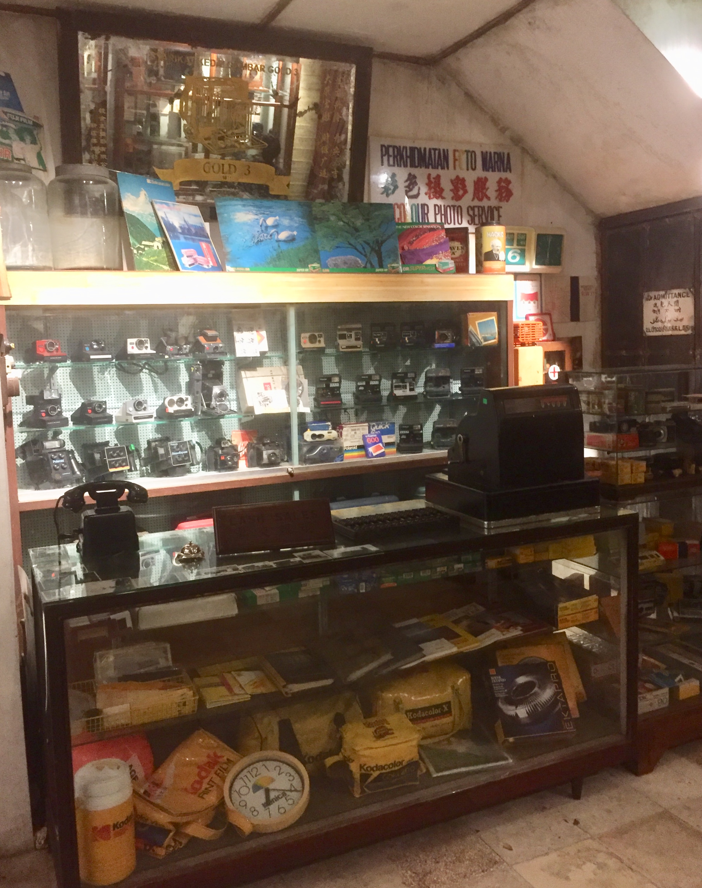
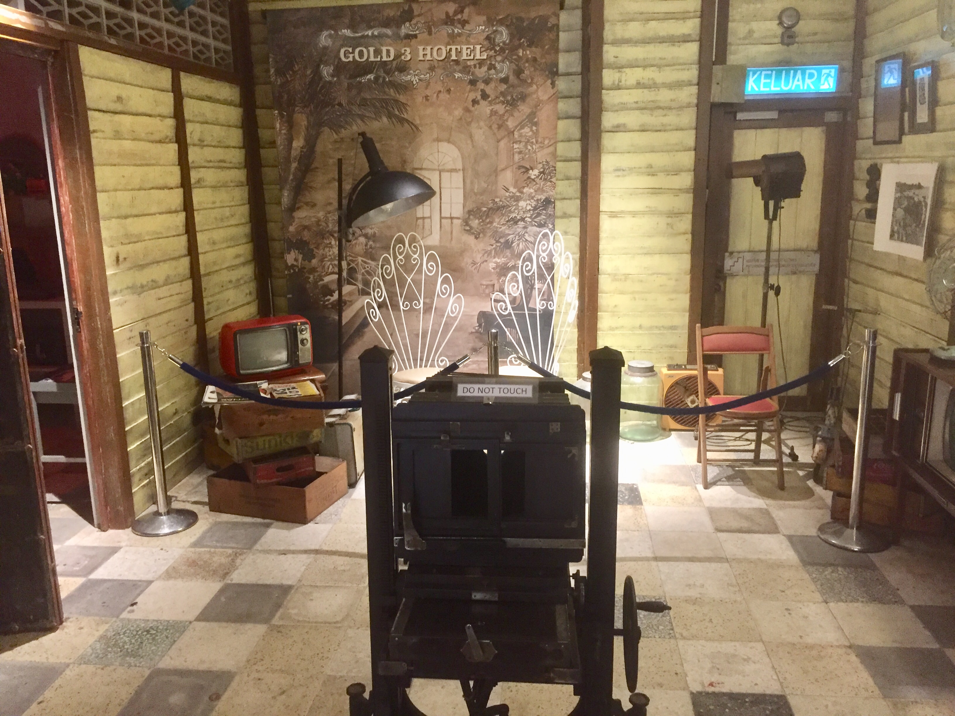
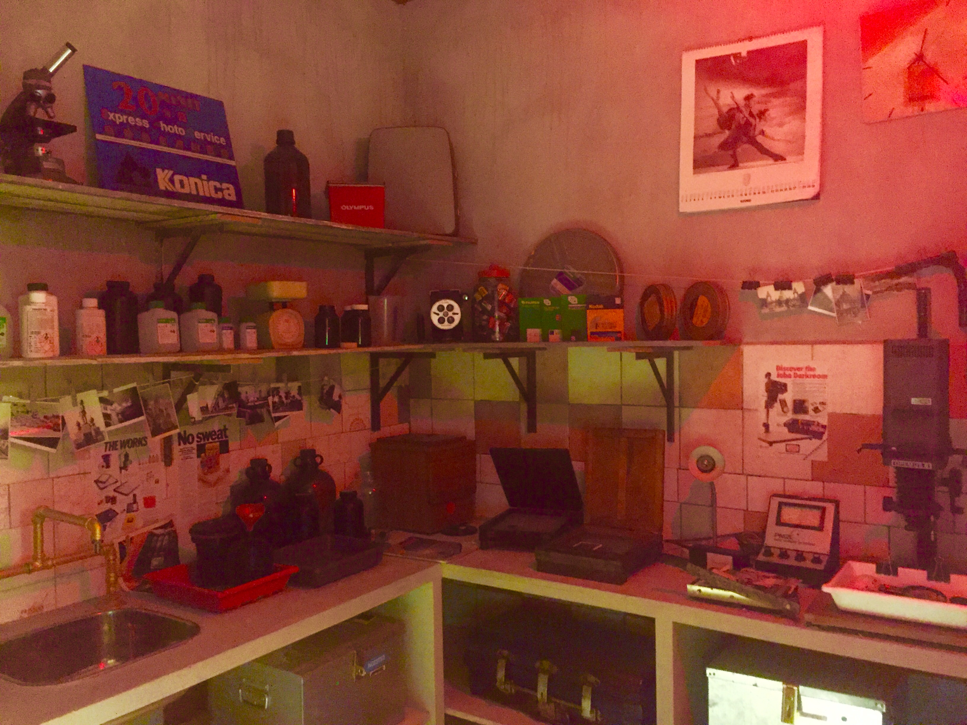
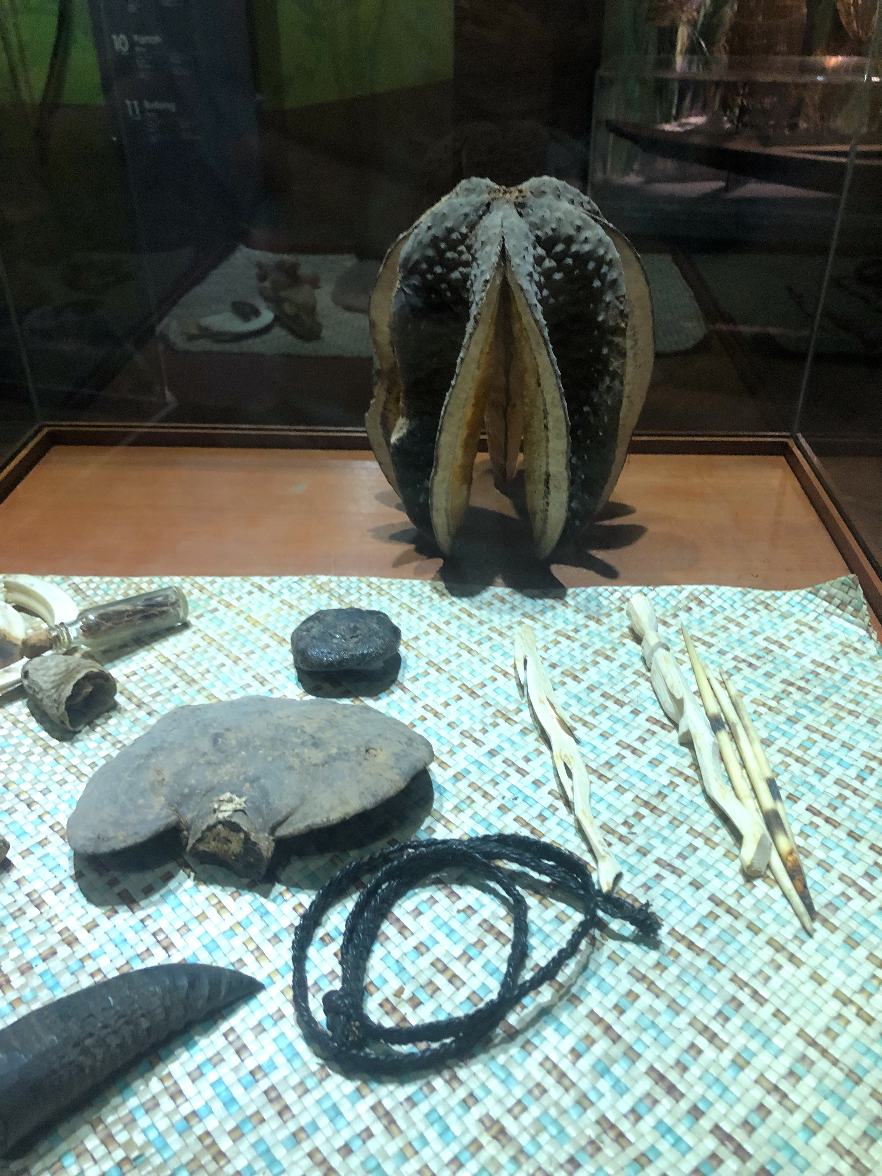
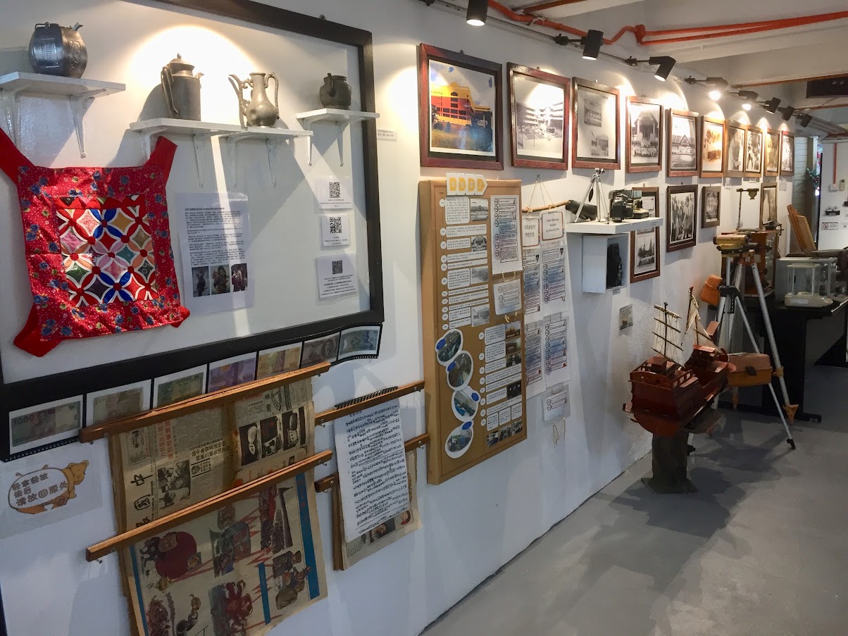
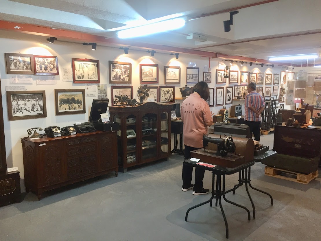
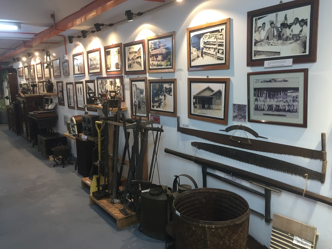
Museums – big or small, special or unique – are found all over Kuching. Among them are the original Sarawak Museum built in 1891 by Rajah Charles Brooke. Chinese History Museum housed in the former Chinese Courthouse built in 1912 by Rajah Vyner Brooke and the Sarawak Islamic Museum housed in the 1930 Maderasah Melayu Building also built by Rajah Vyner. But the Borneo Cultures Museum (BCM) tops it all. Opened in March 2022, this 5-storey building with distinctive architectural features reflecting the traditional crafts of Sarawak, displays the best examples of Sarawak’s material culture.

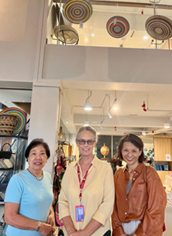
With Dr. Louise Macul, centre, founding member, Friends of Sarawak Museum in the BCM bookshop. Photo by author.

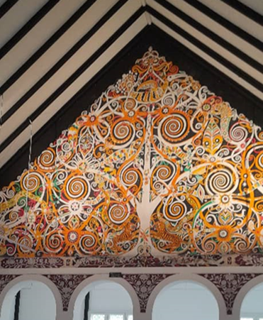
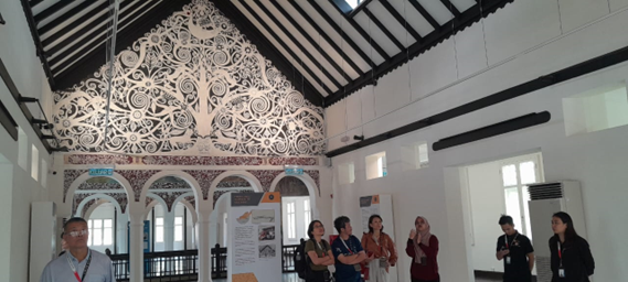
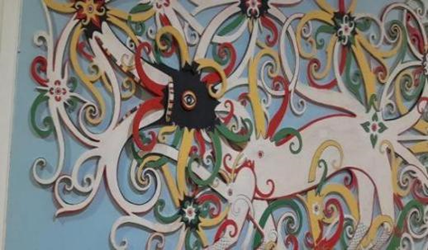
Murals in the Sarawak State Museum, commissioned by Tom Harrisson, Curator of the Sarawak Museum (1947 – 1966). Photo by author.

Kenyah painted wood carving by Tusau Padan, in Hotel Telang Usan. Photo by author.

The Kenyah-owned Hotel Telang Usan exhibits paintings by Kenyah artist extraordinaire Tusau Padan (1933–1996). Tusau often said he was doing ‘all that the old people taught me, not to seek fame but to preserve a beautiful tradition’. The paintings here complement the four masterpieces by artists from Long Nawang, East Kalimantan, in the old Sarawak Museum.

The Tun Jugah Foundation, registered in 1985 perpetuates the memory of Tun Datuk Patinggi Tan Sri Temenggong Jugah anak Barieng by collecting, recording and preserving Iban culture, language and oral history. The museum/gallery promotes traditional methods of Iban weaving through a display of costumes and pua kumbu, antique and modern, complete with weaving materials and implements. There is also an exquisite collection of beads, silverware and jewellery.

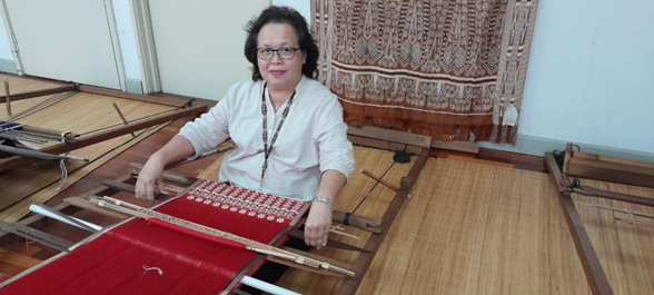
Janet Rata Noel, Curator, Museum and Gallery, Tun Jugah Foundation, at her loom. The Foundation encourages all its staff to learn the Iban crafts of weaving and beading. The Foundation conducts demonstrations and workshops. Photo by author.

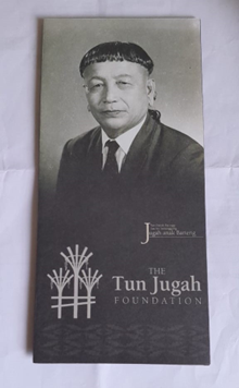
Born in a longhouse in Kapit, Jugah anak Barieng was a Malaysian politician of Iban descent. Even though he had no formal education, he played a fundamental role in the formation of Malaysia in 1963. Tun Jugah is said to be ‘the bridge to Malaysia’ for without his signature (thumbprint!) there would not be any Malaysia. Photo source: Tun Jugah Foundation.

Kuching is also a major food destination. Each ethnic group has its own delicacies with varying preparation methods. Examples of ethnic foods are the Iban tuak (rice wine), Melanau tebaloi (sago palm crackers) and umai (raw fish in lime juice) and Orang Ulu urum girua (pudding).

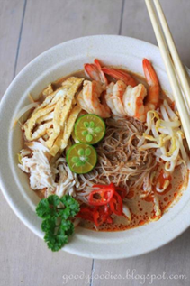
A bowl of Sarawak laksa. Photo source: Goody Foodies (https://goodyfoodies.blogspot.com/2014/04/recipe-sarawak-laksa.html)

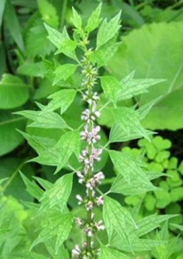
Wild herb: Motherwort. Photo source: Wikipedia.

Some of the notable dishes, such as Sarawak laksa, kolo mee, and ayam pansuh, have made their way into the menus of Kuala Lumpur eateries, their tastes being increasingly appreciated by the palates of west Malaysians. Creeping in are midin (edible fern), gula apong-flavoured desserts, kway chap (broad rice noodles in spiced broth with offal), and salted ikan terubok (a local fish).

Still relatively unknown are ayam kacangma, a chicken dish made with motherwort, its unique bitter taste complemented with tuak and a popular post-natal dish; wild brinjal (terung Dayak/terung assam) soup made with smoked or salted fish with ginger, garlic, onion, and pepper; and de-shelled smoked-dry prawns, chewy and flavourful, in kerabu or salads. Fresh prawns are shelled, then straightened (unlike the ordinary salted, curled up dried prawns) before being laid on mesh trays to be smoked. It’s a laborious process and retails at RM250 a kilo.

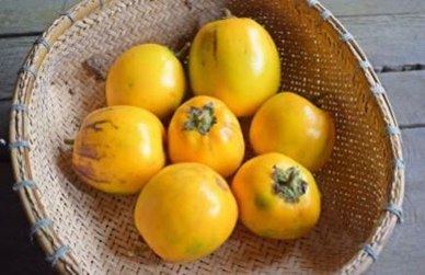
Terung Dayak, a native cultivar of wild eggplant. This local eggplant is spherical in shape and comes in yellow to orange hues. It is called terung asam due to its natural tart flavour. Photo source: Borneodictionary.com

Bario rice is a rare grain grown in the Kelabit Highlands, where the soil is fertile and the temperature is cool. It is irrigated by unpolluted water from the mountains and it takes six months for the grain to mature, yielding aromatic, marble-white rice with a sweet taste and slightly sticky texture, richer in minerals than normal rice. Cultivated by hand with no pesticides using traditional farming methods and with only one yield a year, real Bario rice is rare and retails at RM25 a kilo. 

There is a cheaper, lesser-quality grain that goes by the same name, and many Malaysians are not aware of the difference. Genuine Bario Rice has been registered as a product of Geological Indication (GI), the practice of labelling food based on national or place origins to protect it as part of a nation’s heritage. Bario salt from the salt springs is another speciality from the highlands. Food can speak to a people’s taste and regional differences and signal a connection to culture and national pride.

For Asian cooking aficionados, Stutong Community Market is the place to go to source uncommon ingredients for traditional dishes. Available here is a wide variety of the bounty of the South China Sea, as well as a variety of fruits and vegetables cultivated, foraged, or imported. The range of products extends to local grocery items from other parts of Sarawak and ethnic cakes, puddings, and pastries. Cooked food and hawker stalls are conveniently located on the first floor (and you can even have your clothes tailored here!).

Sarawak has developed its own distinctive culture, different to what you would find in peninsula Malaysia. The geographical location of these two capital cities, separated by the South China Sea, has similarities and dis-similarities.  Visit this City of Unity and Gastronomy for a comparative appreciation of Kuala Lumpur and Kuching.

Edited by Dr Louise Macul

Special thanks to:

  • Dr. Louise Macul for taking us on a tour of the Borneo Cultures Museum and unstintingly sharing her knowledge, and articles in dayakdaily.com
  • Edward Mansel who took us on a walking tour on the trail of the White Rajahs. An octogenarian, he has witnessed an exciting part of Sarawak’s        history. The walking tour ended with a driving tour!
  • Janet Rata Noel who took us through the Tun Jugah Foundation galleries.
  • My friend of many years, Melinda Siew, her husband Kenny, mum Margaret and sons Keegan and Kaedan whose hospitality made our visit so comfortable. Margaret drove us to Stutong and all over Kuching south, and to Petra Jaya, from the airport and to the airport, unceasingly pointing out landmarks along the way, along with interesting snippets of people, places and things unique to Sarawak.
  • Fellow Museum Volunteer JMM, Noriko Nishizawa, for her companionship and care throughout the trip.

References

  1. Munan, Heidi (2015) Sarawak Historical Landmarks
  2. Lim, Jerome. (7 July 2012). St. Joseph Cathedral, Kuching. The Long and Winding Road Blog. https://thelongnwindingroad.wordpress.com/
  3. Sarawak witnesses remarkable progress: Poverty rate reduced to 9 pct, major infrastructure projects underway: https://dayakdaily.com/sarawak-witnesses-remarkable-progress-poverty-rate-reduced-to-9-pct-major-infrastructure-projects-underway/
  4. Bario rice – a rare grain: https://www.theborneopost.com/2012/01/29/bario-rice-a-rare-grain/
  5. Kuching division starts Sarawak’s journey of progress: https://themalaysianreserve.com/2021/01/20/kuching-division-starts-sarawaks-journey-of-progress/
  6. “Kuching, Malaysia” in the Britannica: https://www.britannica.com/place/Kuching
  7. Ting, John H.S. (2018). The History of Architecture in Sarawak before Malaysia. Kuching: Pertubuhan Arkitek Malaysia Sarawak Chapter.
  8. Kuching in Wikipedia: https://en.wikipedia.org/wiki/Kuching

M & M – Meet the Pros and Museum

By Eric Lim

22 July 2023 (Saturday): Before long, I found myself in another M & M session. This time, it involved [M]eeting professional golfers (‘[M]eet the Pros’) and exploring a camera [M]useum – all within a single day, and they are both hobbies that bring me immense enjoyment!

Meet the Pros

I’ve been playing golf for nearly three decades now, and it seems I’m hooked for life. It is always exciting playing in different golf courses and with different people of different skill levels. Every single round of golf is different and we are always looking forward to hitting that one big shot, like what Harvey Penick who was an American professional golfer envisaged ‘your next shot is a new experience. It might be the best shot you ever hit in your life’. So when the opportunity came to ‘Meet the pros’, I had quickly signed up in the hope of getting some valuable tips to improve my golf game and to get closer to that ‘best shot I ever hit in my life’.

Photo source : MST Golf Group Berhad

The event was held at MST Golf Arena, an indoor golf centre located at Gardens Mall, in the heart of Mid Valley City, Kuala Lumpur. Three local professional golfers, namely Ervin Chang from Kajang, Selangor, Paul San from Sarawak and Shahriffuddin Ariffin from Malacca, made their appearance in person. All three of them are currently playing in the Toyota Tour circuit. The tour was founded by the late Tun Ahmad Sarji in 2010 and was known originally as the PGM Tour (Professional Golf of Malaysia Tour). This year with the inclusion of UMW Toyota Motor and MST Golf, together with Professional Golf of Malaysia (PGM), the name changed to Toyota Tour. MST Golf has established its name in the golf retail industry locally as well as in Southeast Asia. With over 30 years of experience, it is now controlling more than 51% of the local golf equipment retail and distribution market in Malaysia. The company was incorporated on 13 November 1989 as Masinthai Marketing Sdn. Bhd. and later changed its name to MST Golf Sdn. Bhd. on 22 April 1992. 20 July 2023 marked a historic milestone for the company as it premiered as a publicly listed company on the Main Market of Bursa Malaysia Securities Berhad. During the swing assessment session, fellow Kajang resident Ervin Chang gave me a valuable tip which I am now following through to achieve better swing consistency. Incidentally, three days after the meet up event, all three participated in the Supra Cup (one of the tournaments in the Toyota Tour programme) that was held at The Mines Resort & Golf Club, Seri Kembangan. Ervin Chang played well and finished tied for first place with Marcus Lim. Unfortunately, Ervin lost the play-off hole to Marcus.

Winners of the Supra Cup that was held at The Mines Resort & Golf Club.
Photo source : Courtesy of Chew Fook Keong

Museum (Camera Museum)

My first job in Kuala Lumpur was with a local company dealing with the supply of photographic, laboratory and film products. The company, located at the corner of the Jalan Tun HS Lee-Jalan Sultan intersection, was the agent for some reputed brand names at that time, namely: Chinon (camera and lenses), Eiki (16mm film projector), Hanimex (camera and slide projector), Popular (flashlight), Polaroid (instant camera system and sunglasses), Mitsubishi (film and photographic printing paper), Sunpak (flashlight), Velbon (camera tripod stand) and Vivitar (zoom lenses). This was where I started my association with photography. After four years, I left and joined a private limited company in the sales and promotion of Pentax 35mm Single Lens Reflex (SLR) camera.

Asahi Optical, the founding company of Pentax, introduced its first 35mm SLR in 1952. The model Asahiflex I, subsequently became the first 35mm SLR manufactured in Japan. And since that time on, it went on to win accolades in the global stage with a long list of the world firsts:

• 1954 – Quick return mirror mechanism (Asahiflex II)
• 1960 – Quick return mirror mechanism received 2nd Science & Technology Agency Director’s Award (Pentax is the first in the camera industry to receive this award)
• 1964 – Through-the-lens (TTL) metering system (Asahi Pentax SP)
• 1966 – Camera manufacturer to produce one million SLR
• 1971 – SLR camera with a TTL automatic exposure control (Pentax EX), and Super Multi Coated lenses (Takumar lens series)
• 1976 – Smallest and lightest SLR camera (Pentax MX and ME)
• 1979 – Incorporate the concept of push-button shutter speed control (Pentax ME Super)
• 1981 – Camera manufacturer to reach the production milestone of 10 million SLR cameras
• 1981 – SLR camera featuring TTL Autofocus (Pentax ME-F)

The company continued to win many more awards. On 31 March 2008, Pentax was defunct as it merged into Hoya Corporation and in 2011, Ricoh acquired all shares of Pentax Imaging Corporation from Hoya Corporation. On 1 August 2013, the company name was changed to Ricoh Imaging Company Limited.

Asahiflex II model / Photo source : Wikimedia Commons

When a friend sent an article from a local social news site that read ‘You probably didn’t know but there’s a Camera Museum in Bukit Bintang with free entry!’ I couldn’t resist but to plan a visit.

Nestled in busy Jalan Bukit Bintang, the Camera Museum lies within the Gold3 Boutique Hotel, located at the side of Fahrenheit 88 shopping centre (formerly known as KL Plaza). Once you enter the hotel, it is beyond a shadow of a doubt that you have reached the right place as cameras and accessories are decorated on the wall behind the reception counter. As a courtesy, inform the staff at the counter that you are there to visit the camera museum and you would be directed to take the lift to Level 2.

Cameras and accessories decorated on the wall. Photo source: Eric Lim

The setting of the camera museum is in the form of a retro camera shop-cum-photo studio. And interestingly, setting the scene at the right corner underneath the neon sign are some old props, namely a close-to-extinction payphone, a paint faded letterbox, an old barbershop pole lamp and an old bicycle. The bicycle is no ordinary bicycle, it is an American-made Schwinn Bicycle.

In 1895, Ignaz Schwinn and Adolph Frederick William Arnold, both German American, founded the Arnold, Schwinn & Company in Chicago and started building bicycles.It was during the time when bicycles were the craze in America. The company continued to strive even with the advent of automobiles at the start of the 20th century, survived the Great Depression period, competed with foreign-made bicycles like the English Racers / Roadsters from Great Britain and Germany and lightweight models from Japan and Taiwan. The company went into bankruptcy in 1992, and since then, Schwinn has been a sub-brand of Pacific Bicycle which was later acquired by Dutch conglomerate Pon Holdings.

The old bicycle on display is a Cruiser bicycle. The model was conceived by Frank W. Schwinn, son of Ignaz, after he came back from a field trip to Europe. It was designed to imitate a motorcycle and targeted the youth’s market. It was introduced to the market in 1933 as the Schwinn B-10E Motorbike. The following year, it was given an upgrade and was renamed Schwinn AeroCycle. The added features include balloon tires (2-2.5 inches / 51-64 mm wide, large-volume, low-pressure tire), streamlined fenders, imitation ‘gas tank’, chrome-plated and battery operated headlight and a push button bicycle bell. It became popular throughout the 1930’s to the 1950’s and popular with paperboys and bicycle couriers. It faded into oblivion when the English Racers / Roadsters were introduced to the American public.

Wall-sized display cabinets / Photo source : Eric Lim

The front section of the retro camera shop-cum-photo studio is guarded by wall-sized display cabinets that are filled with black and white photographs of old Kuala Lumpur (front, right) and vintage cameras, photographic accessories, old movie projectors and photographic film rolls (front, left and centre, right). I found several twin-lens reflex cameras on the shelf (Chinese-made Seagull and Yashica), big cameras with lenses mounted on extendable bellows, compact cameras and portable cassette players, radio, black and white portable television set and even an old typewriter. At the centre left section, located behind the cash register, is a showcase that is packed with a line-up of Polaroid vintage instant cameras like the popular SX-70 series (models like SX-70, nonfolding Presto and Pronto / year 1972 to 1978), 80 series (EE44, EE88 / year 1976 to 1977), 600 series (OneStep 600, Quick 610 / year 1983), Pocket camera (I Zone / year 1999) and Studio / Portrait camera (Minipotrait, Studio Express).

Showcase filled with Polaroid vintage instant cameras / Photo source : Eric Lim

The next section is where the memories of special occasions such as anniversaries, graduation, festivities are captured. The photo studio is fully equipped with a studio camera at the centre, lighting at strategic corners, backdrop and props. And the final piece to complete the jigsaw is the darkroom. It is stored with all the necessary chemicals, printing papers, trays, meter, weighing scale, water basin and dim lighting.

Studio and the darkroom / Photo source : Eric Lim

Whether you are a camera enthusiast or not, this camera museum is worth a visit. You are basically walking through the history of photographic cameras and accessories. It brings back sweet memories of the era before the digital age.

‘Life is like a camera, focus on what’s important. Capture the good times. Develop from the negatives. And if things don’t work out, take another shot’. – Zaid K. Abdelnour

References

1. Toyota Golf Tour
https://www.toyota.com.my/toyota-tour/

2. MST Golf Group
https://www.mstgolfgroup.com/

3. About Pentax , chronology
https://web.archive.org/web/20071224170918/http://www.pentax.co.jp/english/company/company/history.html

4. Schwinn Bicycle Company – Wikipedia
https://en.wikipedia.org/wiki/Schwinn_Bicycle_Company

5. Cruiser bicycle – Wikipedia
https://en.wikipedia.org/wiki/Cruiser_bicycle

6. List of Polaroid instant cameras – Wikipedia
https://en.wikipedia.org/wiki/List_of_Polaroid_instant_cameras

Understanding Contemporary Orang Asli Handicraft Culture & Heritage

Muzium Seni Kraf Orang Asli (MSKOA)

By Yun Teng

Many visitors to Muzium Negara tend to focus on the main four galleries, unaware of the other galleries on the premise. One of the lesser-known galleries, in my opinion, is the Muzium Seni Kraf Orang Asli (MSKOA) located near the car park. I was once red-faced when vising the MSKOA with a friend, despite being a qualified Muzium Negara volunteer guide, I struggled to grasp the context from the captions provided next to the exhibits. Hence I promptly registered for Reita Rahim’s upcoming talk as soon as the poster was released.

Reita Rahim, a former graphic designer turned freelance craft researcher, has dedicated the past 20 odd years to documenting the customs, beliefs, practices and way of life of the Orang Asal, while training them to improve their crafts via colour management and quality controls.

She began her talk with the clarification that the indigenous on the Peninsular is referred to as “Orang Asli’, in Sarawak they are the ‘Dayak’ and ‘Orang Ulu’, and in Sabah they are the ‘Anak Negeri’. Collectively they are referred to as ‘Orang Asal’.

Her talk was very informative. I shall attempt to record everything in detail, for the benefit of my fellow volunteer guides. Points taken are placed into different categories, for easier reading.

Population

 Malaysia (Peninsular)Taiwan
Population0.64% (2019) (1)2.5% (3)
Life expentancyAbout 20 years lower than the national rate. (2)10 years lower. (4)
SourceiDAMAK, June 2021, KKM collected it during COVID vaccination project   Masron, T.; Masami, F.; Ismail, Norhasimah (1 January 2013). “Orang Asli in Peninsular Malaysia: population, spatial distribution and socio-economic condition”. J. Ritsumeikan Soc. Sci. Hum. 6: 75–115.(3) Data and official document  extracted Wikipedia: 臺灣原住民族   (4) Excerpt from a talk https://youtu.be/HAMf7m23M_w

Style of Living

EventsDescription
New bornsNew borns and young toddlers are considered vulnerable in the family. They need to be well taken care of before going out to explore the world. Note: Do not freely photograph them. It is a required courtesy to ask permission before taking any photos of them.
AmuletsA ‘durian-like’ fruit that can be found in the gallery is one of their protection amulets. The seeds found inside the fruit is glassy and sharp. See photo below.


(Photo by Yun Teng)
AgricultureAccording to their beliefs, heaven is called ‘Pulau Buah’ (Island of Fruits), thus named to represent a sense of security, since they were often challenged by poverty and hunger.
 Rice is the main staple food, followed by tapioca and yam. The Orang Asli eventually planted a variety of rice, some are endangered species. They ploughed and harvested rice in a variety of ways, using special tools (not a ‘sabit’), as shown below.


(Photo by Reita Rahim)
  Orang Asal (Peninsular)Penan
 Rice swiddeningThey rotate the crops every 5-7 years. They are not nomadic.They are nomadic, hunting and gathering from the wild. They do not plant rice.
HuntingThe blowpipe is a primary tool, sharp tips applied with poison from the Ipoh tree. A fine line is scored just below the tip to ensure it breaks off once it hits its target, ensuring the poison remains in the victim.
BlowpipesBamboo Pipes are made with bamboo (Temiang), straight in between segments, perfect for viewing and taking aim. They are two-layered, the inner pipe will nest within a wider outer pipe.Wood Belahan techniques Wood is cut into half lengthwise, the inner part removed.Wood
A special technique is employed to drill a hole down the middle of the wood.
 Temiar  SemaiSemelai (Tasik Bera)Penan Murud
 Bamboo is not popular amongst the Orang Asli of the South, since it is scarce in this area.  
FishingFishing techniques are inherited from their forefathers, using a variety of tools and traps to catch fish from rivers or clams from coastal waters.


(Photo by Yun Teng)
ClothingClothes are made from the bark of a tree called “Artocarplus elasticus”, by pounding, soaking and stretching in order to make the material more ‘wearable’.
AccessoriesThey have accessories such as headgear, bead necklaces (some made of edible seeds), ear plugs or nose pricks.
Headgear and masksTemiarMah MeriOther Orang AsalDayak
 They are the main group. They invented headgear.Dance with masks.

(Photo by Reita Rahim)
Now they see it as an identity.Headgear made of beads.
MasksMasks were made with pieces of wood joined by articulated jaws. This practice is rarely seen these days as it involved a lot of workmanship.


(Photo by Yun Teng)
TransportationSome groups of Orang Asal used to live as sea nomads. They do not live that way anymore because the wood for making the boats, (which can be opened up naturally when the bark is dehydrated with a firing technique) can no longer be found in the jungle.


(Photo by Reita Rahim)
EntertainmentSome musical instruments are designed for ritual, whereas some for entertainment.
Musical instrumentsPercussion instruments include the genggong & kelunthong and the gambang (there’s even a double-player one). The wind instruments are the flutes Selaung, pensol and si-oi. The string instruments include the mouth harps such as jurieg, kerab meroi, din keranting, banjeng and kereb lab.
 Stampers dance (Ritual)Magunatip (Entertainment)  Bamboo Dance (Festival)
 SemaiAborigines from Sabah and SarawakTaiwan aborigines, the Ami tribe
ArtsCrafts are made from materials they are able to gather. Most woodcrafts are made with wood from the Pokok Angsana, some made with Cengal and Pulai (commonly gathered but a soft wood).
WoodcraftMah MeriJahut
 Mostly about stories of their moyang (ancestor).Mostly about spirits that make humans ill or feel uneasy.

Illness and Healing

AncestryMoyang
Realms in alternateThe other realm is in a reverse alteration.
For instance: 1) Small in this world, big in the other. Hence, the food offered to ancestors has to be small so that ‘in the other world’ it is a big portion. 2) Day in this world, night on the other side, so a candle has to be lit.
Healing ritualsHealing with the power from their ancestors is very common among the tribes. The ancestors are summoned to a location with a particular collection of woven leaves where communication can be carried out.


(Photo by Yun Teng)

Death and Graves

Burial is a very important event. A proper grave is prepared for the deceased with their belongings placed on the grave and a tree planted to serve as a marking. On the sixth day, the deceased will be told to stay in the realm of the other world, everyone will move on then.

A burial side of Jahut. (Photo by Reita Rahim)

Burial side (artefact) in MSKOA. (Photo by Yun Teng)

With this brief documentation, I am now able to speak a little about the Orang Asli when I bring visitors to the gallery. There are still many more stories to learn. A two-hour talk can only provide a tiny glimpse into their universe.

This Muzium Seni Kraf Orang Asli (MSKOA) in Muzium Negara, and the one in Muzium Perak (Taiping) that I visited, are good places to start to better understand them. We should approach this understanding with due respect, embracing the uniqueness of their culture.

M & M – Mount & Mountain

By Eric Lim

That was the theme for my recent sojourn in neighbouring Indonesia. The trip was ‘three years in waiting’ due to the global pandemic of Covid 19. Join me on a journey to some of the popular tourist spots in the province of East Java.

Day One

Upon our arrival at the Juanda International Airport, named after the 11th and the last Prime Minister Djuanda Kartawidjaja, near the capital city of Surabaya, we were immediately transported to the Ijen District in the Bondowoso Regency,  located at the eastern end of the province. It was a six-hour journey and by the time we arrived at the Arabica Home Stay Hotel, it was almost dinner time. You are right if you say the familiar Arabica name relates to coffee. Arabica coffee seedlings were first brought in by the Dutch in the late 17th century and by 1711, saw the first shipment of coffee fromJava to Europe and sold at high prices. Since then, coffee has been cultivated widely in Indonesia. The fertile soils, high altitude and the suitable climatic conditions have been the key factors in the cultivation of coffee in the Bondowoso Regency.

View of Mount Ijen (in the background) fromArabica Home Stay Hotel.
Photo source: Eric Lim

Day Two

It was an early morning start for day two of the tour with the highlight of hiking up Mount Ijen, an active volcano within the Ijen Volcano Complex. The volcanic history in this area started about 300,000 years ago with a single large stratovolcano named Old Ijen (Gunung Purba Ijen / Ijen Purba). Then, about 50,000 years ago, after a series of enormous explosive eruptions, it produced a caldera ten miles wide and many small stratovolcanoes have formed within the caldera. Mount Ijen is one of the stratovolcanoes and it covers part of the eastern margins.

Mount Ijen is probably the only site in the world where one can see these unique features – the largest and most acidic crater lake in the world, home to the phenomenal Blue Fire / Flames and artisanal sulfur mining.

* The dimension of the crater lake is approximately 950 x 600 meters with a depth of 200 meters, and the altitude is about 2,386 meters / 7,828 feet above sea level. The crater lake is filled with turquoise-blue water which is caused by its extreme acidity and a high concentration of dissolved metal content. And the cause of its acidity is an inflow of hydrothermal waters charged with gases from a hot magma chamber below.

Mount Ijen crater lake.
Photo source: Eric Lim

* The Blue Fire / Flames is the result of the reaction of the hot, flammable sulfurous gases emitted from the active solfatara meeting earth’s oxygen-rich atmosphere. Some of the gas condenses in the atmosphere to produce flows of molten sulfur that also burn with an electric blue flame. The flames can only be seen at night. Besides Mount Ijen, the only other sites where Blue Fire / Flames occur are at Dallol Mountain in Ethiopia and in Iceland.

Blue Fire / Flames.
Photo source: Kawah Ijen Volcano

* As the burning gases (Blue Fire / Flames) cool, it would turn into solidified sulfur slabs. In order to speed up the process, mining companies have installed ceramic pipes on active gas vents that condense it into liquid sulfur which then drips and solidifies on hard sulfur mats. Miners will use metal poles to break the solid sulfur and carry it down the mountain in reed baskets. Sulfur mining at Mount Ijen has been active since 1968 and it remains as the last and only artisanal sulfur mining in the world.

Sulfur slabs in reed basket.
Photo source: Eric Lim

We started our ascent to the rim crater of Mount Ijen at Paltuding Post. Based on the information given by our local guide, the distance is about 3 km (one way) and we should reach the top within two hours on average. It’s uphill all the way but the track is well trodden and wide, with many rest stops in between and a canteen with toilet facilities at the third quarter stage of the climb. We were also informed that for those who do not want to ‘break a sweat’, taxi service is available to be hired. The so-called ‘taxi’ comes in the form of a trolley which allows the user to sit at the center with the feet up while three locals would drag it up to the summit. This service would certainly add more value to an already popular tourist destination – ‘now everyone can visit and reach the summit of  Mount Ijen’. On our day of the visit, we only managed to see the crater lake and encounter some of the sulfur miners. Prior, we were told that the Blue Fire / Flames are out of bound due to increased hazard risk in the area.

Mount Ijen taxi service.
Photo source: Eric Lim

On the way back, I discovered an abandoned building just before the canteen. On closer scrutiny, the semi-circular building is called Pondok Bunder (Bunder House) and was built during the colonial government of Dutch East Indies in 1920. Originally used as the basement camp for irrigation employees who managed Ijen dam. Later, it was used to measure rainfall around the area and in anticipation of any natural disaster that may occur.

The next stop was the Blawan Hot Springs Complex. It was just the perfect place to be, to soak our tired legs and for some relaxation. After about thirty minutes, we left the hot springs refreshed and full of energy. We left the hotel at about noon time and travelled west to the city of Malang where we had late lunch, and then to the mountain village of Cemoro Lawang. Our accommodation,  Cemara Indah Hotel, is situated right at the edge of Bromo Tengger Semeru National Park where Mount Bromo is located.

(In May, UNESCO announced the endorsement of Ijen as a new Global Geopark. Incidentally, in the same communique, Kinabalu in Sabah is also named as a new UNESCO Global Geopark. The Geopark includes Mount Kinabalu, Poring Hot Springs and the Ranau-Tambunan area.

Does our country have volcanoes? The answer is yes and the volcanoes are all located in Sabah. Four of them are within the Tawau Hills Park and according to Dr Seach, who is a scientist and volcano adventurer, Mount Bombalai at an elevation of 531 meters / 1,742 feet is the only active volcano in Malaysia. Still on volcano, at the time of writing, it was reported that a volcano at Reykjanes Peninsula, south of Iceland’s capital Rejkjavic, had erupted after hundreds of minor earthquakes were detected earlier. However, it did not pose any ‘immediate risks’ as the eruption took place in an uninhabited area.)

Pondok Bunder.
Photo source: Eric Lim


At Blawan Hot Springs Complex
Photo source: Eric Lim

Day Three

View of sunrise from the top of Mount Bromo.
Photo source: Eric Lim

At the start of the hike to the top of Mount Bromo (in the background) and the concrete stairway on the steep slope.
Photo source: Eric Lim

Again, we woke up at the crack of dawn and by the time we assembled at the front office, the 4×4 jeeps were all set and ready to go. Just like the previous Mount Ijen trip, we had to put on a few layers of clothes at the start of the day and then take it off piece by piece once the vigorous hiking set in and as the day progressed. So off we went to the foot of Mount Bromo which is just 2.5 km away from the hotel. It was still pitch dark when we got down from the jeep and with the help of our LED headlights, we soon made it to the last part of the hike, the steep 254 steps concrete stairway to the top of the crater. We were huffing and puffing by the time we had reached the top and the situation was made worse with the strong sulfur smell as the crater is now just below where we stood. We found a new spot along the narrow path and waited patiently to catch the very first glimpse of sunlight. We did not have to wait too long before daybreak and as i checked my watch, it was just 5.30 am local time (Indonesia is one hour behind Malaysian time). As we were making our way down, we saw a wave of tourists rushing towards us, many arriving on horsebacks. Just like us, they would have seen the sunrise (at other lookout points) and were now making their way up to Mount Bromo while we were heading the opposite direction, to the ‘sea of sand’, past the Luhur Poten Hindu temple and to our little picnic area at the far end, away from the crowd. After a short rest at our hotel, we made the return journey to Malang and before we checked in to the Ibis Styles Hotel, we visited an apple plantation at Batu, just outside of Malang.

At the Sea of Sand.
Photo source: Tigaatappicture

* The area where Mount Bromo is located has experienced multiple episodes of volcanic activity over millions of years which resulted in the collapse of the summit area and forming a large caldera. Mount Bromo is situated within the Tengger Caldera which is a massive volcanic crater with a diameter measuring about 10 km (6.2 miles) and it has a small active crater with a diameter of approximately 800 meters (2,625 feet) and a depth of about 200 meters (656 feet). Standing at 2,329 meters (7,641 feet) tall, Mount Bromo has been active since at least the 18th century with the first recorded eruption that occurred in 1775. Eruption in 1822 resulted in ash emission and lava flows that reached the nearby sea. The period between 1915 and 1921 saw an increased volcanic activity that resulted in the formation of a new crater known as the ‘sea of sand’ crater which is a unique and prominent feature of Mount Bromo landscape. In the local language, it is called ‘lautan pasir’ and ‘pasir berpisik’. One of the most recent significant eruptions occurred in January of 2010 which resulted in the closure of the surrounding area to tourists. Today, monitoring and research efforts are in place to better understand the volcanic activity in the area and provide early warning systems to local communities.

Mount Bromo is considered a sacred site by the Tengger people, a Hindu ethnic minority living in the surrounding area. The Tengger claim to be descendants of the Majapahit Kingdom and they practice a unique blend of Hindu – Buddhist beliefs that incorporate elements of animism and ancestral worship. Mount Bromo is believed to be the site where the deity Brahma, the Hindu god of creation, sacrifices his son by throwing him to the crater as an offering. The annual Yadnya Kasada festival is held at the Luhur Poten Hindu Temple and Mount Bromo where the Tengger people make offerings of fruits, flowers, vegetables, livestock as well as money to appease the gods and seek blessings for the community.

At the Sea of Sand and Luhur Poten Hindu Temple.
Photo source: Eric Lim

* East Java province is the largest apple growing area in Indonesia. Batu, together with neighbouring Pasuruan and Malang is collectively known as Indonesia’s ‘City of Apples’. Apple is said to have been brought into the country by the Dutch colonizers in the 1930’s and first planted in the Pasuruan regency. There are a few varieties of apples grown in the orchards like Anna, Rome Beauty and Manalagi (Indonesian for ‘where else’). On our visit, we were introduced to the latter which is rather small, green to yellow in colour, round and when we took a bite, it was slightly hard but crunchy. In recent years, the effects of climate change are taking a toll on apple growers and many are switching to other fruit crops like oranges.

Enjoying freshly plucked ‘Manalagi’ apple at the orchard.
Photo source: Eric Lim

Day Four

Finally, we could put the morning rush of the last three days behind us and settle for a nice, cozy and satisfying morning breakfast at the hotel. Also, we would not be hiking up mountains anymore, instead we would be visiting the other main attractions in this part of the world i.e. waterfalls. And the waterfall we would be visiting is none other than Tumpak Sewu.

*Tumpak Sewu is regarded as the biggest and most beautiful in the whole of East Java. Tumpak Sewu is loosely translated to mean ‘a thousand waterfalls’ in the Javanese language. It is located in the Lumajang Regency and the nearest major city to the waterfalls is Malang which is about a two-hour drive. People from Malang called it Coban Sewu and I reckoned, Malaysians will call it Air Terjun Tumpak Sewu. The waterfall stands at a whopping 120 meters (390 feet) and Mount Semeru which is the highest mountain on the island of Java provides the best backdrop for Tumpak Sewu. There is another waterfall by the name of Goa Tetes which is closeby and usually visited in conjunction with Tumpak Sewu.

There are two ways to enjoy the magnificent view of this wonderful waterfall i.e. from the top and at the bottom. For the first view, all we needed to do was to walk past the entrance gate for about ten minutes and arrive at the observation deck. At the deck, we had a wide and unobstructed view of the massive waterfalls below. It was truly an unforgettable sight of the beauty of mother nature. Unfortunately, we were not able to see Mount Semeru due to the hazy background.

Panoramic view of the waterfall.
Photo source: Eric Lim

To see the waterfall from below, it called for some adventure as we navigated through rushing waterfall streams, slippery rock surfaces, bamboo ladders, side ropes and chains to reach the waterfall’s ravine. There were several viewpoints from the bottom of the waterfall but we decided on one ‘sweet spot’ and walla!, the photos came out just the way we liked it.

View from the bottom of the waterfall.
Photo source: Eric Lim

Getting up the boulder for the photo shoot took a while as it is constantly wet and slippery. And when the task was over, we moved to the other direction, to Goa Tetes which is another ten minutes hike from here. After another round of photo shoots, it was time to head back to the top and to our waiting van.

For those who are visiting and planning to go to the bottom of the waterfalls, here are some essentials needed for the trip – get the correct shoes like sandals with grip, aqua boots; wear waterproof or quick dry clothes; bring a dry bag, waterproof camera, plastic cover for your phones and towel.

Photoshoot at Goa Tetes.
Photo source: Eric Lim

We had lunch at Desa Wisata Ampelgading where we were served local traditional foods and dishes. Desa Wisata Ampelgading is one of the participants of the Village Tourism programme that is initiated by the Ministry of Tourism and Creativity Economy. Upon our return to Surabaya, we managed to squeeze some time for some last minute shopping. Later, we had dinner at a Chinese restaurant which specializes in Hakka food.

Lunch at Desa Wisata Ampelgading.
Photo source: Eric Lim

Day Five

We had made reservations to return in the afternoon so we still had the morning for one more sightseeing trip and we had chosen to visit The Mosque of Muhammad Cheng Hoo / Cheng Hoo Mosque. Just before reaching the mosque, we had a fleeting glance of the Submarine Monument-cum-Museum. The submarine was built by Russia in 1952 and it started service for the Indonesian Navy on 29 January 1962. The submarine was later converted into a museum and was officially opened to the public on 5 July 1998.

*The construction of The Mosque of Muhammad Cheng Hoo / Cheng Hoo Mosque began on 15 October 2001 and was opened to the public the following year. The design of the mosque took inspiration from the Niu Jie (Ox Street) Mosque in Beijing which was built in 996 AD. This mosque is a dedication to Admiral Cheng Hoo (Zheng Ho) who was a devout Muslim. The pagoda at the center of the main building is octagonal which represents Pat Kwa, symbolizing luck and prosperity in Chinese culture and for the Muslims, it symbolizes spider webs which played a role in Prophet Muhamad’s survival during a chase in a cave. The building measures 11 meters by 9 meters – eleven to echo the measurements of the Kaaba in Mecca and nine to symbolize the nine pious leaders who spread Islam in Java. The mosque can accommodate about 200 worshippers.

Cheng Hoo /  Zheng Ho Mosque.
Photo source: Eric Lim

References

Coffee production in Indonesia – Wikipedia

Kawah Ijen Volcano

https://www.nationalgeographic.com/photography/article/the-struggle-and-strain-of-mining-devils-gold

MOUNT IJEN HIKE INDONESIA – A Complete Guide – The Travel Author

UNESCO names 18 new Global Geoparks | UN News

Volcano Live

Iceland: Volcano erupts in Litli-Hrútur after weeks of earthquakes | CNN

Mount Bromo Volcano | Geology, History

In Indonesia, climate change takes a bite out of apple crops – LiCAS.news | Light for the Voiceless

https://jadesta.kemenparekraf.go.id/desa/ampelgading

Cheng Hoo Mosque Surabaya

Cheng Hoo Mosque: An Oriental Divinity

Day 2 at Lenggong: Suevites Galore and More!

By Ilani Jamin

Lenggong Valley in Perak was listed as a UNESCO World Heritage site in June 2012 for its significance in archaeological value. It is where the most complete skeleton in Southeast Asia, the 11,000-year-old Perak Man, was found along with other important discoveries.

Bukit Bunuh

Our second day of the Lenggong trip started off at a special place called Bukit Bunuh. Upon being driven into an oil palm plantation, we were surprised to witness a large area strewn with extraordinary rocks of various shapes and sizes. Ranging from 1-3m blocks of combined smooth and rough surfaces, these are suevite rocks, which are remnants of impactite rocks that resulted from a meteorite crashing in the area about 1.83 million years ago. These special rocks were exposed by land terracing works several years ago, thus affording us today a direct experience of the terrain.

Scattered suevite rocks at Bukit Bunuh, Lenggong.

Bukit Bunuh, the oldest palaeolithic open site in Malaysia, is the centre of a meteorite impact with an approximately 5 km-diameter complex crater. During the impact, a central uplift was formed at Bukit Bunuh where impact temperature and pressure were high enough to immediately melt the surrounding land, producing partly melted and resolidified rocks as well as impact rocks known as suevites. From a larger perspective, the crater at Bukit Bunuh is located between Peninsular Malaysia’s main mountainous ranges – Bintang Range to its left and Titiwangsa Range to its right.

Our archaeological researcher leaning against a sizable suevite rock.
Image courtesy of MV Yun Teng.

A suevite rock picked up from the ground.

A 1.83-million-year-old hand axe found buried in one of the suevites was among thousands of pebble and flake tools excavated at Bukit Bunuh, which provided evidence that its Palaeolithic community had several options for raw materials as their stone tools were made of suevite, quartzite, cherty metasediment and quartz. Physical remnants of the meteorite have not been found and it is considered that most of it would have been burnt upon entry leaving only evidence of temperature and pressure on the ground.

Bukit Sapi

Participants listening to a brief about Bukit Sapi.
Image courtesy of MV Yun Teng.

Our next stop was Bukit Sapi, located a few minutes’ drive from Bukit Bunuh, which is a big rock of whitish colour located at the corner of a main road. Smaller rocks around its vicinity were also found covered with a loose, powdery texture of white ash. Here lies evidence of deposition from Sumatra’s Toba volcanic ash, occurring as a result of a massive volcanic eruption around 74,000 years ago.


This super-volcano eruption was the largest volcanic eruption in the past 28 million years. Its aftermath was believed to have brought on a two-week period of darkness due to lack of visibility in affected areas, including India and the Indian Ocean which were covered by 15cm-thick debris. Of all the ash deposit sites in Malaysia, Bukit Sapi had the most amount of Toba ash. Initially, the soil at Bukit Sapi was unsuitable for agriculture due to the high amount of volcanic ash in its soil and therefore, extra work had to be done to make the soil more fertile.

A small rock covered with deposits of Toba ash
found on the ground at Bukit Sapi.

Bukit Badak

View of Gua Badak as we approached its base
to climb up to the site of cave drawings.

Our next stop of interest was Gua Badak, home to some interesting modern rock art. Getting up close to see the drawings meant we had to carefully tread some steep and uneven rocky patches.

The charcoal drawings found at different parts of the cave were made by Negrito aborigines, probably just over 100 years ago. During their hunting trips, they took shelter in the caves and made sketches depicting objects, both natural (people, animals, trees) and man-made items (bicycles, cars). Due to years of exposure to wind and other natural elements, many of these drawings have now faded.

Our archaeological researcher giving a brief of the cave drawings.
Image courtesy of MV Yun Teng.

A drawing of matchstick men can be seen at the
upper right corner of this cave image.

Sungai Temelong

After descending Gua Badak, we were brought for snail hunting to Sungai Temelong, a shallow stream that passes through Temelong village. Going down the muddy bank was quite slippery but the real challenge was digging underwater along the riverbank to extract edible snails. These were the same species of snails cooked in coconut cream and chilli which we had enjoyed at dinner the night before.

Our guide, Pak Rosli, demonstrating the art of scavenging snails which naturally embed themselves within the riverbank soil.

Our catch of the day after some 20 minutes of hunting for these black snails.

Overall, the second and final day of the Lenggong trip was filled with exciting and memorable activities, serving as useful pointers to move us, as museum volunteers, toward further exploration in our shared interests of archaeology, geology and the history of this region.

References

  1. https://highlanderimagesphotography.com/2022/10/29/meteorite-impact-site-bukit-bunuh-lenggong-valley/
  2. Abdullah, Lyn & Talib, Nor & Saidin, Mokhtar. (2020). CATATAN GEOLOGI GEOLOGICAL NOTES Mineralogical evidence from Bukit Bunuh impact crater and its contribution to prehistoric lithic raw materials.
  3. https://www.forbes.com/sites/davidbressan/2021/07/12/study-shows-how-humanity-survived-the-toba-supervolcano-eruption/?sh=414c54f23c81
  4. http://cavinglizsea.blogspot.com/2012/09/gua-badak-drawings-lenggong.html

Stadium Merdeka and Merdeka 118 Visit by MVs

By Lobsang Chenrezig

(Note: MVs were invited on this visit to give feedback on ideas for heritage tours of the Merdeka Precinct.)

On 6 May 2023, a breezy and beautiful Saturday morning, MVs were honoured to be invited to witness the development of a new iconic building for Malaysia – Merdeka 118. We were greeted and given a very warm welcome by the staff of PNB Merdeka Ventures Sdn Bhd followed by a briefing by their CEO, Y.M. Tengku Dato’ Abd Aziz Tengku Mahmud. Y.M. Tengku Dato’ Abd Aziz Tengku Mahmud started his briefing with the history of how PNB Merdeka Ventures Sdn Bhd became involved with the development of Merdeka 118, which is part of Stadia Land.

Stadia Land consists of 6 lots :-

Changkat Pavilion site (Lot 354 & Lot 355)
Taman Tuanku Abdul Rahman (Lot 742)
Stadium Negara (Lot 743) – National Heritage
Stadium Merdeka (Lot 744 & 747) – National Heritage

In 1994, the Malaysian Government transferred Stadia Land to Puncak Vista Sdn Bhd (“PVSB”), a subsidiary of UEM Berhad (via Syarikat Tanah dan Harta Negara) as per the terms and conditions of the Agreement for UEM to build the National Sports Complex in Bukit Jalil. In 1997, Pengurusan Danaharta National Berhad (“Danaharta”) took over Stadia Land from PVSB due to the 1997 Asian financial crisis. On the suggestion of Tun Ahmad Sarji, the 9th Chief Secretary to the Government from 1990 to 1996, who was also a former President of Badan Warisan, PNB Merdeka Ventures Sdn Bhd acquired Stadia Land from Danaharta in 2000. The 1997 Asian Financial crisis prevented 2 heritage stadiums from being demolished. Under the PVSB plan, only Lot 747 is to be preserved as a memorial and the rest of the buildings in the other 5 lots are to be demolished.

There were only 100 floors in the original plan. However, as nearly 20 floors were required for machinery, utilities, etc, the number of floors had to be increased. The management decided to stop at 118, pronounced “Yat Yat Fatt” in Chinese meaning daily prosperity! Merdeka 188, standing at 678.9m tall (a very easy number to remember, in the sequence of 6,7,8,9), is the tallest building in South East Asia and the second highest building in the world after Burj Khalifa standing at 828m tall. Its form was inspired by the outstretched hand gesture made by Malaysia’s first Prime Minister in 1957, when he declared the nation’s independence in Stadium Merdeka, which is part of the Merdeka 118 precinct.

Merdeka 118 comprises a Shopping Complex from levels 1-3, offices up to level 96, Hotel at levels 97-98, and observation deck at levels 115-118. Visitors descending from the observation deck will end at Level 3, the “Malaysian Floor” – to experience Malaysian cultural products and food.

After the briefing, all of us were geared up with PPE complete with safety boots. It was not easy to move around in the heavy PPE and every step taken wearing those safety boots felt like foot-weight lifting. We were taken up to floor 116 by the service lift, which could accommodate all 20 MVs and our guides. The journey from the ground to floor 116 only took approximately 65 seconds. Unlike other buildings, lift evacuation in the event of fire is allowed in Merdeka 118.

We were amazed by the spectacular view at level 116. We could see the National Museum, Victoria Institution School, Stadium Merdeka, Royal Museum, National Mosque, Old KL Railway Buildings, Chin Woo Stadium, Daya Bumi Building, Dataran Merdeka, Parliament Building, Bank Negara and the canopy stretching over Petaling Street. With so much to look at and a lovely cooling breeze, it was an out-of-the-world experience and we wished we had more time to enjoy it.

A brief explanation was given about the glass used for the building. There are three layers of glass. These are non-conjoining glass with space in between them. For safety purposes, if there is a slight crack in one layer, all the three pieces of glass will be replaced.

After enjoying the spectacular view and cooling breeze at level 116, we were brought back to the meeting room for lunch. We passed through the temporary office which will be turned into a carpark with a vehicle number plate recognition system. With 8,000 park bays available, visitors can use the vehicle number plate recognition system to locate their cars.

Behind the development of Merdeka 118 lies an incredible noble vision and mission. Merdeka 118 is a proud symbol of Malaysia’s independence with plans for the betterment of the people. Accessibility between the Merdeka 118 precinct and its immediate surroundings will be improved. It aims to build relationships, enhance resilience and incubate new content with the communities surrounding Merdeka 118 through its Merdeka Community Grants Programme. This Programme includes activities such as Heritage Walk & Talk, Vocational Training for Underprivileged Young Women, PESZTA Festival in conjunction with Merdeka Month at Kampung Attap and Economic Empowerment Programme.

And last but not least, the Merdeka 118 project includes the reactivation of Stadium Merdeka, which has hosted countless memorable events in the past. The preservation and restoration work had reversed the stadium back to the original 1957 look. The original floor tiles were found to be still manufactured in India, which enabled the replacement of the damaged floor tiles. The original turnstiles were found and retrieved from Manchester. Unesco has recognized the restoration works and in 2008 it was conferred the Cultural Heritage Conservation Award.

Our visit ended with a scrumptious Raya lunch, receiving souvenirs from Merdeka 118, and presentation of souvenirs from our Honorary President, Puan Afidah Zuliana Abdul Rahim to PNB CEO, Y.M. Tengku Dato’ Abd Aziz Tengku Mahmud. We left Merdeka 118 with a nostalgic feeling of what our country went through on the road to independence for all of us to enjoy a harmonious, prosperous and beautiful Malaysia with its unique diversity … proud to be Malaysian!

Out of Museum: A trip to Lenggong Valley

By Ringo Wong Yun Teng

“Here lies the Perak Man.”

This could be a standard script when we take visitors to Gallery A of Museum Negara, passing by the corner from the entrance, before the Dong Son drum. Perak Man is a complete skeleton found in Lenggong Valley, dated 10,000 years ago. We all know about the ‘told’ stories of the bones, i.e., the skeleton, the excavation site and the pelvic bone that signify that the bones belong to a man. We also learned the ‘untold’ stories, such as the genetic disorder of the Perak Man and the respect he gained from his tribe in our classroom or publications. However, there is still a bundle of stories lying in Lenggong Valley, underneath the soil layers, to be revealed.

Hence, the trip to Lenggong Valley took the Museum Volunteers out from museums and publications, to be like an archaeologist, at least for a few hours.

The trip was under a ‘summer-like’ hot sun, but we took it as a summer camp excitedly. The group of volunteers were from different batches, and we hardly knew each other before this trip; but we had lots of precious bonding opportunities at this campsite. Our ‘battery’ wore off slightly early on the first day because we visited a lot of caves in only three hours during the late afternoon. Thus, we faced the reality of our stamina ­– we missed the stargazing activity and slept soundly, lights off at 11 pm (or earlier).

The Lenggong Temporary Gallery was the ‘appetizer,’ specially prepared for the museum volunteers since the Gallery had not been opened to the public in the last few years. At this gallery, we got to know some precious stones and tools from the Palaeolithic age, including the 1.83-million-year-old suevite rock, which we learnt more about on the following day.

The highlight of the day was Gua Kelawar (Bat Cave), where the 8,000-year-old Perak Woman was found. This site provided us with some ‘out-of-textbook’ information on the ancient people. We learnt that Perak Woman’s burial was covered by later habitation levels on the same site. We saw shells embedded in the soil and understood the connection between the sea level and the habitation choices of the ancient people. The caves also gave us a picture of how it has been selected as a shelter, cohabiting with other creatures such as snakes and bats. However, the mountain and caves are now deformed, possibly due to geographical movements and human activities such as quarries.

There was a shortcut from Gua Kelawar A (Bat Cave A) to the exit, where the whole journey could be shortened to only a 500m walk under the home of bats, but we were brought through another route, which was full of adventure in the caves. These caves are all located in the Bukit Kepala Gajah limestone complex, named as such because an elephant head is outlined from afar.

We walked past Gua Kelawar B (Bat Cave B), to reach Gua Ular (Snake Cave), named as there are a lot of snakes in this cave at night. We had a bit of ‘team building’ in this cave, helping each other navigate the dark cave.

Caves here are normally named after an animal commonly seen there; Gua Ngau (Ngau Cave) got its name after a tiger’s roar was heard. Despite the tiger, the faunas that I wished I could encounter are two snail species – Sinoennea lenggonegensis and Diplommatina lenggonegensis – as well as a lizard, Cyrtodactylus lenggongensis, which is a unique species found only in Lenggong Valley. Read more here.

After Gua Ngau, we had a choice of continuing straight to Gua Kajang, the last cave on our list, or taking a detour via Gua Puteri; only seven of us took this rock-climbing challenge. The cave is associated with a lot of folk tales, stories made up around the stalagmites and stalactites seen in the cave.

We have to thank En. Rosli (also known as Pak Li or Encik Li), the living ‘Perak Man’, for all the adventures and stories. En. Rosli was also the man who found the stone in which Perak Man’s tooth was embedded, a day before Prof. Zuriana Majid and her team’s project was closed, hence opening another huge chapter for the team.

We would like to express our deepest gratitude to Dr. Nisa, Dr. Shaiful and Research Officer En. Shyeh for sharing their knowledge and ‘stories’.

“Here lies the Perak Man.” was my line where I brought museum visitors through Gallery A, but after this trip, I think I will have to enhance my script with the following:

“Here lies the Perak Man, and also Perak woman (or women), they are all found in the caves of this World Heritage Site known as ‘Lenggong Valley’.”

A Very Rough Guide to Sungai Way

By Eric Lim

Introduction

Early on in my working career, I had worked in two companies located at Section 51A in Petaling Jaya, just off the Federal Highway. And Sungai Way which is just a short distance away, is where my colleagues and I used to frequent for lunch, where there were plenty of food choices and at reasonable prices. Recently, when I heard that there is a mini museum in the area, I immediately messaged a ‘kind-of-foodie’ friend to make plans to visit over the weekend, and he replied ‘let’s go’.

Sungai Way is made up of SS8 (Sungai Way Free Trade Industrial Zone), SS9 (residential zone) and SS9A (Seri Setia / Sungai Way New Village) and is one of three sections that combined as the Petaling Jaya sub district (the prefix SS stands for Sungai Way – Subang). Together with Sungai Buloh, Bukit Raja and Damansara, it forms the Petaling district which is regarded as the smallest district in Selangor. 

Map of the sub districts of Selangor.
Photo source : Wikimedia Commons

History

Sungai Way is named after the river that meanders across the area. The river is 12 km long and begins as two small water channels that meet and converge into one channel that flows to meet Sungai Penchala and continues for a short distance to Sungai Klang. Today, 100%  of the river has been concrete-channelized (appearing like a drain) for its entire stretch making it a typical urban river. 

The discovery of rich tin deposits in the area had resulted in an influx of Chinese migrant workers as early as 1870. When the British opened the second train line connecting Kuala Lumpur to Bukit Kuda near Klang on 15 September 1886, it is believed that one of the stations was located at Sungai Way. This had benefited the area and it continued to make rapid expansion. At the turn of the 20th century, rubber was introduced and there was a large-scale rubber planting effort within the surrounding area. 1908 saw the start of rubber tapping in the estates around Sungai Way. The boom for both commodities contributed greatly to the economy of Sungai Way. All these came to a standstill when our country went through its two most tumultuous and turbulent periods, first the Japanese Occupation and followed three years later, the Emergency.

The Americans dropped atomic bombs on Hiroshima and Nagasaki on the 6th and 9th August 1945 respectively and on the 15th August, Emperor Hirohito announced the surrender of Japan over a radio broadcast. Incidentally, it was the first radio address by the Emperor. After three years and eight months of Japanese rule, the British returned and resumed control of our country once again. However, a period of unrest emerged again when three European plantation managers were shot and killed at Sungai Siput on 16 June 1948 by suspected Communist militants. This marked the start of the Emergency. It reached its climax when the then highest ranking British officer in the country, Sir Henry Gurney  was assassinated while on his way to Fraser Hill on 6 October 1951. Right after, General Sir Gerald Templer was appointed as the British High Commissioner and Director of Operations. Under his command, he carried out Sir Harold Briggs’ recommendations, which included the resettlement of rural Chinese in ‘new villages(xincun in Mandarin / sanchuen in Cantonese). By the end of 1951, over 400,000 people had been resettled in 500 new villages around the country. 

Photo source: PETALING JAYA: THE EARLY DEVELOPMENT AND GROWTH OF MALAYSIA’S FIRST NEW TOWN

Sungai Way is one of the new villages established near our capital city. The British gathered scattered Chinese communities in Puchong, Damansara, Old Klang Road and Cheras into Sungai Way new village. According to local records, a total of 3,000 residents settled in the new village, consisting mainly of Hakkas and Hokkiens. After the war, the population of Kuala Lumpur increased at a very fast pace until the British administration had to mobilize resettlement programmes. One of the programmes was to build a new town. In 1952, vast tracts of former coffee, rubber and ex-mining land along Old Klang Road were acquired and the new town of Petaling Jaya (affectionately known as PJ)  took shape. From the moment PJ started developing, the fate of Sungai way was sealed and it grew in tandem with the progress.

Arrival of VP Richard Nixon’s convoy at Sungai Way new village.
Photo source: Journey through US Vice President Richard Nixon’s 1953 visit to Malaya – ExpatGo

VP Nixon visiting the school at Sungai Way.
Photo source: Sungai Way New Village History Corridor

VP Nixon meeting Indian laborers at a rubber plantation.
Photo source: Sungai Way New Village History Corridor

On 26 November 1953, Sungai Way played host to a Very Important Person, then United States Vice President, Richard Nixon and his wife Thelma Catherine. Nixon’s visit to Malaya was to assess the political and military threats posed by  Communists in the region following Mao Tse Tung’s recent takeover of China. While in Sungai Way, VP Nixon visited the village market, school, rubber plantation and a tin dredge. This was followed by the construction of the Kuala Lumpur – Klang Highway that cut across the middle of the new  town of PJ  through the land reserved for recreational purposes. This highway was intended to replace the longer and cumbersome Old Klang Road. The first phase was completed in 1957, making PJ (including Sungai Way) more accessible and convenient. The highway was opened to traffic on 14 January 1959. In the 1960s, the highway was upgraded to a full motorway (expressway / freeway) and was renamed Federal Highway Route 2. The opening of this highway had greatly helped the industrial zones in PJ and also saw an expansion and creation of more industrial areas like Section 51A in 1960. The people of Sungai Way particularly in the construction sector were involved in the work on the Subang Airport in 1961. It was completed and opened to traffic on 30 August 1965 and at that time, it had the longest runway in Southeast Asia. In an effort to move the country towards industrialization, the Free Trade Zone Act 1971 was gazetted, and in 1972 saw  the opening of the first Free Trade Zone in Bayan Lepas, Penang. In the same year, the Sungai Way Free Trade Zone was officially opened. Major Electrical and Electronics companies like Motorola and National / Panasonic set up operations at Sungai Way FTZ and provided employment for the locals as well as foreign workers. Many hostels were set up in Sungai Way to cater for the foreign workers. Today, the Free Trade Zone has been renamed Free Trade Industrial Zone in line with the FIZ Act 1991. Since 1992, Sungai Way has been known as Seri Setia.

Places of Interest

Photo source : Google Maps

The Sungai Way Market Food Court (1) would be the main focus point for the residents of Sungai Way. It’s a three storey building with the wet market on the lower ground and dry market on the ground floor. The food court is on the top floor, and this was where I met my ‘kind-of-foodie’ friend for breakfast. Many of the stalls have been operating for many years, some as far back as their grandparent’s time. The food court is fairly large and is very clean. We then crossed the main road to the opposite multi-purpose building where the Sungai Way New Village History Corridor (2) is located, in the former basement carpark. This mini museum was officially opened on 12 December 2021 and the first in Malaysia to be developed by a local community management council. The museum showcases the progress of the village from the time of the communist insurgency before independence right up to the present day. Currently, 80% of the items on display are contributed by the local community. The museum is open on Saturdays and Sundays, from 9.00 am to 1.00 pm and entrance is free.

Sungai Way New Village History Corridor.
Photo source : Eric Lim

Across the busy Jalan SS9A / 14, about 100 meters from the museum is the Sungai Way Police Station (3). Just next to the Police Station is the SJK(C) Sungai Way (4), the same school which VP Nixon visited in 1953. Then, it was known as the Convent School. The school was built in 1934. Just within Sungai Way new village / SS9A, there are altogether 6 places of worship which clearly reflect on the multiracial mix of the area. The places of worship are Sungai Way Christian Church at Jalan SS9A/1, Leng Eng Teng Khiew Ong Tai Tay Temple at Jalan SS9A/1, Masjid Ridhwani at Jalan SS9A/8, Tho Guan Seng Teng at Jalan SS9A/9, Seventh Day Adventist Church at Jalan SS9A/14 and Kam Ying Temple at Jalan SS9A/15. The Sri Sakthi Easwari Temple (5) is located just outside Jalan SS9A/12. There are several popular Chinese restaurants located on this street (on the right side of this one way street). Moving on to the Sungai Way Free Trade Industrial Zone / SS8, the current Icon City (6) is where the National factory was located and across the Lebuhraya Damansara Puchong (LDP) is where Freescale Semiconductor (7) is situated.

Getting There

If you are coming from Kuala Lumpur, use Federal Highway Route 2. After passing PJ Hilton (on the left), keep left to Jalan Templer and Jalan 222. Keep right at the traffic junction and immediately keep left to Jalan 51A/225 until the second traffic light. Turn right to Jalan SS9A/14 / Sungai Way new village – Seri Setia.

From Klang, either exit left after passing Icon City on the left to Jalan SS9A/1 (Public Bank and LBS Bina Group Bhd office on the left would be the landmark) or go further and turn left to Cycle & Carriage PJ. At the traffic junction, turn left to Jalan SS9A/14. 

References

QuickCheck: Does the ‘SS’ in SS2 mean Sungai Way-Subang? | The Star: https://www.thestar.com.my/news/true-or-not/2023/03/24/quickcheck-does-the-039ss039-in-ss2-mean-sungai-way-subang

Water Project – Geography of Sungai Way: http://www.waterproject.net.my/index.cfm?&menuid=3

The Malayan Emergency 1948 to 1960 – Anzac Portal: https://anzacportal.dva.gov.au/wars-and-missions/malayan-emergency-1948-1960

Malayan Emergency | National Army Museum: https://www.nam.ac.uk/explore/malayan-emergency

Sejarah | jkkk seri setia: https://jkkkserisetia.wordpress.com/history/

PETALING JAYA: THE EARLY DEVELOPMENT AND GROWTH OF MALAYSIA’S FIRST NEW TOWN: https://www.jstor.org/stable/41493670

New village’s history dates back to 1800s | The Star: https://www.thestar.com.my/metro/metro-news/2021/12/15/new-villages-history-dates-back-to-1800s

Guardians of Sg Way legacy | The Star: https://www.thestar.com.my/metro/metro-news/2021/12/15/guardians-of-sg-way-legacy

A Very Rough Guide To Jempol and Bahau

By Eric Lim

Introduction

The Clock Tower is an iconic landmark of Bahau / Photo source : Wikimedia Commons

Moving back to Negeri Sembilan, this time to the district of Jempol. It is the largest district in the state which covers approximately 22% of the total land area of Negeri Sembilan. It shares boundaries with the district of Jelebu, Kuala Pilah, Tampin, Bera in Pahang and Segamat in Johor. Prior to becoming the Jempol district, it was known as Bahau Kecil, under the administration of the Kuala Pilah district. Jempol was declared a district on 1 January 1980. Then on 29 January 2019, the status was upgraded to a municipal council, the fourth municipal council in Negeri Sembilan. The two principal towns in the district are Bandar Seri Jempol (previously known as Bandar Baru Serting, and the current district capital) and Bahau. This article will focus on the history of the district, Jempol and the town of Bahau.

History

Map of districts and mukims of Negeri Sembilan today.

Map of towns in the district of Jempol / Photo source : Wikimedia Commons

Jempol was not in the original Malay federation that consisted of nine states when Raja Melewar became the Yam Tuan Besar of Negeri Sembilan in 1773. However, when the British arrived in the state, Jempol was very much in the picture where a series of treaties were signed between the 1870’s to the 1890’s. Sungai Ujong was the first state in Negeri Sembilan that had requested for British protection in 1874. On 23 November 1876, a treaty was signed between Tengku Antah and the minor states of Johol, Inas, Ulu Muar, Terachi, Gunung Pasir and Jempol; witnessed by British officials from the Straits Settlements which recognized Tengku Antah as the Yamtuan of Sri Menanti. This treaty effectively ended the civil war in the state where the warring states were divided into two, the East region came under Sri Menanti and the West consisting of Sungai Ujong, Jelebu and Rembau. On 13 July 1889, the rulers of Tampin and Rembau joined Sri Menanti and agreed to a confederation known as ‘The Old Negri Sembilan’ and placed themselves under the protection of the British government. The states were then separated into two districts namely Kuala Pilah which administered the minor states of Sri Menanti and Johol; and Tampin which took care of Rembau, Tampin and Gemencheh.

Charles Mitchell / Photo source : Wikimedia Commons

Martin Lister / Photo source : Sejarah-ahmadyaakob.com: PENUBUHAN KONFIDERASI NEGERI SEMBILAN

When Charles Mitchell (full name Charles Bullen Hugh Mitchell) succeeded William Edward Maxwell as the 14th Governor of the Straits Settlements in 1894, he had proposed that Sungai Ujong and Jelebu be amalgamated with ‘The Old Negri Sembilan’ faction. He commented that ‘the Negri Sembilan are a small confederation in which Sungai Ujong was in old days included, so that their combination under one Resident is historically sound as well as politically convenient’. It was initially met with resistance but later, both states agreed to the proposal. On 8 August 1895, a treaty was signed and a larger and modern Negeri Sembilan was constituted and Martin Lister was appointed as the first Resident. The following year, Negeri Sembilan joined the other three protected states in the Malay Peninsula namely Perak, Selangor and Pahang, in the formation of the Federated Malay States (FMS). The first Resident General of FMS was Frank Athelstane Swettenham. Finally, in a treaty on 29 April 1898, the Yamtuan of Sri Menanti was elected the official ruler of Negeri Sembilan.

The history of Jempol long precedes the formation of Negeri Sembilan, and some believed it was even earlier than the Malacca Sultanate. The district was first settled by people from Pasai, a Muslim kingdom on the north coast of Sumatra (Acheh today).This kingdom was the first to convert to Islam, believed to be in the second half of the 13th century. The settlers started the cultivation of paddy in the state and due to the fertility of its soil, enjoyed a bountiful harvest every year. This prompted them to name the area ‘Jempol’ which roughly translated to mean ‘beautiful and the best place’.

Jempol continued to thrive when the locals discovered two navigable waterways that proved to be invaluable assets. These two rivers flowed in opposite directions from the interior, one to the direction of the Straits of Malacca and the other drains to the South China Sea, creating a shortcut for traveling from the west coast to east coast without having to go through the arduous journey round the southern tip. This led to the start of the trans peninsula trade route used by both local Malay and foreign traders. And the key factor that attracted foreign traders to this trade route was gold. This waterway was marked on early mapping of South-East Asia compiled by cartographers of the West from the 16th century. However, the waterway is depicted as a continuous river or canal as roughly bisecting the peninsula. This glaring error was corrected by Emanuel Godinho de Eredia in a map drawn in 1602.

16th century maps showing the waterway. / Photo source : https://www.jstor.org/stable/1150179

Emanuel Godinho de Eredia was born at Malacca on 15th July 1563. He was of Bugis – Portuguese descent and had his early education at College of the Company of Jesus, Malacca. When he reached thirteen, he was sent to Goa where he completed his studies in astronomy, cartography and mathematics. In 1594, he was ranked ‘Descobridor e Adelantado da Nova India Meridional’ by King Philip I of Portugal. ‘Descobridor’ means ‘officer commissioned to organize the work of exploration and discovery’ and the rest of the title supposedly means ‘the southern land’. He did not see action for six years and only in 1600, he was given the green light. He returned to Malacca to make preparations for the exploration but local wars intervened and he was forced to stay back to see action for the next four years. During this time, he was made the commanding officer of the southern squadron of 70 armed ships. In 1604, he founded the Fortaleza de Muar (Fortress of Muar) located at the mouth of Muar river and joined General Andre Furtado de Mendoca in the conquest of Kota Batu, the capital of Johore at that time. Then he was met with some health issues that kept him away from starting his exploration. He then turned to writing books until his last book in 1620. He died in 1623. His books were never published in his lifetime. Declaracam de Malaca e da Índia Meridional com Cathay (Description of Malacca, Meridional India and Cathay in English) written in 1613, first translated to French in 1880 and later to English by JV Mills in April 1930, contains valuable information on Malacca and the surrounding region when it came under the control of the Portuguese. It also included maps and illustrations, including the location of the two rivers that formed the trans peninsula trade route as mentioned above.

Map by Emanuel de Godinho Eredia showing the location of the Panarican (in box)
/ Photo source : Wikimedia Commons

Self portrait of Emanuel de Godinho Eredia / Photo source : Wikimedia Commons

Emanuel de Godinho Eredia discovered that the two main rivers, Pahang river (Rio de Pan in the map) and Muar river (Rio de Muar), are separated by land about 600 meters apart. He also pointed out two points, namely Sartin (Serting today) and Jompol (Jempol), and these are names of tributaries of Pahang river and Muar river respectively. He also named the place ‘Panarican’, from the Malay word ‘penarikan’ which is from the root word ‘tarik’, meaning to pull / drag. The overland portage of vessels and goods were carried out by the locals, elephants and buffalos. Later, in 1614, he appended an explanatory note in the map that ‘Por panarican passao de Malaca a Pam em 6 dias de caminbo’ meaning ‘By the Panarican, one travels from Malacca to Pahang in 6 days’ journey’. It was believed that the journey using the open sea south route would take up to six months and traders also face the risks of rough waters and pirates.

According to local text references, the Panarican / Jalan Penarikan in Malay, was used by merchants from Arab to spread Islam in the interior during the 11th century. The route was also frequented by the Sultanate of Malacca, Pahang and Negeri Sembilan. In the 14th century, at the height of power of the Srivijaya and Majapahit Kingdom, Jalan Penarikan was an active trade route between the interior and the cities along the shores of the Malay Peninsula. Sultan Mahmud also used the route to escape from the Portuguese. Earlier, Hang Tuah had used it to accompany the beautiful Tun Teja from Pahang to Malacca. At the start of the 17th century, the newly formed Dutch V.O.C was a threat to the Portuguese’s monopoly in the region. On 25 February 1603, the Dutch managed to capture Portuguese’s treasure ship, Santa Catarina, at the Strait of Singapore. The ship and its cargo were taken back to Europe as booty of war. After that incident, the Portuguese diverted to use Jalan Penarikan to return to Muar. It also cited the journey through the portage taken by Charles Gray in early January 1827, and in his journal, he noted that he made an overnight stop in a small village called Bahru, which is believed to be Bahau today. Coincidentally, the next part of this article would be on Bahau.

The first railway line built by the British linked Taiping in the Larut Valley to Port Weld, covering a distance of about 8 miles (13 kilometers) , was officially opened for traffic on 1 June 1885. By the turn of the new century, saw the formation of the Federated Malay States Railway (FMSR) and in 1903, the railway track was extended from Prai in Province Wellesley (Penang) in the North, running across Perak and Selangor to reach Port Dickson in Negeri Sembilan in the South. The next phase of construction was in the state of Johore, starting in 1904. And in 1910, saw the start of the East Coast Line connecting the West to the East coast states of Pahang and Kelantan.

The first stretch of the East Coast Line between Gemas and Bahau was opened on 4 April 1910. Also on the same day, was the opening of the branch line from Bahau to Kuala Pilah in the interior. The opening of this branch line was to serve the tin mining industry at Parit Tinggi which is situated north of Kuala Pilah. This line was in operation until 1930 when it was dismantled due to stiff competition with road transport. On 1 October 1910, the East Coast Line was extended from Bahau to Pahang, reaching Triang located in the south west of the state. The line was completed with the opening section of the last stretch between Gua Musang and Kuala Gris in Kelantan on 5 September 1931.

1929 FMSR map showing the branch line between Bahau and Kuala Pilah and Bahau – Triang.
Photo source : FMSR 1929 railway map

The next significant record of Bahau in the history archive came during the Japanese Occupation. Japanese forces landed in Kota Bharu on 8 December 1941 and in just two months, they had steamrolled the peninsula and were fighting the British in Singapore. On 15 February 1942, Lieutenant General Arthur Percival surrendered the island to the Japanese. The loss came as a great shock to Prime Minister Winston Churchill. With an impending chronic food shortage, Japanese authorities immediately embarked on a Grow More Food Campaign in the city state. However, the campaign did not produce the desired results. The next course of action by the Japanese was to set up agricultural settlements outside of Singapore. The Chinese were the first group to be coaxed into the resettlement project and Endau in Johor was the venue for the project. The pioneer settlers arrived in September 1943 and by the end of that year, 12,000 Chinese had made Endau their new home.

Settlers building the rudimentary road from the train station to the settlement
Photo source : Bahau: A Utopia That Went Awry

The next group to join the project were the Eurasians and the new venue was Bahau. The first settlers consisting of mainly young, single men and led by Catholic Bishop of Singapore, Adrien Devals arrived in late December 1943. They took the overnight train from Singapore to Gemas, followed by a local train to Bahau town and walked the last five miles (8 km) to the site of the settlement. Prior, the site had been cleared and rejected by the Japanese for use as an airfield and by the Chinese group who had wanted Endau instead. The Japanese name for the settlement was ‘Fuji Go’ which means ‘Fuji Village or beautiful village’. These men were tasked to clear the land of dense forest, build a rudimentary road from the train station to the settlement and set up the basic infrastructure for the arriving families. By April 1944, the population had risen to 2,000, of which about half were Chinese Catholics and it also included European Protestants families and neutrals from countries like Denmark, Switzerland, Romania and Russia. Each family was given three acres of land to build their own home with whatever that they could find from the jungle and to grow crops.Though they had enjoyed some measure of freedom from the Japanese, many of them suffered from malnutrition and diseases such as malaria which eventually led to a high death toll. Japanese Occupation came to an end in August 1945, and immediately after, the MPAJA (Malayan People’s Anti Japanese Army) guerilla movement took over control of the country for a brief spell. Bahau was finally liberated with the arrival of Force 136 on 3 September 1945. The settlement was abandoned and settlers returned to Singapore. (In total, Japanese authorities had created three agricultural settlements outside of Singapore, namely Endau, Johor for the Chinese, Bahau, Negeri Sembilan for the Eurasian community and Pulau Bintan in Indonesia for the Indians).

Photo source : Google Maps

According to the 2020 survey, the population of Bahau stands at 32,018. Federal Route 13 (FR13 in the map) that links Juasseh to Bahau, cuts across the town to connect to Federal Route 10 (FR10) to Rompin and Gemas. In essence, the straight stretch of FR13 is built over the old railway track that used to run from Kuala Pilah to Bahau. Remnants of the old tracks like stone foundations can still be seen underneath the road. There are two popular trails that are open all year-round and are beautiful to visit at any time of the day in Bahau. The elevation of Bukit Penarikan (1) is 1364 ft / 416 meters and the 3.2 km out-and-back trail takes an average of 1 hour 28 minutes to complete. It is regarded as a moderately challenging route. Bukit Taisho (2) is shorter than Bukit Penarikan, and it takes a slightly shorter time to complete. However, it attracts more hikers / visitors as they can enjoy a spectacular sky mirror and breathtaking sea of clouds view from the peak of the hill. The modestly built Bahau train station (3) is located at the center of town. Today, Bahau has the distinction as the only town in the west coast to be served by the East Coast Line instead of the west coast main line. The name Bahau is believed to come from a Chinese / Cantonese phrase ‘Makou / Mahou’ meaning ‘horse’s mouth’ and there is a nearby Chinese village by the name of ‘Mahsan’ which means ‘horse’s body’.

View from the peak of Bukit Taisho
Photo source : Bukit Taisho: 116 Reviews, Map – Negeri Sembilan, Malaysia | AllTrails

Getting there

From Cheras, use the Cheras – Kajang Expressway (E7) that would link to Kajang Dispersal Link Expressway / SILK (E18). Look out for Exit 1804 Kajang Perdana, then link to LEKAS (E21) Lebuhraya Kajang Seremban. Exit at Paroi interchange and link Federal Route 51 (Seremban to Kuala Pilah). At Kuala Pilah, join Federal Route 13 to Bahau.

Note

Negeri Sembilan was historically spelt as Negri Sembilan.

References

1. Info Jempol | Portal Rasmi Majlis Perbandaran Jempol (MPJL): http://www.mdjl.gov.my/ms/pelawat/info-jempol

2. Penubuhan Konfederasi Negeri Sembilan – PeKhabar: https://pekhabar.com/h-i-d-s-penubuhan-konfiderasi-negeri-sembilan/

3. bab 4: negeri sembilan sebagai sebuah persekutuan: http://studentsrepo.um.edu.my/722/5/BAB4.pdf

4. Sejarah-ahmadyaakob.com: PENUBUHAN KONFIDERASI NEGERI SEMBILANhttp://matsejarah.blogspot.com/2014/07/penubuhan-konfiderasi-negeri-sembilan.html

5. A Curious Feature on Early Maps of Malaya: https://www.jstor.org/stable/1150179

6. EREDIA’S DESCRIPTION OF MALACA, MERIDIONAL INDIA, and CATHAY: https://www.jstor.org/stable/pdf/41560454.pdf

7. Three of Eredia’s illustrations: https://www.jstor.org/stable/41587427?searchText=&searchUri=&ab_segments=&searchKey=&refreqid=fastly-default%3A7f53f5e82f747c062c72613a4a30c736

8. Analysis Of Alternative Trade Route Based On Earliest Cartography And Textual Data: https://www.europeanproceedings.com/article/10.15405/epsbs.2018.05.43/image/3

9. The Capture of the Santa Catarina (1603) | Peace Palace Library: https://peacepalacelibrary.nl/blog/2018/capture-santa-catarina-1603

10. Federated Malay States Railway – Museum Volunteers, JMM: https://museumvolunteersjmm.com/2020/12/07/federated-malay-states-railway/

11. Mamoru Shinozaki in Syonan-To: https://museumvolunteersjmm.com/2020/04/23/mamoru-shinozaki-in-syonan-to/

12. Bukit Taisho: 116 Reviews, Map – Negeri Sembilan, Malaysia | AllTrails: https://www.alltrails.com/trail/malaysia/negeri-sembilan/bukit-taisho

Professor Gary Lit Ying Loong on his book “If the Sky Were to Fall…”

By Hani Kamal

It was a warm morning on May 20th 2023 when Professor Gary shared with us the stories from his book. They were his father’s stories from the past, of wartime sufferings and post-war endeavours in the 1940s to 1950s. He started off by telling us why he named the book as such. The title of his book was taken from a Chinese/Cantonese saying (the Professor used a lot of Cantonese throughout the talk):

说如果天要塌下来用作毯子
Shuō rúguǒ tiān yào tā xiàlái yòng zuò tǎnzi

This literally means if the sky falls, just use it as a blanket to cover. Meaning, whatever happens, take it easy as there are no hardships or problems that one cannot solve.

He explained the picture shown on the cover of the book: the family running towards Kampar Hill, away from the advancing Japanese troops.

Gary just retired as an academician from Nanyang Technological University Singapore and is presently a Visiting Professor at some universities in Asia and Europe. It was during the Covid pandemic lockdown that he started to write this book. He also waited until his father’s passing to record and share his memoirs of those tumultuous years. “I had to wait for three events to come to pass before I could publish my father’s memoirs,” confides Lit, elaborating: “The first was that the Communist Party of Malaya (CPM) laid down its arms, and the second, the death of its leader, Chin Peng. The third was the passing of my father.”

It was not just an oral account of his late father, but he also went on to conduct extensive interviews and he documented the events that took place. He spoke about two difficult periods – during the Japanese Occupation and the post-war aftermath by the British Administration. Gary wanted history to be seen from the view of common folks and not “top-down” accounts as written by the British administrators. In doing so, hidden truths about the past can be reviewed.

He went on to share with us the importance of Kampar Hill, which was strategic for the retreating British soldiers fighting the advancing Japanese troops. Kampar Hill was the last line of defence for the British. Each and every time he passes by Kampar Hill, he can feel the hills coming alive with fighter jets flying past, roaring tigers and the droppings of bombs. When the Japanese occupied Malaya, schools in Kinta Valley such as ACS in Kampar and SMI in Ipoh were used as detention/torture centres. Up until now, students claim some classrooms are haunted, “ada hantu” (there are ghosts).

Gary also shared with us his interviews with a few war survivors who were brutally tortured. What took part were gruesome tortures and murders among the Chinese in Malaya also called Sook Ching (ethnic cleansing) as the Chinese were anti-Japanese and supported the fights that took place in mainland China. At this point, I noticed one or two MVs left the room as the events and details depicted were too intense to bear.

His account of the New Villages was not short of more suffering. Prof broke into his Cantonese again when he spoke about what happened to the villages. How women folks called the village security guards “牛头马脸 Niútóu mǎ liǎn”. Meaning the head of an ox and the face of a horse. For the Chinese, these are equivalent to the guards of hell.

Prof spoke for almost one and a half hours, the signs to stop were raised, and with permission from the audience, he spoke about his late brother, Kapt. Lit Ying Wai. The late Kapt Lit was a fighter pilot with RMAF (Royal Military Arm Force of Malaya). It was hard for Senior Lit to allow Kapt Lit to join the RMAF as he may have to fight his own relatives such as Ah Keong, was their cousin who joined the Communist Party of Malaya (CPM). Tragically, Ah Keong died during a power struggle within the Party, a case of false ideology and broken dreams. Kapt Lit succumbed to his injuries in a road accident after the war. He was only 31 years old.

An article was written by Gary Lit and published in the Sunday Times.