Visit to the Province of Shandong, China

Written By Eric Lim

Introduction

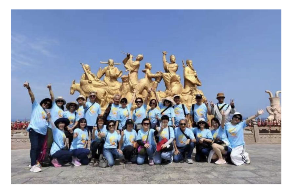
In May 2024, I embarked on a journey to Shandong, China, with a group of 31 Malaysians. Our goal was to explore the cultural heritage and historical sites of this province. From the ancient significance of Mount Tai to the legacy of Confucius in Qufu, each destination revealed a unique aspect of Shandong’s history. Our itinerary included coastal cities like Qingdao and Yantai, known for their historical charm, as well as inland cities like Jinan and Zibo, where traditional customs thrive alongside modern developments. This narrative recounts our travels through Shandong, offering insights into its historical richness and cultural diversity.


Province of Shandong

Photo : Google map

Shandong (山东) is a coastal province located in the north east of China. Shandong, which means ‘East of the mountains’ consists of two distinct segments – inland zone, bounded by the provinces of Hebei, Henan, Anhui and Jiangsu respectively from north to south; and the Shandong / Jiaodong Peninsula, located between Bohai Sea to the north and Yellow Sea (Huanghai) to the south.  And lying across these vast stretches of sea is the Korean Peninsula. The Yellow River (Huang He) runs through the province and empties into the Bohai Sea. It is the second longest river in China, after the Yangtze River.

Shandong is now a major grain producer in China and its major crops include wheat, corn, soybean, kaoliang, spiked millets, sweet potatoes and the cash crops are peanuts, cotton, tobacco and fruits. Some of you may have eaten Shandong peanuts which are large in size, and are well suited for oil pressing, turning into peanut cooking oil. Shandong is rich in natural resources particularly crude oill (Shengli oil field) and coal (around Yanzhou and Tengzhou). There are also major iron ore deposits located near Zibo and Laiwu, and some bauxite is mined near Nanding, Zibo. Edible salt is produced on the coasts of the Shandong Peninsula. Shandong is also a cradle for many national giants in light industry such as brands like Haier Electronics, Hisense Electronics, Tsingtao Beer, Jinan Qingqi Motorcycle, Konfujia Liquor, Yangtai Dongyue, Jinan Heavy Truck, just to name a few.

The history of Shandong dates back to over 400,000 years with the discovery of the Yiyuan Man, the earliest Shandong human known by far, in the center of the province. Yiyuan Man is classified as archaic humans of the genus homo erectus from the middle Pleistocene age. Moving to the Neolithic Age, civilizations developed one after another, with the Longshan Culture noted for its highly polished black pottery (or egg-shell pottery). Shandong formed part of the territory of the Shang and Zhou dynasty. Shandong is also the birthplace of two great philosophers, Confucius (Kong Qiu / 551-479 BC) and Mencius (Meng Ke, Mengzi / 372-290 BC). The famous Venetian, Marco Polo, was appointed as Governor of Yanzhou in Jining Prefecture in the 1280’s by Kublai Khan, during his reign as the first emperor of the Mongol-led Yuan Dynasty of China. During the Qing Dynasty, a series of treaties and agreements were signed in which China was forced to concede many of its territorial and sovereignty rights to foreign imperialist powers especially Great Britain, France, Germany, United States, Russia and Japan. Shandong / Jiaodong Peninsula was occupied briefly by Japanese troops after the Sino-Japanese War 1894-1895. In 1898, Germany seized the port of Qingdao while the British gained control of the coastal town of Weihai. And with the advent of World War I, Japan took over German interests in the peninsula and made the Twenty One Demands compelling the Chinese to give official recognition to the renewed occupation. This took effect from 1919 to 1922. The Japanese continued their domination during the Sino- Japanese War of 1937 to 1945. After the war, it was a fight between Chinese Communists and the Nationalists, which resulted in the former taking control of Shandong by the end of 1948.

Another Shandong native that became the talking point of the whole nation was Jiang Qing. She was the third wife of Chairman Mao Zedong who rose to become the most influential woman in the People’s Republic of China, coinciding with the Cultural Revolution that was gripping the nation from1966 until 1976. After the death of Mao in 1976, Jiang and three others who formed the radical ‘Gang of Four’ alliance were arrested for their role of fomenting widespread civil unrest during the country’s turbulent history. She spent many years in jail and finally committed suicide in 1991.

We began our trip to the Province of Shandong by visiting the Shandong Peninsula – covering the coastal cities of Qingdao, Qixia, Yantai and Penglai – before moving to the Inland Zone, to Weifang, Zhoucun in Zibo, Qufu, Taian (Mount Tai scenic area) and completing the trip at Jinan, the provincial capital.

(1)Qingdao 青岛

We touched down at the Qingdao Jiaodong International Airport which is currently the largest airport in the province. It was officially opened to the public on 12 August 2021 and the terminal is designed in the form of a starfish with five connected airside concourses. This design is similar to the Beijing Daxing International Airport. For comparison, Qingdao Jiaodong International Airport is twice the size of Heathrow Airport. The International Air Transport Association or IATA code for this airport is TAO and it is located about 32 km from the city proper.

Qingdao has a rich history and offers several interesting sites for visitors. Notable places include the Tsingtao Brewery, founded in 1903, which is currently the sixth largest brewery in the world. Another key site is the May 4th Square, a large public square with a focal red sculpture called the May Wind, offering a panoramic view of the CBD, with government buildings to the north, the ocean to the south, and high-rises on the other two sides. Opposite the square is the Qingdao Olympic Sailing Centre, where the 2008 Summer Olympics sailing events were held.

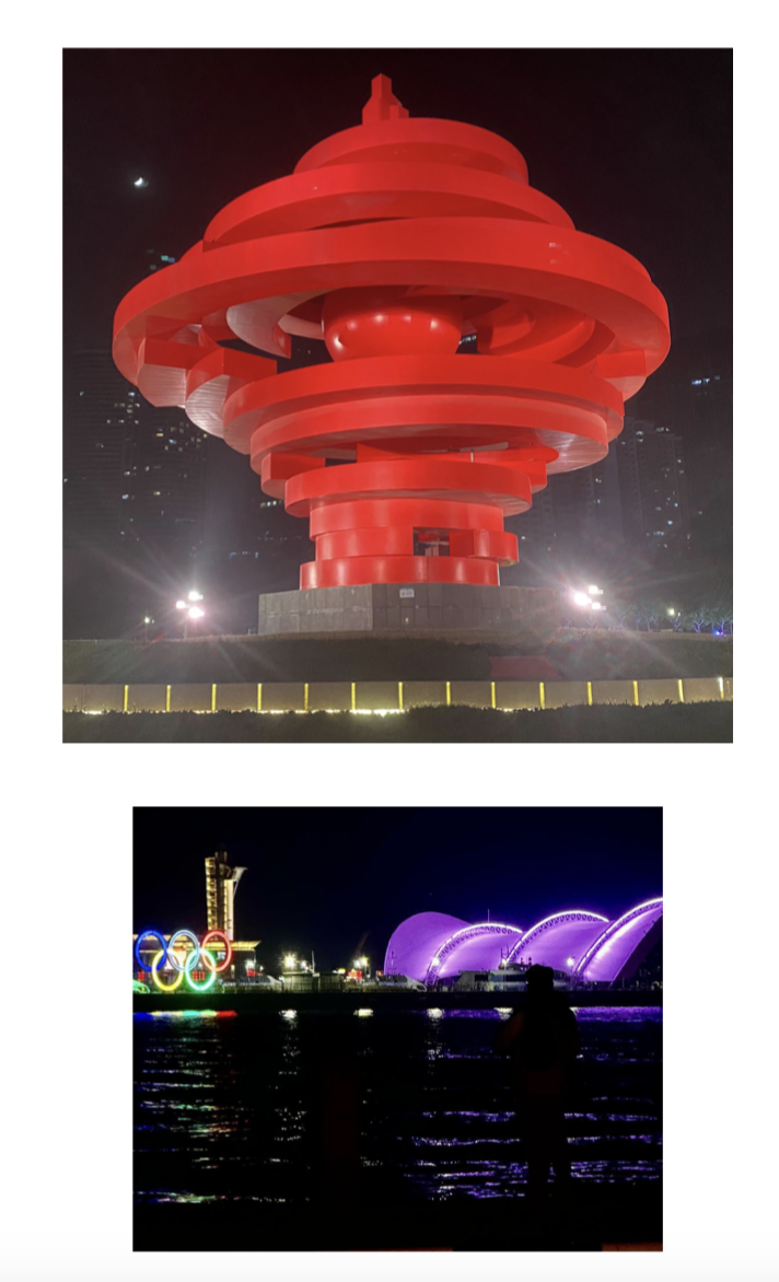
(L) May Wing at May 4th Square / (R) Qingdao Olympic Sailing Centre. Photo : Eric Lim

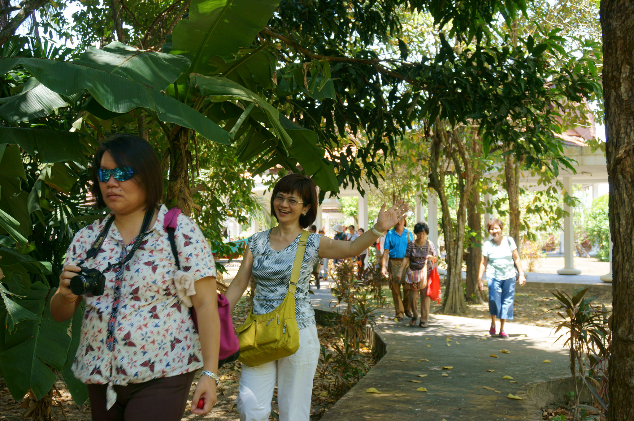
The next morning after breakfast, we went to West Shinan CBD where we visited Zhan Qiao, Xiaoyushan Park and Badaguan. Zhan Qiao is a famous pier and is the iconic symbol of Qingdao. Founded during the reign of the Qing Dynasty in 1891 and known then as Changhong Yuanyin, was originally built as a military dock and later, extended by the Germans to 440 meters long. At the end of the pier is the two-storey Huilan Pavilion which was built in 1931. Huilan Pavillion is the logo of Tsingtao Beer. Xiaoyushan Park (Little Fish Hill) was built in traditional Chinese style in 1983, offering a hilltop view of Qingdao. Badaguan scenic area was built in the early 20th century. The eight roads in the area were all named after China’s great ancient military forts. Most buildings in the area are villas with courtyards, typical of the modern European architectural style. Badaguan is a popular destination for wedding photography.

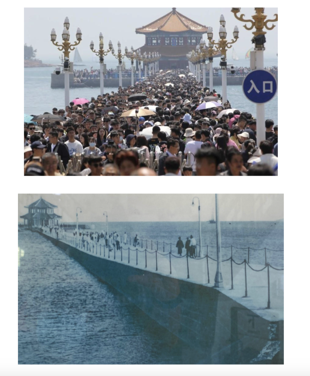
(L) Zhan Qiao during the recent May Day celebration, just like the old Chinese saying, “人山人海 ren shan, ren hai” (people mountain, people sea) (R) Old photo of Zhan Qiao / Photo: SCMP

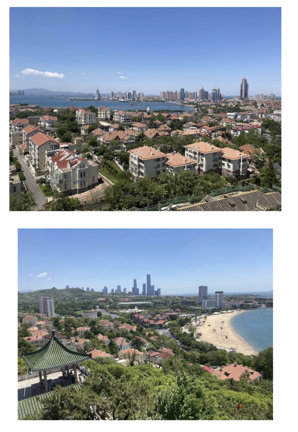
View from Xiaoyushan Park / Photo : Eric Lim

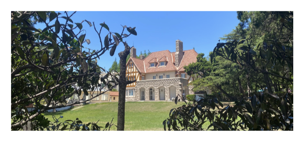
European architectural villa at Badaguan / Photo : EricLim

(2) Qixia  栖霞 and Yantai 烟台

Still remaining within the Shandong / Jiaodong Peninsula, we continued our journey to the  neighbouring Yantai Prefecture where we visited Qixia, Yantai and Penglai. At the stopover at landlocked Qixia, which won the title of “The Apple Capital of China”, we visited the other famous attraction of the town, the Mou Family Manor

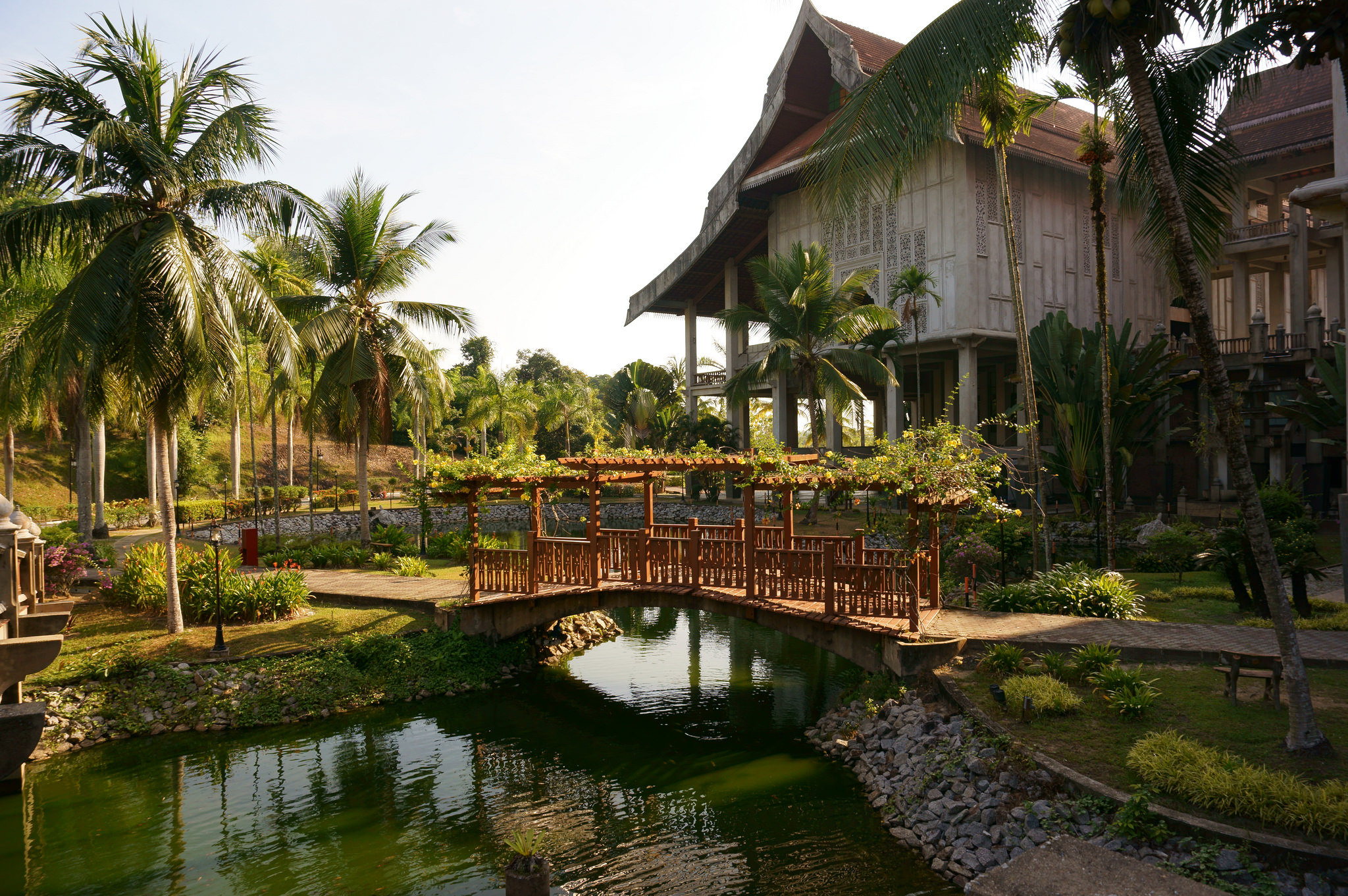
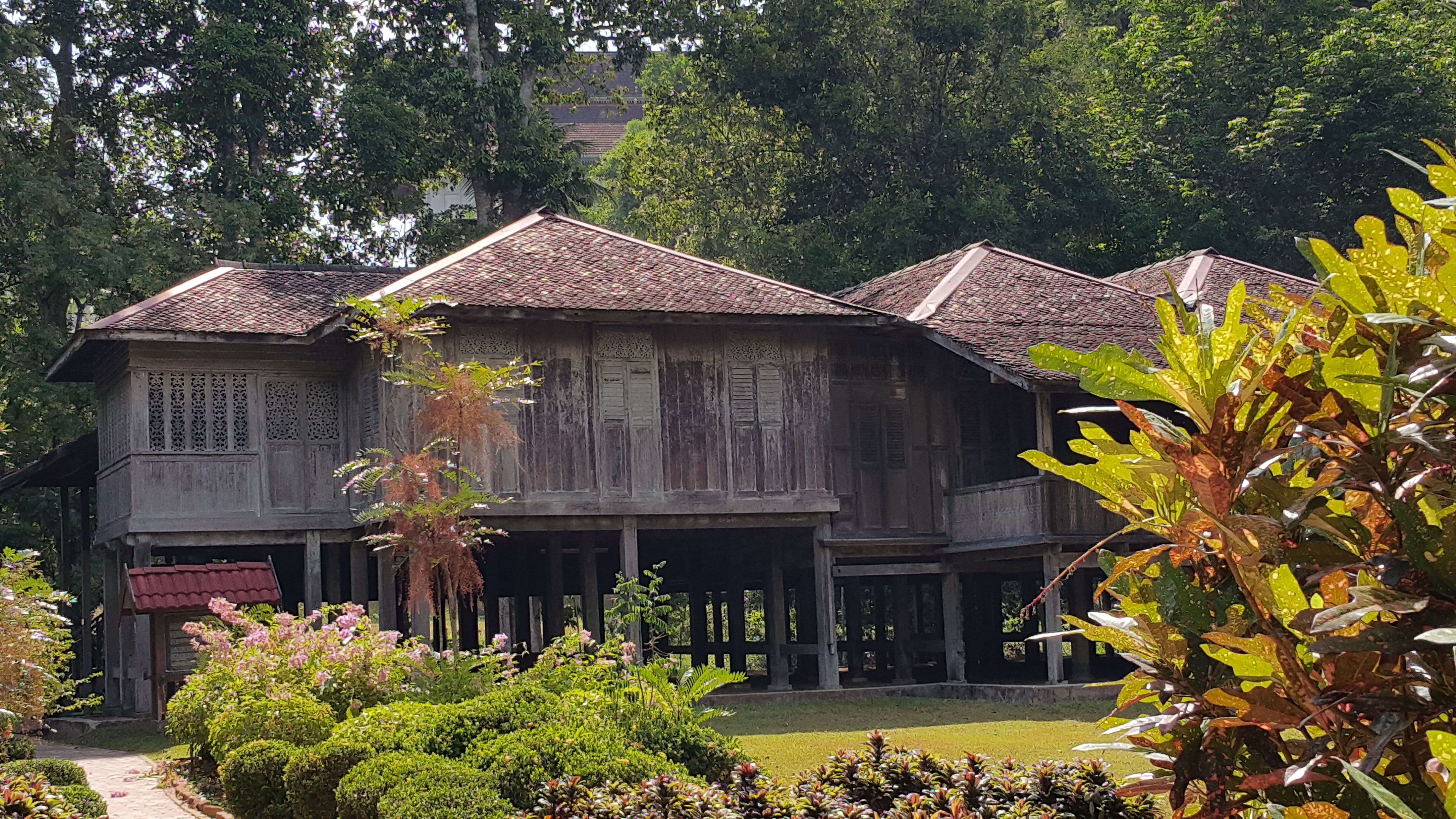
The residential complex that belonged to landlord Mou Molin was built during the Emperor Yongzheng period (1723-1735) of the Qing Dynasty (1644-1911). Since then, it had undergone 200 years of continuous addition, expansion and repair; and finally completed in the current form in 1935. Today it covers an area of more than 20,000 square meters with more than 480 rooms, and is one of the well preserved and largest family manors in China. The manor was used as the site for a popular television series aired in China in 2010 about the Mou family, appropriately titled “Mou Family Manor / 牟氏莊園 / Mou Shi Zhuang Yuan”.

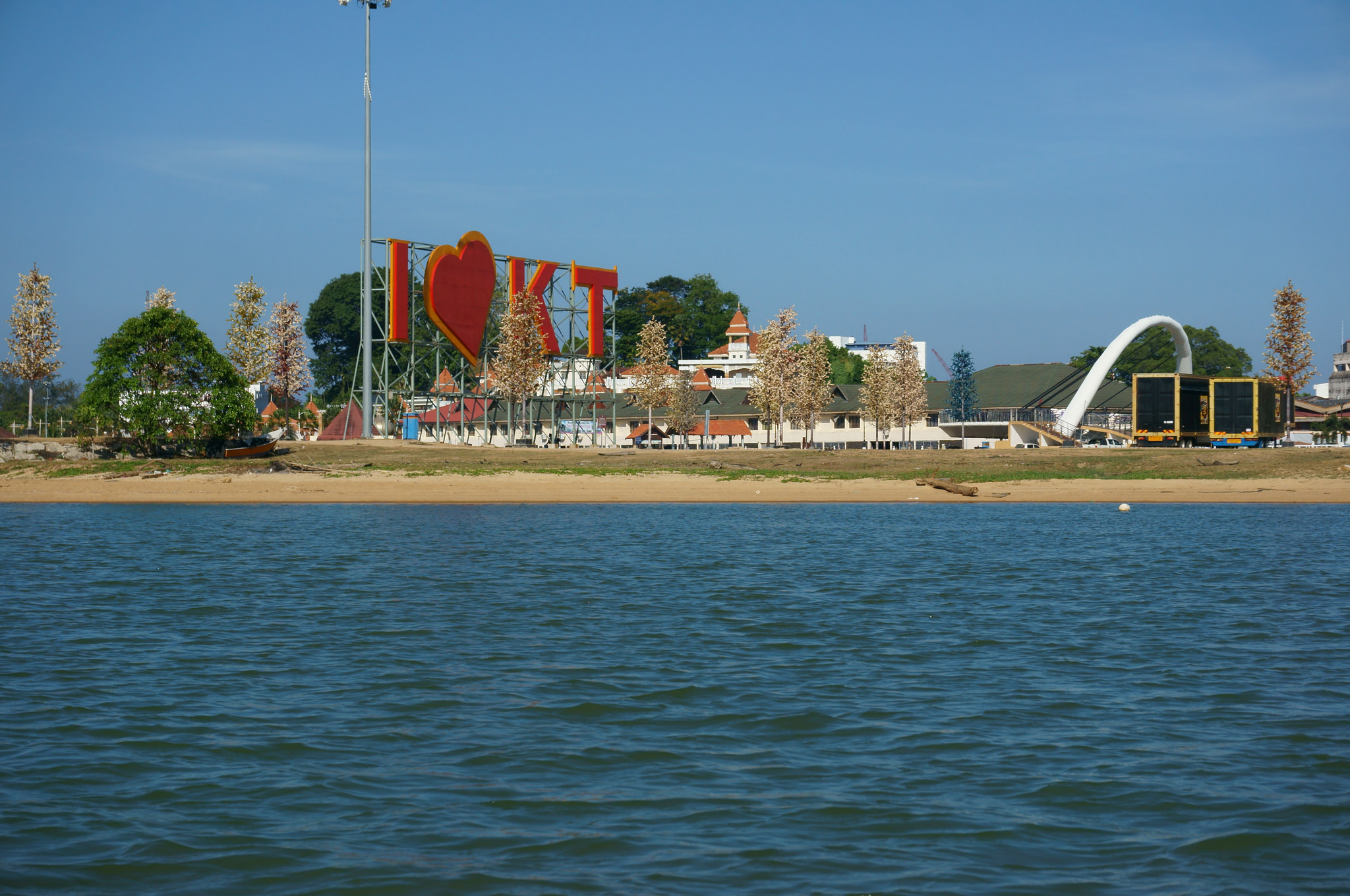
The port city of Yantai was traditionally known as Zhifu (Chefoo). It was during the Ming Dynasty that the prototype of Yantai city was recorded when the Ming government proceeded to set up the Qishan Garrison in order to strengthen its coastal defense. In 1861, Yantai was opened to international commerce as a treaty port. However, Yantai and other ports of northern Shandong stagnated due to the rapid development of Qingdao by the Germans after 1898. Moving forward to 1958, Yantai Special Zone was established and in 1983, Yantai was set up as a prefecture-level city. 

In 2017, Shandong Provincial government made a decision to restore and develop the entire old section of the city i.e. Suochengli district  into a AAAA rated tourist attraction (tourist attractions in China were graded according to criteria on a scale of A to the highest 5A). The opening was delayed due to the Covid pandemic and officially opened to the public during the Spring Festival in 2021. There are more than 280 restored cultural relics (buildings) and many of the old housing were converted into restaurants.

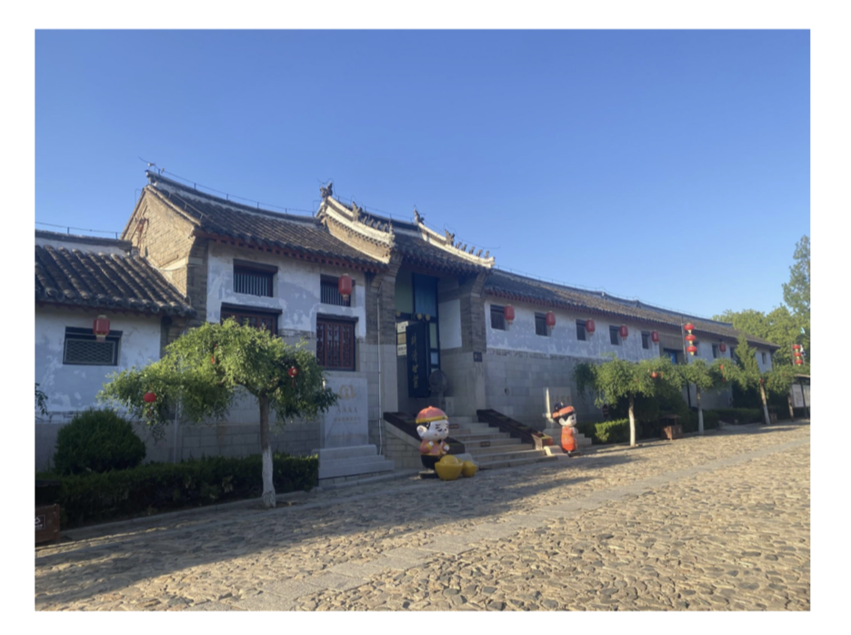
Entrance to Mou Family Manor / Photo source : Eric Lim

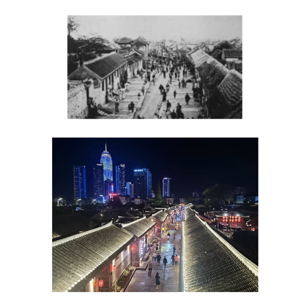
Old and new Souchengli District at Yantai / Photo source : Yantai – Suocheng District 所城里 – live2makan and Eric Lim.

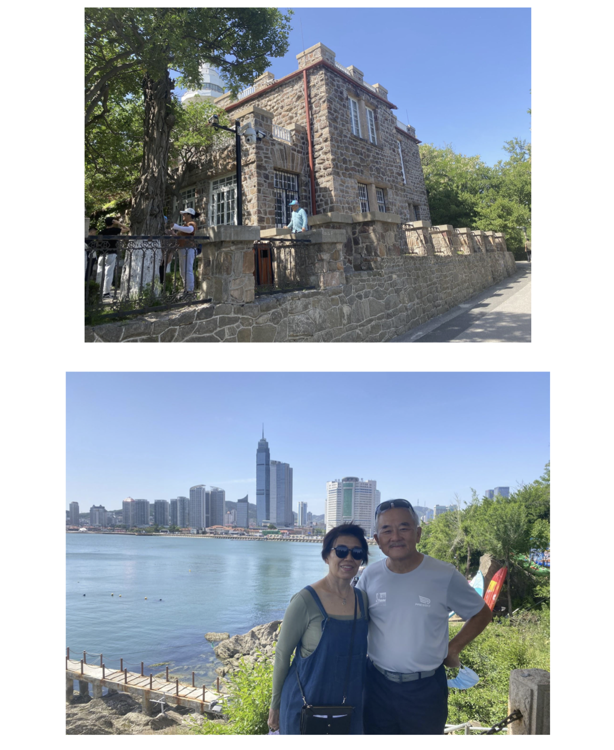
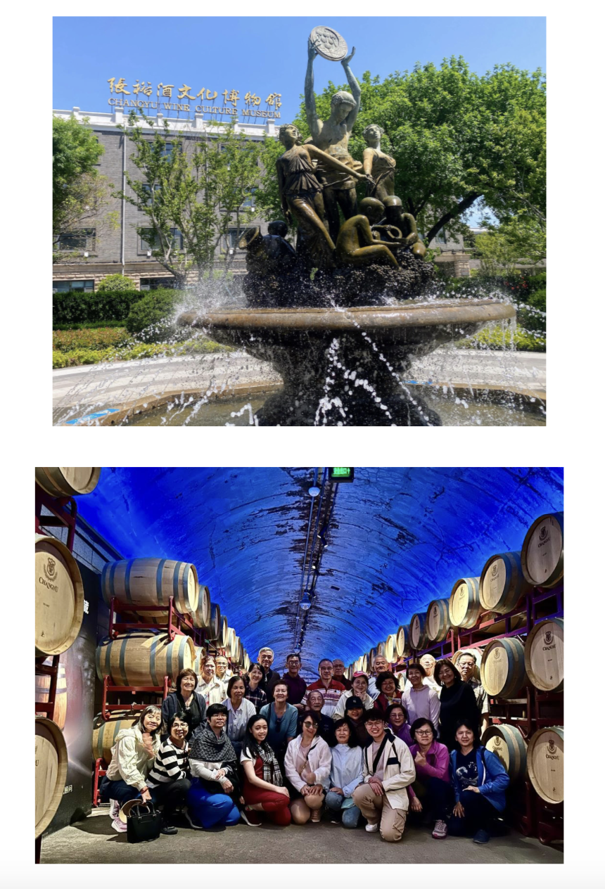
Yantai, which literally means ‘beacon tower’, derives from a lookout beacon built on a hill as part of a 15th century coastal defense system erected against Japanese pirates. Yantai Hill Park is one of the highest hills in the city and a popular tourist attraction. The peak of Yantai Hill  was the location of the old lookout beacon. Surrounding the hill are a large collection of historical Western architecture buildings including the former consulates and residence of the UK, US, Japan and Denmark which date from the 19th century. Today, these buildings are mostly converted into museums, with one specially dedicated to Yantai Beijing Opera art. Next on the itinerary was a visit to the ChangYu Wine Culture Museum, at the site of the former ChangYu Wine Company. Cheong Fatt Tze, a name most Malaysians are familiar with, founded the winery in 1892. Today, it is China’s oldest and largest Western-style winery which produces grape wines as well as brandy and a Chinese health liquor. An underground cellar was built in 1894 and it became the first underground wine cellar in Asia when it was completed in 1903. The cellar is still in use for wine storage. 

(Cheong Fatt Tze (Zhang BiShi) came to the Malay peninsula at a young age of 16. He went on to become a successful and powerful Nanyang business magnate, and was once regarded as the richest man in Malaya. He built a mansion on Leith Street in Georgetown and was dubbed ‘La Maison Bleu’ (the Blue House). In 1990, it was acquired and went into restoration to its authentic original form and it won the National Architecture Award for Conservation 1995, followed by winning the UNESCO Conservation Award 2000.)

Views of Yantai Hill Park / Photo : Eric Lim

ChangYu Wine Culture Museum  / Photo source : Eric Lim

(3) Penglai 蓬莱

Penglai is about 75 km from Yantai, lying on the northwest corner of the Shandong Peninsula. It was formerly known as Dengzhou or Tengchow. It was the first port in the Shandong Peninsula to be opened to foreigners in 1858. And since ancient times, Penglai has been known as ‘Wonderland on Earth”. Penglai Pavilion scenic area is one of the earliest tourist sites in Shandong that is awarded the 5A rating (most important and best maintained tourist attractions in People’s Republic of China).It is a large park of ancient buildings, temples, palaces and towers. It was first constructed in 1061 during the Song Dynasty (960-1279). Penglai Pavilion is one of the ancient Four Great Towers of Ancient China, together with Yellow Crane Tower, Pavilion of Prince Teng and Yueyang Tower. It is famous for the Taoist legend of ‘8 immortals crossing the sea’. The legend goes that the eight immortals crossed the sea by using their unique powers after they got drunk in Penglai Pavilion. This magic inspired a popular saying in China that goes like this “when the eight immortals cross the sea, each one shows his special feat. Each tries to outwit the other”. In the modern context, it would mean “that everybody has his or her own way of dealing with things”. The site also attracts countless tourists to witness the wonders of mirages phenomenon known as ‘the Fata Morgana mirage’.The different temperature of the sea water and the coast line has resulted in the appearance of this optical illusion. 

Not too far from Penglai Pavilion is the newer attraction called the Eight Immortals Crossing The Sea / Penglai Baxian scenic area  The entire site is built on a man made island that is shaped like a magic gourd floating above the sea. There are two major structures in the scenic area, namely  the majestic Wangying Tower and an ancient style pagoda Huixian Pavilion, that houses the statues of the Eight Immortals and other Taoist great masters.

Statue of the Eight Immortals at Penglai / Photo : Eric Lim

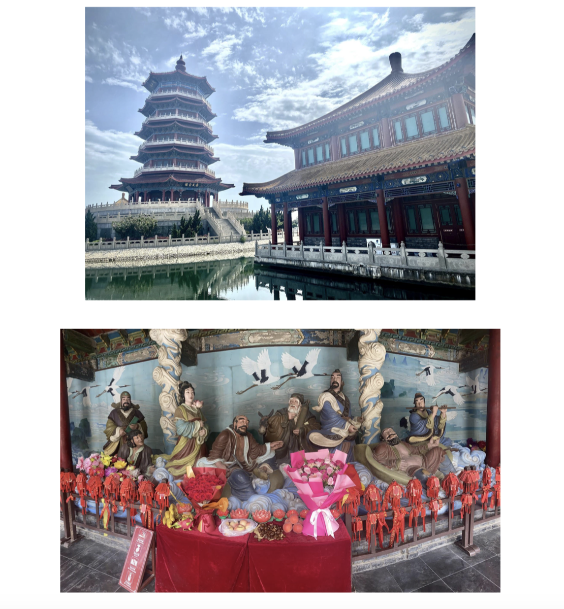
Eight Immortals Crossing The Sea / Penglai Baxian scenic area / Photo : Eric Lim

(4) Weifang 潍坊

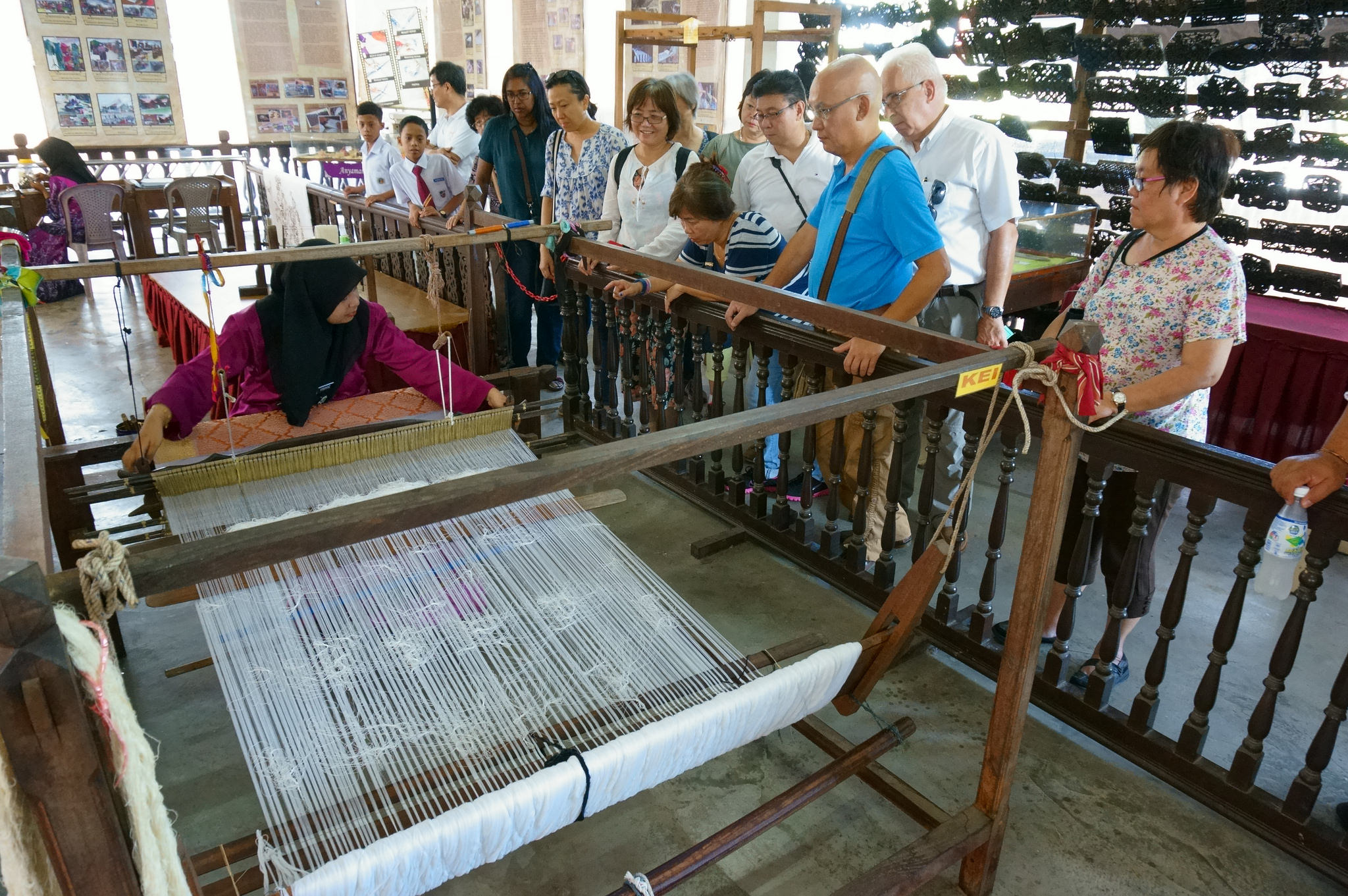
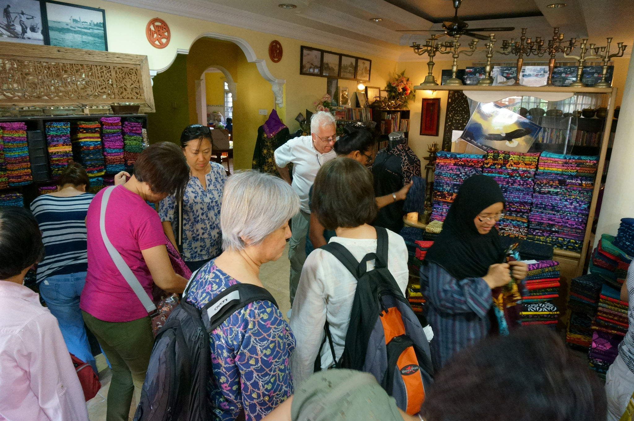
Having completed the coastal cities route, we next moved to the Inland Zone to the prefecture-level city of Weifang,which has a population of 9.3 million at the 2020 census. The city is also known as the ‘capital of kites / city of kites’.The first kite festival was held here in 1984 which attracted kite lovers from all over the world, and since then, the Weifang International Kite Festival is held every April. We made a stopover at the Hanting District of Weifang to visit the Yangjiabu Folk Art Grand View Garden. This site mainly exhibits the artistic style and delicate craftsmanship of Chinese New Year paintings, woodblock printings, kite production and Chinese paper cuttings. At the kite museum, one can learn the origin, research and development of Yangjiabu kites until today which have profound influence both in China and abroad. Weifang kites, represented by Yangjiabu kites, was named as’ National Intangible Cultural Heritage’ by the State Council of China in 2006. 

(Incidentally, we have our annual Pasir Gudang World Kite Festival in Johor. This year, the event was scheduled from February 24 to March 3. It was first held in 1995)

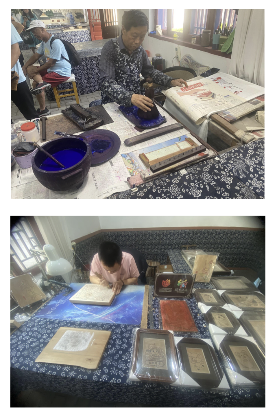
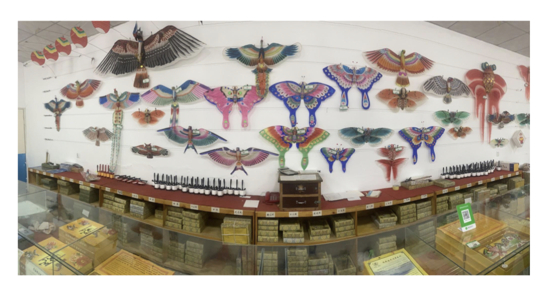
At Yangjiabu Folk Art Grand View Garden / Photo : Eric Lim

(5) Zibo 淄博

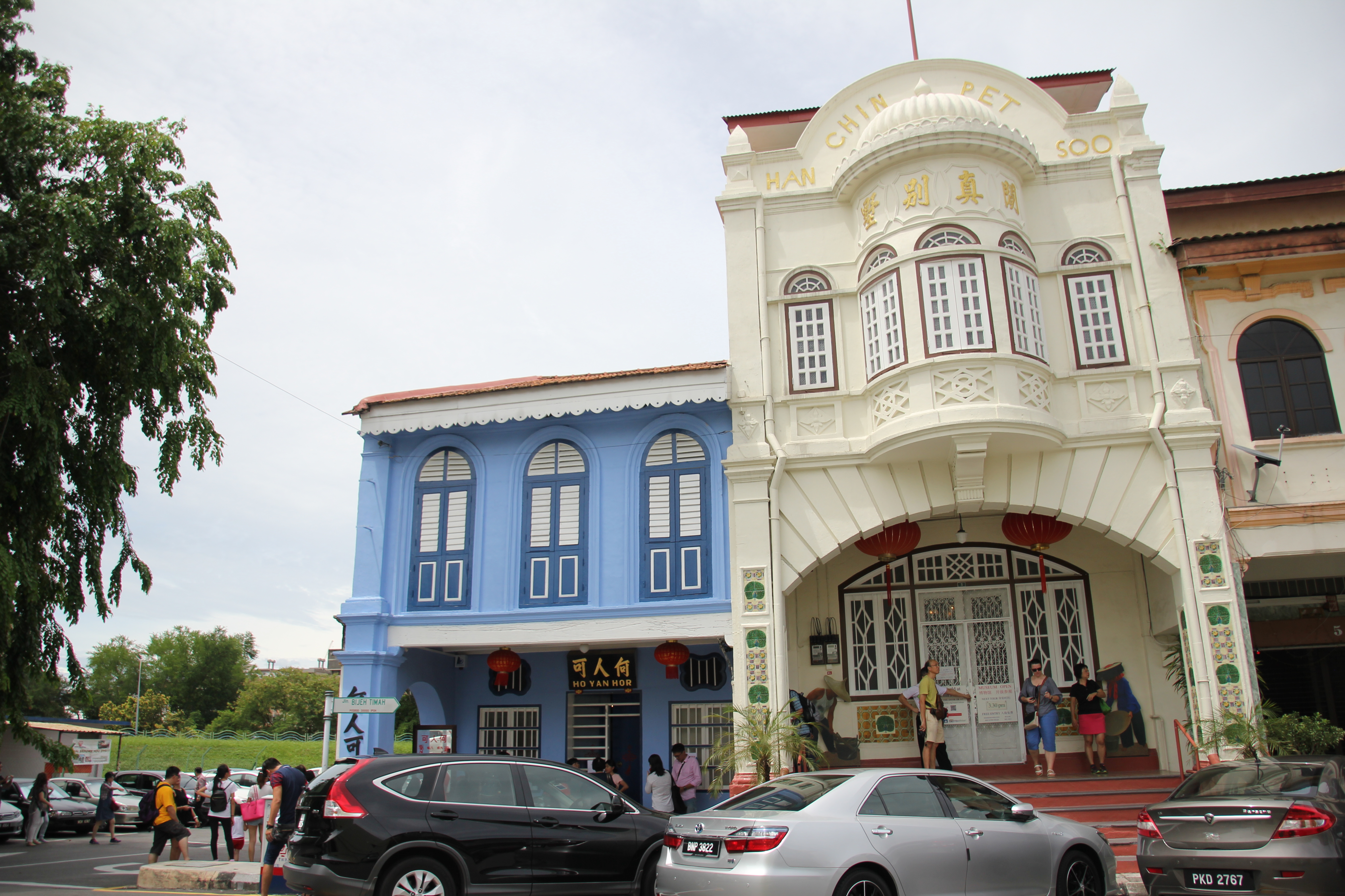
After the visit to Yangjiabu Folk Art Grand View Garden, we travelled to the next prefecture-level city of Zibo. Zibo was the centre of the ancient State of Qi during the Spring and Autumn (770-476 BCE) and Warring States (475-221 BCE) periods. Its capital Linzi was the most populous city in China at its peak. It became a centre of an important ceramic and glass industry. During the period of the Silk Route, Zibo was a major centre of silk supply. It then developed into a major industrial complex when the railway linking Qingdao and Jinan which was completed in 1904 passed through important market towns within Zibo. Today, it is home to petrochemicals, textiles and porcelain factories. Zibo’s greatest claim to fame came when the then FIFA President Sepp Blatter proclaimed the city as the birthplace of soccer based on its link to an ancient ball game.

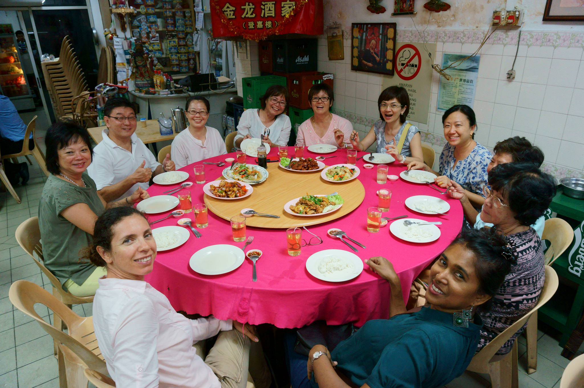
It was quite late when we arrived at Zhouchun Ancient City, one of the urban districts governed by Zibo. During the Ming and Qing Dynasty, Zhouchun developed to be a major commercial town known as ‘No. 1 village in the world’ and its famous local product i.e Shaobing / Sesame Seed cake is also known as the ‘No. 1 Shaobing / Sesame Seed cake in the world’. Zhouchun Ancient City is currently regarded as a ‘living museum of ancient commercial architecture’. Unfortunately on the evening of our visit, we could not savour the famous Shaobing.

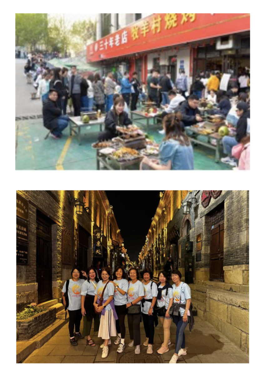
(L)Barbeque craze at Zibo / Photo : Zibo’s barbecue craze draws crowds and regulatory action – SHINE News  (R) At Zhouchun Ancient City / Photo : Eric Lim

(6) Qufu 曲阜

After a night of merriment, we headed next to Qufu, the capital of the small independent state of Lu which flourished from the 6th to 4th BCE. Qufu is also best known as the birthplace and place of residence of the great Chinese philosopher and founder of Confucianism, Confucius (Kong Fuzi, Kong Zi) 551 – 479 BCE. We stopped for two days to visit the Temple and Cemetery of Confucius and the Kong Family Mansion, together these sites have been listed as a UNESCO Heritage Site since 1994. These three sites are collectively known in Qufu as San Kong  (三孔). It is also rated as a 5A tourist attraction. We also visited Nishan Sacred Land, situated in the Nishan Cultural Tourism Resort on Nishan Mountain.

The Temple was built in 478 BCE to commemorate him, and has been destroyed and reconstructed over the centuries. Today it comprises more than 100 buildings while the Cemetery contains Confucius’s tomb and the remains of more than 100,000 of his descendants.

The Kong Family Mansion developed from a small house into a gigantic aristocratic residence of which 152 buildings remain. The most prominent landmark on Nishan Cultural Tourism Resort is the world’s highest sculpture of Confucius standing at 72 meters high. It also features a cultural complex consisting of a lecture hall, study centre, temple of Confucius and a performance centre. 

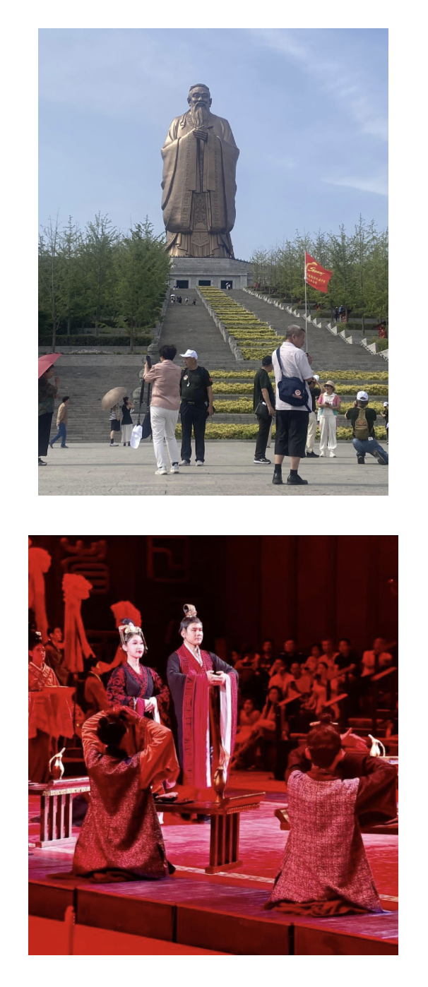
At Nishan Sacred Land / Photo : Eric Lim

(7) Taian 泰安

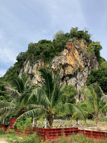
Taian City is located at the center of Shandong province and is regarded as the place of origin for Chinese civilization. Traces of human existence date back to more than 500,000 years ago. Modern humans (homo sapiens) appeared in the area 50,000 years ago and in the Neolithic Age (New Stone Age), several cultures namely Beixin culture, Dawenkou culture and Longshan culture, emerged where they had lived in settlement and started farming and domestication of animals. Today, Taian is one of the north-south transportation hubs in China. Taian is a key producer of plaster, sulphurite and granite. And Taian granite has been used in many well known Chinese buildings like the Great Hall of the People, Tiananmen Square and the Monument to the People’s Heroes at Tian’anmen Square. 

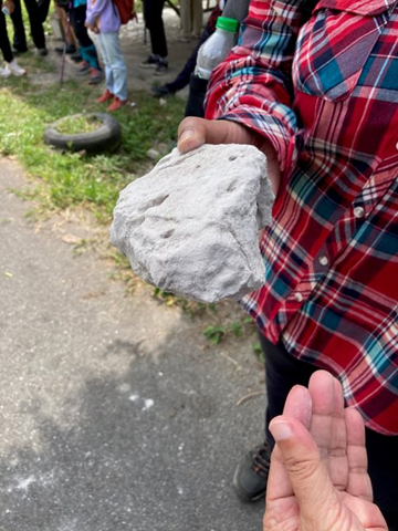
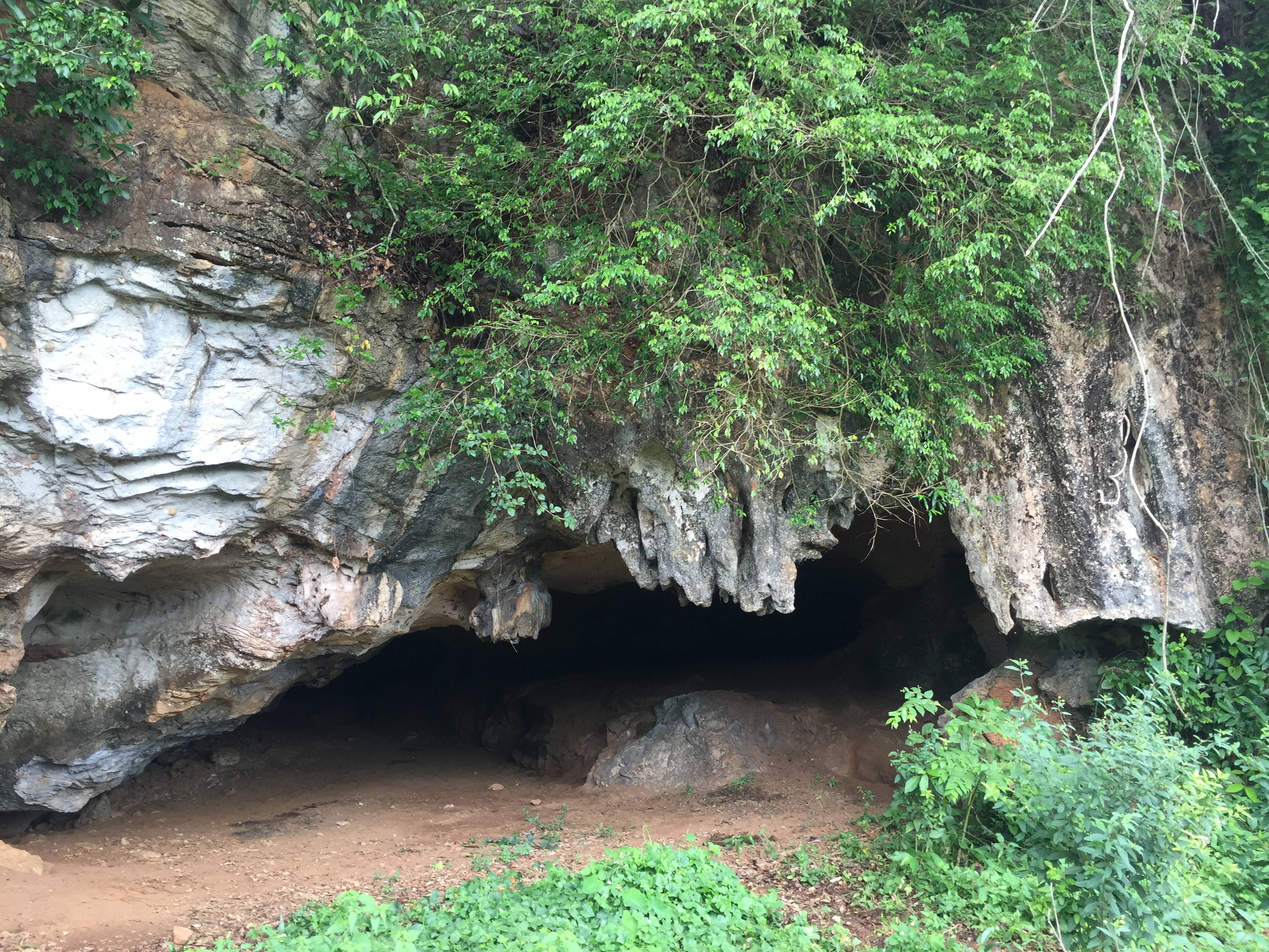
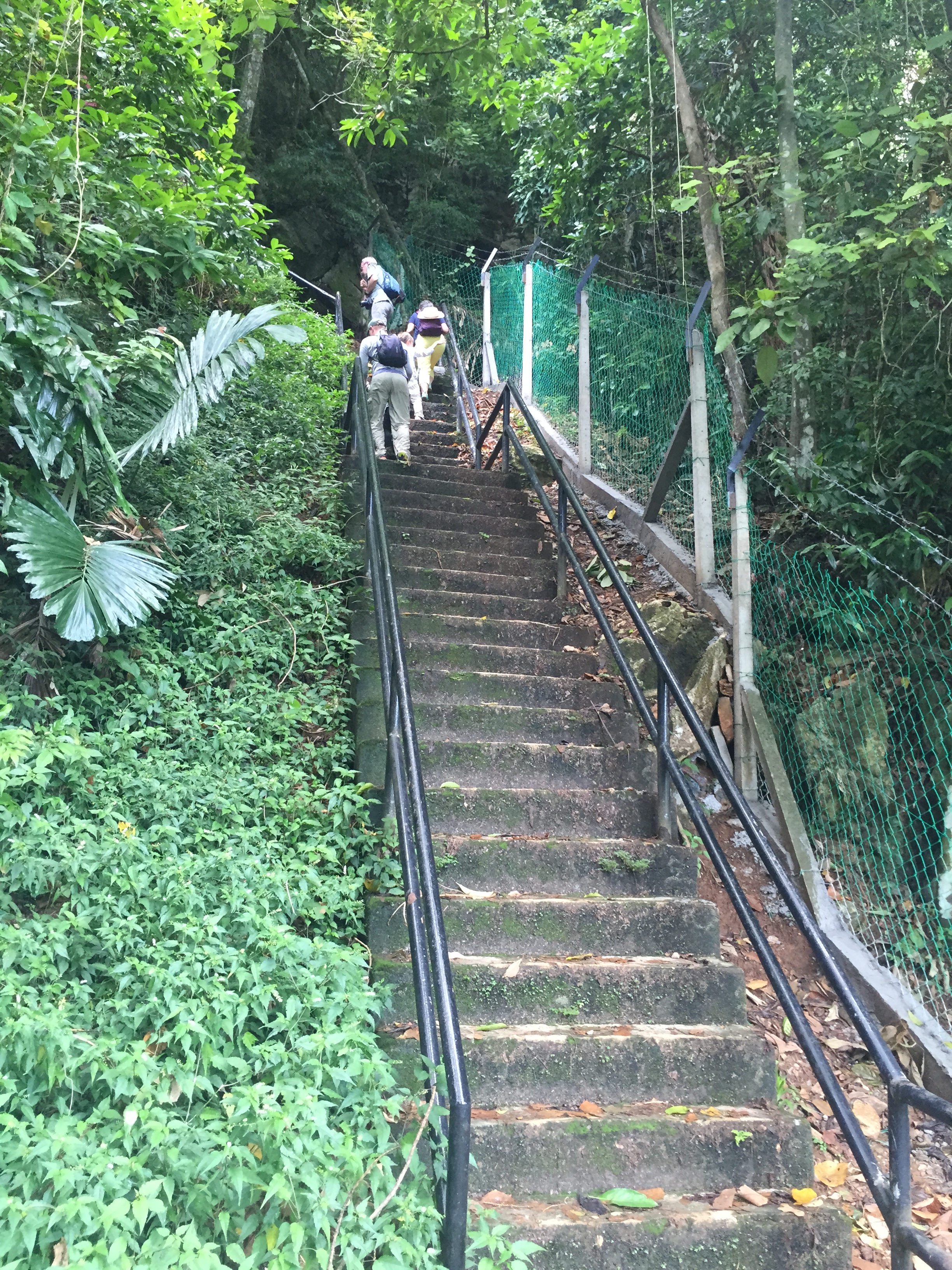
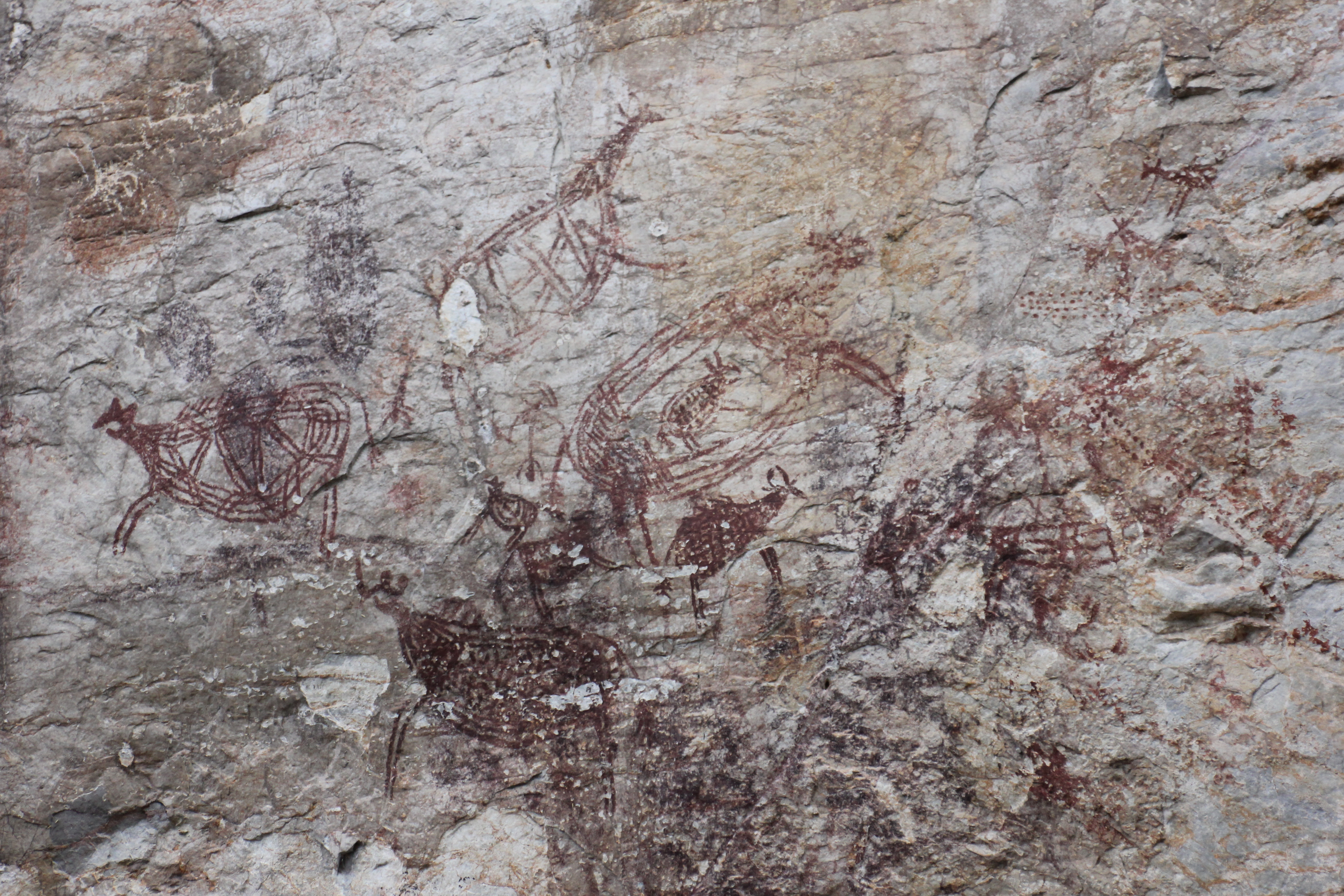
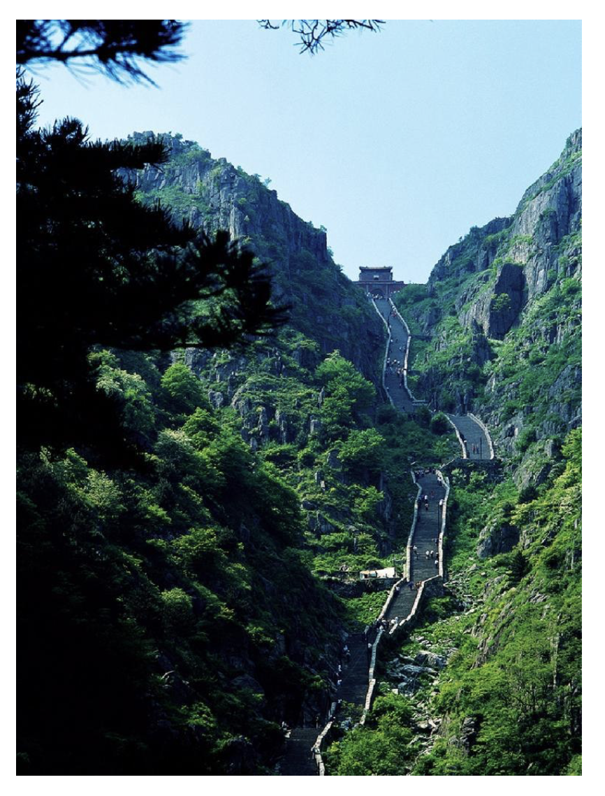
Taian is the home to Mount Tai (泰山), originally known as Daishan / Daizong, is the most famous of the five sacred mountains in China. For 2,000 years, it was one of the principal places of worship where the Emperor paid homage to Heaven and Earth in the Fengshan sacrifices (Feng – offerings to Heaven and Shan – offerings to Earth). On the mountain, there are 12 historically recorded Fengshan ceremonies, about 1,800 stone tablets and inscriptions and 22 temples. Its highest peak is referred to as the Jade Emperor Peak and is 1545 metres above sea level. Mount Tai has been designated a UNESCO World Cultural and Natural Heritage Site since December 1987 and rated 5A tourist attraction. There are two ways to reach the summit –  by foot, which would take from two and a half to six hours to climb up the 6,660 stone steps or by a combination of bus and cable car.

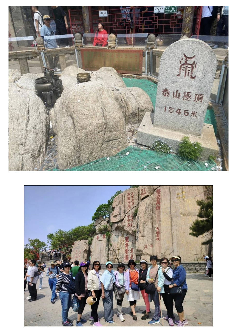
(L) Summit stone at Jade Emperor Peak  (R) Cliff inscription / Photo : Eric Lim

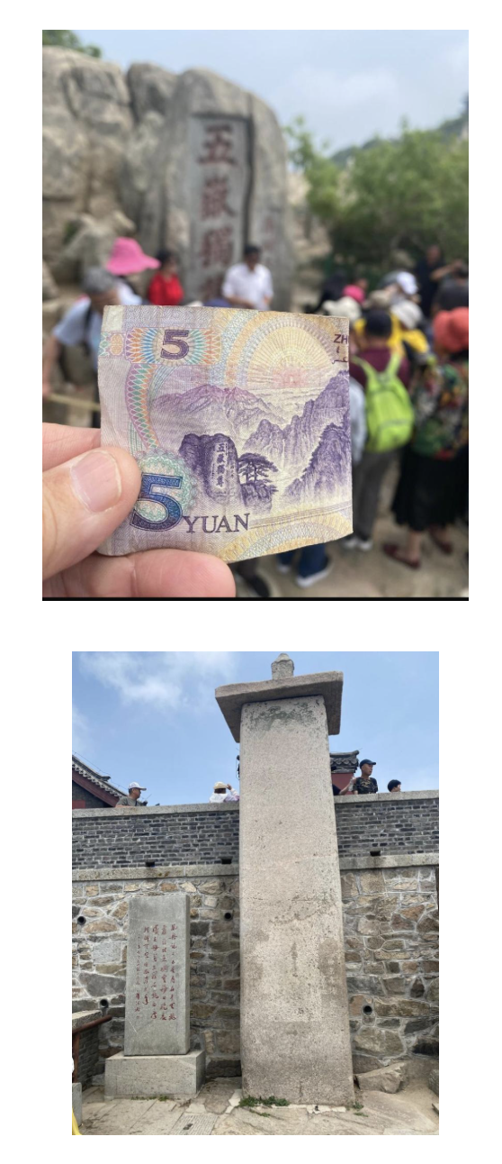
(L) Mount Tai appear on the reverse side of the five Yuan banknote  (R) Wordless Monument in front of the Jade Emperor Peak / Photo : Eric Lim

Climbing up to the summit of Mount Tai  / Photo :By Charlie fong – Own work, Public Domain, https://commons.wikimedia.org/w/index.php?curid=5327850

(8 )Jinan 济南

We have finally arrived at the provincial capital city of Jinan. Jinan is also known by its nickname City of Springs because of the artesian wells that bubble up within the city limits. There is a list of 72 springs within the city that has been kept and updated since the times of the Jin, Ming and Qing dynasties. The water from these springs flows north towards the main landmark, Daming Lake and onwards to the Yellow River. Baotu Spring, which is ranked first in the list, has been known as the ‘Number 1 spring under the heavens’ is located in the southwest of the ancient town of Jinan. It is one of three springs (the other two are Black Tiger Spring and Five Dragon Pond Spring), one river (the Moat), one lake (Daming Lake) and four parks (Baotu Spring Park, City Ring Park, Five Dragon Pond Park and Daming Lake Park) that make up the World’s Best Spring Scenic Area which is graded 5A tourist site and Key National Park. After dinner, we were taken to QuShuiting Street (Winding Water Pavillion Street in English). The history of the street can be traced back to the 4th-6th century CE, during the Northern Wei Dynasty. It was named after the Qushui Pavilion which used to be frequented by scholars and the literate during that time. Coincidentally, it was China’s 520 Day, a public holiday celebrated on May 20 as ‘I Love You Day’ as the numeral date sounds like ‘I Love You‘ in Mandarin. It is yet another Chinese Valentine’s Day as the country celebrates the Western Valentine’s Day on February 14 and the traditional Chinese lover’s day, Qixi on Lunar 7th day of the 7th month. The day made for a perfectly fitting end to our sojourn in the Province of Shandong and to cherish the happy moments with our spouses.

Daming Lake / Photo : Wikimedia Commons

Reference

Visa-free travel extended till 2025 | The Star

Shandong | History, Population, Map, Cuisine, & Facts | Britannica

Introduction to Shandong Province

Mou’s Manor | Interesting times

Yantai – Suocheng District 所城里 – live2makan

Penglai, land of fairy tales

Seeking Immortals in Penglai | The World of Chinese

Temple and cemetery of Confucius and Kong mansion

Mount Taishan – UNESCO World Heritage Centre

Which fashion campaigns for China’s 520 Day hit the mark? | Jing Daily.

Day 2 at Lenggong: Suevites Galore and More!

By Ilani Jamin

Lenggong Valley in Perak was listed as a UNESCO World Heritage site in June 2012 for its significance in archaeological value. It is where the most complete skeleton in Southeast Asia, the 11,000-year-old Perak Man, was found along with other important discoveries.

Bukit Bunuh

Our second day of the Lenggong trip started off at a special place called Bukit Bunuh. Upon being driven into an oil palm plantation, we were surprised to witness a large area strewn with extraordinary rocks of various shapes and sizes. Ranging from 1-3m blocks of combined smooth and rough surfaces, these are suevite rocks, which are remnants of impactite rocks that resulted from a meteorite crashing in the area about 1.83 million years ago. These special rocks were exposed by land terracing works several years ago, thus affording us today a direct experience of the terrain.

Scattered suevite rocks at Bukit Bunuh, Lenggong.

Bukit Bunuh, the oldest palaeolithic open site in Malaysia, is the centre of a meteorite impact with an approximately 5 km-diameter complex crater. During the impact, a central uplift was formed at Bukit Bunuh where impact temperature and pressure were high enough to immediately melt the surrounding land, producing partly melted and resolidified rocks as well as impact rocks known as suevites. From a larger perspective, the crater at Bukit Bunuh is located between Peninsular Malaysia’s main mountainous ranges – Bintang Range to its left and Titiwangsa Range to its right.

Our archaeological researcher leaning against a sizable suevite rock.
Image courtesy of MV Yun Teng.

A suevite rock picked up from the ground.

A 1.83-million-year-old hand axe found buried in one of the suevites was among thousands of pebble and flake tools excavated at Bukit Bunuh, which provided evidence that its Palaeolithic community had several options for raw materials as their stone tools were made of suevite, quartzite, cherty metasediment and quartz. Physical remnants of the meteorite have not been found and it is considered that most of it would have been burnt upon entry leaving only evidence of temperature and pressure on the ground.

Bukit Sapi

Participants listening to a brief about Bukit Sapi.
Image courtesy of MV Yun Teng.

Our next stop was Bukit Sapi, located a few minutes’ drive from Bukit Bunuh, which is a big rock of whitish colour located at the corner of a main road. Smaller rocks around its vicinity were also found covered with a loose, powdery texture of white ash. Here lies evidence of deposition from Sumatra’s Toba volcanic ash, occurring as a result of a massive volcanic eruption around 74,000 years ago.


This super-volcano eruption was the largest volcanic eruption in the past 28 million years. Its aftermath was believed to have brought on a two-week period of darkness due to lack of visibility in affected areas, including India and the Indian Ocean which were covered by 15cm-thick debris. Of all the ash deposit sites in Malaysia, Bukit Sapi had the most amount of Toba ash. Initially, the soil at Bukit Sapi was unsuitable for agriculture due to the high amount of volcanic ash in its soil and therefore, extra work had to be done to make the soil more fertile.

A small rock covered with deposits of Toba ash
found on the ground at Bukit Sapi.

Bukit Badak

View of Gua Badak as we approached its base
to climb up to the site of cave drawings.

Our next stop of interest was Gua Badak, home to some interesting modern rock art. Getting up close to see the drawings meant we had to carefully tread some steep and uneven rocky patches.

The charcoal drawings found at different parts of the cave were made by Negrito aborigines, probably just over 100 years ago. During their hunting trips, they took shelter in the caves and made sketches depicting objects, both natural (people, animals, trees) and man-made items (bicycles, cars). Due to years of exposure to wind and other natural elements, many of these drawings have now faded.

Our archaeological researcher giving a brief of the cave drawings.
Image courtesy of MV Yun Teng.

A drawing of matchstick men can be seen at the
upper right corner of this cave image.

Sungai Temelong

After descending Gua Badak, we were brought for snail hunting to Sungai Temelong, a shallow stream that passes through Temelong village. Going down the muddy bank was quite slippery but the real challenge was digging underwater along the riverbank to extract edible snails. These were the same species of snails cooked in coconut cream and chilli which we had enjoyed at dinner the night before.

Our guide, Pak Rosli, demonstrating the art of scavenging snails which naturally embed themselves within the riverbank soil.

Our catch of the day after some 20 minutes of hunting for these black snails.

Overall, the second and final day of the Lenggong trip was filled with exciting and memorable activities, serving as useful pointers to move us, as museum volunteers, toward further exploration in our shared interests of archaeology, geology and the history of this region.

References

  1. https://highlanderimagesphotography.com/2022/10/29/meteorite-impact-site-bukit-bunuh-lenggong-valley/
  2. Abdullah, Lyn & Talib, Nor & Saidin, Mokhtar. (2020). CATATAN GEOLOGI GEOLOGICAL NOTES Mineralogical evidence from Bukit Bunuh impact crater and its contribution to prehistoric lithic raw materials.
  3. https://www.forbes.com/sites/davidbressan/2021/07/12/study-shows-how-humanity-survived-the-toba-supervolcano-eruption/?sh=414c54f23c81
  4. http://cavinglizsea.blogspot.com/2012/09/gua-badak-drawings-lenggong.html

Out of Museum: A trip to Lenggong Valley

By Ringo Wong Yun Teng

“Here lies the Perak Man.”

This could be a standard script when we take visitors to Gallery A of Museum Negara, passing by the corner from the entrance, before the Dong Son drum. Perak Man is a complete skeleton found in Lenggong Valley, dated 10,000 years ago. We all know about the ‘told’ stories of the bones, i.e., the skeleton, the excavation site and the pelvic bone that signify that the bones belong to a man. We also learned the ‘untold’ stories, such as the genetic disorder of the Perak Man and the respect he gained from his tribe in our classroom or publications. However, there is still a bundle of stories lying in Lenggong Valley, underneath the soil layers, to be revealed.

Hence, the trip to Lenggong Valley took the Museum Volunteers out from museums and publications, to be like an archaeologist, at least for a few hours.

The trip was under a ‘summer-like’ hot sun, but we took it as a summer camp excitedly. The group of volunteers were from different batches, and we hardly knew each other before this trip; but we had lots of precious bonding opportunities at this campsite. Our ‘battery’ wore off slightly early on the first day because we visited a lot of caves in only three hours during the late afternoon. Thus, we faced the reality of our stamina ­– we missed the stargazing activity and slept soundly, lights off at 11 pm (or earlier).

The Lenggong Temporary Gallery was the ‘appetizer,’ specially prepared for the museum volunteers since the Gallery had not been opened to the public in the last few years. At this gallery, we got to know some precious stones and tools from the Palaeolithic age, including the 1.83-million-year-old suevite rock, which we learnt more about on the following day.

The highlight of the day was Gua Kelawar (Bat Cave), where the 8,000-year-old Perak Woman was found. This site provided us with some ‘out-of-textbook’ information on the ancient people. We learnt that Perak Woman’s burial was covered by later habitation levels on the same site. We saw shells embedded in the soil and understood the connection between the sea level and the habitation choices of the ancient people. The caves also gave us a picture of how it has been selected as a shelter, cohabiting with other creatures such as snakes and bats. However, the mountain and caves are now deformed, possibly due to geographical movements and human activities such as quarries.

There was a shortcut from Gua Kelawar A (Bat Cave A) to the exit, where the whole journey could be shortened to only a 500m walk under the home of bats, but we were brought through another route, which was full of adventure in the caves. These caves are all located in the Bukit Kepala Gajah limestone complex, named as such because an elephant head is outlined from afar.

We walked past Gua Kelawar B (Bat Cave B), to reach Gua Ular (Snake Cave), named as there are a lot of snakes in this cave at night. We had a bit of ‘team building’ in this cave, helping each other navigate the dark cave.

Caves here are normally named after an animal commonly seen there; Gua Ngau (Ngau Cave) got its name after a tiger’s roar was heard. Despite the tiger, the faunas that I wished I could encounter are two snail species – Sinoennea lenggonegensis and Diplommatina lenggonegensis – as well as a lizard, Cyrtodactylus lenggongensis, which is a unique species found only in Lenggong Valley. Read more here.

After Gua Ngau, we had a choice of continuing straight to Gua Kajang, the last cave on our list, or taking a detour via Gua Puteri; only seven of us took this rock-climbing challenge. The cave is associated with a lot of folk tales, stories made up around the stalagmites and stalactites seen in the cave.

We have to thank En. Rosli (also known as Pak Li or Encik Li), the living ‘Perak Man’, for all the adventures and stories. En. Rosli was also the man who found the stone in which Perak Man’s tooth was embedded, a day before Prof. Zuriana Majid and her team’s project was closed, hence opening another huge chapter for the team.

We would like to express our deepest gratitude to Dr. Nisa, Dr. Shaiful and Research Officer En. Shyeh for sharing their knowledge and ‘stories’.

“Here lies the Perak Man.” was my line where I brought museum visitors through Gallery A, but after this trip, I think I will have to enhance my script with the following:

“Here lies the Perak Man, and also Perak woman (or women), they are all found in the caves of this World Heritage Site known as ‘Lenggong Valley’.”

A Very Rough Guide To Gemencheh and Gemas

by Eric Lim

Introduction

The next town from Tampin to the east via Federal Route 1 is Gemencheh. The distance is 27.3 km, which is almost the same distance from Gemencheh to the following town of Gemas, which sits on the border between Negeri Sembilan and Johor. Both towns have a number of things in common; for starters, both towns start with the alphabets ‘G, E and M’, both are located in the district of Tampin, and the establishment of these settlements have something to do with a precious ‘gem’, in this case one of the most popular precious metals with investors, this is gold.

History and Places of Interest

Gemencheh

Photo source : Google Map

The area was initially called Sungai Siput but was later changed to Mencheh, the name of the wife of Penghulu Supai who was a Jakun (indigenous people). According to Newbold, gold mines were in existence in Gemencheh in the 1830’s, which was entirely a Malay industry. Sites were selected by a pawang (shaman / healer) and primitive methods were used to obtain the gold dust. Small nuggets were also found. The total output was twenty kati (equivalent to twelve kilograms) per annum. In 1890, the Undang (Lawgiver) of Johol, Datuk Saeto wanted to restart gold mining in Gemencheh and to keep it in the control of Johol but residents of Gemencheh disagreed. This dispute led to several clashes at Bukit Talang (Kampung Pulau [1] today) between Datuk Muda Pilih who led the group fromJohol and Raja Husain for Gemencheh. The latter retreated but later mounted another attack. The British who were in a strong position in the state at that time told Datuk Saeto to fire Datuk Muda Pilih for his crimes against the residents of Gemencheh but was met with refusal by the latter. Much later, Datuk Muda Pilih was killed. Gold mining in Gemencheh ended in 1893 and it disappeared from record. Newbold, whose full name was Thomas John Newbold, was an officer of the East India Company’s Madras Army who served in Malacca from 1832 to 1835. During his three-year’s stay, he had collected materials for his book and other papers for publication. His book has become a valuable document of the Straits Settlements.

(Left) Sungai Kelamah War Memorial / Photo source : Wikimedia Commons(Right) Remnants of the wooden bridge and the new bridge / Photo source : Malaya at War (part 1) – Museum Volunteers, JMM

Moving forward to the period of the Japanese Occupation, after losing the Battle of Slim River to the Japanese on 7 January 1942, British and Commonwealth forces abandoned Kuala Lumpur and withdrew southward beginning on the morning of 10 January. Japanese troops secured Kuala Lumpur with relatively little difficulty at 8.00 pm on 11 January. By the afternoon of 14 January, Japanese forces had advanced past Gemencheh town and were fast approaching the Gemencheh bridge outside the town and just 12 km north of Gemas. Unbeknownst to the Japanese, the 2/30 Battalion of the Australian Imperial Force under Lieutenant Colonel Frederick Gallaghen, nicknamed Black jack, had arrived and occupied positions to the rear of the bridge along the main trunk road on 12 January. The B Company of 2/30 Battalion, which was chosen by lot to conduct the ambush, moved to the bridge area the following day. The ambush occurred at 4.20 pm. Once a large group of Japanese had reached the engagement site, the bridge was detonated and the Australian soldiers hurled grenades and started firing at the Japanese. According to records from battalion members who were present at the ambush, estimate that approximately 600 Japanese were killed. It was also recorded that the action at Gemencheh bridge was the first time that Australian and Japanese troops had met in battle. Today, a new bridge has been built. The remnants of the old wooden bridge can still be seen and not too far from here is the memorial site called Sungai Kelamah War Memorial[2] (war story to continue in the section on Gemas).

(Left) Datuk Mohd Taha (Right) Datuk Mokhtar HashimPhoto source : 3 Assassination Cases That Will Forever Remain in Malaysian History

The town continued to hog the headlines of local dailies. Two events took place that sent shockwaves to the nation. The first took place in the early hours of 14 April 1982 at Kampung Seri Asahan [4] where Datuk Mohamed Taha Talib who was then the Negeri Sembilan Legislative Assembly Speaker, was gunned down outside his home. It was eight days before the 1982 Malaysian Election (GE6). On 10 July, Datuk Mokhtar Hashim, the Member of Parliament for Tampin and Minister of Culture, Youth and Sports and four others were arrested and charged with the murder of Datuk Taha. After seventy-six days in court, which was one of the longest criminal trials in Malaysian history at that time, Datuk Mokhtar was sentenced to death by the Kuala Lumpur High Court in March 1983. It was later commuted to life imprisonment by the Pardons Board in 1984. After serving for seven years, he was released from prison following a royal pardon by the then Yang Di Pertuan Agong, Sultan Azlan Shah. A posting on Facebook on 18 November 2020 confirmed the passing of Datuk Mokhtar at Ampang Hospital at 3.10 am on the same day. He was 78.

The second event was also a scene of killing. It happened on 12 January 2010 at Kampung Batang Rokan [3] where a 34 year-old man killed his grandparents, father and younger sister. He then returned to Shah Alam with his father’s head where he buried it in a Muslim cemetery. He was caught the next day when he tried to attack an auxiliary police officer with a knife near the Masjid Jamek LRT station. In September 2010, he was acquitted of the crimes on the ground of insanity but ordered that he be held at the pleasure of the state ruler.

Gemas

Photo source : Google Map

The first settlers arrived in the area around 1890’s and named the place, first, in accordance to the actual topography of the surroundings, which was literally covered with swamps with lateral roots that grow upward, as Paya Akar and then changed it to Ayer Terap (latex from the Terap tree). The Terap tree is a native flora and can grow to a height of 45 metres with buttress roots. The bark of the Terap tree is used by the locals for lining baskets and bins, making house-walls and as strings while the latex from the tree, which is very sticky, is used for bird trapping. When the British came in the early 1900’s, they found gold while digging around the district and decided to call the place ‘Goldmas’, a combination of  the word Gold in English and Malay (emas), and it eventually evolved into ‘Gemas’.

(Left) Terap tree / Photo source : Terap – Artocarpus elasticus
(Right) Railway map – connection between Malacca, Tampin and Gemas / Photo source:  http://braderdm.blogspot.com/2009/01/fmsr-tampin-melaka-line.html

When the Federated Malay States Railway was formed in 1901, the tracks were still separated between Perak and Selangor. The North to South trunk line was finally connected in 1903 between Perai and Port Dickson. The Malacca Government Railway then proceeded to link Tampin to Malacca, which was opened on 1 December 1905 and the section connecting Tampin to Gemas was opened to traffic on 1 October 1906. Upon the completion of the latter, the Malacca Government Railway was absorbed into the Federated Malay States Railway. This was followed with the opening section between Gemas and Segamat on 1 March 1908 and the whole of the railway through Johor was commissioned on 1 July 1909. With the completion of the North-South section, the next phase was to connect the railway line to the East from Gemas, which started in 1910.

The date 5 September 1931 witnessed the completion of the East Line (aka East Coast Line) connecting Gemas and Bahau (in Negeri Sembilan) through to Mentakab and Kuala Lipis (in Pahang) and finally to Gua Musang, Tumpat and Sungai Golok (in Kelantan). Today, Gemas is an important railway hub in the country. It is located at the intersection of Keretapi Tanah Melayu (KTM) East and West Coast main lines, which is now collectively known as KTM Intercity rail service. As of now, KTM Intercity is the only train service that transports passengers from Tumpat to Johor Bharu Sentral. Meanwhile, the ETS (Electric Train Service) inter-city electric rail service is currently operating from Gemas to Padang Besar up North in Perlis. Previously, Gemas was the southern terminus of the KTM Komuter Southern sector shuttle train but since 20 June 2016, the shuttle service terminates at Pulau Sebang/Tampin station. The original Gemas station [1], which was opened sometime in 1922, is still standing, located just beside the completely new station complex that was built in 2012.

The ambush at Gemencheh bridge on 14 January 1942 and the fierce fighting in the ensuing day has become known as the Battle of Gemas. The rather lop-sided engagement at the bridge lasted for twenty minutes after which Captain Desmond Jack Duffy, Officer Commanding B Company, told his men to withdraw according to plan to the rendezvous area. Duffy wrote a report when he was held captive as a prisoner of war at Changi gaol and described the aftermath of the ambush: ‘…. the whole of the roadway was completely covered with fallen enemy and their bikes – the road was literally a complete stretch of dead and wounded enemy as there was not a move out of the whole stretch and I doubt if it would have been possible to have walked over this bit of road unless the walker walked on bodies’.

Painting by Murray Griffin depicting the ambush at Gemencheh bridge 
Photo source : Gemencheh Bridge

The Japanese advance came to a sudden halt. They immediately set out to repair the bridge using timber from a nearby sawmill and by dawn the next day, Japanese Type 95 Ha-Go tanks were rolling across the new bridge and heading up the Tampin-Gemas trunk road [2] to the vicinity of 61 mile peg, where the main 2/30 Battalion was waiting for their arrival. A roadblock made up of concrete cylinders was set up and further strengthened with the addition of four anti-tank artillery regiments. In the battle, five tanks were destroyed but Japanese forces continued the attack with reinforcements on the ground as well as taking full command of the air. Japanese aircrafts were bombing Gemas, battalion headquarters and company areas. This resulted in the withdrawal of the battalion in mid-afternoon to the Gemas River. For the Japanese troops, they have now arrived at the southernmost state of Johor, inching ever closer to their ultimate destination, Fortress Singapore.

(Left) Road block made up of concrete cylinders at Gemas
(Right) Map showing the Battalion area at Gemas
Photo source : Gemencheh Bridge

According to the article ‘Sejarah Gemas-Ruangan Lorekan Remaja’, written by students from Sekolah Menengah Tuanku Abdul Rahman, Gemas which won the first prize in a national level secondary school history writing competition, revealed that there are two memorial sites in Gemas. One of the sites is located near the KTM (Keretapi Tanah Melayu) sports club. Immediately after occupying the town, Japanese troops had constructed a monument to commemorate their colleagues who were killed at the ambush. Families of the fallen soldiers will come for the memorial service every five years. The other site is located about 100 metres from a Hindu temple and this is to commemorate Indian railway workers who were killed by Japanese soldiers.

(Left) Indian railway workers and (Right) Japanese soldiers memorial sites in GemasPhoto source : Sejarah Gemas (ruangan lorekan remaja) · Malaycivilization

When Captain Duffy, later promoted to Lieutenant Colonel, retreated with his men, they stayed the first night in the jungle. The following night, they found their way to the Gemas golf links where they found half a tin of condensed milk, a few bottles of soda and tonic water. They spent the night in the golf links and the next morning, headed through the rubber plantation and eventually made it to the battalion headquarters. Today, the golf links is known as Gemas Golf Resort [3], an 18-hole par 72 golf course. The three-storey clubhouse houses a three-star hotel with 43 guestrooms, meeting rooms, a restaurant and a swimming pool.

Gemas Golf Resort / Photo source : Gemas Golf Resort in Tampin, Tampin, Negeri Sembilan

A new township called Gemas Baru [4] is located about one kilometre from the Johor-Negeri Sembilan border and it comes under the Segamat district. Though the towns are in two different states, both towns share the same postal code 73400.

Getting There

From Kuala Lumpur city centre, use the North South Highway (E2 South) and exit at Exit 227 Simpang Ampat. After the toll plaza, turn left to join Lebuh AMJ (Alor Gajah – Central Melaka – Jasin Highway) a.k.a Federal Route 19 to Simpang Ampat. Once the Simpang Ampat Police Station is in sight on the left, turn left to join M10 – Jalan Kemus / Sempang Ampat. Upon reaching Pulau Sebang intersection, turn left to join Federal Route 61 / Jalan Alor Gajah – Tampin a.k.a Jalan Dato Mohd Zin (former Melaka Chief Minister Mohd Zin Abdul Ghani). Upon reaching the intersection in Tampin town, turn to join Federal Route 1 / Jalan Tampin – Gemas to Gemencheh and Gemas.

References

The Negri Sembilan Economy of the 1890’s (page 50)

THREE 19th CENTURY MILITARY AUTHORS OF THE FAR EAST (page 147 – 149)

Sejarah Gemencheh. · Malaycivilization

Malaya at War (part 1) – Museum Volunteers, JMM

JUDGMENT DAY FOR MOKHTAR

Former minister Mokhtar Hashim dies

Gruesome killings that rocked a nation

Sejarah Gemas (ruangan lorekan remaja) · Malaycivilization.

Terap – Artocarpus elasticus

Gemas Tourism: Best of Gemas, Malaysia – Tripadvisor

Gemencheh Bridge

In this Series

Please click HERE for a list of articles in the ‘A Very Rough Guide’ series.

French MVs at Yogyakarta

by Marie-Andree Abt

For the fourth time, the French MV`s of Jakarta, Singapore and Kuala Lumpur met for a cultural gathering. This time, we were four from Kuala Lumpur and 18 altogether. We had the opportunity to visit Borobodur, Prambanan and a part of old Yogyakarta with all the information we could have dreamed about, thanks to the hard work of the Jakarta French team.

image2
French MVs at Borobodur

After half a dozen loops above the airport due to a malfunction of the control tower, we landed and were welcomed by the president of the IHS (initiator of these cultural meetings) and Laurence, both former Kuala Lumpur MVs. We were met by a few other Jakarta guides and went directly to visit Candi Mendut and sank into the Buddhist culture. Candi Mendut is one of the three buildings erected aligned with Borobodur in the 9th century. It was restored beginning of the twentieth century using the anastylose method, a technique developed by the “French School of Oriental Art” (yeah!!).

Then we proceeded to the Manohara Hotel, very conveniently situated, right at the foot of Borobodur. From there, our guides brought us to a wonder for tea time, the Aman Jiwo hotel. Modelled on a stupa, the lobby is facing Borobodur valley with the rooms spread in half concentric circles of smaller stupas, just like Borobodur itself. We had the opportunity to visit the rooms but for the asking price, we decided to come back only for the tea with our respective husbands! After a long delay and also a few rounds in the sky of Yogyakarta, the Singapore guides arrived and could enjoy the breath taking site seeing.

Back to the hotel, we met the last of the Jakarta guides (no tea in wonderland for them, sadly!). Then the serious work began: a cultural “apero” was waiting for us at the library. Most of “foreign” guides had bought a bottle of wine at the duty free and after the welcome word and batik gift from our president, we shared the firsts of them while listening to Colette presenting the highlight of the trip: Borobodur. We learned it was built in the 9th century by kings of the Sailendra dynasty. It is a mountain temple made of 4 square terraces and 3 round ones, each one smaller than the preceding one and topped  by the main empty stupa. Each square terrace comprises two walls facing each other and displaying a strip depicting the life of Buddha, the legend of his previous lives and the everyday life of common people of the time. The first terrace walls being higher than the other three, accommodate two strips per wall. The pilgrims had (and again since the 90’s only and after a long oblivion) worshiped, by doing as many tours of the galleries as there are strips; altogether, they have to walk 5km before reaching the circular terraces where 72 stupas containing a Buddha are their reward. On the last terrace a large empty stupa shows the vacuity of life. Here the pilgrim can make a wish and tour the stupa with an uneven number of paces and in silence to get it granted.

Then it was dinner again for us in the nice Plataran hotel. The Mongolian barbecue was delicious!

After a short night for most of the MVs, they woke up at 4:15 am to go and discover Borobodur at sunrise. Too early for me! But it was said to be very nice in the mist. After a well-earned breakfast (for them…), we all went to the foot of Borobodur for further talks on central Java history and Buddhism. That is when we discovered the difference between enlightenment and awakening, vacuity and emptiness. I cannot say I understood everything but, well, I was enlightened! At long last, we began the climb of the sacred mountain and received more information about the nicest and most famous bas-relief. There we discovered the famous 4 boats which are not from Majapahit, as they were carved too early to be from that kingdom’s time, but plain Javanese boats.

image1
Javanese traditional boat on a Borobodur bas relief

We did only one tour of each gallery. When we arrived at the main stupa, all of us tried the wish trick (even though the silent part was difficult for us!). Let`s see if our wishes will be fulfilled!

We climbed down the temple and up again a hill facing Borobodur for a last presentation of the restoration of Borobodur before a well-earned nasi or mee goreng back at the hotel.

Then it was the much expected visit of the …. unexpected: the “gereja ayam”. After yet another straining climb, a kind of pillbox in the shape of a hen was awaiting us. Our guides told us it was a prayer room built by a man who had a vision; God told him to build a prayer room in the shape of a dove in the middle of the jungle and here it was, very unexpected indeed! Even though, it was not completed due to lack of funds and looking more like a hen (ayam) rather than a dove.

image3
Gereja ayam

Back to the bus, we went to the last of the three buildings built aligned with, and at the same time of, Borobodur, Candi Prawon. It is a shrine (probably the shrine of a King), not a temple. Then it was back to Yogyakarta, where a 2 hours rest was most welcome. Then, we learned about the story of Yogyakarta, one of the only two provinces with a sultan only since 1755, the other one being Solo. We also had our first encounter with Hinduism, in a presentation of Prambanan. Prambanan was built at the same time as Borobodur. It is a cluster of temples. The main one is dedicated to Shiva (Agastya, Ganesh and Durga), between one to Brahma and one to Vishnu; each god’s temple is fronted by atemple dedicated to his own vehicle, respectively Nandi, Hamsa and Garuda.

image4
Ganesh in Shiva temple at Prambanan

In front of these 6 temples were 254 or 249 (we cannot remember!) small temples which are now just piles of stones anyway and whose function has yet to be determined.

During the diner at a French restaurant that followed, we emptied a few more bottles and were happy to have a good night sleep after!

Wednesday morning we met our local French speaking guide for a visit of old Yogyakarta. He showed us a wet market and we took nice pictures of the group at the Sultan’s Bath. None of us were sent a flower to go and swim at his private swimming pool!

From there we went and visited the underground mosque. I was there when Wahida called about the university visits on the 9th December and 12th January, relayed by Sylvia to KL MVs; by the way, we still need help for the visit on the 12th January at 4:00 p.m. !!

We finished the morning in a “wayang kulit” workshop where we learned the symbols belonging to the Javanese philosophy in the carvings of the puppets. The ones I remember:

  • They have a long nose because they look for knowledge in the West.
  • They have big feet and short legs to stand firmly on Earth.

The lower part of their bodies is round like the Earth with carvings representing Fire, Water and Air.

image5
Details on a puppet carving

The tree of life is full of symbols as well. The base is a Yoni, then there are several animals: the bull (strength), the tiger (cleverness), the snake and some monkeys.

After tasting some of the preferred courses of the sultans, we reached Prambanan. During the visit, Colette described each divinity but, unfortunately for the 4 of us, it was soon  time to go and catch our plane back home and we could not attend the end of the lecture. The Jakarta guides left one hour after us and the Singapore MVs had a plane only the next morning at 6:00 am! But at least, they could finish the bottles Wednesday night. I do not know in which state they were in the morning!

As you can see it was a very busy, interesting, enriching trip, well washed down (not only with wine, but rain as well!); I want to thank the Jakarta team for all their hard preparatory work.

You are interested in this kind of trip? I`ll tell you two secrets, Jamil asked me the contact of the “Singapore Friends of Museums” to organise a similar treat with them. And Karen is considering a field trip to Borobodur.

image6
Prambanan

Tambun & Ipoh Heritage Trip

by Julia Stanbrook

Bright and early on Saturday 18th June, forty of us set off for a mini adventure in and around Ipoh. The temperature in the morning was perfect for scaling limestone hills and standing outside; not too hot and not too cold and defiantly not raining! It looked like it could be a perfect day.

IMG_4318We began with a tour of Gua Tambun, looking at how Prehistoric man lived. Very quickly, we found evidence of one of their meals, clearly there were no bins around at the time. Many small shells were just thrown onto the floor with the ends snapped off so they could suck the juicy morsel out from within. We explored caves on the lower levels of the limestone hill – the only evidence of ancient man was his food remains. But then they had lived here nearly 9,000 years ago – what did we expect to find?

IMG_4313We tracked Neolithic man’s movements and worked our way up the limestone hill. It seems that for some reason, and they don’t know precisely why yet, man moved up the hill and started living higher. We climbed the 130+ steps up to see the evidence left from 4,000 years ago. Of course, we knew this would be cave art, we’d read Elizabeth’s emails!

I, for one, eagerly looked around, hmm… some modern graffiti, some bird nests, some overhanging rocks. Where’s the rock art?! It was only when we were split into teams and given a little treasure hunt, looking for the rock art, that we found our first piece of art – after that the wall came alive; shapes, swirls, arrows, dancing people (anthropomorphs), animals (zoomophs). Over 600 to be seen. Sadly, most of the teams only managed to identify about 10-15 of the 50 or so art pieces we’d been asked to find, although in our defence, some of the paintings had faded and it’s not as easy as we made it look, standing there with one’s head tilted right back!

Tambun_Pictoglyphs_June2016 071These paintings were made in the most gorgeous reds and purples, from crushed up hematite mixed with resin, spit, urine or animal fat as a binder. These, we were told by our archaeologist and his student who is studying the paintings, are the only Neolithic red paintings to survive in modern Peninsula Malaysia.

They were first discovered and studied in 1959, when 80 forms of rock art were identified along with 49 stone tools; but in 1984 more rock art pieces were discovered along with some Neolithic pottery sherds. In 2009, using more sophisticated technology, over 600 rock art pieces were discovered on hitherto unknown panels.

To end our visit at the rock art, we all had the opportunity to create some rock art of our own using hematite and a modern form of binder (which was a relief, I didn’t fancy using spit or urine!!) and a small disk of plaster that had also been prepared earlier. Most of us tried to re-create the cave art we could see, but one or two more adventurous painters painted rather beautiful landscapes! Pre-historic man would have been very impressed; I know I was!

After this we gathered up our cars and travelled in convoy to Ipoh. Having parked and got our instructions, we were free to roam the area known as Concubine Alley and have a tasty lunch. The specialty was bean sprouts cooked in soy sauce! Yummy.

Tambun_Pictoglyphs_June2016 128At 2 pm prompt, we started our tour of the Han Chin Pet Soo museum. Han Chin Pet Soo, translated, means: Entertainment & Leisure Villa. It was a club for the very rich Hakka Chinese tin miners – it was invite only and no wives allowed (we found out why later…..!) The club was set up on 5th May 1893 and the building was donated by Towkay Leong Fee, a very rich tin mine owner.

Leong Fee came from China to Penang as a poor teenager. He heard that there may be tin in Ipoh, so he and 15 of his friends came to Ipoh where very soon he made enough money to buy his own tin mine; and the rest, as they say, is history. By 1893, he had 4 wives and 2 concubines. This was pretty normal for the time and this is also why these rich men decided they needed a place to get away from all those women (I guess it gave all the women a break from them too – a win, win).

In 1929 the small building that Leong Fee had originally donated was knocked down and the building we see today was constructed. Upstairs was the leisure and pleasure area. It was described to us as the Four Evils – Gambling, Opium, Prostitutes & Secret Societies.

Tambun_Pictoglyphs_June2016 174There was a large gambling area for the men to play Mahjong or Russian Poker, along with many other card games. The prostitutes would wait on them, or entertain them with music and song and of course other prostitute activities, shall we say….. The majority of the prostitutes came over from Japan, but sadly when times got hard for the miners it got hard for these ladies too and many of the prostitutes found themselves begging on the streets to try and make ends meet.

IMG_4331We had an explanation of the opium habit. I had always wondered why hard porcelain pillows were used by opium users, they never look that comfortable. It was so they could put their possessions into the hollow of the pillow and then rest their heads back and enjoy their opium state and not have to worry about their personal items being stolen. I’m not sure what would stop a sober thief from lifting the stoned opium users head up, stealing their worldly goods and placing the unaware head back on the now empty porcelain pillow, but there you go, one probably doesn’t think logically when stoned!

The secret societies were seen as one of the evils as they really left people with no choice. You were told to join; you were told to fight until your death, if necessary; you were told what to do, when to do it and when to stop! And none of this was negotiable. Possibly OK if you were high up in the society, but if you were a lowly participant it can’t have been that good for you.

The average Chinese mine worker earned $1 a day. But as they could only work on days when it was not raining, this meant they didn’t have a steady income. That said, $1 was a lot of money then, a meal would cost about 1 cent, so these men would have probably felt pretty flush.

Tambun_Pictoglyphs_June2016 172You would think to carry the tin around, from mine and around the market place to be sold, they would use tin buckets, but no! Tin buckets were too heavy, even when empty, so rubber buckets were used instead, handy that by this time rubber plantations had really taken off.

Out of interest the last dredger to be built in Malaysia was in 1985. It’s still working today, but has been moved to Indonesia.

We finished our day with a trip around the Hor Yan Hor Herbal museum where we learned about the medicinal uses of all sorts of plants. We finished with a cooling brew which was perfect for the hot afternoon.

On our drive back home, my husband and I pondered on all we had seen. For such a new nation, there is very old history to be proud of and I would like to thank both Elizabeth & Yeow for bringing it to life for us and organising such a full, interesting and fun packed day. I can’t wait for the next tour!

MV Trip to Kuala Terengganu – Day 3

by Natalia Gutierrez

The agenda for the day 3 (Thursday 21.04.2016) in Kuala Terengganu included a visit to the Islamic Civilization Park and a photo stop at the Crystal Mosque as part of the highlights of the day. But at the end of the day, more landmarks were added to our agenda, and we were definitely delighted about all we had seen and learnt during the third day’s excursion in Kuala Terengganu.

It was almost 9:00 am when we started boarding the JMM bus. We thought we were heading directly to the Islamic Civilizations Park, but we made instead a detour and our first stop was: Shopping! And the question followed: Again?… Yet, this was a different type of shopping.

We headed to the old market ‘Kampong Tiong’ located within the boundaries of the Kampong Cina.

view from old mkt of kg tiong
View of the small old market of Kampong Tiong in Kampong Cina

Regarded as a heritage landmark in Kuala Terengganu, Kampong Cina, as it is named by the locals, or Chinatown as it is most commonly known, has maintained its features and traits since the late 19th century. The attractiveness of the centuries-old buildings along Jalan Bandar, granted the area a place on the Watch list of the World Monument Fund. Under the name of Kampong Cina River Frontage, the World Monument Fund helped to support the conservation of Malaysia’s historic waterfront district with the aim of “revitalizing Kampong Cina and upgrading the capabilities of the traditional structures, so growth could be accomplished while a unique way of life is preserved” (Wmf.org, 2015).

kg cina
Traditional structures and a gracious representative of Kampong Cina in Kuala Lumpur

The arrival of the first Chinese migrants to Kuala Terengganu and the founding of the city’s Chinatown cannot be specifically dated “but some records indicate that Chinese settlers arrived here as early as the 16th century” (Hogan Jr, 2015). As we learned from the inscription on the wall in front of the Low Tiey´s well, the migration of Chinese came from the province of Fujian and started during the late Ming dynasty and early Ching dynasty (Yaw in Chinese Assembly Hall of Terengganu, 2004). Among the wanderers, there was a particular Chinese clan, who had travelled south from China about 300 years ago and settled in the area now known as Kuala Terengganu. The clan’s name was Lim, they were farmers and to cultivate the land, they dug up a well for the supply of water for the farm and for their domestic needs. The interesting story behind this well, which makes it a cultural and historical attraction in Kampong Cina, is that in 1875 the town of Kuala Terengganu experienced drought causing most of the wells to dry up except for the well of the Lim clan. They were kind enough to share theirs well’s water with the rest of the town’s folks. Mr Lim Keng Hoon was the family’s patriarch and was holding the post of Low Tiey at that time. The term Low Tiey can be understood as Chinese community leader (Myfareast.org, 2016). The Low Tiey’s well was named after Mr Lim in recognition of his family’s generosity during that period of time. The well was divided in two sections, male and female, to ease the bathing etiquette of the conservative society of the time.

The Low Tiey’s well at Kampong Cina

The Pasar Besar Payang was the next spot we visited. Housed in a two-storey building, the market has a wide range of products, from fishes, vegetables and fruits to regional handicrafts, such as batik and songket textiles, which were reasonably cheap and offered us early retail therapy for the day. As locals frequently do their shopping at the Pasar, this gives outsiders, the opportunity to experience local culture as well.

Impressions of the Pasar Besar Payang

Right after we finished the shopping spree at the pasar, we moved forward in our tour schedule and continued our journey to the Islamic Civilizations Park. The park is promoted as an edutainment park with the mission to “provide alternative family recreational and educational activities based on the Islamic principles” (Tti.com.my, 2016). The Monument Park is a tourist attraction that showcases 22 replicas of Islamic architectural structures which are mostly places of worship for the Muslim community. The edutainment park also includes the Taman Tamandun Islam Water Wheel, which re-creates the theory of early Muslim engineering stored in the books of the Arab Muslim scholar and engineer Al-Jazari (Famous Inventors, 2016).

The Islamic buildings featured at the park are considered “glories of Islamic civilization from all over the world” (TTI.Org, 2016).  The visitors to this impressive Theme Park can get a glimpse of the iconic buildings of Islamic history through the meticulous replicas of 22 remarkable mosques, tombs and citadels from around the world. A documentary screening, available at some of the attractions, can be watched before proceeding with the visit of the whole structure. The documentaries and exhibition galleries add extra knowledge on the history behind each of the Islamic architectural masterpieces.

islamic civilization
Replicas of monuments of Islamic Civilization from around the world at the Taman Tamandun Islam

Among the replicas, the Dome of the Rock is one of a very impressive character. The shrine is located within the Al Masjid Al Aqsa area or Noble Sanctuary of Al Aqsa in in the Old City of Jerusalem. Under its Arabic names, the building is well-known as Masjid As-Sakhrah and Qubbat As-Sakhrah (Visitmasjidalaqsa.com, 2016).  It is situated in the middle of the plateau of Al Masjid Al Aqsa and was built in 692 C.E. by Al Malik ibn Marwaan. The Dome of the Rock building preserves the Sacred Rock commemorating “the Prophet’s Muhammad’s Ascension to Heaven accompanied by the angel Gabriel” (Newworldencyclopedia.org, 2016).

IMG_3953
An impressive replica of the Dome of the Rock, a marvelous monument of Islamic culture

Another imposing construction in the vicinity of the park is the Crystal Mosque. Its construction started in 2006 and it was inaugurated in 2008. The outside structure is made of glass and steel, which gives its crystal-like appearance and therefore its name. The architectural style is basically contemporary but traces of Moorish and Gothic architecture were incorporated as well.  According to the Islamic Tourism Centre (2016) the Crystal Mosque is the country’s first ‘intelligent’ mosque with a built-in IT infrastructure and wifi connection, providing visitors with internet access.

crystal mosque
The stunningly beautiful Crystal Mosque

The excursion to the Taman Tamadun Islam concluded with a quick look at the souvenir arcade. Luckily, the shop also provided us with most needed snacks and drinks.  By the time we have finished the tour, we were hungry and quite overworked after touring the park at a ‘melting’ temperature of 38 degrees Celsius. We then ambled towards the photo stop at the Crystal Mosque to take de rigueur group photo before driving to the hawker center where we had our long awaited lunch.

The last place of interest in our agenda was the Bukit Puteri or Princess Hill. We took the stairs and climbed up to the top of the hill. Elevated towards the Terengganu river and the South China Sea, the Princess Hill “has been a witness of the historical development of Kuala Terengganu” (Official Portal of Malaysia National Archives, 2016).  The breeze and the view of the Istana Maziah were most enjoyable.  The hill was used as a fortress during times of civil wars. Historical artifacts can be found at the top of the hill, among those: the Bell, made in 1908 to replace the original bell called ‘Negara’ which was made in 1853 during the reign of Sultan Umar. The Bell was used to alert the people about danger. The Throne of Sultan Umar can also be found at the fort. Last but not least, a lighthouse, which guided the fishermen and seaman to get to the port of Kuala Terengganu in past times, is placed at the hilltop.

bukit puteri
Views from Bukit Puteri

The day 3 of our MV trip to Kuala Terengganu ended with new experiences and brains fuller with knowledge.

well
Well at Low Tiey


References

Famous Inventors. (2016). Al-Jazari. [Online] Available at: http://www.famousinventors.org/al-jazari [Accessed 4 May 2016].

Myfareast.org. (n.d.). Terengganu. [Online] Available at: http://www.myfareast.org/Malaysia/terengganu.html [Accessed 4 May 2016].

Hogan Jr, D. (2015). Time-travel to Kuala Terengganu’s Chinatown. Free Malaysia Today. [Online] Available at: http://www.freemalaysiatoday.com/category/leisure/2015/10/28/time-travel-to-kuala-terengganus-chinatown/ [Accessed 4 May 2016].

Islamic Tourism Centre. (2016). Masjid Kristal (Crystal Mosque). [Online] Available at: http://www.itc.gov.my/mosque/masjid-kristal-crystal-mosque/ [Accessed 10 May 2016].

Newworldencyclopedia.org. (2016). Dome of the Rock. [Online] Available at: http://www.newworldencyclopedia.org/entry/Dome_of_the_Rock [Accessed 5 May 2016].

Official Portal of Malaysia National Archives. (2016). Bukit Puteri. [Online] Available at: http://www.arkib.gov.my/en/web/guest/bukit-puteri [Accessed 10 May 2016].

Tti.com.my. (2016). Mission & Vision | Taman Tamadun Islam. [Online] Available at: http://www.tti.com.my/about/company/missionvision [Accessed 10 May 2016].

Visitmasjidalaqsa.com. (2016). Islamic History of Al Masjid Al Aqsa. [Online] Available at: http://www.visitmasjidalaqsa.com/islamic-history-of-al-masjid-al-aqsa/ [Accessed 10 May 2016].

Wmf.org. (2016). Kampung Cina River Frontage. World Monuments Fund. [Online] Available at: https://www.wmf.org/project/kampung-cina-river-frontage [Accessed 4 May 2016].

Sailing the Terengganu River

Jane Chan shares her views on the river cruise that marked the start of the Museum Volunteers’ visit to Kuala Terengganu (19 Apr 2016)

26016044143_5929e4a697_kIt was hot and sunny when we started the cruise in two fishermen taxis from near Duyong Island (Pulau Duyong). We separated ourselves into two groups, each occupying a taxi boat with a distance of 50m between us so that we will have a calmer sail.  As we travelled inland towards the Terengganu State Museum and Islamic Civilization Miniature Centre, we could feel the soft breeze kissing our cheeks giving a cooling effect.

26526337512_a8cd5b2280_k
The white constructions in the background resembles the seagulls on the head of a boat aiming to fish

Our local guide was in the same taxi as Elizabeth, Cze Yan, Julie, Mariea, Wai Mun, Yeow, myself, together with few others that left the jetty ahead of the President, Jega, and the rest.  Without noticing that we were actually by the open museum marine exposition site, we who sat at the engine corner just concentrated ahead of us towards the Islamic Civilization Centre and Crystal Floating Mosque. It was only on the following day that we realized that we were at the riverbank adjacent to the museum. We also learned that the reason the Crystal Mosque was constructed as such  was because the architect wanted to reflect the people of Terengganu living on tilted houses along the river bank.

26553667931_31bfcd5f11_k
The beautiful Crystal Mosque

The view of the riverbank is magnificent under the bright sun beam; despite the intense heat with two dry months, the river is not muddy. The money spent to reclaim and beautify the once fishermens’ shoreline is worth more than my words.

20160419_170503
The bridge that links Duyong Island to the mainland

26553675091_839330c1bb_k

MV Trip to Kuala Terengganu – Day 2

The Museum Volunteers organised a study trip to Kuala Terengganu between 19 – 22 Apr 2016. Chen Poh Leng has the story for Day 2 (20 Apr).

Day 2 of our visit started with a hearty buffet breakfast at the hotel that included delicious local fare such as nasi dagang (rice) with gulai ikan tongkol (fish in gravy), pulut kelapa (coconut covered glutinous rice balls) with salted fish and cucur ikan bilis (fried dough with anchovies). With much stored energy, we headed off to the Terengganu State Museum, the highlight of our trip.

26015979223_d3947da737_k
Muzium Negeri Terengganu

We were all awed by the main museum building’s beautiful architecture and the very first thing we did was to take a group photo with this beauty. The architect, Raja Dato’ Kamarul Baharin Shah, incorporated Terengganu’s old palace design into this creation. The museum complex spans over a land area of 27 hectares and consists of a main museum, a fisheries museum, a maritime museum, four traditional houses with herbs and botanic gardens. The grounds of the museum is so beautiful we were told that wedding photography is a common occurrence there. There are a total of 9 galleries covering textiles, royal, Islamic, craft, petroleum, natural history, seafaring and trade and finally, fisheries and marine park.

20160420_092336_2
Batu Bersurat Terengganu

We were privileged to be warmly welcomed and guided by the director of the museum, Tuan Haji Mohd Yusof bin Abdullah. He told us that the concept of the architecture was based on the local dwelling concept where houses could easily be extended and connected with corridors as families grew. The houses could just as easily be dismantled. He shared with us that the main purpose of building the state museum had to do with the inscribed stone Batu Bersurat first discovered in 1887 in Terengganu. This is the most famous artefact of the state. It has the Malay language inscribed using Jawi script on dolomite stone. He highlighted that one of the main reasons of the ease of the spreading of Islam in the Malay Archipelago was the writing of the Malay language in Jawi script. According to him, the Malay language had additional 5 Jawi ‘symbols’ or characters compared with the Arabic language.

26593019206_d5bee08185_kAs we moved into the craft gallery, we learned:

  • the use of natural dye in the making of batik material
  • Malay traditional cloth weaving, although with a weaving machine, was labour intensive
  • the use of brass ware in everyday life was common while that of silver ware was less common

In the maritime museum, we climbed into an actual cargo boat on display and were introduced to some sea faring facts within the south east Asian region. We were also introduced to various types and characteristics of different types of perahu (boats), the most famous being perahu payang. We were told that the boat building skill was special in that no plans were drawn. It was all ‘within the head’ passed down from one generation to another.

26013436804_59d647ea53_k
Walking the museum grounds

As we moved along the grounds we could see many different fertile flora around us. We were introduced to various fruits trees and herbal plants by Tuan Haji Mohd Yusof who shared the benefits of consuming them. He had special interest in this subject and thought preserving these plants would complement the museum complex’s grounds while being environment friendly. Fruit trees we saw included the belimbing, the tropical fig as well as tropical olive trees.

20160420_102224
Istana Tengku Long. This traditional house was relocated to the museum’s grounds from its original location at Sungai Besut.

The museum excursion took up the whole morning and by the time we finished, it was time to refill our tummies. The authentic Peranakan lunch we had at On The Way Kopitiam, located in Chinatown, was most enjoyable. Everyone was delighted with the delicious local Peranakan fare. Dishes included, laksa, laksam, rojak as well as lekor (fish cake) served in 2 versions; steamed and fried. The satisfying meal was finished off with a bowl of ice kacang desert which helped cool down our bodies.

Following lunch, we were led to Pulau Duyung by the museum staff to witness the building of a wooden perahu (boat) the traditional way. The type of wood used was the cengal which is a type of hardwood. The wood type is also used to build Malay houses. The cengal, just like teak wood, is able to withstand harsh weather and does not attract insects. The visit ended with warm appreciation and goodbye wishes extended to the hospitable museum staff from the MV group.

26404728400_1fa0aae6f4_k
At Pulau Duyung – a boat in the process of being built

Our next stop was that of Masjid Tengku Tengah Zaharah, the floating mosque. It was built by the late Sultan Mahmud Al-Muktafi Billah Shah, father of the current sultan of Terengganu in 1993 and opened in 1995. Named after the mother of the current Sultan, it was yet another beautiful mosque and a photo snapping spot for us.

26585334052_c6cc73b0f1_k
Masjid Tengku Tengah Zaharah

26678338305_af14082eb5_k
Weaving at Nor Arfa Craft Complex

Next on our itinerary was the Nor Arfa Craft Complex where we witnessed 2 demonstrations relating to the cloth industry – the printing of batik as well as the weaving of the songket cloth. After this, our retail therapy commenced. Most of us ended the visit with items to bring home. The combined purchases entitled us to some complimentary items which were then given to the lucky ones resulting from a lucky draw following this visit.

26678332145_a86692ebfe_k
Batik galore!

The last visit for the day was to a home family business. This is the home of a young family that is in the batik business. We were welcomed into more retail therapy. This time a warmer welcome as we were served local snacks and drinks. I was impressed with the young children helping out their parents in conducting business.

The day ended with yet another but final meal for the day. Our dinner was at the Golden Dragon Restaurant, also in Chinatown, before heading back to the hotel for much a needed shower and a good rest. While it was tiring, the day was indeed enjoyable. We were enriched knowledge wise, experience wise, vitamin D wise (due to the intense sun) but NOT wallet wise, thanks to retail therapy. At day end, we were a happy bunch for sure – a day well spent and money well spent.

26074225733_77cdf3b21a_k
A satisfying end to Day 2

Day 3 – Bujang Valley Archaeological Museum

by Yong Khee Chong (KC)

Having experienced field activities the day before, we were all excited and looking forward to visiting the Bujang Valley Archaeological Museum. Along the route, the presence of Gunung (Mount) Jerai and the padi-fields were mesmerizing and helped set the mode for more excitement ahead. It is the first archaeological museum in Malaysia and it was opened on January 23rd 1980 by His Royal Highness Tuanku Abdul Halim Mu’adzam Shah, the Sultan of Kedah. It was built to exhibit proto-history artefacts found in Bujang Valley which was considered  a leading entreport in its time.

575
Singha Mukha

Upon arrival, we were warmly greeted by the museum staff and the sunny weather. After group photos, we started with an outdoor walk, admiring those ancient stone artefacts and the reconstructed candi from the glorious Bujang Valley era. Among the stone artefacts on display are the Singha Mukha (carved stone with face of a lion that served as the guardian of temple), various types of pillar and statue bases, granite blocks, stone mortars, and even giant sugarcane juicers from 19th CE.

Amidy252

There are 4 temple ruins or candi within the museum compound and we followed the walking trail that led to them.

Amidy293
Candi Bukit Batu Pahat

Candi Pendiat (Site 16) was discovered in 1940 by Quaritch Wales at Kampung Pendiat and it was relocated to the museum compound in 1974.

Candi Bukit Batu Pahat (Site 8) is the most well-known candi in Bujang Valley. It was excavated by Quaritch Wales from 1936 to 1937 and was reconstructed in 1960 at its original place.

Candi Pengkalan Bujang (Site 21), also discovered by Quaritch Wales in 1936 as a pair with Site 22 at Kampung Pengkalan Bujang, was relocated here in 1976.

Candi Bendang Dalam (Site 50), excavated sometime in 1960s at Kampung Bendang Dalam, was relocated to the museum in 1976.

En. Azman, who is the museum curator, guided us through the walk and patiently explained the various candi, their components and functions. He had to repeatedly point out the position of mandapa (lower platform), vimana (higher platform which housed with lingga and yoni), and somasutra (the flow of holy water) – we were like a bunch of school kids all over again.

The Gallery

We were then ushered to the main building and given a tour of the objects on display. A model of a map of Bujang Valley is placed at the entrance to give visitors an idea of the geographical landform.

Remnants of various religious artefacts as well as inscription stones are displayed at the gallery. Hindu figurines, Buddha statues and inscription stones highlight the influence of Hindu-Buddhism in the early era. Various other treasures such as ceramics, porcelain, beads and coins indicate that Bujang Valley was indeed a thriving entreport.

combined

As we departed, the museum not only reminded us of the architectural and archaeological marvels found in Bujang Valley but the surrounding lush tropical rainforest and the magnificent Gunung Jerai backdrop left us with a lasting impression and a peaceful mindset.

Soon after leaving the museum, we were treated to some nice surprises before our journey back to Kuala Lumpur: a quick stop at the Kelulut Honey Farm in Merbok followed by a lunch stop at Tanjung Dawai for seafood.

We, as Museum Volunteers, are certainly a privileged lot with all the warm welcomes and hospitality received throughout the journey. As the bus headed south to Kuala Lumpur, we felt blessed that we now have more stories to share with the rest of our museum friends and visitors.

Until the next journey then…

Amidy325
Honey tasting at the Kelulut Honey Farm